Log in
All resources
Create a design
2,298 Free Images of Dividers
address sides of divided back postcards
feldpostbriefe von hans
fonds ancely - bibliothèque municipale de toulouse - maps
steel engraving print
bibliothèques de toulouse
bibliothèque nationale de france
raymond bonheur
victor levasseur - maps of france
baroque
atlas, ou représentation du monde universel et des parties d'icelui, faicte en tables et descriptions très amples et exactes, divisé en deux tomes. édition nouvelle... - btv1b53103889w
collections of musée cernuschi
baroque
schetsboek met 51 bladen, van antoon derkinderen
symbolism
oriental scenery (part 5)
orientalism
drawings by matthijs maris in the rijksmuseum amsterdam
hague school
postcards published by paul pittus
feldpostbriefe von hans
feldpostbriefe von hans
6 pfennig stamps
book illustrations in the british museum
philips galle
rauchfangkehrergasse 20, vienna
feldpostbriefe von hans
stonesfield mosaic
1733 engravings
coats of arms of cities in lot-et-garonne
victor levasseur - maps of france
prints in the national army museum (united kingdom)
the campaign in india 1857-58 (1859)
victor levasseur - maps of the world
19th-century maps of martinique
19th century maps of haute-vienne
coats of arms of haute-vienne
coats of arms of nîmes
baroque
coats of arms of chalon-sur-saône
alphonse de lamartine
coats of arms of saint-brieuc
old maps of côtes-d'armor
19th-century maps of indre-et-loire
coats of arms of tours
victor levasseur - maps of france
pierre-jean david
collection drawings and prints from het utrechts archief
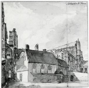
utrecht dom church in art
old maps of meurthe (department)
coats of arms of nancy
coats of arms of cities in manche
19th-century maps of manche
19th-century double hemisphere world maps
maps by alexandre vuillemin
address sides of divided back postcards
feldpostbriefe von hans
victor levasseur - maps of france
19th-century maps of ain
coats of arms of cities in pyrénées-atlantiques
old maps of pyrénées-atlantiques
old maps of charente-maritime
coats of arms of la rochelle
marine paintings in the royal collection of the united kingdom
dominic serres
renaissance portrait paintings in the walters art museum
portrait paintings by willem key
illustrations from bulgarian folk crosses
mezdra municipality
address sides of divided back postcards
feldpostbriefe von hans
address sides of divided back postcards
feldpostbriefe von hans
address sides of divided back postcards
feldpostbriefe von hans
address sides of divided back postcards
feldpostbriefe von hans
illustrations from bulgarian folk crosses
monuments and memorials in pleven
address sides of divided back postcards
feldpostbriefe von hans
address sides of divided back postcards
feldpostbriefe von hans
address sides of divided back postcards
feldpostbriefe von hans
atlas, ou représentation du monde universel et des parties d'icelui, faicte en tables et descriptions très amples et exactes, divisé en deux tomes. édition nouvelle... - btv1b53103889w
maps of the peloponnese by gerardus mercator
atlas, ou représentation du monde universel et des parties d'icelui, faicte en tables et descriptions très amples et exactes, divisé en deux tomes. édition nouvelle... - btv1b53103889w
17th-century maps of silesia
atlas, ou représentation du monde universel et des parties d'icelui, faicte en tables et descriptions très amples et exactes, divisé en deux tomes. édition nouvelle... - btv1b53103889w
maps of guinea by mercator-hondius
map of the circle of westfalia by sanson
louis cordier
atlas, ou représentation du monde universel et des parties d'icelui, faicte en tables et descriptions très amples et exactes, divisé en deux tomes. édition nouvelle... - btv1b53103889w
maps of candia by ortelius and mercator
le duché de poméranie compris sous le cercle de la haute-saxe divisé suivant qu'il est présentement partagé entre la couronne de suède et l'eslecteur de brandebourg, où sont les duchés de... - btv1b53202543b
sanson maps of the circles of germany
atlas, ou représentation du monde universel et des parties d'icelui, faicte en tables et descriptions très amples et exactes, divisé en deux tomes. édition nouvelle... - btv1b53103889w
17th-century maps of chile
atlas, ou représentation du monde universel et des parties d'icelui, faicte en tables et descriptions très amples et exactes, divisé en deux tomes. édition nouvelle... - btv1b53103889w
maps of waldeck by gerardus mercator
sheet music covers in the british museum
lithographs in the british museum
coloured lithographs in the british museum
sheet music covers in the british museum
maps by john cary
1799 maps
address sides of divided back postcards
feldpostbriefe von hans
history of blankenburg (harz)
feldpostbriefe von hans
feldpostbriefe von hans
1941 postmarks
feldpostbriefe von hans
1941 postmarks
address sides of divided back postcards
feldpostbriefe von hans
feldpostbriefe von hans
1937-05-13 postmarks
bibliothèque nationale de france
maps by thomas kitchin
drawings in the kupferstichkabinett berlin
jagdschloss grunewald by wilhelm barth
paintings by ambrosius holbein in the kunstmuseum basel
northern renaissance
collection drawings and prints from het utrechts archief
utrecht dom church in art
maps of alsace by guillaume sanson
1700s maps of alsace
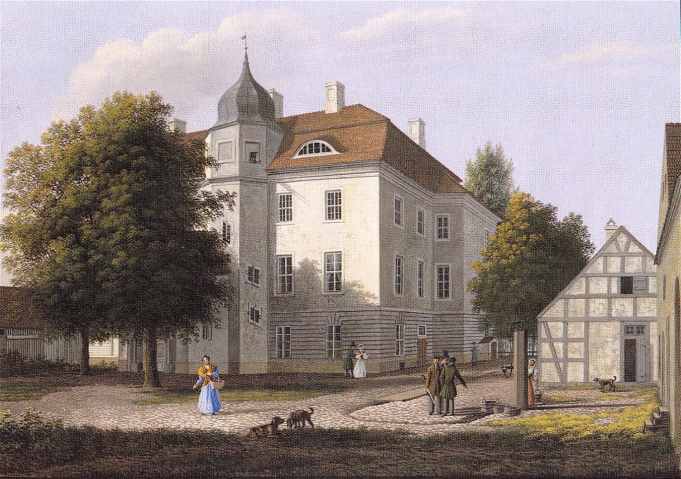
drawings in the kupferstichkabinett berlin
jagdschloss grunewald by wilhelm barth
drawings of the judgement of solomon
bequest of f.g. waller
old county maps of hertfordshire
maps by thomas kitchin
1800s maps of the iberian peninsula
maps by john cary
frescoes from the casa degli epigrammi greci (pompeii)
ancient roman frescos - fourth style
astronomical events
meteors in art
1944 in germany
1944 posters
andries bonger
symbolism
fonds ancely - bibliothèque municipale de toulouse - maps
19th-century maps of calvados
feldpostbriefe von hans
dietrichsroda
1945 in mecklenburg-vorpommern
feldpostbriefe von hans
book illustrations in the british museum
german renaissance,northern renaissance
drawings in the kupferstichkabinett berlin
jagdschloss grunewald by wilhelm barth
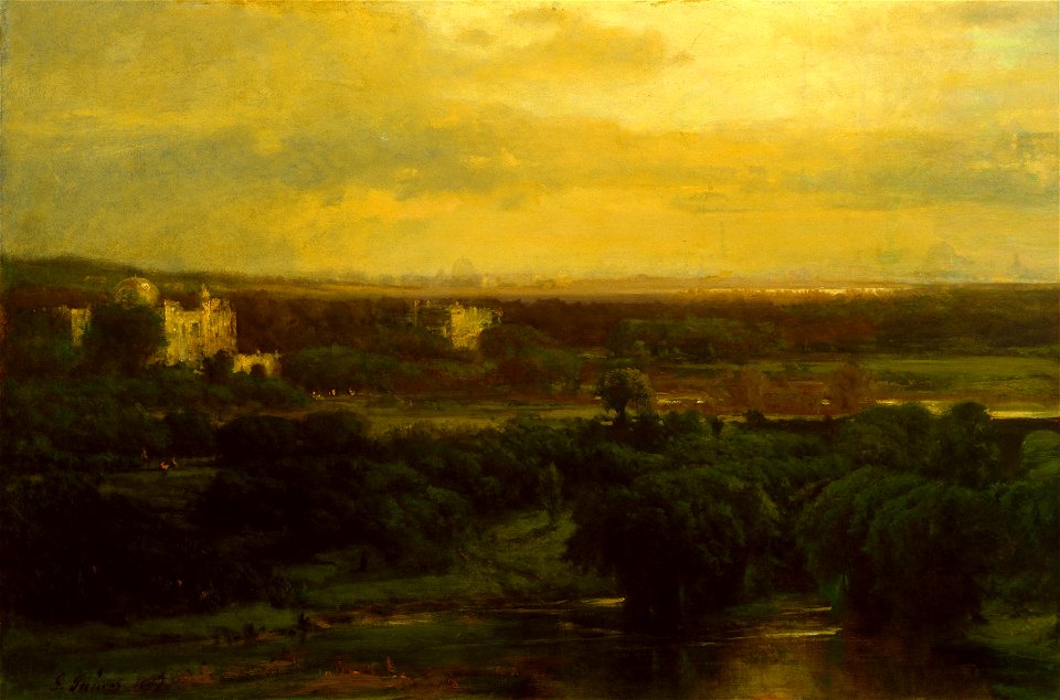
paintings by george inness
hudson river school
bibliothèque nationale de france
félix robaut
l'empire d'allemagne divisé en ses dix cercles en leurs principaux estats. le royaume de bohême et les provinces qui en dépendent - nouvellement reveu et corrigé par le sieur sanson... ; lud. cordier... - btv1b532023318
sanson maps of the circles of germany
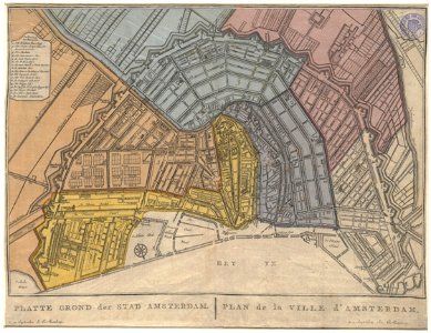
old maps of amsterdam
evert maaskamp
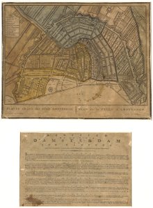
old maps of amsterdam
evert maaskamp
address sides of divided back postcards
feldpostbriefe von hans
drawings by nicolaes maes in the rijksmuseum amsterdam
pen and ink drawings in the rijksmuseum amsterdam
collections of musée cernuschi
baroque
collections of musée cernuschi
baroque
collections of musée cernuschi
baroque
illustrations from bulgarian folk crosses
svetoslav, silistra province
collections of musée cernuschi
baroque
collections of musée de la vie romantique
romanticism
address sides of divided back postcards
feldpostbriefe von hans
address sides of divided back postcards
feldpostbriefe von hans
drawings by unknown artists in the statens museum for kunst
drawings by andrea celesti in the statens museum for kunst
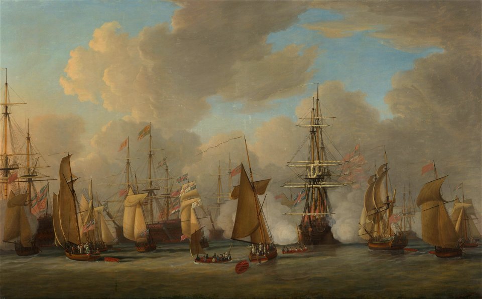
prints, drawings and watercolours of the royal museums greenwich
hms invincible (ship, 1907)
address sides of divided back postcards
feldpostbriefe von hans
address sides of divided back postcards
feldpostbriefe von hans
address sides of divided back postcards
feldpostbriefe von hans
feldpostbriefe von hans
6 pfennig stamps
address sides of divided back postcards
feldpostbriefe von hans
dutch 19th-century drawings in the rijksmuseum amsterdam
schetsboek met 35 bladen, van gerrit postma
old maps of northumberland
maps by thomas kitchin
feldpostbriefe von hans
6 pfennig stamps
address sides of divided back postcards
feldpostbriefe von hans
drawings by winslow homer in the cooper–hewitt, smithsonian design museum
realism
1720s maps of palestine
nicolas de fer
1701 - 1800 of 2,298
Next page
/ 23