Log in
All resources
Create a design
441 Free Artworks of Maps Of Belgium
atlas novus (blaeu)
1645 maps of belgium
maps with cartouches
atlas van der hagen (volume 2)
atlas van der hagen
atlas van loon
17th-century maps of belgium
coats of arms on maps
bibliothèque nationale de france
17th-century maps of the netherlands
claes jansz. visscher (i)
joannes van doetecum (i)
maps by homannsche erben
latin-language maps
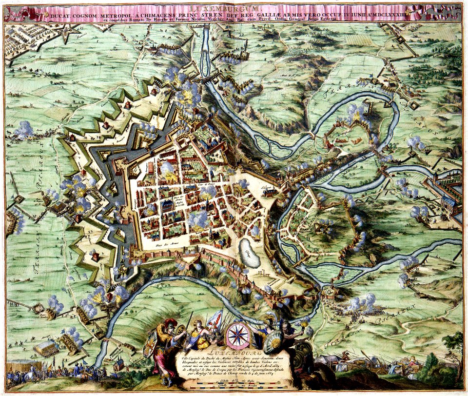
old maps of luxembourg
1855 maps
french-language maps
1710 maps
latin-language maps
johannes ratelband
dutch-language maps
johannes ratelband
ardennes (belgium)
gallia belgica
1740s maps of belgium
southern netherlands
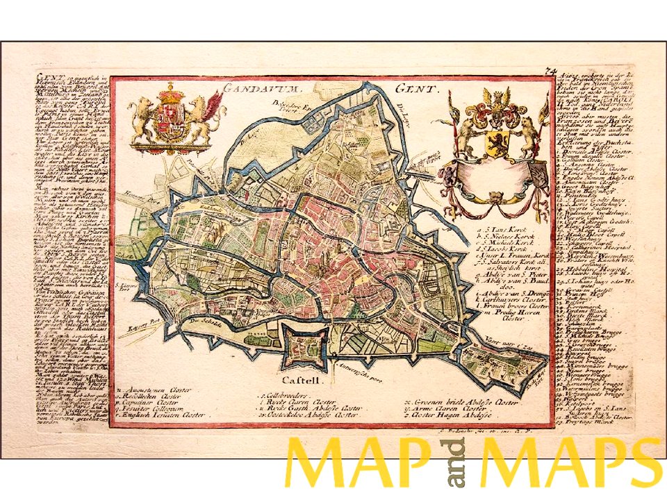
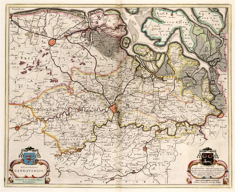
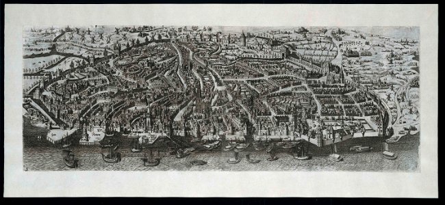
map of ghent by jan blaeu
atlas van loon
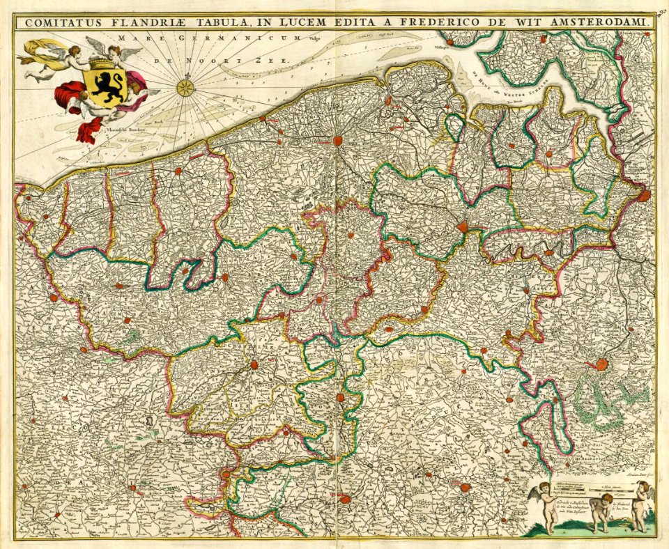
maps by frederick de wit
1680s maps of belgium
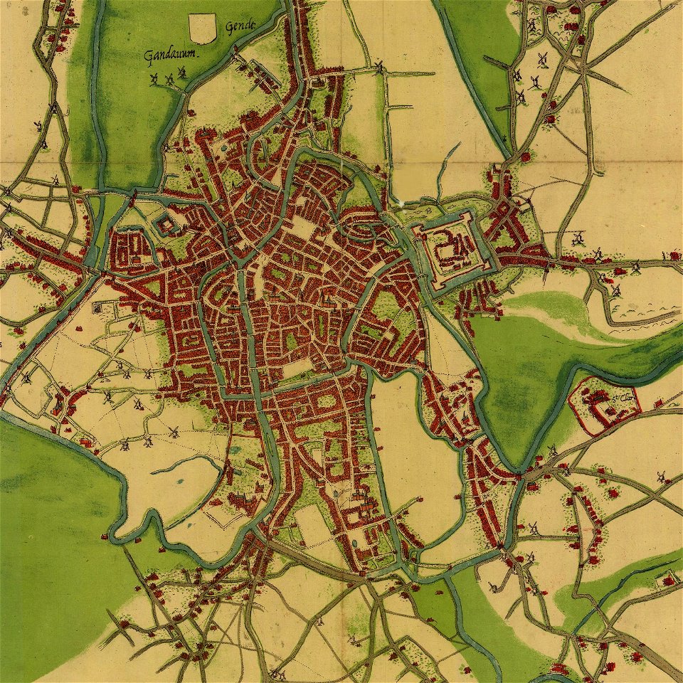
map of ghent by jacob van deventer
map of ghent by gabriel bodenehr
history of rail transport in belgium
enzyklopädie des eisenbahnwesens
pieter van der keere
ships on maps
maps by abraham ortelius
latin-language maps
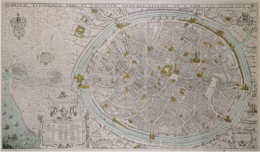
maps of bruges by jan blaeu
flandria illustrata
1700s maps of belgium
old maps of lorraine
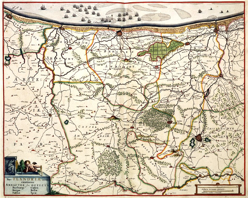
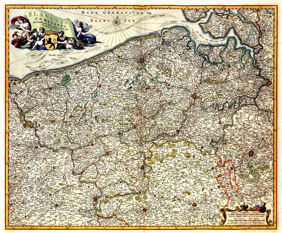
maps of the county of flanders
johannes ratelband
maps by frederick de wit
1662
old maps of ghent
atlas van loon
encyclopaedia universalis mundaneum
pacific
historical images of the gravensteen (ghent)
atlas van loon
map of bruges by marcus gheeraerts (i)
gracht
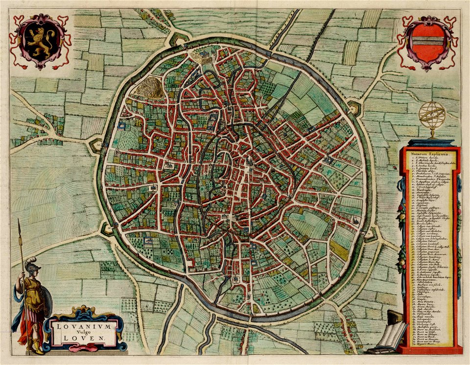
old maps of leuven
atlas van loon
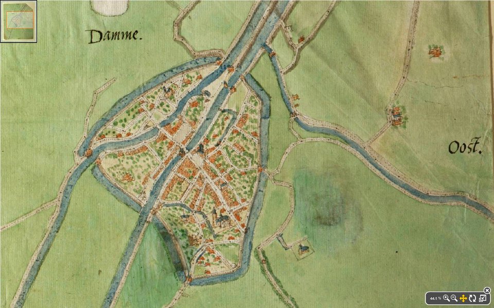
map of damme by jacob van deventer
lieve
atlas van der hagen (volume 2)
maps with cartouches
prints from manesson travaux de mars at the peace palace library
fortifications in belgium
maps of territories in the burgundian circle
atlas novus (blaeu)
maps of territories in the burgundian circle
atlas novus (blaeu)
maps of the dutch republic
nicolaes van geelkercken
maps with cartouches
atlas van der hagen
flemish 16th-century prints in the rijksmuseum amsterdam
maps of antwerp city walls
coat of arms of germany
1642 maps of croatia
maps with cartouches
atlas van der hagen
maps with cartouches
atlas van der hagen
maps with cartouches
atlas van der hagen
maps with cartouches
atlas van der hagen
prints in the royal collection of the united kingdom
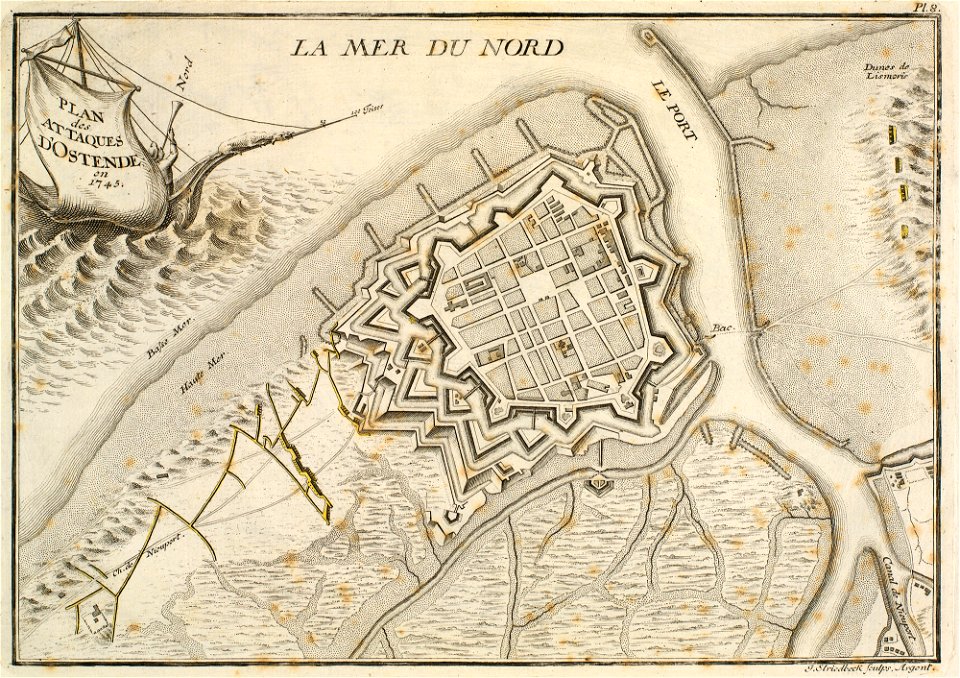
history of ostend
19th-century satirical maps
1899 maps of europe
old maps of france
maps of reims
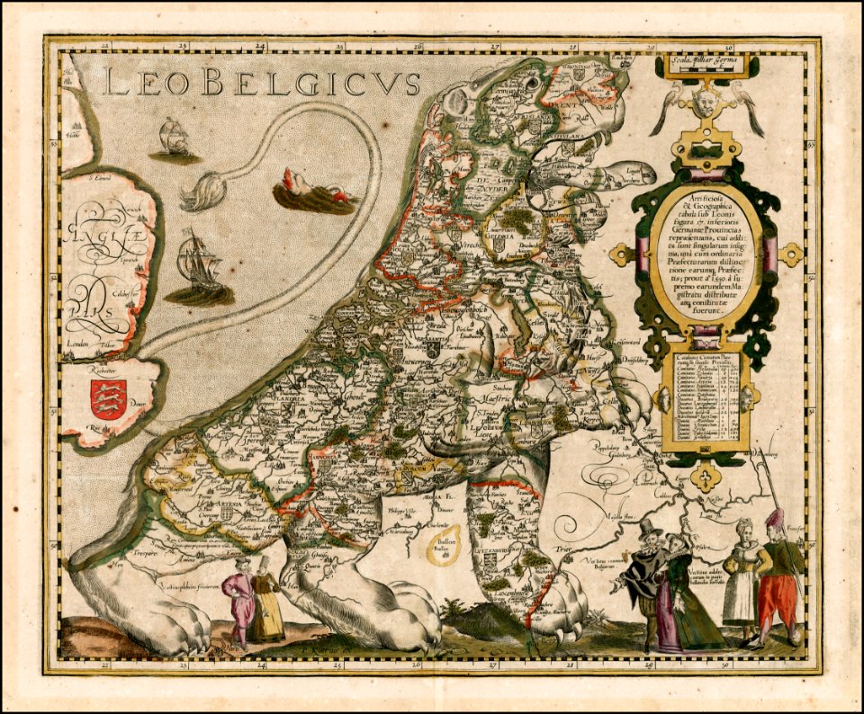
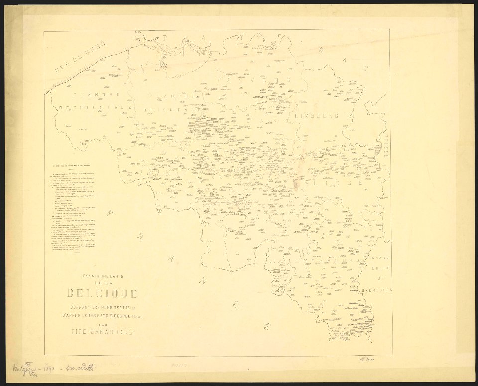
maps of belgium
dendermonde
lillo
merksem
lillo
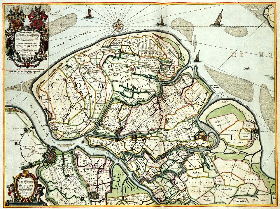
old maps of zeeland
western scheldt
maps of luxembourg city walls
maps with cartouches
maps and topographical views by joris hoefnagel
drawings by joris hoefnagel
maps with cartouches
zeebrugge
old maps of zeeland
atlas van der hagen
antwerp
hoboken
nicolas iii de larmessin
gerardus mercator
ekeren
lillo
17th-century maps of the netherlands
1609
1660s maps of belgium
old maps of bruges
maps by pieter van der keere
maps by abraham ortelius
old maps of brabant
1666 in belgium
maps by pieter van der keere
maps by abraham ortelius
maps by cornelis anthonisz.
1560 maps of europe
1730s maps of belgium
maps of houthulst
maps of antwerp by braun & hogenberg
city map
maps of the county of flanders
county of zeeland
maps by willem and johannes blaeu
copper engravings
1804 maps of europe
maps by john cary
1660s maps of belgium
old maps of bruges
maps by pieter van der keere
old maps of north brabant
copper engravings
1619 engravings
maps of the duchy of limburg
1645 maps of belgium
house of arenberg
parks in belgium
old maps of brussels
jacobus harrewijn
1748 maps of the netherlands
1740s maps of belgium
maps of territories in the burgundian circle
1645 maps of belgium
maps of the united kingdom of the netherlands
françois bohn
1645 maps of belgium
tournaisis
old maps of north brabant
1645 maps of belgium
maps of territories in the burgundian circle
17th-century maps of the north sea
maps by willem and johannes blaeu
maps of the duchy of limburg
1590s maps of the netherlands
1590s maps of belgium
1600s maps of belgium
old maps of flanders
maps of ghent by i. tirion
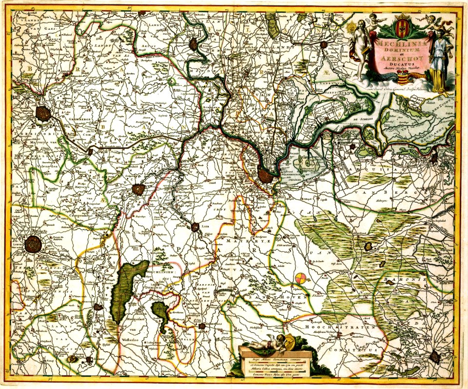
lordship of mechelen
1645 maps of belgium
16th-century maps of the netherlands
16th-century maps of belgium
maps of ghent by i. tirion
maps by pieter van der keere
old maps of flanders
history of nord-pas-de-calais
ships on maps
maps of ghent by i. tirion
1580s maps of the netherlands
1580s maps of belgium
old maps of north brabant
1645 maps of belgium
ptolemy's 3rd european map
bologna ptolemy
maps by pieter van der keere
old maps of liège (province)
map of expo 1913
expo 1913
maps of philippeville by braun & hogenberg
maps of mariembourg by braun & hogenberg
full size ferraris maps of belgium
emmanuel-jean-nepomucène de ghendt
1573 maps of europe
christian sgrothen
old maps of blankenberge
flandria illustrata
maps of territories in the burgundian circle
1645 maps of belgium
ambrosio spinola, marqués de los balbases
engravings by jacques callot
history of tienen
atlas van loon
old maps of ostend
siege of ostend
coats of arms on maps
1645 maps of belgium
daniel de la feuille
1747 maps of belgium
coats of arms of the roman catholic diocese of liège
1645 maps of belgium
1 - 100 of 441
Next page
/ 5