Log in
All resources
Create a design
124 Free Artworks of Maps Canada
old maps of canada
maps in the library of congress
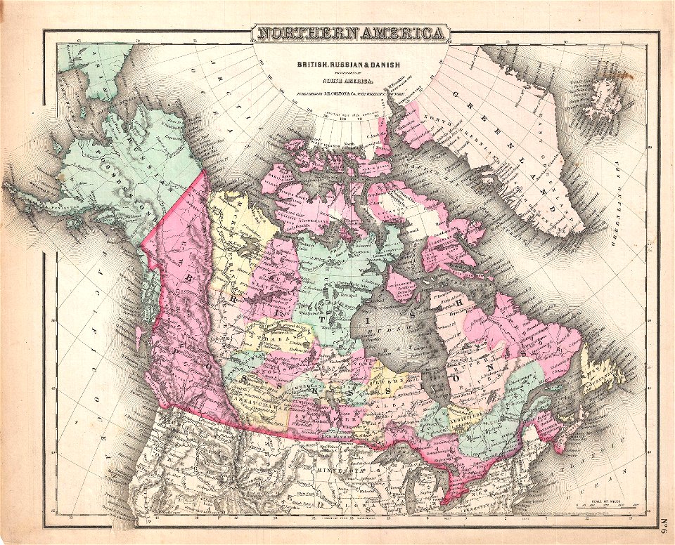
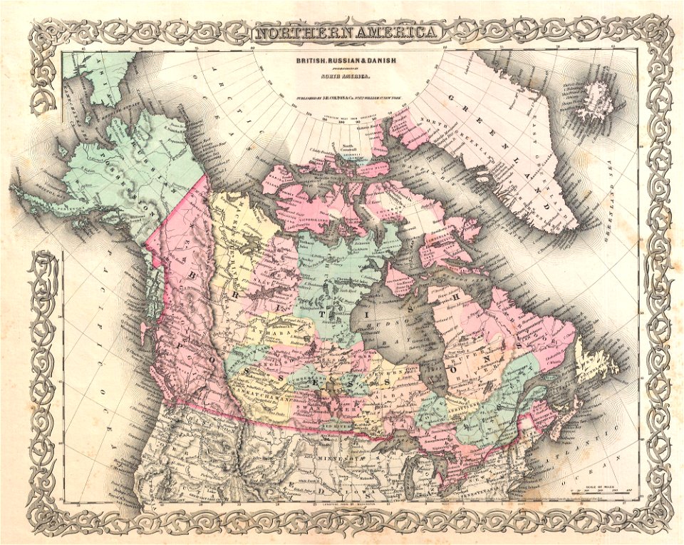
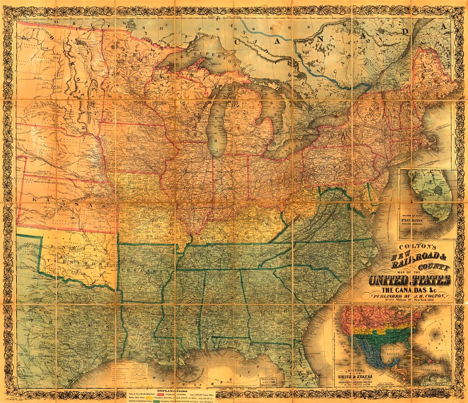
maps by joseph hutchins colton
old maps of canada from the norman b. leventhal map center
old maps of the united states from the norman b. leventhal map center
1814 maps
maps by john tallis
english-language maps
arthur heming
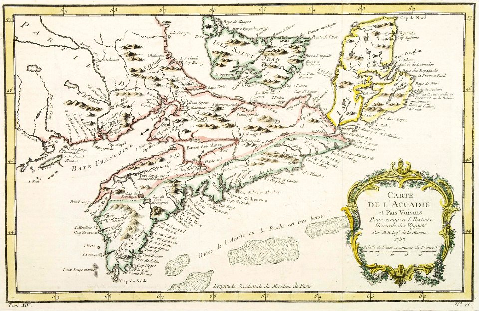
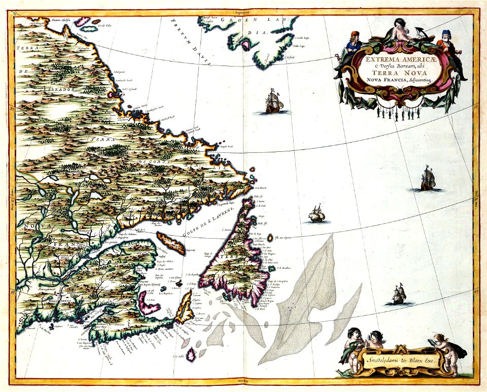
old maps of new france
old maps of greenland
old maps of canada
old maps of canada
province of canada
maps by samuel de champlain
old maps of new france
maps by jacques-nicolas bellin
old maps of canada
old maps of new france
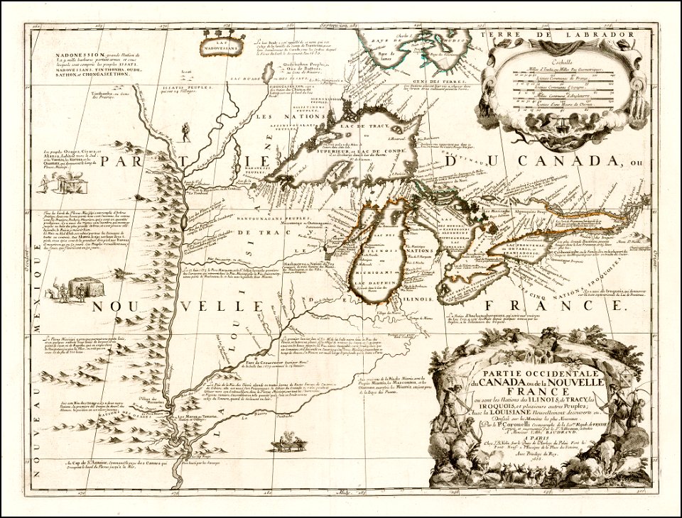
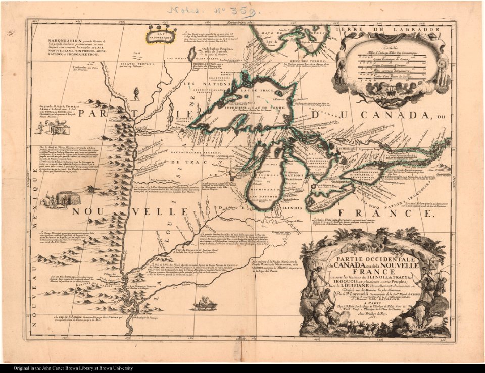
maps by coronelli
maps by joseph hutchins colton
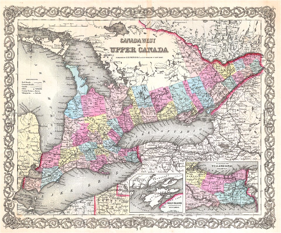
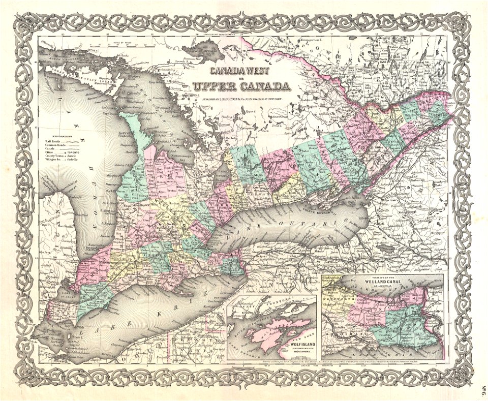
upper canada
old maps of new brunswick
old maps of newfoundland
18th-century maps of north america
1794 maps
old maps of new france
maps by coronelli
old maps of new france
maps by coronelli
maps in the library of congress
old maps of ohio
maps in the library of congress
old maps of ohio
maps in the library of congress
old maps of canada
maps in the library of congress
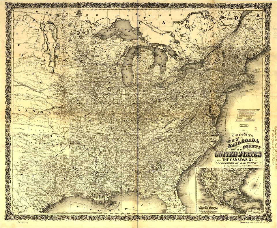
1860 maps
maps in the library of congress
1862 maps
maps in the library of congress
old maps of canada
maps in the library of congress
old maps of canada
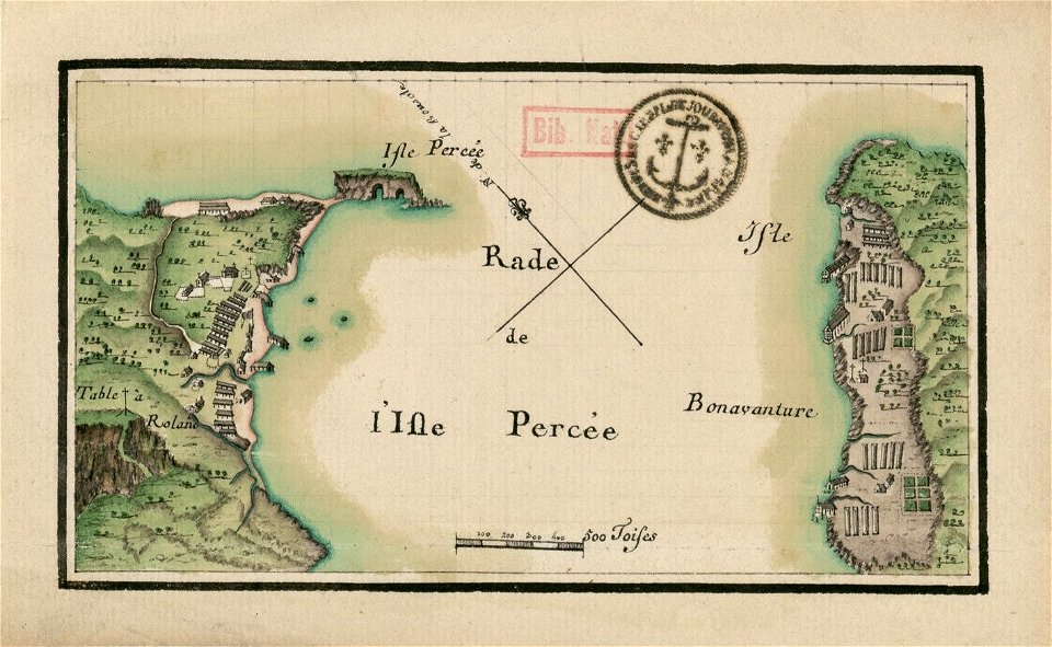
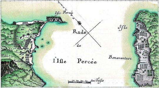
île bonaventure
percé
île bonaventure
percé
maps in the library of congress
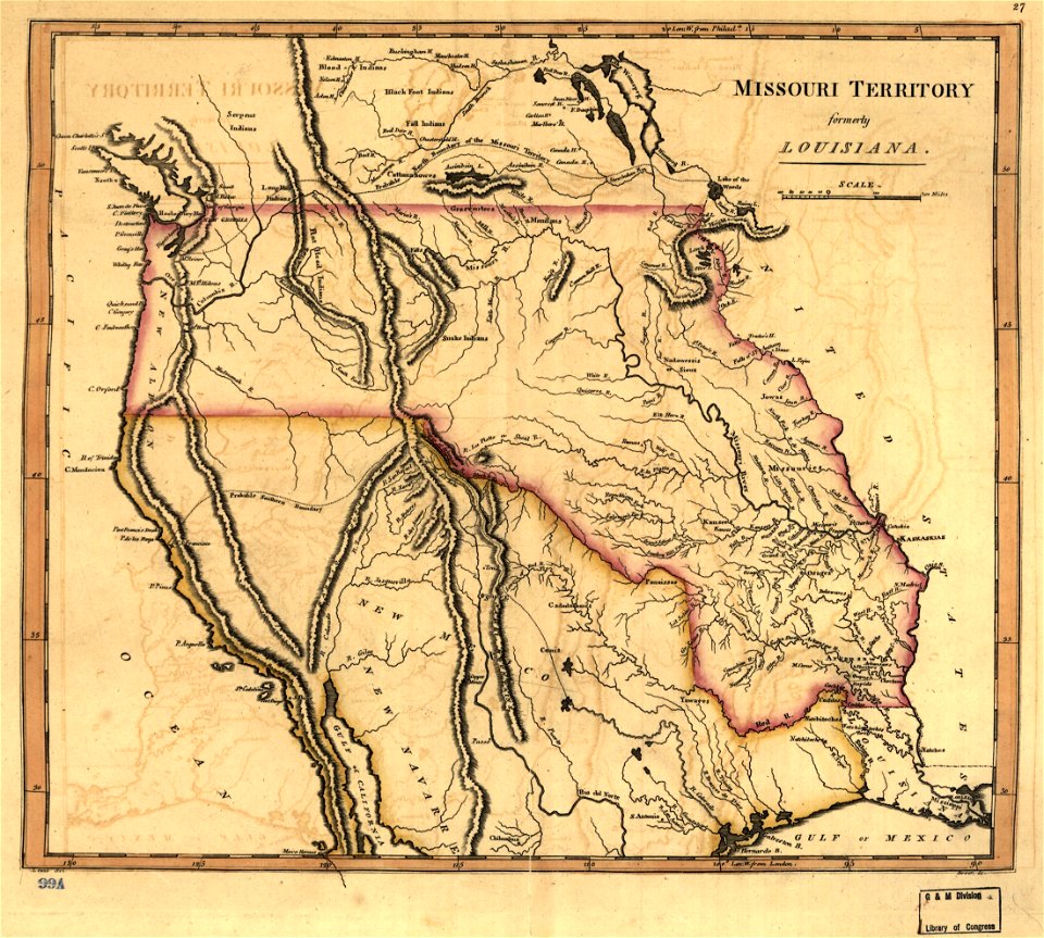
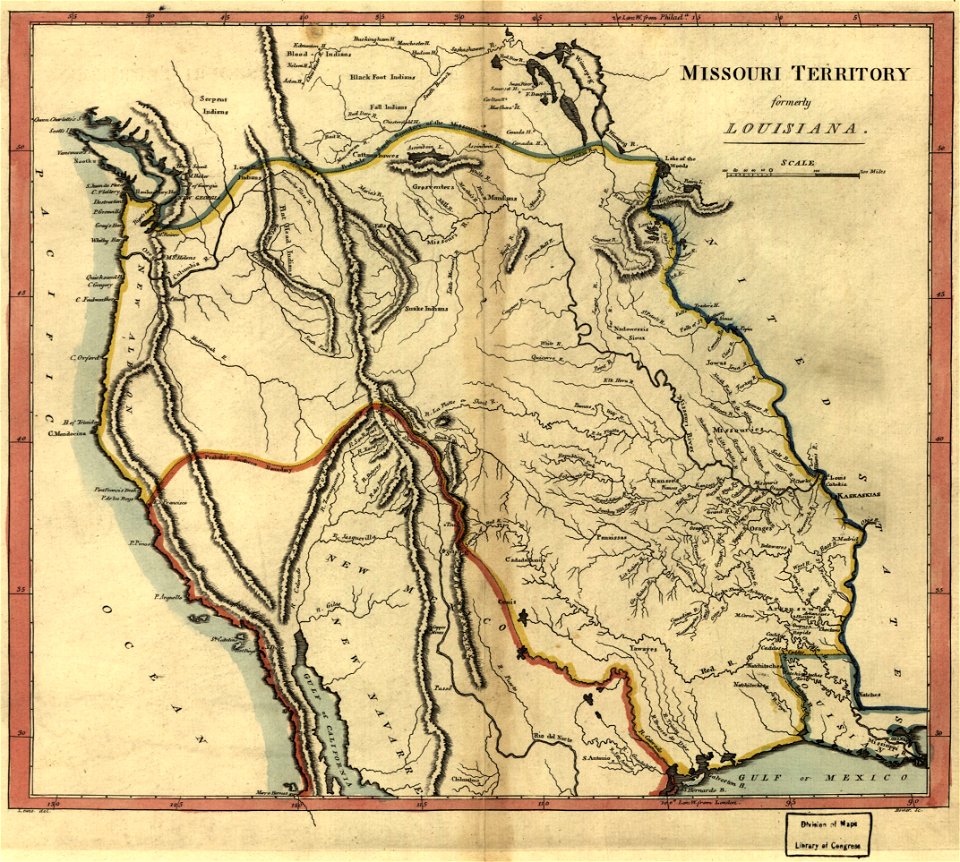
missouri territory
maps by joseph hutchins colton
1855 maps of ontario
paintings in the huntington library
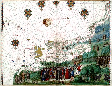
vallard atlas
united states geological survey maps
old maps of new york (state)
old maps of the saint lawrence river
maps by joseph hutchins colton
old maps of the united states
old maps of canada
old maps of the saint lawrence river
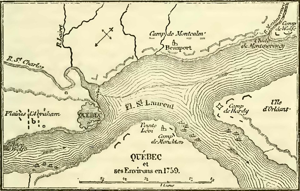
history of quebec
old maps of the saint lawrence river
maps by joseph hutchins colton
17th-century maps of canada
codex canadensis
atlante veneto (raremaps.com) volume 2
old maps of canada
bruce county
ontario
old maps of new brunswick
old maps of newfoundland
maps in the library of congress
old maps of maine
maps in the library of congress
old maps of maine
maps in the library of congress
1867 maps
maps in the library of congress
1867 maps
old maps of north america
1755 mitchell map
old maps of north america
1755 mitchell map
old maps of north america
1755 mitchell map
volume 1 of le tour du monde
john franklin
maps with cartouches
old maps of canada
popular science monthly illustrations/volume 13
drainage basin maps of north america
old map
old maps of new brunswick
old maps of virginia
1853
54
prints from bonne atlas de toutes les parties at the peace palace library
1780 maps of canada
charts and maps of the royal museums greenwich
prints from mémoires des commissaires du roi et de ceux de sa majesté britannique at the peace palace library
jean ignace de la ville
robert wallis (engraver)
henry warren
1850s maps of ontario
maps by john tallis
robert wallis (engraver)
henry warren
maps in the library of congress
history of sherbrooke (quebec)
maps by john tallis
maps by john rapkin
frontispieces from england
maps by william faden
1849 maps of north america
old maps of canada
maps indicating exploration
royal geographical society
history of sherbrooke (quebec)
1881 in quebec
description de l'universe
1710s maps of canada
maps from the mechanical curator collection
through the subarctic forest (1896) by pike
old geological maps by jean-etienne guettard
jean étienne guettard
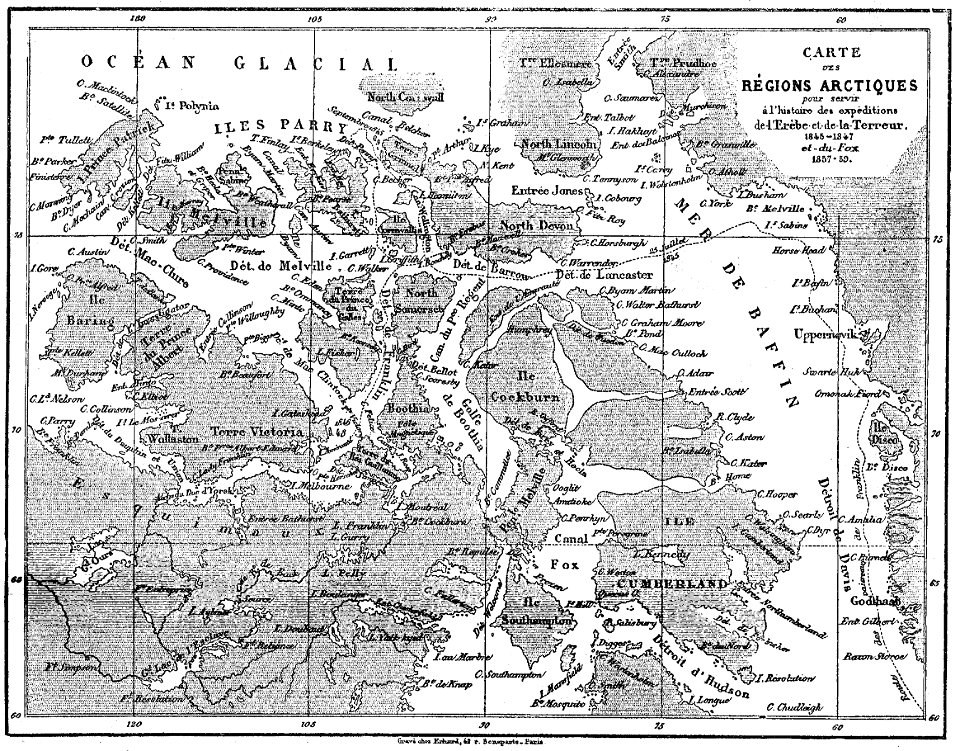
victory expedition
northwest passage
old geological maps by jean-etienne guettard
jean étienne guettard
victory expedition
northwest passage
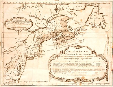
1777 maps of new york (state)
1777 maps of new jersey
old maps of the american revolution
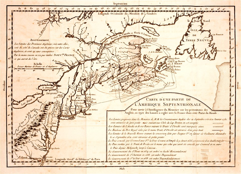
1777 maps of quebec
the earth and its inhabitants, vol. xii: africa, vol. iii
canary islands in the 1890s
fish
maps
maps by daniel lizars
1830s maps of belize
maps
sea
maps in the library of congress
1777 maps of north america
across the sub-arctics of canada, a journey of 3,200 miles by canoe and snow shoe through the hudson bay region (1908)
old maps of canada
considérations géographiques et physiques sur les nouvelles découvertes au nord de la grande mer
1755 maps of north america
1807 maps of canada
maps by john cary
historical map collection
maps of new france
miscellaneous items in high demand, ppoc, library of congress
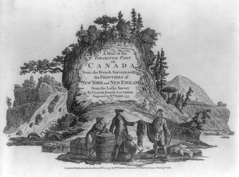
maps by claude joseph sauthier
ghosts & ghoulish scenes
maps of the history of the united states
old maps of the british empire
cartography
maps
1900s maps of alaska
silver
old maps of the united states from the norman b. leventhal map center
old maps of canada from the norman b. leventhal map center
atlas maior, vol 12 (america) - joan blaeu, 1667 - bl 114.h(star).12
1667 maps
across the sub-arctics of canada (1898)
arthur heming
bird
maps
prints by isaac weissenbruch in the rijksmuseum amsterdam
maps in the rijksmuseum amsterdam
across the sub-arctics of canada, a journey of 3,200 miles by canoe and snow shoe through the hudson bay region (1908)
arthur heming
maps by daniel lizars
1831 maps of mexico
prints by jan luyken in the rijksmuseum amsterdam
engravings of birds in the rijksmuseum amsterdam
travel
maps
across the sub-arctics of canada (1898)
rangifer tarandus (illustrations)
across the sub-arctics of canada (1898)
arthur heming
1770s maps of alaska
robert de vaugondy
maps from the earth and its inhabitants, vol. xv
hydrological maps of the united states
maps in the library of congress
1777 maps
maps of the rocky mountains
1810s maps of canada
arnold's geographical handbook (1899)
1890s maps of canada
arnold's geographical handbook (1899)
1890s maps of canada
an empire story; stories of india and the greater colonies told to children (1908)
old maps of canada
1690s maps of the caribbean
1690s maps of the americas
considérations géographiques et physiques sur les nouvelles découvertes au nord de la grande mer
1750s maps of the russian empire
maps by daniel lizars
1831 maps of mexico
arctic expeditions from british and foreign shores - from the earliest to the expedition of 1875 (1875)
1870s maps of canada
1 - 100 of 124
Next page
/ 2