Log in
All resources
Create a design
26,489 Free Artworks of Map
bibliothèque nationale de france
victor levasseur - maps of france
fonds ancely - bibliothèque municipale de toulouse - maps
steel engraving print
bibliothèques de toulouse
maps by willem and johannes blaeu
raymond bonheur
baroque
eran laor cartographic collection
guillaume sanson
maps from the earth and its inhabitants, vol. iv
loch etive
maps from the earth and its inhabitants, vol. xiii
topographic maps of angola
maps from the earth and its inhabitants, vol. xviii
treaty of tordesillas
1860 valentine map of new york city
george hayward
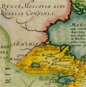
maps of persia by mercator-hondius
details of old maps
engravings of topographia braunschweig lüneburg
burg calenberg
chicago and the midwest, newberry library
1931 maps
amérique méridionale (1748, d'anville)
rococo
19th century maps of haute-vienne
coats of arms of haute-vienne
coats of arms of nîmes
baroque
coats of arms of chalon-sur-saône
alphonse de lamartine
coats of arms of saint-brieuc
old maps of côtes-d'armor
19th-century maps of indre-et-loire
coats of arms of tours
victor levasseur - maps of france
pierre-jean david
maps from university of amsterdam special collections
atlas der neederlanden
maps made in the 17th century
lazio
maps of haarlemmerhout
old maps of haarlem
the columbian magazine (1789)
pre-raphaelite brotherhood
terrae sanctae tabula by guillaume delisle (1763)
eran laor cartographic collection
maps by jakob van der schley
history of hormuz island
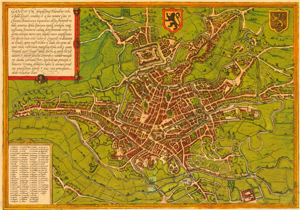
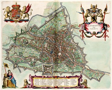
maps of ghent by braun & hogenberg
liber qvartvs contrafactur vnd beschreibung von den vornembsten stten der welt (zzk 0.32)
patrimonium 2 (project)
map of the circle of austria by sanson
1700s maps of austria
map of the circle of the rhineland by sanson
1730s maps of rhineland-palatinate
map of the circle of austria by sanson
1700s maps of austria
old maps of the republic of genoa
maps by alexis-hubert jaillot
eran laor cartographic collection
jean-claude richard de saint-non
maps in the library of congress
plaine de grenelle
maps of ports and fortresses of the mediterranean by marco boschini (1651)
old maps of souda (crete)
1640s maps of greece
marco boschini
18th-century maps of the iberian peninsula
maps in the rijksmuseum amsterdam
munich in the 17th century
baroque
nicolas-andré monsiau
neoclassicism
nova & accurata ducatuum slesvici et holsatiae tabula
2008 iowa election maps
demographics of iowa
17th-century maps of nord (department)
maps by gerard valck
17th-century maps of mexico
maps by gerard valck
maps by willem and johannes blaeu
siege of 's-hertogenbosch
maps of strasbourg in the 17th century
baroque
eran laor cartographic collection
guillaume sanson
maps of south asia by mercator-hondius
considérations géographiques et physiques sur les nouvelles découvertes au nord de la grande mer
old maps of the yellow sea
map of ghent by jan blaeu
atlas van loon
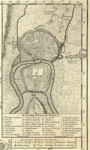
1698 map of evesché de meaux
maps of moers by johannes mercator
maps of castile by mercator-hondius
topographischer atlas der schweiz
old maps of zollikon
maps of castile by mercator-hondius
chaharbagh madrasa in art
pascal coste
media from the national library of finland
classicism
claes jansz. visscher (ii)
leo belgicus
british library - off the map alice collection - wonderland
british library - off the map alice collection
maps of komárom by braun & hogenberg
chaika (boat)
portolan charts by willem and johannes blaeu
latin-language maps
maps of the west-indische compagnie
1770 maps
atlas maior, vol 6 (scotland and ireland) - joan blaeu, 1667 - bl 114.h(star).6
1667 maps
paintings by antônio parreiras in the museu antônio parreiras
paintings of nude females by antônio parreiras
prints by jan luyken in the rijksmuseum amsterdam
maps in the rijksmuseum amsterdam
maps from the earth and its inhabitants, vol. xviii
maps of the ancash region
atlas vingboons
1665
gerardi mercatoris atlantis novi. pars tetria (1638)
17th-century maps of lombardy
maps by matthäus merian
baroque
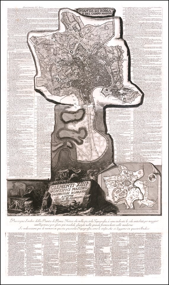
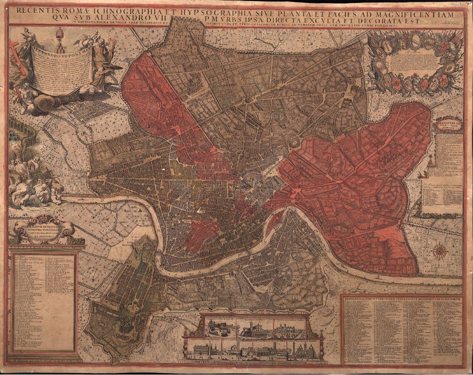
18th-century maps of rome
neoclassicism
gemeente atlas van nederland - south holland
maps of hei- en boeicop
17th-century maps of southeast asia
description de l'universe
maps of aa en hunze
gieten
19th-century maps of dresden
vogelsches gartenhaus
old maps of skagerrak
maps of oslofjorden
maps by willem and johannes blaeu
old maps of groningen (city)
1640s maps of bavaria
atlas novus (blaeu)
17th-century maps of iceland
atlas novus (blaeu)
siege of bredevoort 1597
old maps of bredevoort
maps by pieter mortier
maps of the cevennes
17th-century maps of the indian ocean
bodleian maps collection
18th-century maps of bohemia
grosser deutscher atlas
daniel friedrich sotzmann
grosser deutscher atlas
maps of paris from bibliothèque nationale de france
dheulland map of paris
maps in the biblioteca federiciana
maps of the duchy of urbino
maps by willem and johannes blaeu
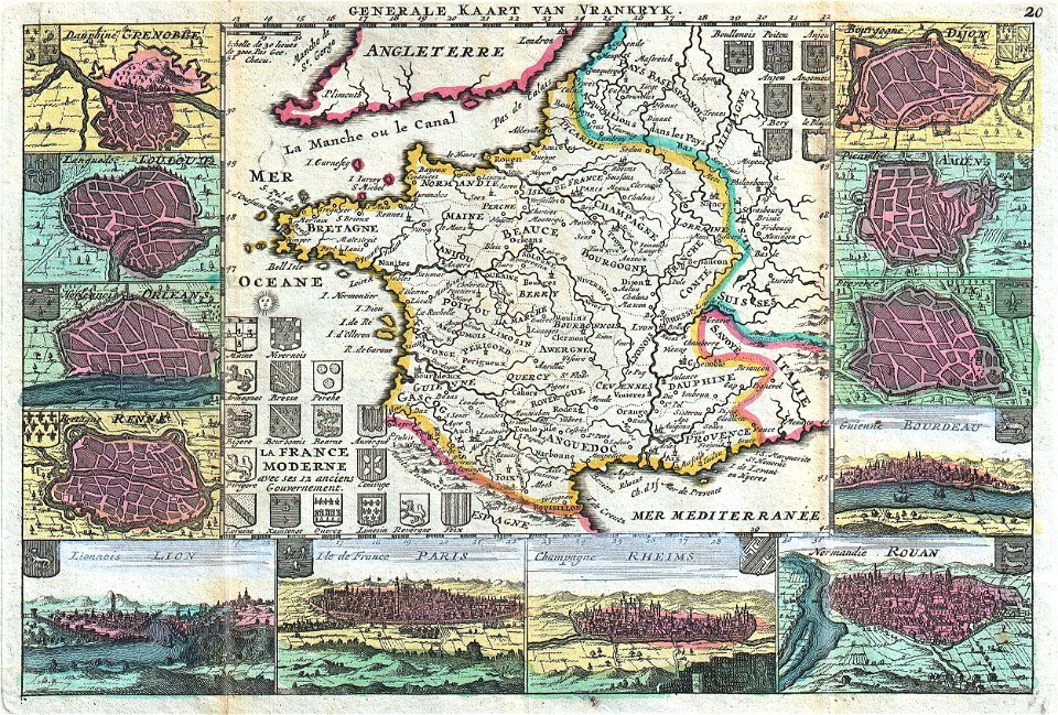
17th-century maps of france
engravings by wolfgang kilian
old maps of bohemia
maps of paris from paris musées
dheulland map of paris
prints in the metropolitan museum of art
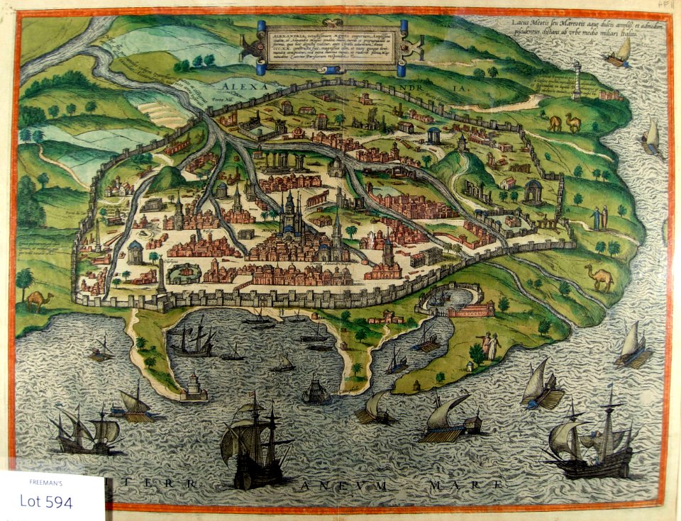
maps of alexandria by braun & hogenberg
hamburgische elbkarte von melchior lorichs
parts of old maps of hamburg
1770s maps of the americas
maps by tomas lopez
map of italy by guillaume delisle (1700)
1700s maps of italy
1770s maps of the americas
maps by tomas lopez
old maps of the history of france
daniel de la feuille
eran laor cartographic collection
jacques chiquet
maps by giovanni giacomo de rossi
17th-century maps of rome
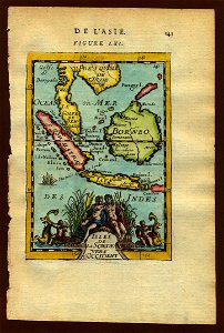
asia noviter delineata
1617 drawings
illustrations to charles dickens's works
a tale of two cities
old maps of westland
old maps of delfland
17th-century maps of istanbul
matteo florimi
old maps of rostock
caspar merian
french-language maps of japan
old maps of japan
london & birmingham railway
charles frederick cheffins
maps of the mahdist war
1890s maps of sudan
old maps of khartoum
history of omdurman
17th-century maps of luxembourg
1689 maps
victorian architecture
festival of empire
6101 - 6200 of 26,489
Next page
/ 265