Log in
All resources
Create a design
26,489 Free Artworks of Map
maps in the library of congress
eran laor cartographic collection
town maps by l. r. burleigh
bird's eye view maps of new york (state)
l. r. burleigh
gemeente atlas van nederland - south holland
bibliothèque nationale de france
1860s maps of south holland
english-language maps
maps by willem and johannes blaeu
maps from the earth and its inhabitants, vol. x
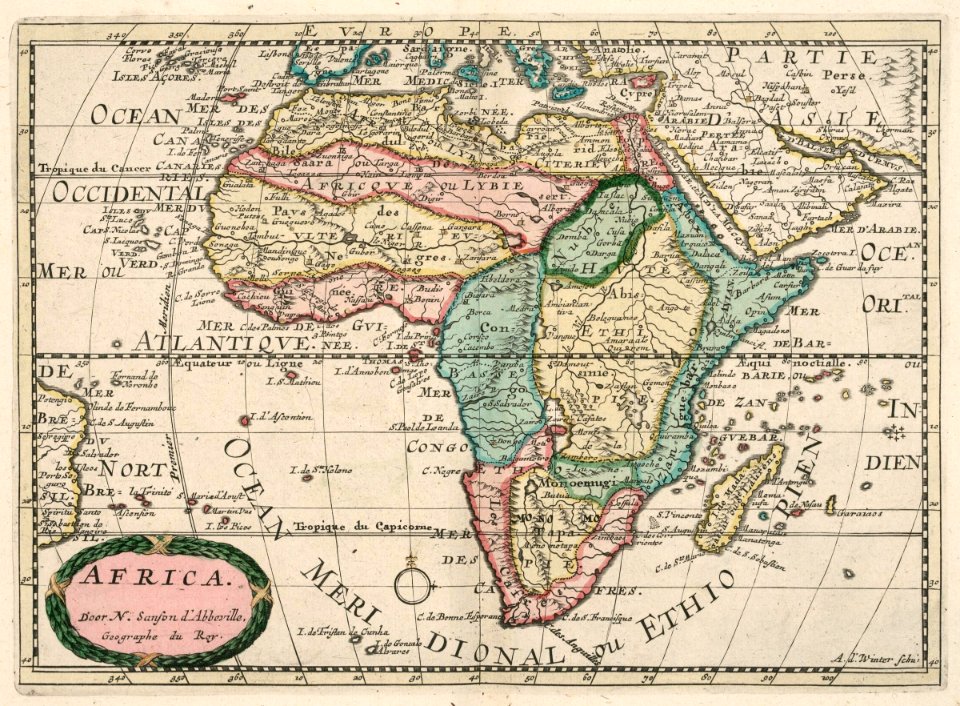
1890 maps of africa
english county maps by john ogilby
old county maps of middlesex
tower of babel in engravings
maps by nicolaes visscher i
17th-century maps of the black sea
description de l'universe
17th-century maps of the black sea
description de l'universe
maps of the kingdom of jaén (crown of castile)
maps of spain by tomas lopez
maps in the library of congress
1875 maps of california
maps of the kingdom of córdoba (crown of castile)
maps of spain by tomas lopez
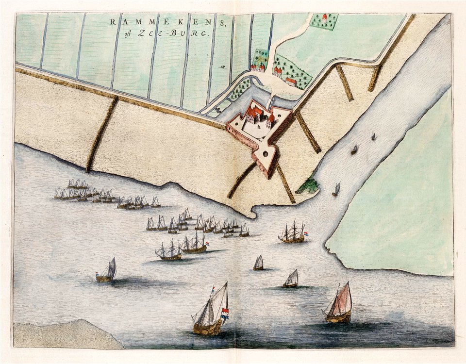
fort rammekens in art
1649 maps
eran laor cartographic collection
english-language maps
maps by willem and johannes blaeu
atlas van loon
curt teich postcard archives, curt teich & company
map postcards
maps from the earth and its inhabitants, vol. xii
africa in the 1890s
speculum romanae magnificentiae (mirror of roman magnificence)
1555
1730s maps of belgium
maps of houthulst
maps of polders in south holland
old maps of delfland
eran laor cartographic collection
german renaissance,humanism
eran laor cartographic collection
german renaissance,humanism
old maps of fictional countries
old maps of new zealand
maps of ethnic groups in the whole caucasus
1890s maps of the caucasus
maps from gallica
propaganda map
18th-century maps of veneto
1700s maps of slovenia
17th-century maps of ireland
maps of munster, ireland
novus atlas sinensis
old maps of jiangxi
17th-century maps of ireland
old maps of connaught
1570s maps of the world
typus orbis terrarum
1570s maps of the world
typus orbis terrarum
maps of lisbon by braun & hogenberg (1572)
maps of cascais by braun & hogenberg
maps from the earth and its inhabitants, vol. x
1910s maps of somaliland
maps from the earth and its inhabitants, vol. xiii
somaliland
mdxii (numeral)
1628 maps
gemeente atlas van nederland - north holland
maps of diemen
gemeente atlas van nederland - north holland
maps of diemen
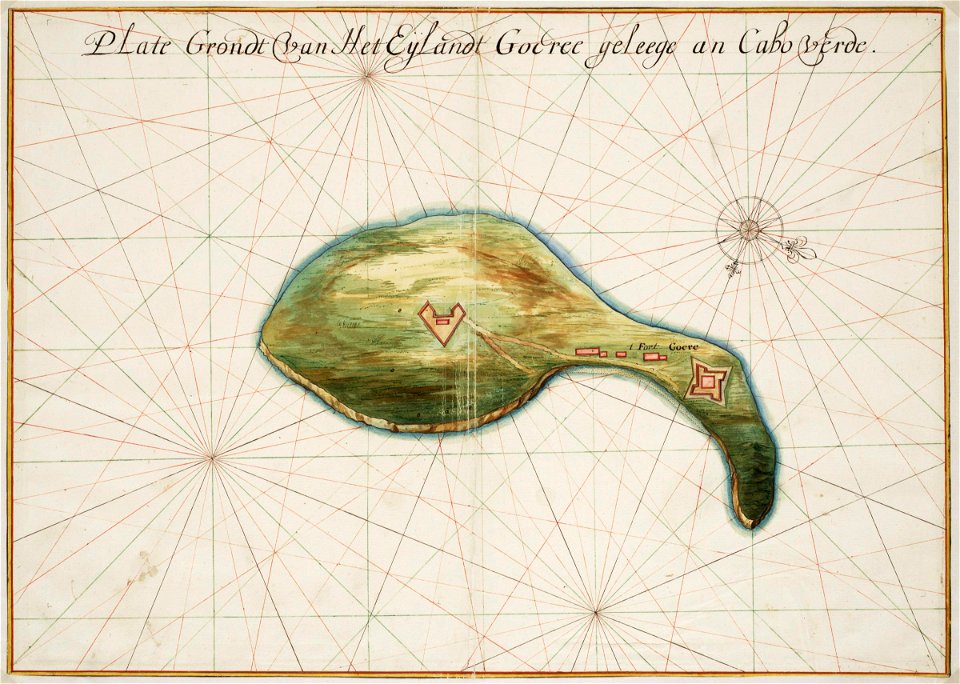
maps of the west-indische compagnie
1747 maps
1899 maps of south america
old maps of suriname
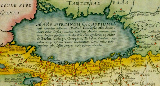
17th-century maps of the caspian sea
maps of persia by mercator-hondius
old maps of the nordic region
1840 maps
1650s maps of the americas
1658 maps
turgot map of paris, david rumsey historical map collection – derivative files
palais royal (1634–1763)
paintings by ezra ames
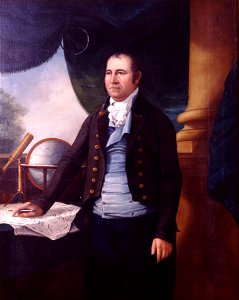
simeon de witt
old maps of the dutch east india company
anthonie de winter
shober & carqueville lithographing company
maps in the library of congress
turgot map of paris, kyoto university library – derivative files
foire saint-germain on old maps
gemeente atlas van nederland - south holland
maps of abbenbroek
maps from university of amsterdam special collections
atlas der neederlanden
roermond in the 17th century
old maps of roermond
paintings in the museo correr
joseph heintz (ii)
media from the national library of finland
classicism
guide joanne espagne et portugal-1915
1915 maps
john rocque 1746 london map (a1-h3)
clerkenwell
old maps of the history of oceania
maps by john cary
old maps of sierra leone
1662 maps
gemeente atlas van nederland - south holland
maps of south holland
maps from the mechanical curator collection available to georeference
maps from the mechanical curator collection
media from accademia delle scienze di torino
1620s maps of italy
18th-century maps of antwerp
maps of antwerp city walls
maps by willem and johannes blaeu
old maps of breda, netherlands
daniel friedrich sotzmann
grosser deutscher atlas
hoogheemraadschap rijnland map, 2nd edition, 1687
linen
guild houses in basel
baroque
everett d. graff collection of western americana
maps by g. w. & c. b. colton & co.
lawrence h. slaughter collection of english maps, charts, globes, books and atlases
nypl lionel pincus and princess firyal map division
maps of the west-indische compagnie
1665
maps of erfurt by braun & hogenberg
maps of jena by braun & hogenberg
maps of the dutch east india company - india
dutch suratte
gemeente atlas van nederland - south holland
1860s maps of south holland
gemeente atlas van nederland - south holland
maps of hendrik-ido-ambacht
hamburg in the 16th century
maps of hamburg-altstadt
eran laor cartographic collection
joseph schwarz
gemeente atlas van nederland - south holland
1860s maps of south holland
gemeente atlas van nederland - south holland
1860s maps of south holland
bodleian maps collection
leo belgicus
french-language maps of turkey
1788 maps of turkey
eran laor cartographic collection
latin-language maps
tourism advertising posters of germany
italian-language maps
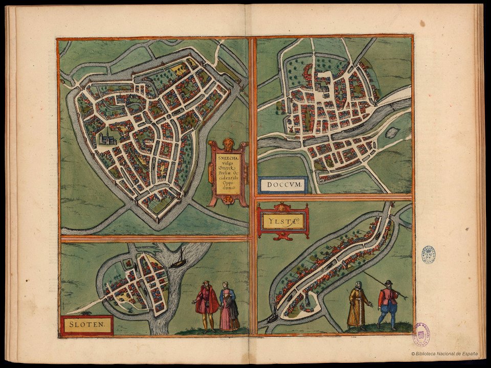
maps of dokkum by braun & hogenberg
maps of sneek by braun & hogenberg
german renaissance,humanism
1490s maps of the world
1667 sanson map of africa
maps by nicolas sanson
berlin-mitte in the 1740s
johann friedrich walther
old maps of north-west frontier province
old maps of the punjab region
maps by pieter mortier
1700 maps of africa
old maps of namur (province)
coats of arms on maps
maps by christian sgrothen
old maps of zeeland
1645 maps
baroque
maps of the dutch east india company - sri lanka
1726
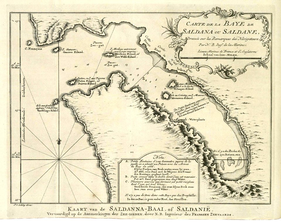
maps of the dutch east india company - south africa
1747 maps of africa
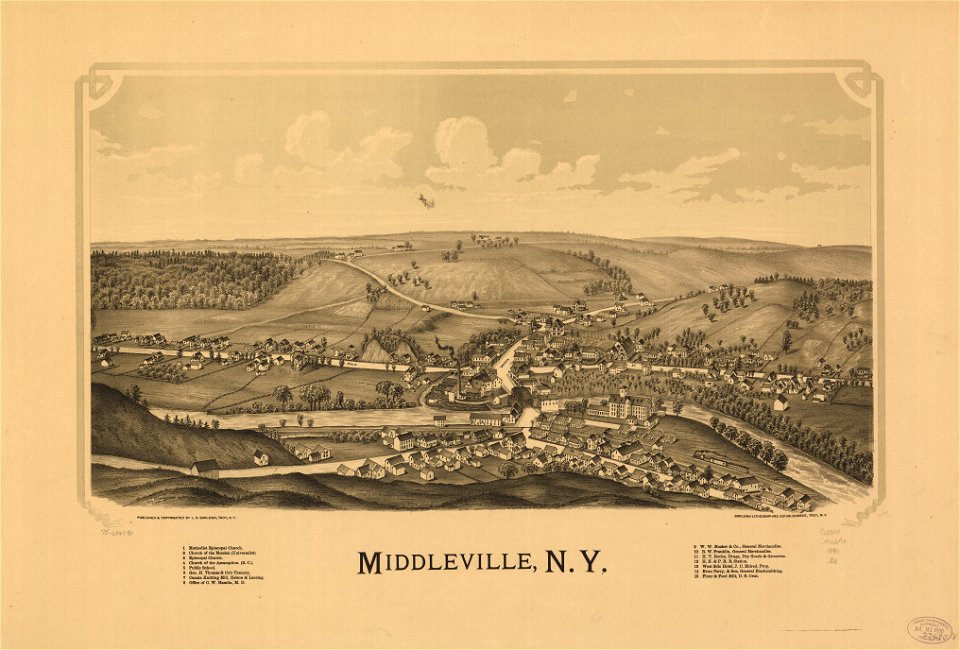
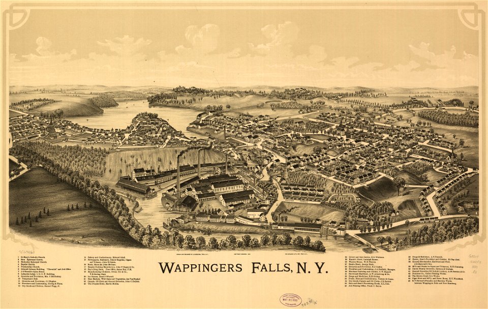
maps in the library of congress
1887 maps of new york (state)
maps in the library of congress
1887 maps of new york (state)
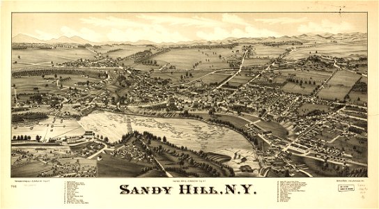
maps in the library of congress
1890 maps of new york (state)
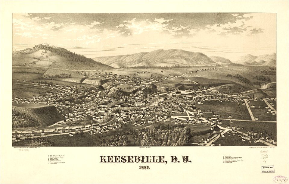
maps in the library of congress
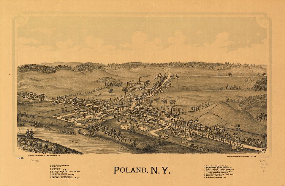
1884 maps of new york (state)
maps in the library of congress
1890 maps of new york (state)
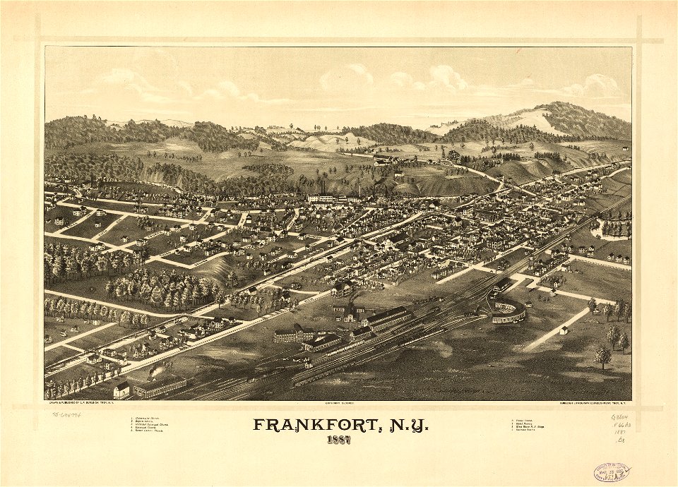
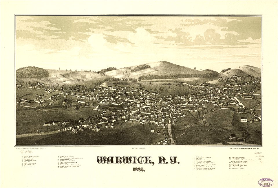
maps in the library of congress
1887 maps of new york (state)
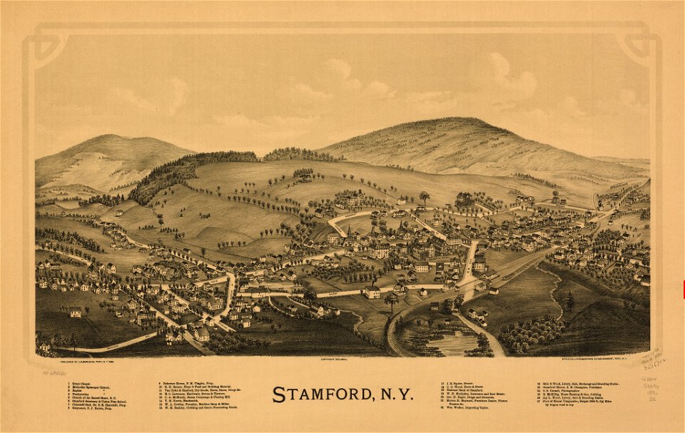
maps in the library of congress
1889 maps of new york (state)
maps in the library of congress
1890 maps of new york (state)
eran laor cartographic collection
edward weller
eran laor cartographic collection
john cary
eran laor cartographic collection
emanuel bowen
eran laor cartographic collection
michael burghers
1890s maps of the philippines
old maps of papua new guinea
gemeente atlas van nederland - south holland
1860s maps of south holland
2701 - 2800 of 26,489
Next page
/ 265