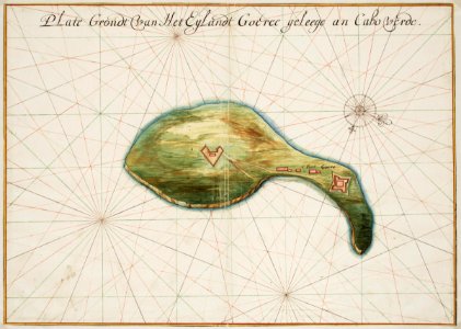
Map of the island of Goeree, Johannes Vingboons, circa 1665
Title in the leupe catalogue (na): "plategrondt van het eijlandt goeree geleege an cabo verde". Map of the island of goeree. Plate grondt van het eijlandt goeree geleege an cabo verde. Notes: the chart forms part of the vingboons atlas. Date: circa 1665. Dimensions: height: 59 cm (23.2 in); width: 42 cm (16.5 in). Medium: watercolour on paper. Collection: Nationaal Archief. AMH-6755-NA Map of the island of Goeree