Log in
All resources
Create a design
172 Free Artworks of Expedition Maps
maps indicating exploration
military maps
maps of the french and indian war
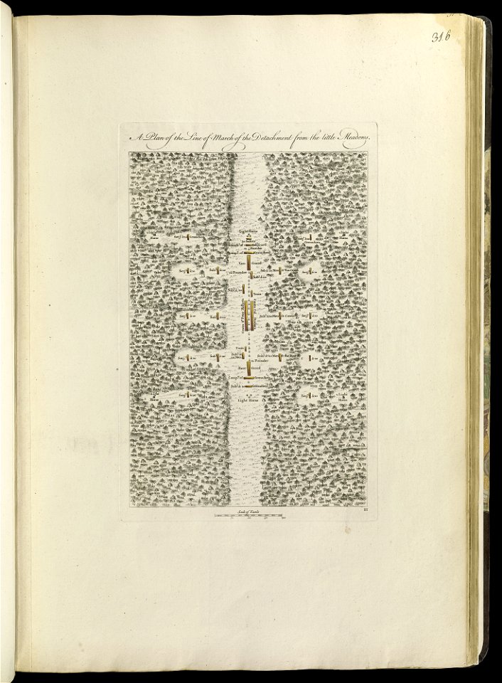
braddock road (braddock expedition)
maps from the earth and its inhabitants, vol. vi
exploration of asia
maps of journeys
charles eugène perron
1768 maps
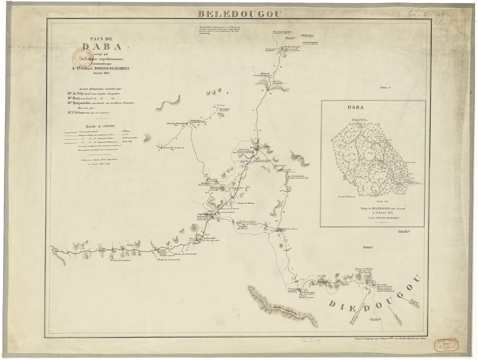
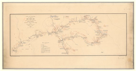
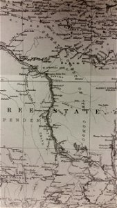
french colonization in africa
maps from the earth and its inhabitants, vol. vi
russia in the 19th century
maps from the earth and its inhabitants, vol. vi
russia in the 19th century
maps from the earth and its inhabitants, vol. vi
charles eugène perron
overwintering on nova zembla by willem barentsz, 1596-1597
maps in the rijksmuseum amsterdam
1876 maps
1884 maps
1876 maps
1884 maps
a voyage to terra australis
1814 engravings
maps from the earth and its inhabitants, vol. vi
maps of the silk road
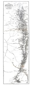
british expedition to abyssinia
henry morton stanley
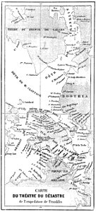
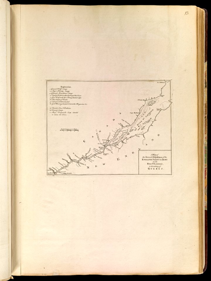
john franklin's lost expedition
volume 1 of le tour du monde
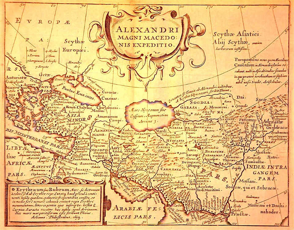
maps of alexander the great's wars
maps of the macedonian empire
military maps
aceh war
maps in the library of congress
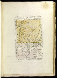
old maps of connecticut
maps in the library of congress
old maps of connecticut
maps of the french and indian war
1768 maps
maps of the french and indian war
1768 maps
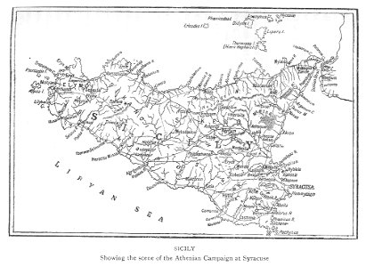
maps of the sicilian expedition
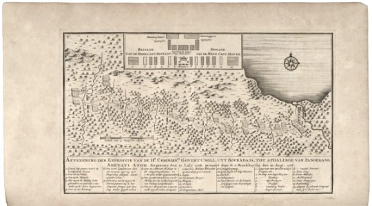
maps of the dutch east india company - indonesia
1724
maps of the french and indian war
1768 maps
maps of the french and indian war
1768 maps
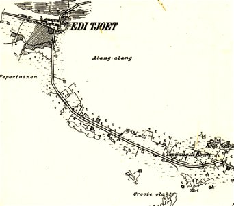
edi expedition
aceh war
maps of the french and indian war
1786 maps
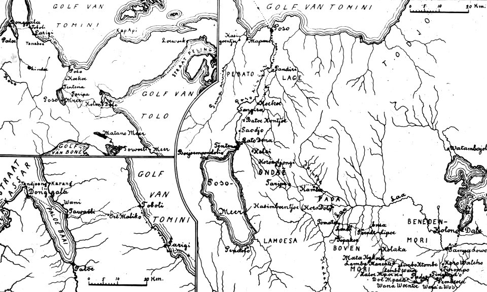
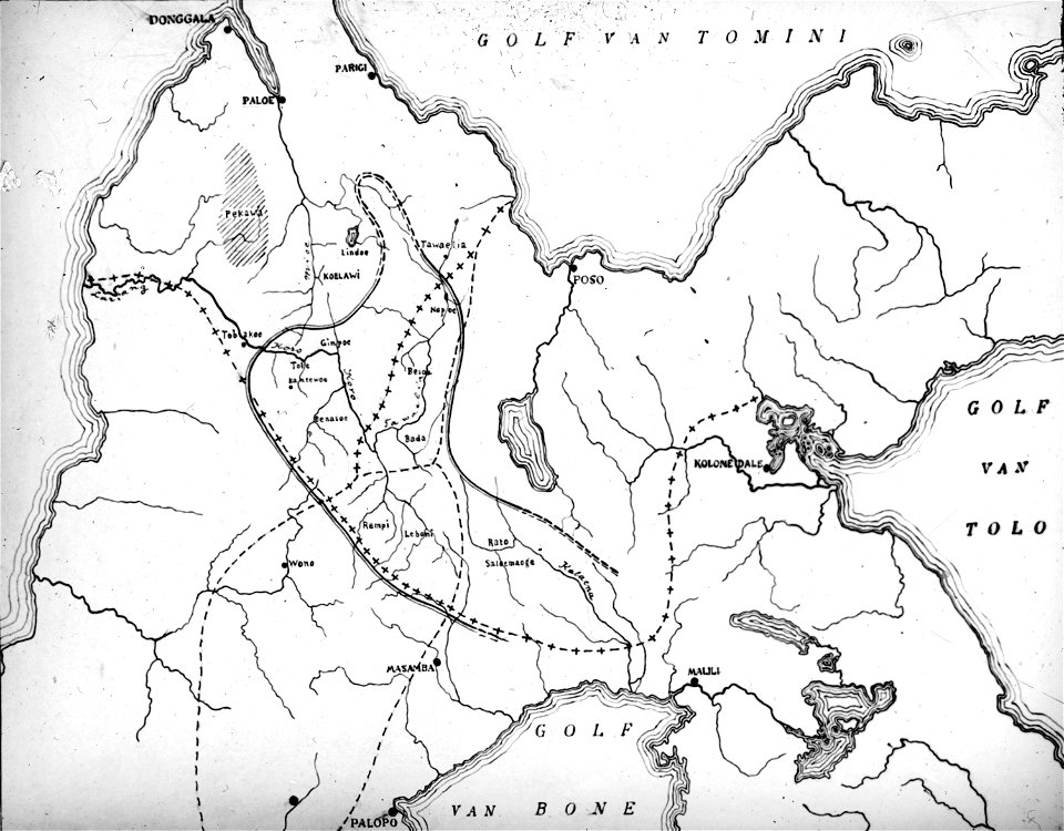
walter kaudern expedition to celebes
20th-century maps of indonesia
english-language maps
old maps of canada
walter kaudern expedition to celebes
walter kaudern
edi expedition
aceh war
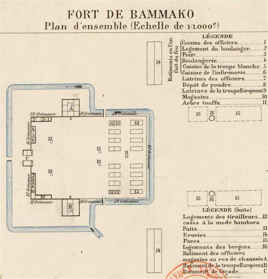
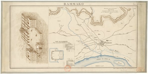
bamako in the 1880s
military maps
charts and maps of the royal museums greenwich
1682 maps
maps of the french and indian war
1768 maps
old maps of guyana
el dorado
maps of the french and indian war
1768 maps
illustrations of cosmographia (münster)
historical images of algiers
french colonization in africa
military maps
old maps of colombia
theodor de bry
through the dark continent
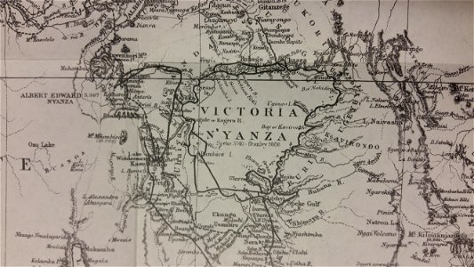
lake victoria
austro-hungarian north pole expedition
images of vasárnapi ujság in 1874
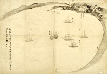
old maps of japan
perry expedition
l'illustration
1865,
volume 5 of le tour du monde
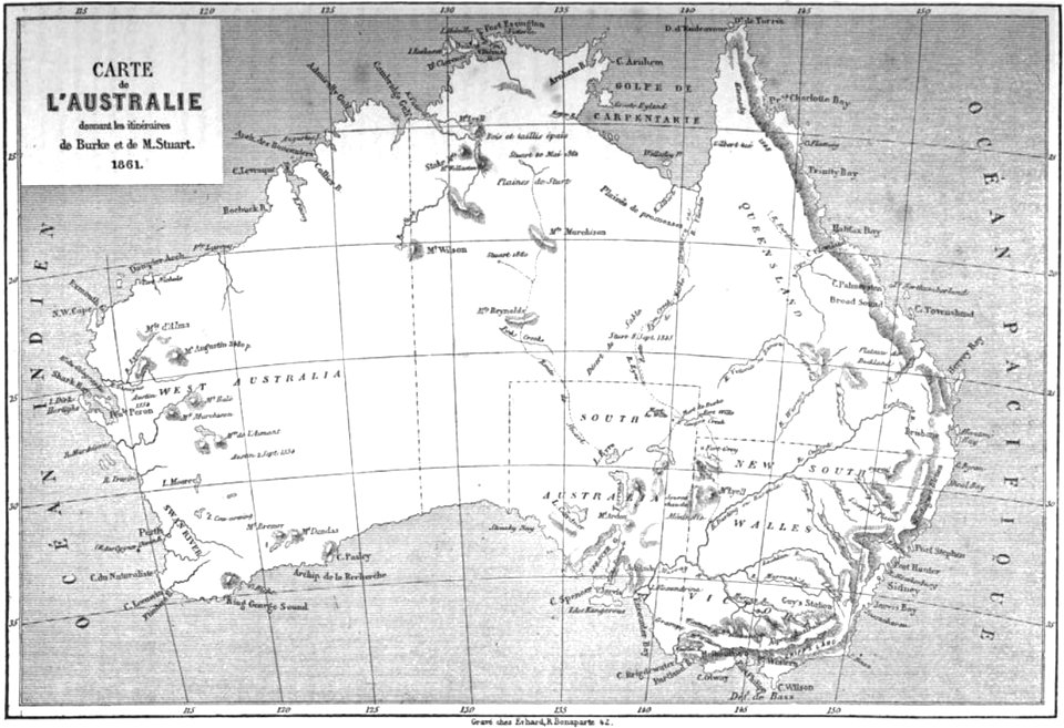
old maps of australia
walter kaudern expedition to celebes
maps of central sulawesi
bamako in the 1880s
military maps
french colonization in africa
military maps
bamako in the 1880s
military maps
french colonization in africa
military maps
old maps of the democratic republic of the congo
lake tanganyika
1853
54
walter kaudern expedition to celebes
walter kaudern
old maps of the democratic republic of the congo
through the dark continent
maps in utrecht university library
north new guinea expedition
maps from gallica
propaganda map
old constellation maps
maps by samuel dunn
old maps of the american revolution
conflicts in 1778
16th-century maps of guyana
old maps of french guiana
old maps of bouvet island
bouvet island
old maps of bouvet island
bouvet island
arabian expedition (1761-1767)
historical images of yemen
maps showing 19th-century history
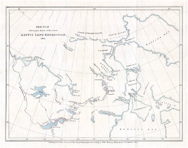
arctic expeditions
old maps of french guiana
1630s maps of brazil
maps indicating exploration
royal geographical society
1520s maps of the world
propaganda map
apsley cherry-garrard
edward wilson
1730s maps of south carolina
old maps of north america
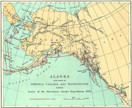
1900s maps of alaska
silver
from edinburgh to the antarctic. an artist's notes and sketches during the dundee antarctic expedition of 1892-93
expedition maps
norwegian north-atlantic expedition (1876-1878)
old maps of jan mayen
old maps of the bering strait
18th-century maps of siberia
victory expedition
northwest passage
victory expedition
northwest passage
austro-hungarian north pole expedition
maps of franz joseph land
arctic expeditions from british and foreign shores - from the earliest to the expedition of 1875 (1875)
1870s maps of canada
ismailïa. a narrative of the expedition to central africa for the suppression of the slave trade (1874)
1874 maps of africa
reisebeschreibung nach arabien und andern umliegender ländern
media from the collections of the danish state archives
geneviève brossard de beaulieu
jean-françois de la pérouse
maps by willem and johannes blaeu
1610s maps of the americas
maps by gouverneur k. warren
maps by edwin freyhold
voyage de découvertes aux terres australes
old maps of australia
narrative of a five years' expedition (1806)
romanticism,fairy painting
ismailïa. a narrative of the expedition to central africa for the suppression of the slave trade (1874)
nyanza, rwanda
maps in "the danish ingolf-expedition"
crustacea malacostraca (1908)
nicolas-andré monsiau
neoclassicism
maps of novaya zemlya
1590s maps
maps from the mechanical curator collection available to georeference
maps from the mechanical curator collection
maps from the earth and its inhabitants, vol. xv
exploration of the arctic
1830 maps of the united states
maps by george w. boynton
1810 maps of north america
1810 maps of mexico
maps from the mechanical curator collection available to georeference
maps from the mechanical curator collection
maps of crossings of the atlantic ocean
1890s maps of the atlantic ocean
7th portuguese india armada (almeida, 1505)
maps of cefala by braun & hogenberg
maps
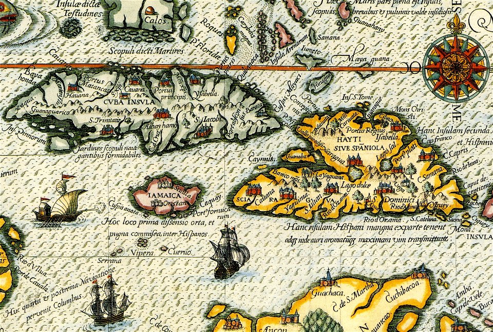
cuba
maps
cuba
maps
cuba
maps
cuba
maps
cuba
ismailïa. a narrative of the expedition to central africa for the suppression of the slave trade (1874)
history of africa
romanticism,fairy painting
old maps of suriname
maps of ottoman algeria
old maps of algiers
corona and coronet (1898)
1898 maps of the world
narrative of the arctic land expedition to the mouth of the great fish river - and along the shores of the arctic ocean, in the years, 1833, 1834, and 1835 (1836)
old maps of the canadian arctic region
victory expedition
1890s maps of south africa
emil holub
1 - 100 of 172
Next page
/ 2