Log in
All resources
Create a design
660 Free Artworks of 1876 Maps
charles eugène perron
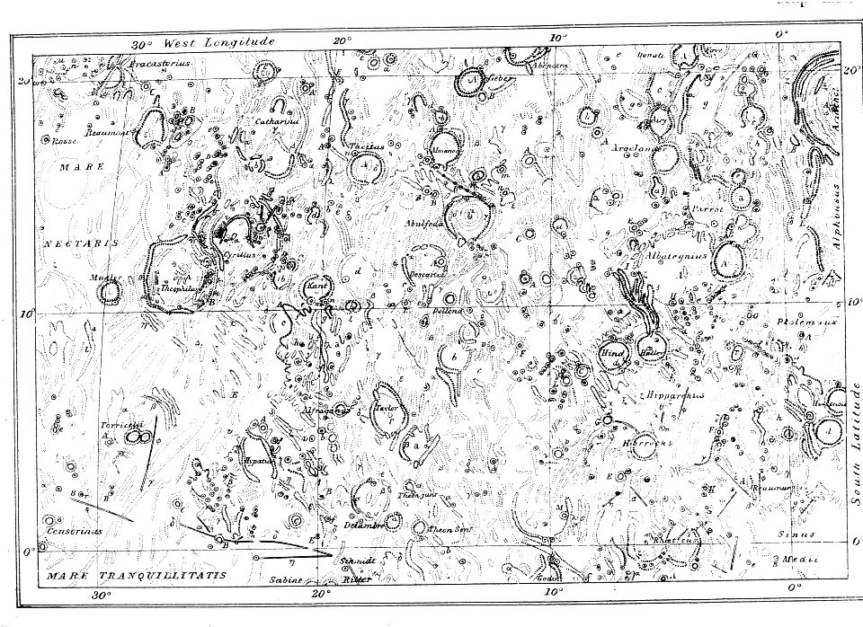
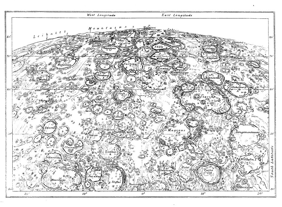
1876 map sheets
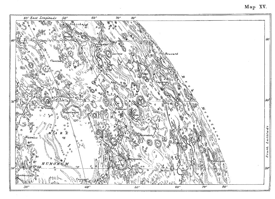
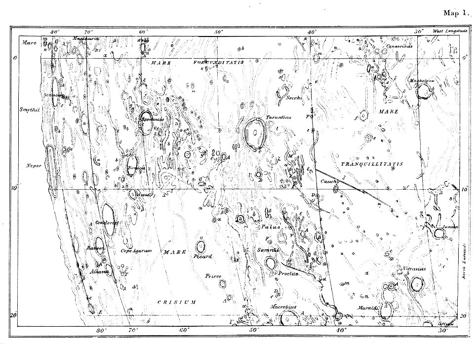
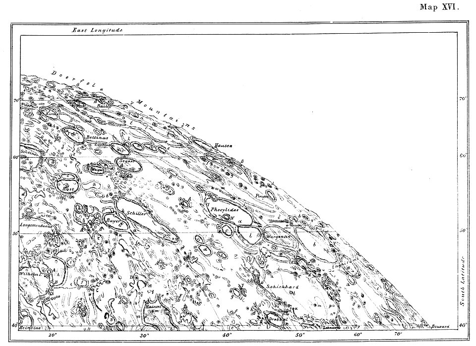
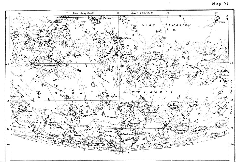
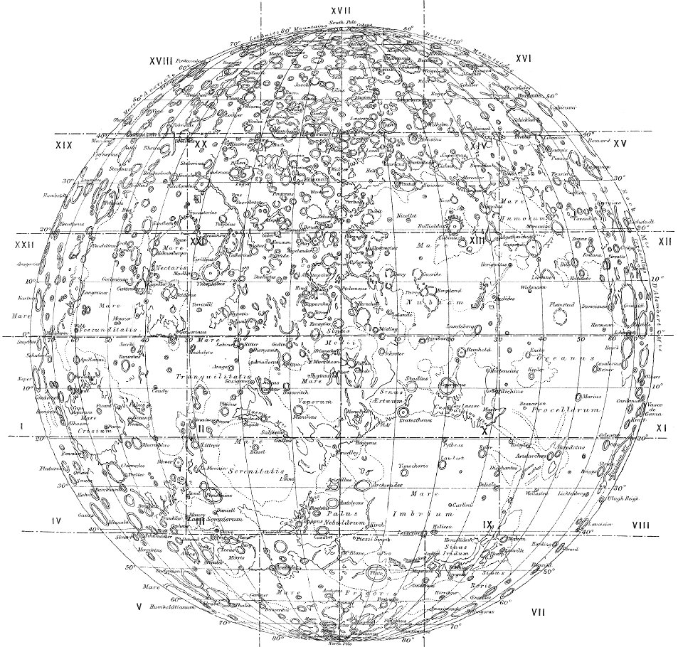
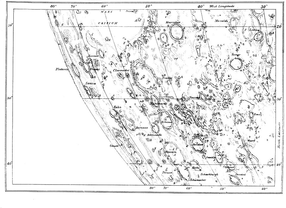
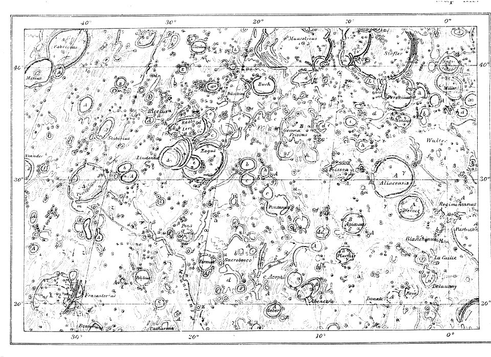
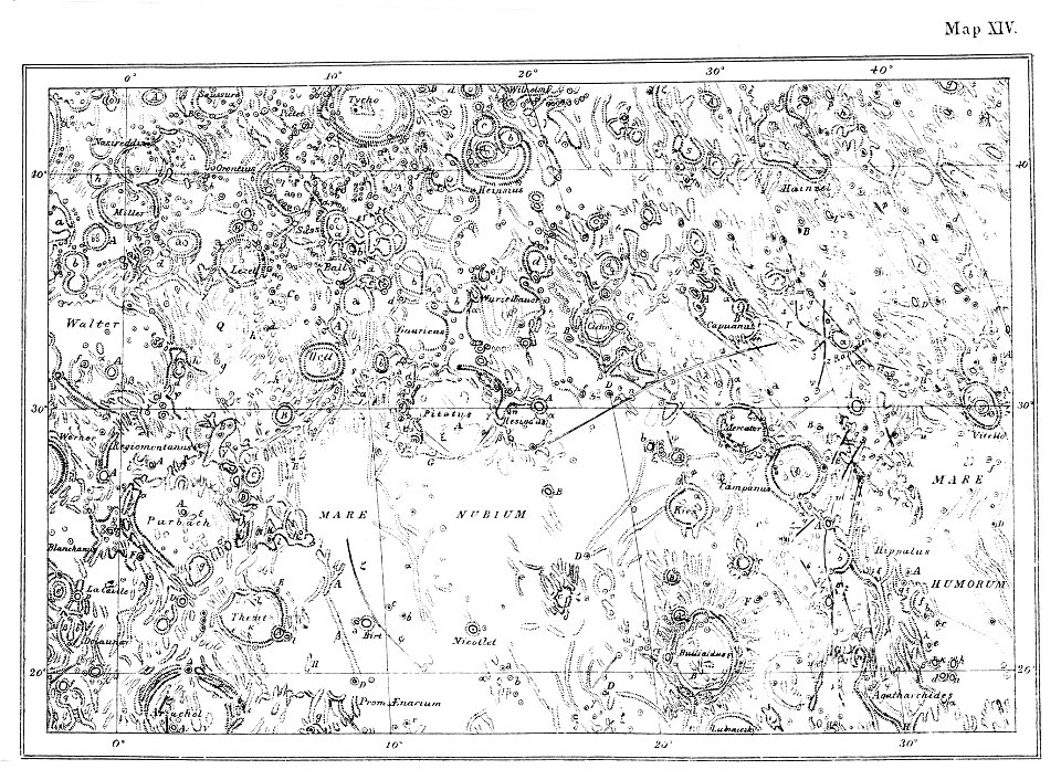
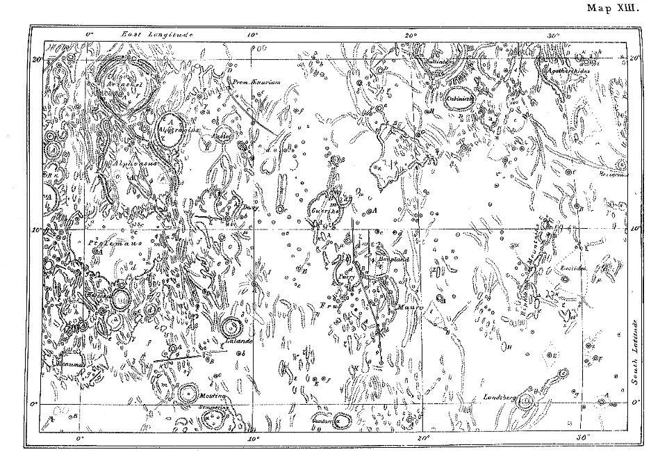
neison
nouvelle géographie universelle, vol. xii
19th-century maps of the azores
19th-century maps of madeira
africa and its inhabitants, vol. ii
the geographical distribution of animals (book)
everett d. graff collection of western americana
maps of ecozones
maps from the earth and its inhabitants, vol. vi
maps indicating exploration
1876 maps
1884 maps
1876 maps
1884 maps
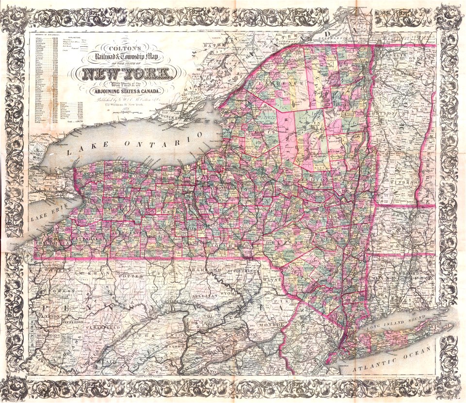
maps by joseph hutchins colton
1876 maps of new york (state)
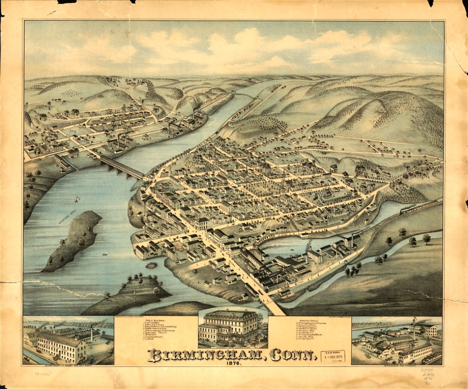
old maps of connecticut
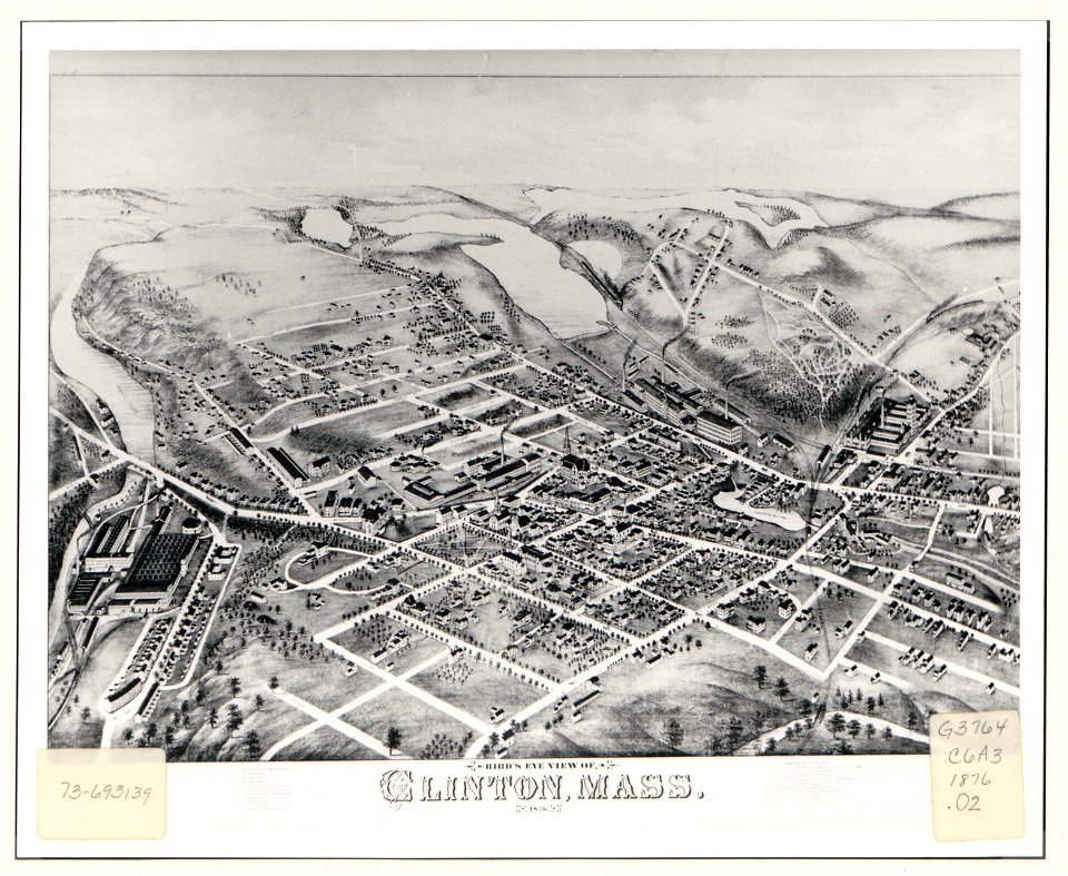
o. h. bailey
massachusetts
clinton
massachusetts
clinton
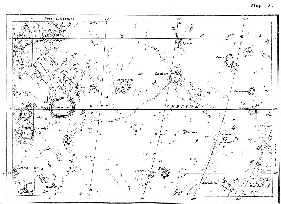
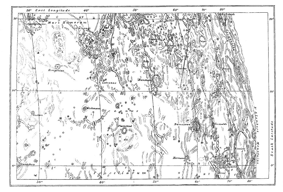
1876 map sheets
neison
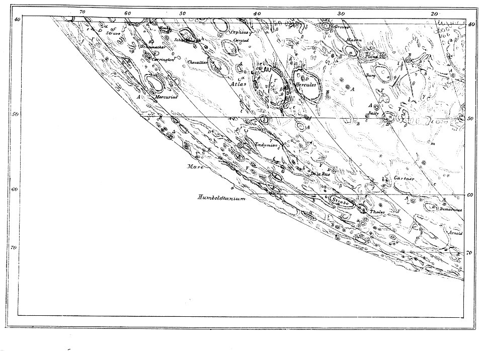
1876 map sheets
neison
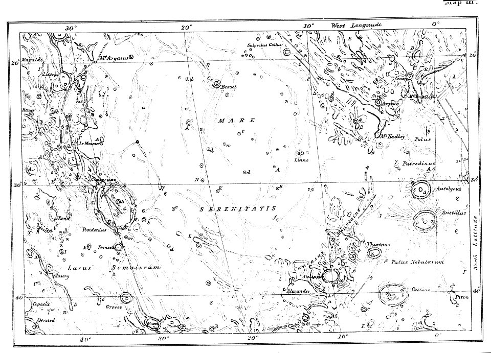
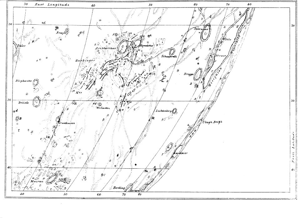
1876 map sheets
neison
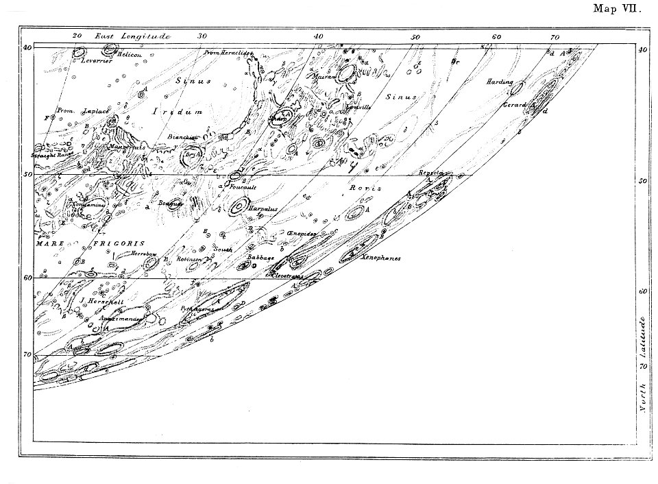
1876 map sheets
neison
1876 map sheets
neison
1876 map sheets
neison
1876 map sheets
neison
1876 map sheets
neison
1876 map sheets
neison
1876 map sheets
neison
1876 map sheets
neison
1876 map sheets
neison
1876 map sheets
neison
1876 map sheets
neison
1876 map sheets
neison
1876 map sheets
neison
1876 map sheets
neison
1876 map sheets
neison
1876 map sheets
neison
1876 map sheets
neison
1876 map sheets
neison
1876 map sheets
neison
1876 map sheets
neison
everett d. graff collection of western americana
everett d. graff collection of western americana
everett d. graff collection of western americana
everett d. graff collection of western americana
everett d. graff collection of western americana
everett d. graff collection of western americana
everett d. graff collection of western americana
1876 maps
lemuria
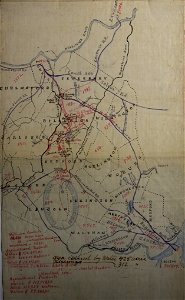
billerica and bedford railroad
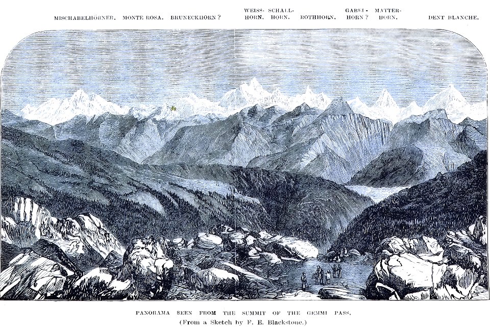
the central alps ... being the second part of the alpine guide ... new edition (with maps) by ball
john - president of the alpine club
timeline of major famines in india during british rule
history of india
john - president of the alpine club
piz languard
john - president of the alpine club
historical images of gemmipass
1870s paintings from france
1876 paintings
nouvelle géographie universelle, vol. i
maps showing 19th-century history
the geographical distribution of animals (book)
zoogeography
media from the national library of finland
classicism
frank leslie's illustrated newspaper, 1876
maps in the library of congress
maps of lake chad
gustav nachtigal
maps from the earth and its inhabitants, vol. vi
maps of journeys
nouvelle géographie universelle, vol. xii
charles eugène perron
nouvelle géographie universelle, vol. xii
charles eugène perron
nouvelle géographie universelle, vol. xii
charles eugène perron
nouvelle géographie universelle, vol. xii
charles eugène perron
pictorial maps of the world
1876 maps of the world
africa and its inhabitants, vol. ii
charles eugène perron
the geographical distribution of animals (book)
maps of ecozones
the geographical distribution of animals (book)
palearctic
africa and its inhabitants, vol. ii
charles eugène perron
nouvelle géographie universelle, vol. xii
charles eugène perron
nouvelle géographie universelle, vol. xii
charles eugène perron
nouvelle géographie universelle, vol. xii
charles eugène perron
old maps of cities in switzerland
maps of biel/bienne
nouvelle géographie universelle, vol. xii
charles eugène perron
nouvelle géographie universelle, vol. xii
charles eugène perron
nouvelle géographie universelle, vol. xii
charles eugène perron
nouvelle géographie universelle, vol. xii
charles eugène perron
nouvelle géographie universelle, vol. xii
charles eugène perron
maps in the library of congress
1876 maps of pennsylvania
africa and its inhabitants, vol. ii
charles eugène perron
old maps of douarnenez
old maps of brest
africa and its inhabitants, vol. ii
charles eugène perron
the geographical distribution of animals (book)
afrotropic
the geographical distribution of animals (book)
nearctic
the geographical distribution of animals (book)
indomalayan fauna
the geographical distribution of animals (book)
neotropic
africa and its inhabitants, vol. ii
charles eugène perron
africa and its inhabitants, vol. ii
charles eugène perron
africa and its inhabitants, vol. ii
charles eugène perron
charles eugène perron
old maps of trabzon
the geographical distribution of animals (book)
australasia
norwegian north-atlantic expedition (1876-1878)
old maps of jan mayen
africa and its inhabitants, vol. ii
charles eugène perron
dr. wilh. junker's reisen in afrika 1875-1886
old maps of khartoum
africa and its inhabitants, vol. ii
charles eugène perron
maps from géographie illustrée de la france et de ses colonies
orientalist painting
1876 maps of north america
1876 maps of the caribbean
austro-hungarian north pole expedition
maps of franz joseph land
africa and its inhabitants, vol. ii
charles eugène perron
maps of rivers of equatorial guinea
komo (river)
19th-century maps of nicaragua
bedford pim
french-language maps of south africa
1876 maps of africa
1876 maps of the united states
old maps of new england
dr. wilh. junker's reisen in afrika 1875-1886
1889 maps of sudan
old maps of the sea of galilee
french-language maps
the comprehensive history of england (1876)
english-language maps showing history
géographie générale; physique, politique et économique (1876)
19th-century maps of bretagne
géographie générale; physique, politique et économique (1876)
old maps of the strait of gibraltar
engravings from michael strogoff by charles barbant
illustrations from michael strogoff by jules férat
engravings from michael strogoff by charles barbant
illustrations from michael strogoff by jules férat
1 - 100 of 660
Next page
/ 7