Log in
All resources
Create a design
154 Free Artworks of Atlases
lawrence h. slaughter collection of english maps, charts, globes, books and atlases
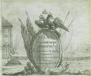
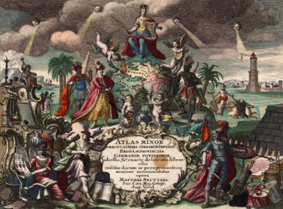
title pages of atlases
gemeente atlas van nederland - south holland
1860s maps of south holland
netherlands in the 1860s
nypl lionel pincus and princess firyal map division
maps of north america
covens en mortier
maps by willem and johannes blaeu
carte de l'amérique septentrionale by guillaume delisle (1700)
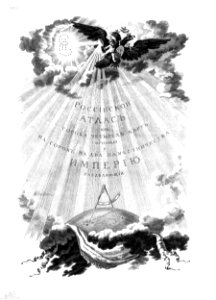
atlas of the russian empire (1792)
title pages of atlases
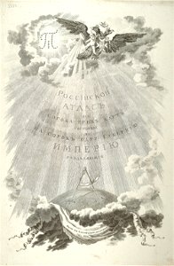
small atlas of the russian empire (1792)
title pages of atlases
coat of arms of the russian empire
title pages of atlases
joan blaeu
old map
illustrated title pages from the netherlands
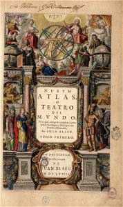
title pages of atlases
color engravings
cornucopia
atlas van der hagen (volume 4)
people with animals in art
nypl lionel pincus and princess firyal map division
geographical atlases
nypl collection of atlases, gazetteers, guidebooks and other books
nypl lionel pincus and princess firyal map division
copper engravings
philips galle
exploration of australia
1593
lawrence h. slaughter collection of english maps, charts, globes, books and atlases
maps of nieuw nederland
lawrence h. slaughter collection of english maps, charts, globes, books and atlases
covens en mortier
title pages of atlases
copper engravings
publications of jesuits
novus atlas sinensis
leopold i, holy roman emperor
novus atlas sinensis
maps by willem and johannes blaeu
title pages of atlases
lawrence h. slaughter collection of english maps, charts, globes, books and atlases
1640s maps of the americas
maps by willem and johannes blaeu
title pages of atlases
gemeente atlas van nederland - south holland
maps of zoeterwoude
a map of the provinces of new york and new jersey, with a part of pennsylvania and the province of quebec
lawrence h. slaughter collection of english maps, charts, globes, books and atlases
gemeente atlas van nederland - utrecht
old maps of amersfoort
lawrence h. slaughter collection of english maps, charts, globes, books and atlases
pre-raphaelite brotherhood
gemeente atlas van nederland - groningen
maps of winschoten
lawrence h. slaughter collection of english maps, charts, globes, books and atlases
de nieuwe en onbekende weereld
lawrence h. slaughter collection of english maps, charts, globes, books and atlases
nypl lionel pincus and princess firyal map division
william frederick mitchell
james sprent virtue
a map of the provinces of new york and new jersey, with a part of pennsylvania and the province of quebec
lawrence h. slaughter collection of english maps, charts, globes, books and atlases
a map of the provinces of new york and new jersey, with a part of pennsylvania and the province of quebec
lawrence h. slaughter collection of english maps, charts, globes, books and atlases
title pages of atlases
1811 books
history of clothing
illustrations
gemeente atlas van nederland - overijssel
netherlands in the 1860s
gemeente atlas van nederland - friesland
old maps of leeuwarden
gemeente atlas van nederland - groningen
maps of appingedam
gemeente atlas van nederland - south holland
maps of noordeloos
maps by willem and johannes blaeu
title pages of atlases
johannes van keulen
gerard van keulen
19th-century maps of south holland
maps of veur
gemeente atlas van nederland - gelderland
netherlands in the 1860s
gemeente atlas van nederland - south holland
1860s maps of south holland
gemeente atlas van nederland - groningen
old maps of groningen (city)
drawings by adolph menzel in the national gallery of art (washington, d. c. )
realism
nypl collection of atlases, gazetteers, guidebooks and other books
nypl lionel pincus and princess firyal map division
lawrence h. slaughter collection of english maps, charts, globes, books and atlases
1700s maps of north america
gemeente atlas van nederland - south holland
maps of alblasserdam
lawrence h. slaughter collection of english maps, charts, globes, books and atlases
covens en mortier
gemeente atlas van nederland - limburg
19th-century maps of maastricht
grosser deutscher atlas
title pages of atlases
gemeente atlas van nederland - south holland
maps of peursum
maps by pieter mortier
indochina
gemeente atlas van nederland - gelderland
maps of ophemert
1866 in the netherlands
maps of almelo
lawrence h. slaughter collection of english maps, charts, globes, books and atlases
de nieuwe en onbekende weereld
lawrence h. slaughter collection of english maps, charts, globes, books and atlases
1700 maps of the atlantic ocean
maps of landgraaf
rimburg
lawrence h. slaughter collection of english maps, charts, globes, books and atlases
1700 maps of the atlantic ocean
lawrence h. slaughter collection of english maps, charts, globes, books and atlases
covens en mortier
lawrence h. slaughter collection of english maps, charts, globes, books and atlases
nypl lionel pincus and princess firyal map division
lawrence h. slaughter collection of english maps, charts, globes, books and atlases
nypl lionel pincus and princess firyal map division
lawrence h. slaughter collection of english maps, charts, globes, books and atlases
maps by claude joseph sauthier
maps of aa en hunze
gieten
maps of aa en hunze
anloo
lawrence h. slaughter collection of english maps, charts, globes, books and atlases
nypl lionel pincus and princess firyal map division
history of alphen aan den rijn
maps of aarlanderveen
atlas maior, vol 11 (asia) - joan blaeu, 1667 - bl 114.h(star).11
title pages of atlases
gemeente atlas van nederland - south holland
1860s maps of south holland
cartouches by jodocus hondius
colored engravings
19th-century maps of south holland
netherlands in the 1860s
gemeente atlas van nederland - south holland
maps of abbenbroek
gemeente atlas van nederland - south holland
maps of zuidland
atlas maior, vol 11 (asia) - joan blaeu, 1667 - bl 114.h(star).11
title pages of atlases
hoogheemraadschap van rijnland
maps of woubrugge
gemeente atlas van nederland - groningen
maps of hoogezand
gemeente atlas van nederland - groningen
maps of noordbroek
gemeente atlas van nederland - south holland
maps of heenvliet
colonial history of the united states
old maps of new york (state)
gemeente atlas van nederland - south holland
maps of geervliet
august kneisel
atlases
maps of morocco by mercator-hondius
lawrence h. slaughter collection of english maps, charts, globes, books and atlases
nypl lionel pincus and princess firyal map division
maps of uithuizermeeden
oldenzijl
carte de barbarie, nigritie, guinée par guillaume delisle (1707)
1792 maps of africa
lawrence h. slaughter collection of english maps, charts, globes, books and atlases
nypl lionel pincus and princess firyal map division
lawrence h. slaughter collection of english maps, charts, globes, books and atlases
nypl lionel pincus and princess firyal map division
lawrence h. slaughter collection of english maps, charts, globes, books and atlases
nypl lionel pincus and princess firyal map division
lawrence h. slaughter collection of english maps, charts, globes, books and atlases
nypl lionel pincus and princess firyal map division
lawrence h. slaughter collection of english maps, charts, globes, books and atlases
novi belgii, atlas maior
14th-century illuminated manuscripts from spain
jong (ship)
old maps of łódź
kosmopolita
british library king's topographical collection
william henry toms
old maps of the new kingdom of granada
maps by willem and johannes blaeu
gemeente atlas van nederland - south holland
maps of alkemade
british library king's topographical collection
robert dodd
battle of the nile
cooper willyams
a map of the provinces of new york and new jersey, with a part of pennsylvania and the province of quebec
lawrence h. slaughter collection of english maps, charts, globes, books and atlases
lawrence h. slaughter collection of english maps, charts, globes, books and atlases
covens en mortier
le neptune francois
jan van vianen
1779 maps of new york (state)
old maps of new york (state)
turgot map of paris, norman b. leventhal map center
sheet 19 of the turgot map of paris
lawrence h. slaughter collection of english maps, charts, globes, books and atlases
atlas novus (blaeu)
1 - 100 of 154
Next page
/ 2


![Titelblad] AFRICA](https://cdn.creazilla.com/illustrations/10000408184/titelblad-africa-sm.webp)


![Novi Belgii, quod nunc Novi Jorck vocatur, Novae q[ue] Angliae & partis Virginiae: accuratissima et novissima delineatio., 1671](https://cdn.creazilla.com/illustrations/10000934523/novi-belgii-quod-nunc-novi-jorck-vocatur-novae-que-angliae-partis-virginiae-accuratissima-et-novissima-delineatio-1671-md.jpg)


