Log in
All resources
Create a design
74 Free Artworks of 19th Century Maps Of Cities
maps by john cary
john cary
french-language maps
1799 maps
19th-century maps of antwerp
maps of antwerp city walls
maps from the earth and its inhabitants, vol. xvi
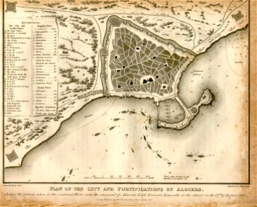
old maps of algiers
algiers in the 19th century
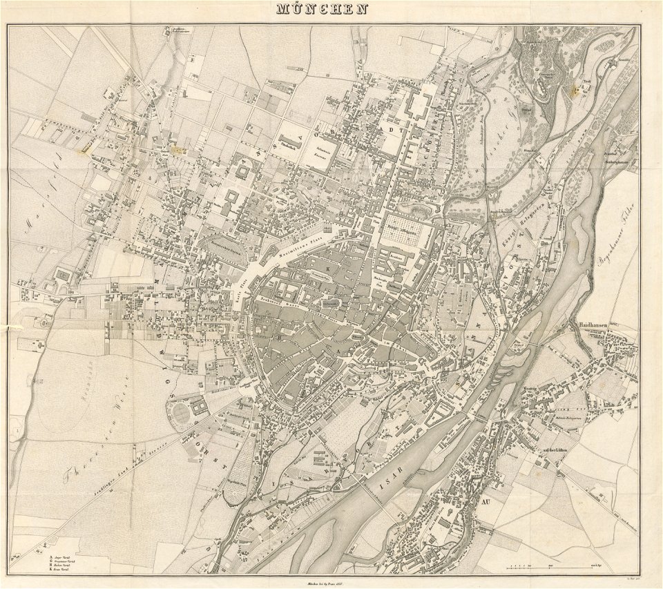
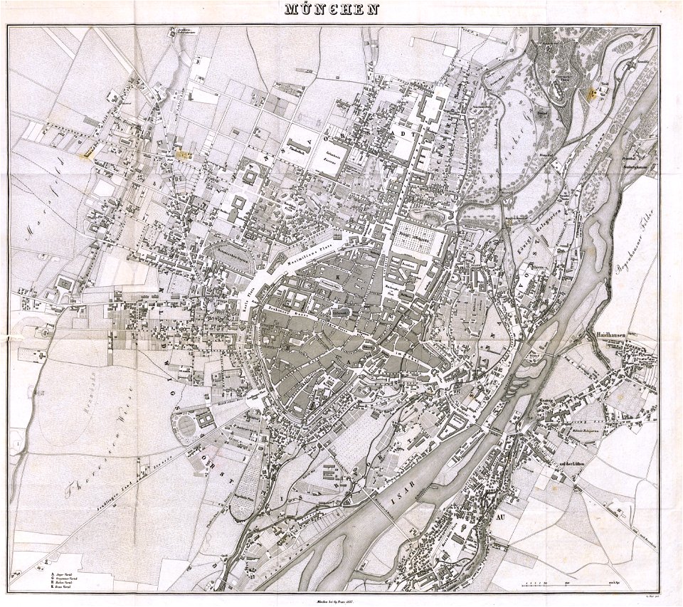
munich in the 19th century
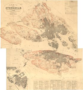
19th-century maps of stockholm
1870 maps
ottoman period in the history of algeria
1816 maps
munich in the 19th century
old city maps of munich
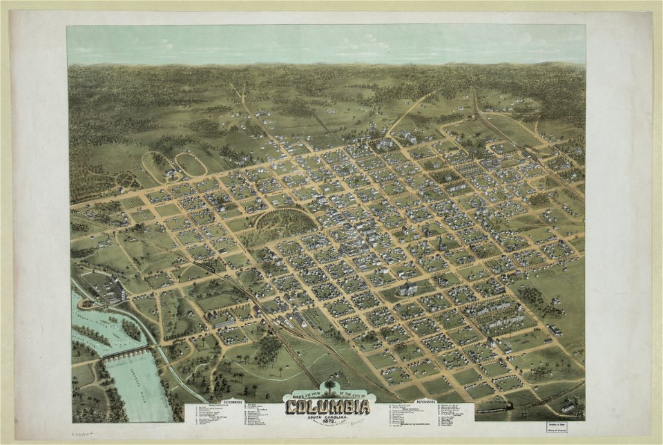
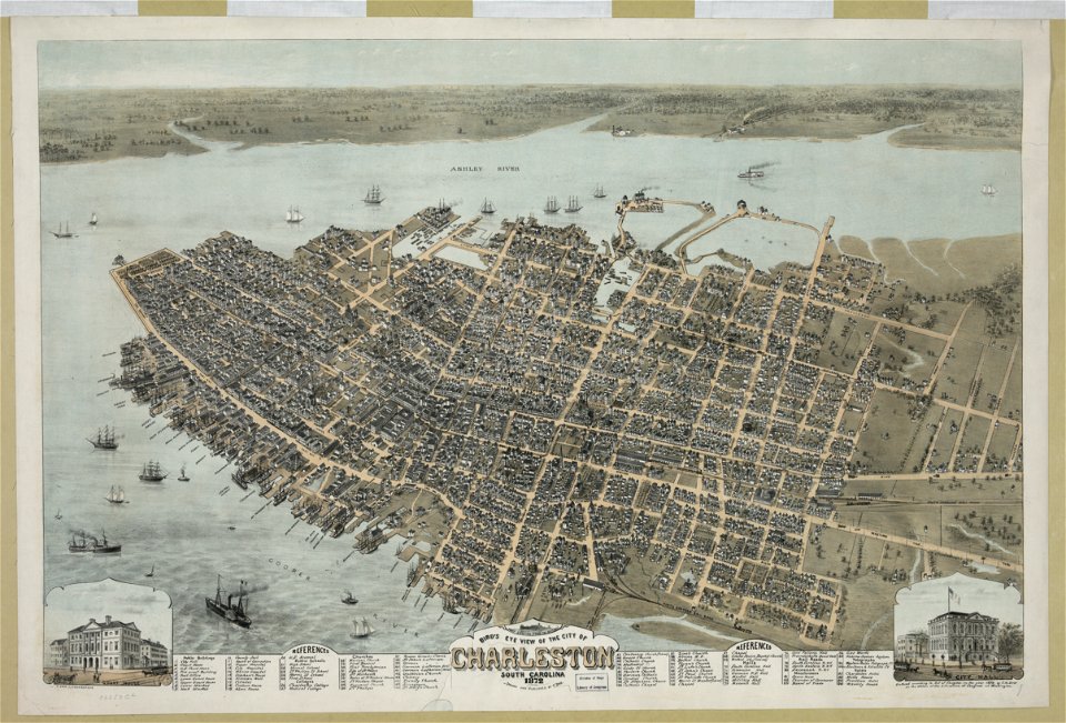
south carolina in the 19th century
columbia
south carolina in the 19th century
columbia
the illustrated london news 1860
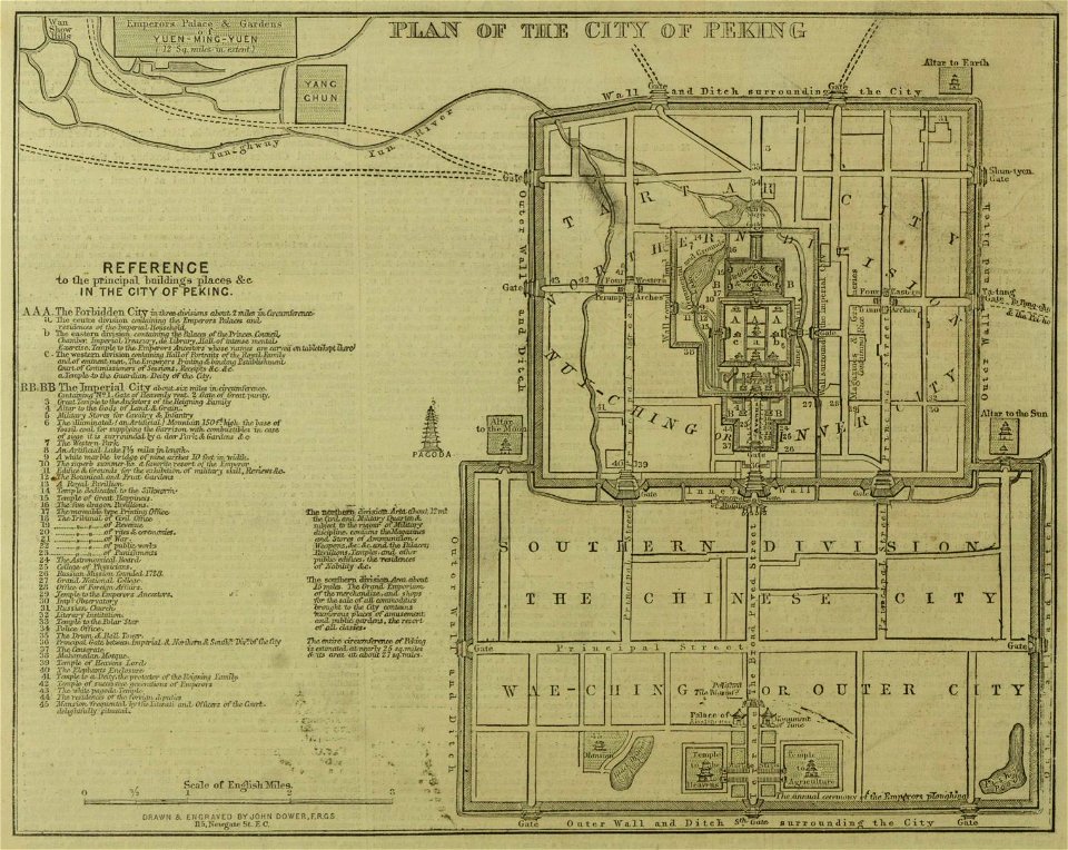
19th-century maps of china
south carolina
charleston
chromolithograph
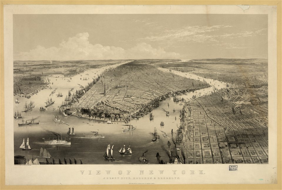
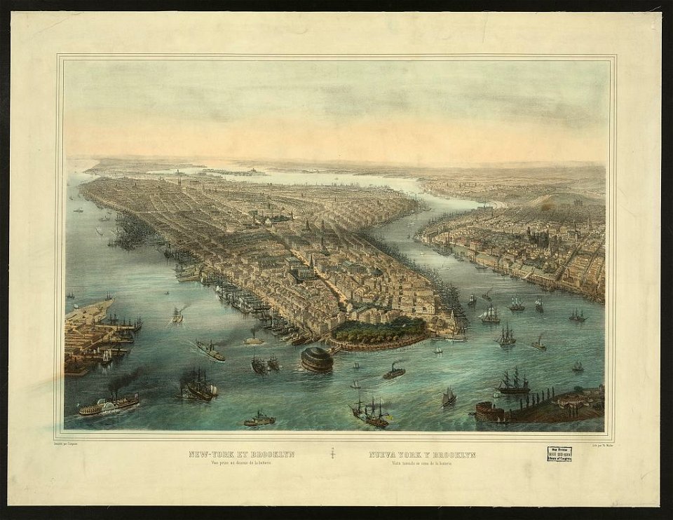
new york city
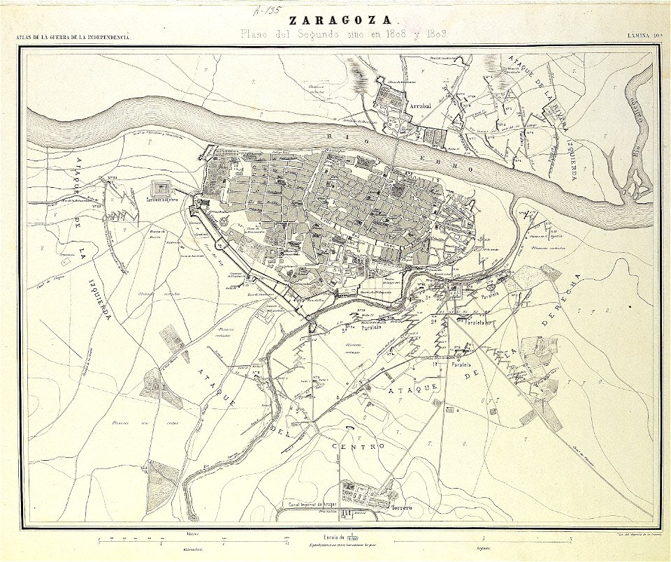
second siege of zaragoza
1868
cádiz in the 19th century
scanned spanish texts
munich in the 19th century
old city maps of munich
chromolithograph
currier and ives
munich in the 19th century
old city maps of munich
19th-century lithographs in the united states
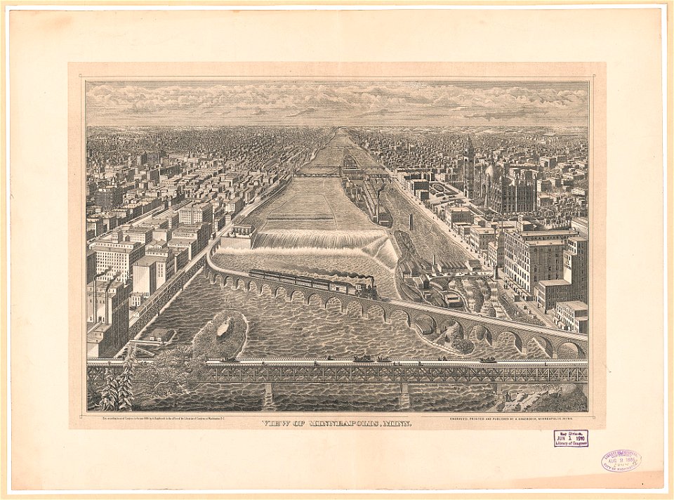
mississippi river at minneapolis
1892 in the united states
laredo, texas
19th-century maps of southeast asia
aristide-michel perrot
caricatures
cartoons
old maps of são paulo (city)
maps of são paulo (city)
antoine-françois tardieu
maps from gallica
great fire of 1866 in quebec city
19th-century maps of quebec city
maps by john cary
1799 maps
maps of utrecht (city) city walls
old maps of utrecht (city)
1860s maps of new york (state)
maps showing 1776
maps, prints and photographs in royal danish library
old maps of kiel
herenpoort (leiden)
old maps of leiden
maps by john cary
1801 maps
algiers in the 19th century
old maps of algiers
print room of the university of antwerp
plattegrond van antwerpen
old maps of algiers
maps from gallica
1830s maps of switzerland
1834 maps of europe
illustrations from découverte de la terre
19th-century maps of cities
print room of the university of antwerp
citadel van antwerpen
old maps of manhattan, new york city
croton aqueduct
19th-century maps of antwerp
maps of antwerp city walls
print room of the university of antwerp
kaarten van vlaanderen (prentenkabinet)
19th-century maps of dresden
vogelsches gartenhaus
chicago and the midwest, newberry library
old maps of the mississippi river
kaiserdom st. bartholomäus in the 19th century
maps of frankfurt-innenstadt
maps by juan lopez
1835 maps of spain
maps by john cary
1799 maps
maps by john cary
1799 maps
1800s maps of egypt
maps by john cary
1801 maps of germany
maps by john cary
china, the scenery, architecture, and social habits of that ancient empire
paintings of the qing dynasty
18th-century maps of ireland
old maps of dublin
geometrischer grundriss von frankfurt am mayn (1811)
untermainkai
maps by john cary
1801 maps
maps from the earth and its inhabitants, vol. xvi
19th-century maps of mexico city
19th-century maps of the malay archipelago
19th-century maps of southeast asia
maps by john cary
1799 maps
old maps of swabia
maps by john cary
english-language maps
maps by john cary
maps of territories in the lower saxony circle
maps by john cary
maps from the earth and its inhabitants, vol. xvi
19th-century maps of mexico city
maps from the earth and its inhabitants, vol. xvi
19th-century maps of jamaica
maps from the earth and its inhabitants, vol. xvi
19th-century maps of mexico city
1739 maps of france
plan de turgot
1739 maps of france
louis bretez
1739 maps of france
plan de turgot
georg friedrich schmidt
samuel von schmettau
japanese paintings in the rijksmuseum amsterdam
kawahara keiga
royal street, french quarter
cafés in new orleans
19th-century maps of groningen (province)
old maps of groningen (city)
1779 maps of the united states
1770s maps of the caribbean
maps of the battle of fredericksburg
19th-century pencil drawings
19th-century watercolor paintings in the united states
anne marguerite hyde de neuville
prints in musée carnavalet
french school
maps in the rijksmuseum amsterdam
emrik & binger
maps in the rijksmuseum amsterdam
emrik & binger
engravings in the government art collection
james sands (engraver)
uxmal in the 19th century
uxmal in art
cartes adresses de l'imprimerie delâtre
engravings in musée carnavalet
dutch 19th-century prints in the rijksmuseum amsterdam
bernardus johannes cornelis dibbets
dutch 19th-century prints in the rijksmuseum amsterdam
bernardus johannes cornelis dibbets
1 - 74 of 74
/ 1