Log in
All resources
Create a design
329 Free Artworks of 17th Century Maps Of Amsterdam
dutch 17th-century prints in the rijksmuseum amsterdam
maps by willem and johannes blaeu
maps in the rijksmuseum amsterdam
maps made in the 17th century
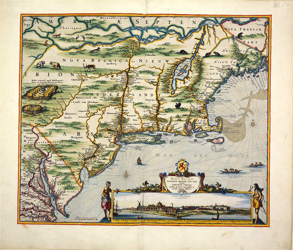
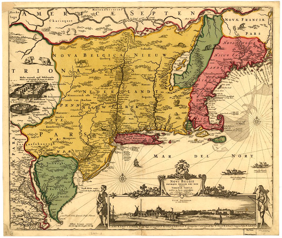
old maps of new york (state)
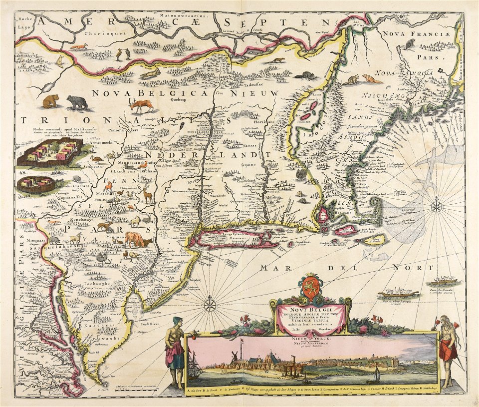
new amsterdam
maps by nicolaes visscher i
adriaen van der donck
maps of nieuw nederland
dirk janszoon van santen
1639 maps
1670 maps
the voyage of the vega round asia and europe
third voyage of willem barentsz
17th-century maps of catalonia
coats of arms of catalonia
dutch 17th-century prints in the rijksmuseum amsterdam
roermond in the 17th century
maps by johannes janssonius
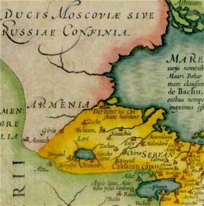
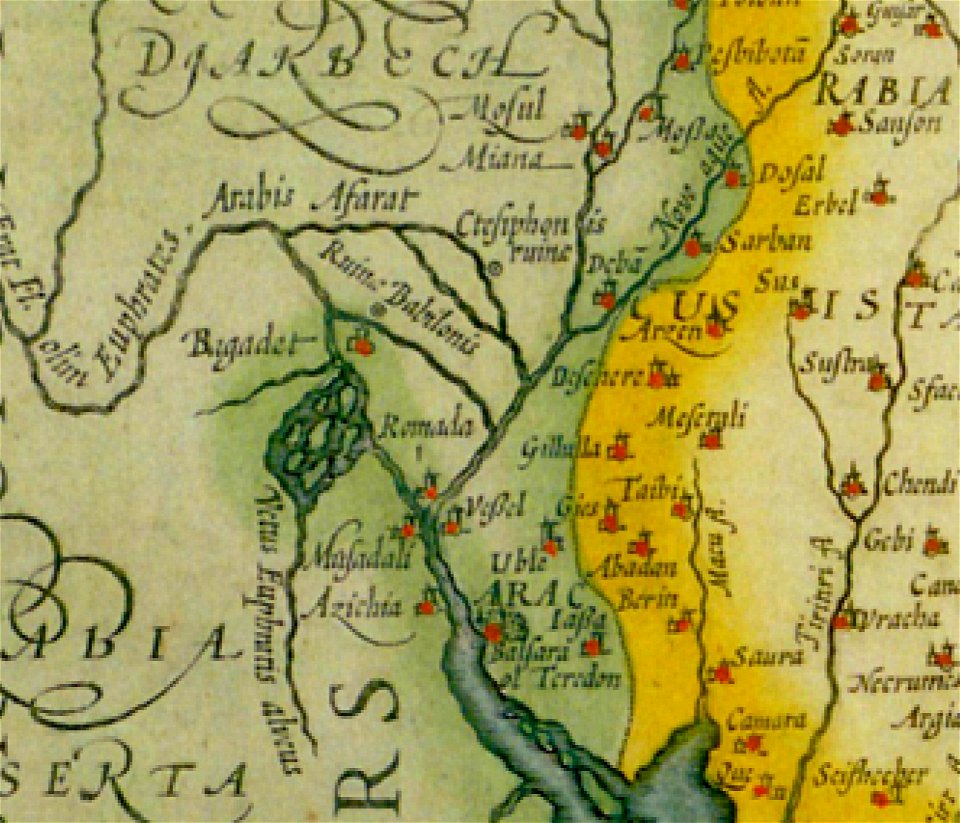
old maps of armenia
dutch 17th-century prints in the rijksmuseum amsterdam
petrus scriverius
dutch 17th-century prints in the rijksmuseum amsterdam
maps in the rijksmuseum amsterdam
dutch 17th-century prints in the rijksmuseum amsterdam
maps in the rijksmuseum amsterdam
dutch 17th-century prints in the rijksmuseum amsterdam
maps in the rijksmuseum amsterdam
dutch 17th-century prints in the rijksmuseum amsterdam
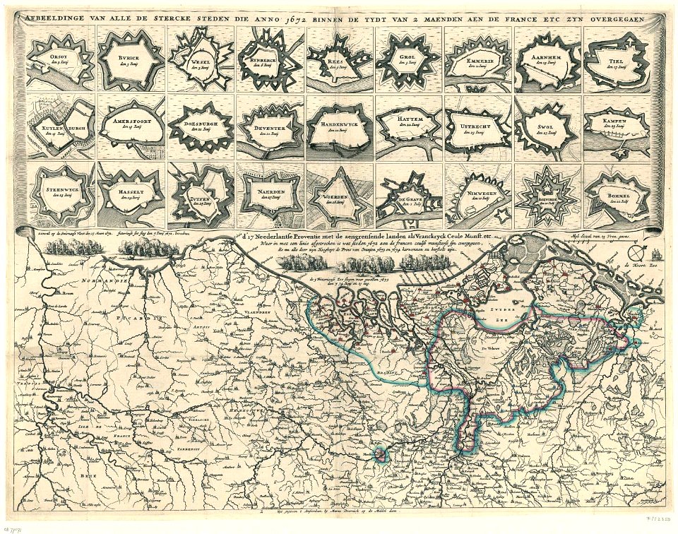
netherlands
dutch 17th-century prints in the rijksmuseum amsterdam
maps in the rijksmuseum amsterdam
büderich (wesel)
netherlands
dutch 17th-century prints in the rijksmuseum amsterdam
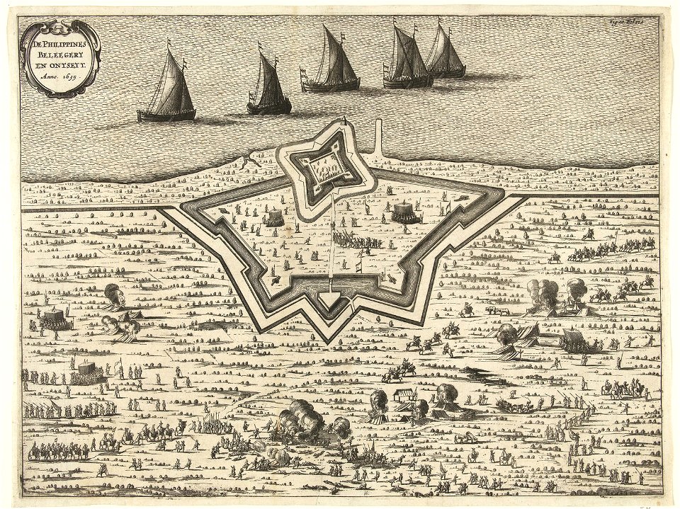
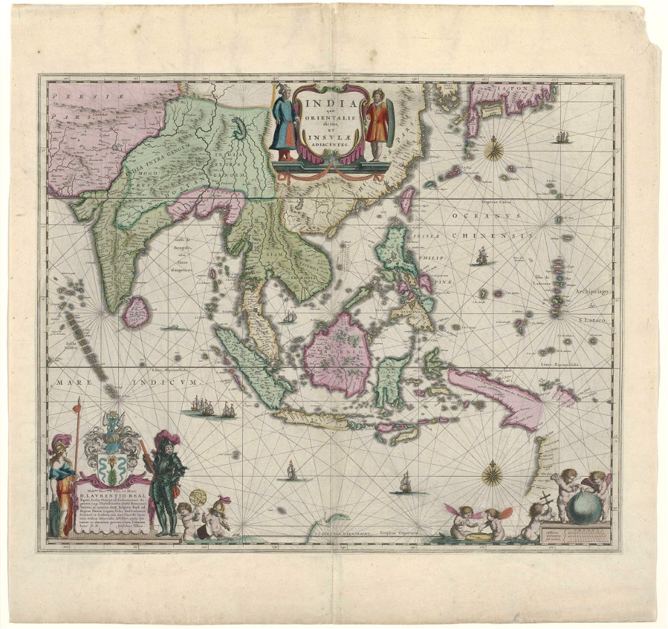
old maps of the philippines
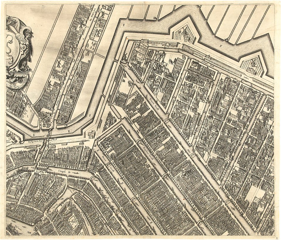
prinsengracht
amsterdam
oudeschans
amsterdam
dutch 17th-century prints in the rijksmuseum amsterdam
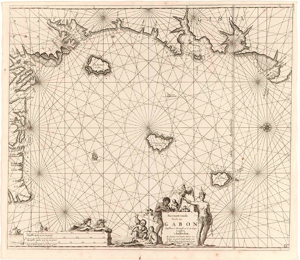
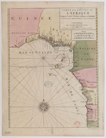
old maps of africa
maps by willem and johannes blaeu
hudson valley
maps by johannes janssonius
maps by jodocus hondius
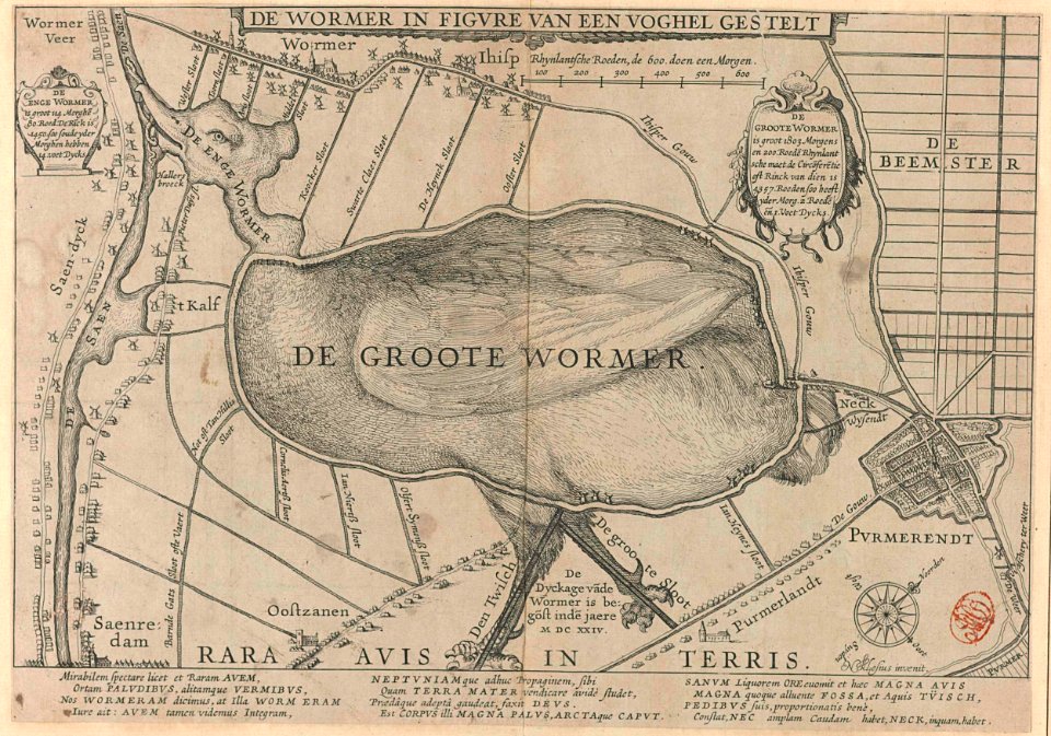
animal shape
purmerend
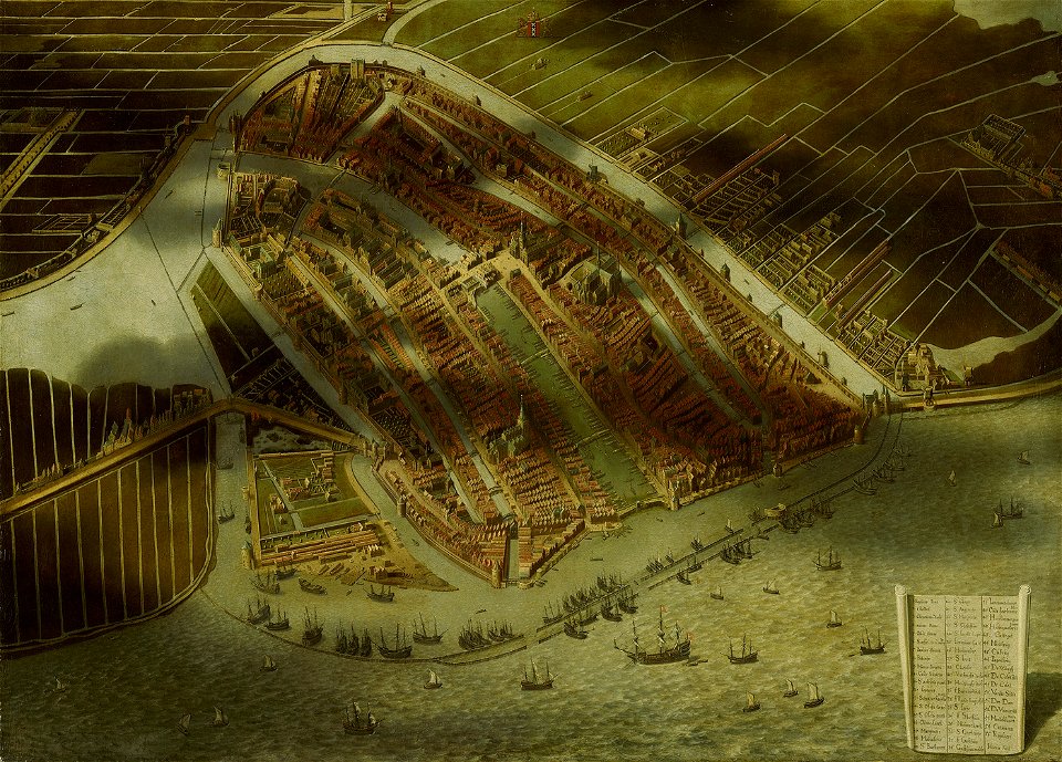
topographical paintings in the amsterdam museum
paintings of amsterdam
maps by willem and johannes blaeu
maps in the rijksmuseum amsterdam
dutch 17th-century prints in the rijksmuseum amsterdam
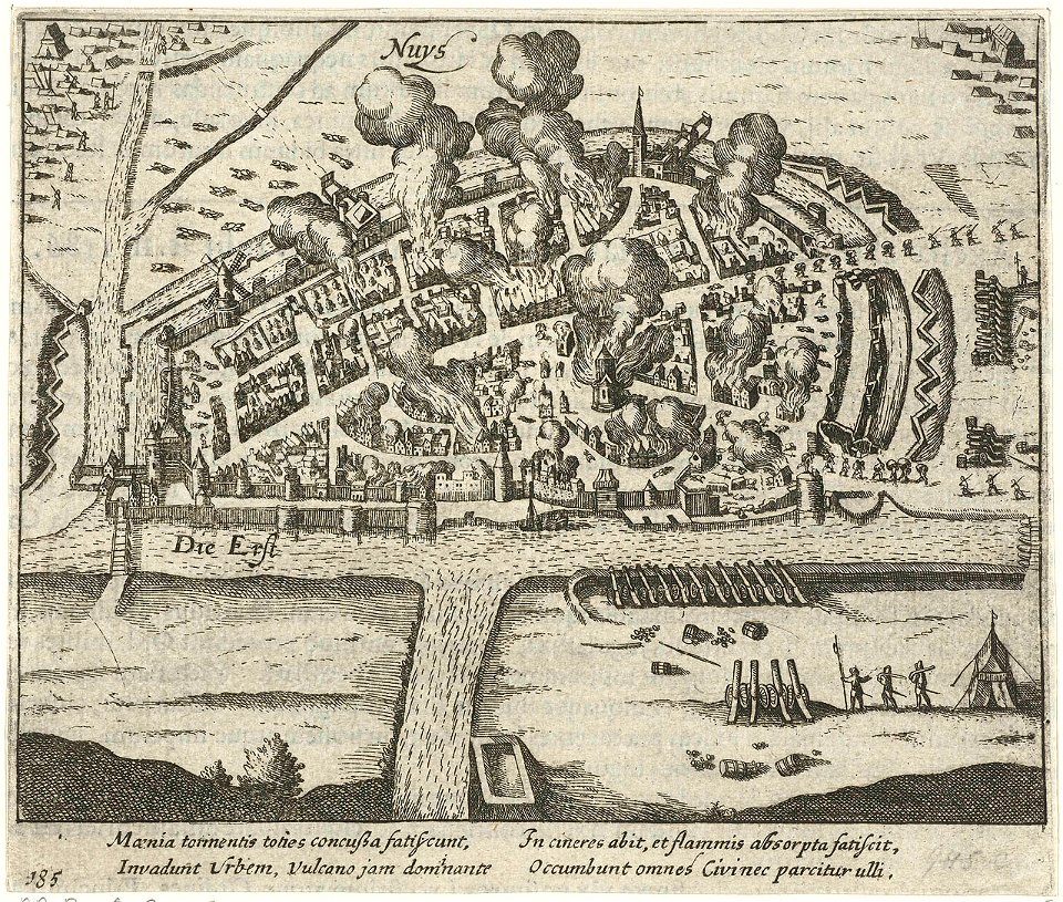
history of neuss
dutch 17th-century prints in the rijksmuseum amsterdam
maps in the rijksmuseum amsterdam
dutch 17th-century prints in the rijksmuseum amsterdam
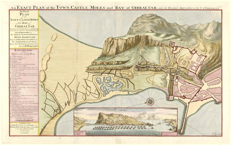
old maps of gibraltar
dutch 17th-century prints in the rijksmuseum amsterdam
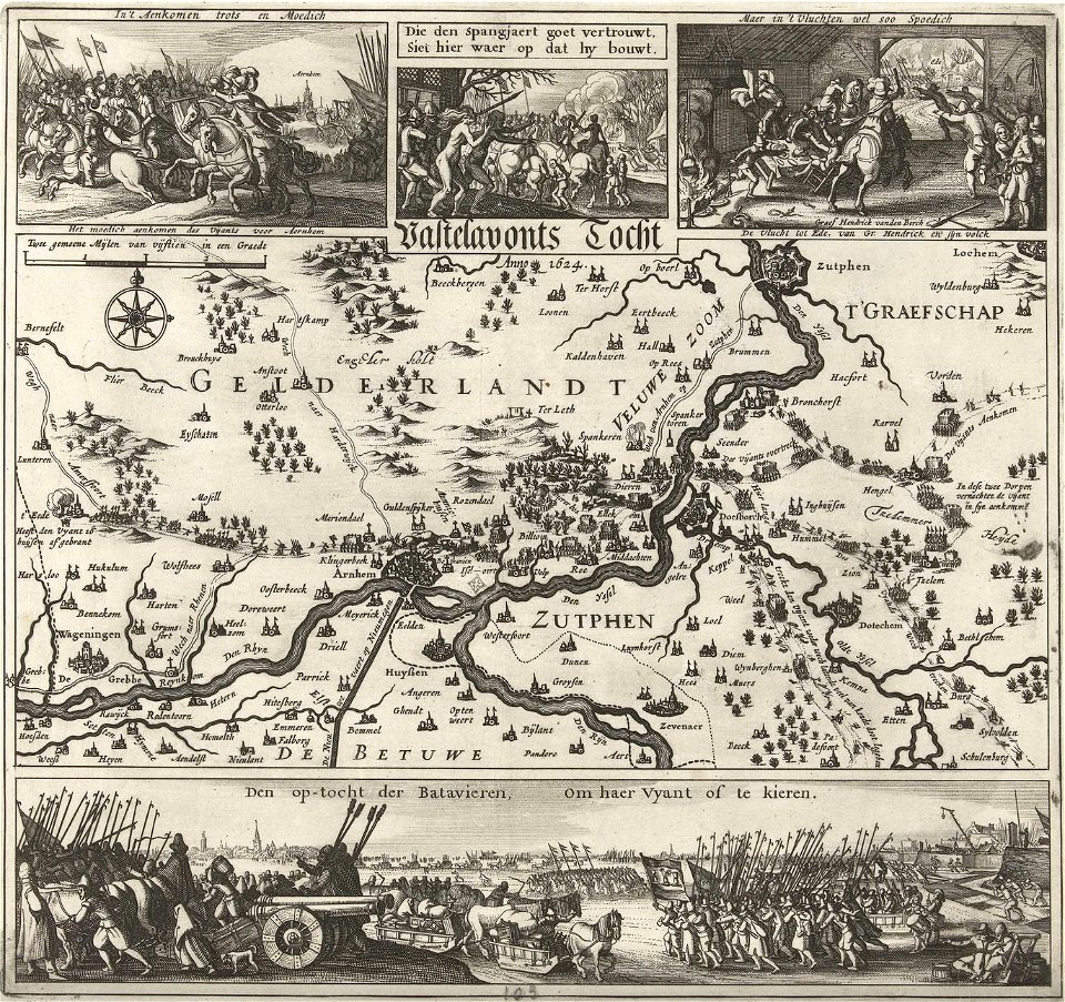
old maps of gelderland
netherlands
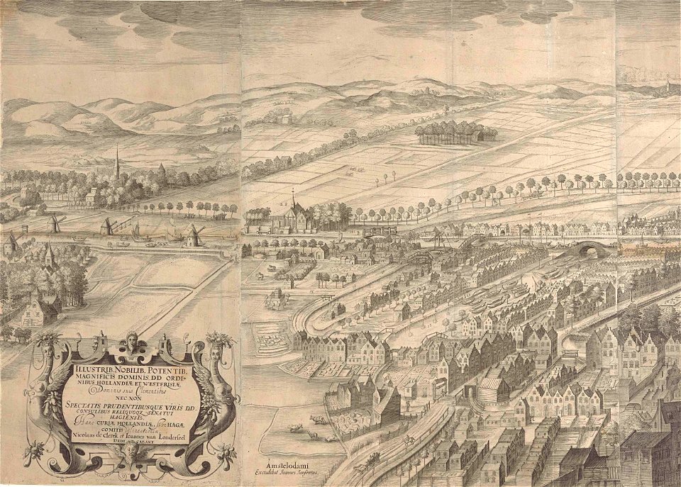
the hague
flemish 16th-century prints in the rijksmuseum amsterdam
1599
topographical paintings in the amsterdam museum
paintings of amsterdam
atlantis magni tomus secundus (biblioteca comunale di trento)
maps made in the 17th century
flemish 17th-century prints in the rijksmuseum amsterdam
frans hogenberg
copper engraving
beavers in art
copper engraving
beavers in art
dutch 17th-century prints in the rijksmuseum amsterdam
ijssel
dutch 17th-century prints in the rijksmuseum amsterdam
maps in the rijksmuseum amsterdam
17th-century oil on canvas paintings in the netherlands
male fur clothing in art
dutch 17th-century prints in the rijksmuseum amsterdam
jan janssonius
copper engraving
beavers in art
dutch 17th-century prints in the rijksmuseum amsterdam
zeeland in art
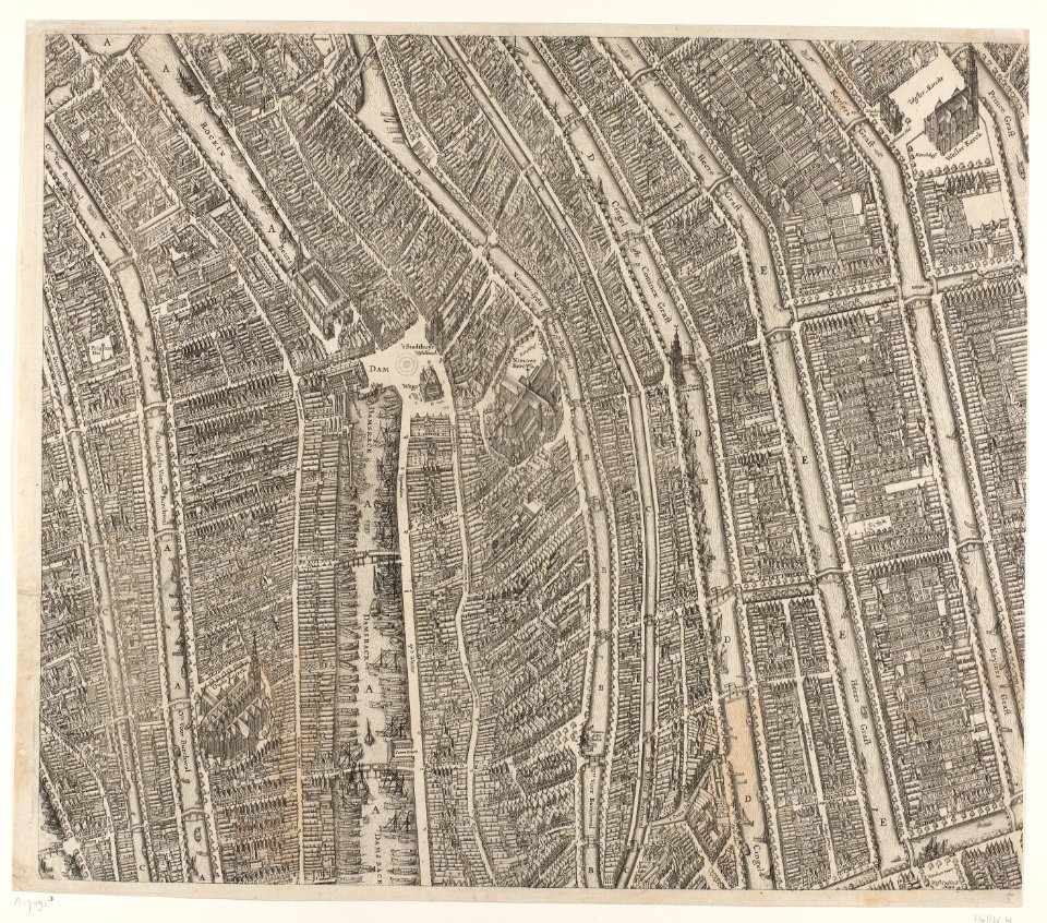
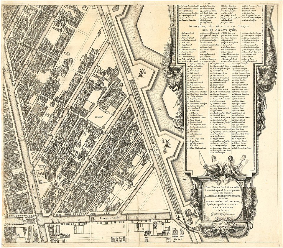
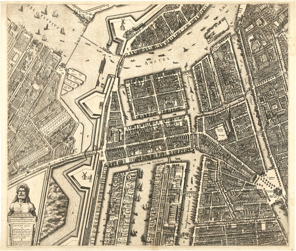
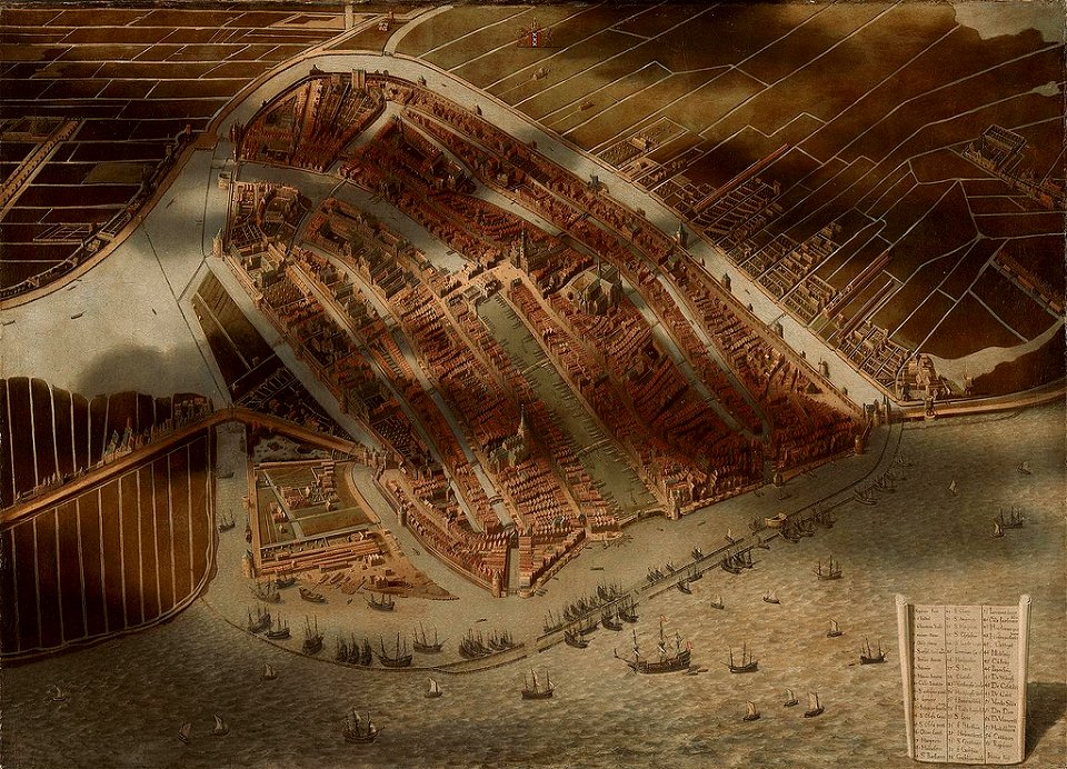
17th-century maps of amsterdam
amsterdam in the 1640s
maps in the library of congress
adriaen van der donck
maps of the west-indische compagnie
1800 maps of the united states
maps in the library of congress
adriaen van der donck
maps in the library of congress
adriaen van der donck
maps by willem and johannes blaeu
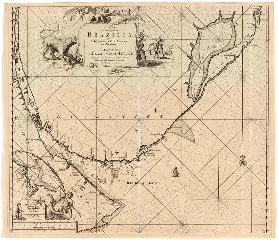
pantanal
atlas van der hagen (volume 4)
atlas van der hagen
maps in the library of congress
adriaen van der donck
maps in the library of congress
adriaen van der donck
atlas van der hagen (volume 4)
atlas van der hagen
lawrence h. slaughter collection of english maps, charts, globes, books and atlases
maps of nieuw nederland
coats of arms of the kingdom of navarre
pales of aragon in heraldry
maps in the library of congress
adriaen van der donck
17th-century maps of africa
maps from gallica
monomotapa
mutapa
dutch 17th-century prints in the rijksmuseum amsterdam
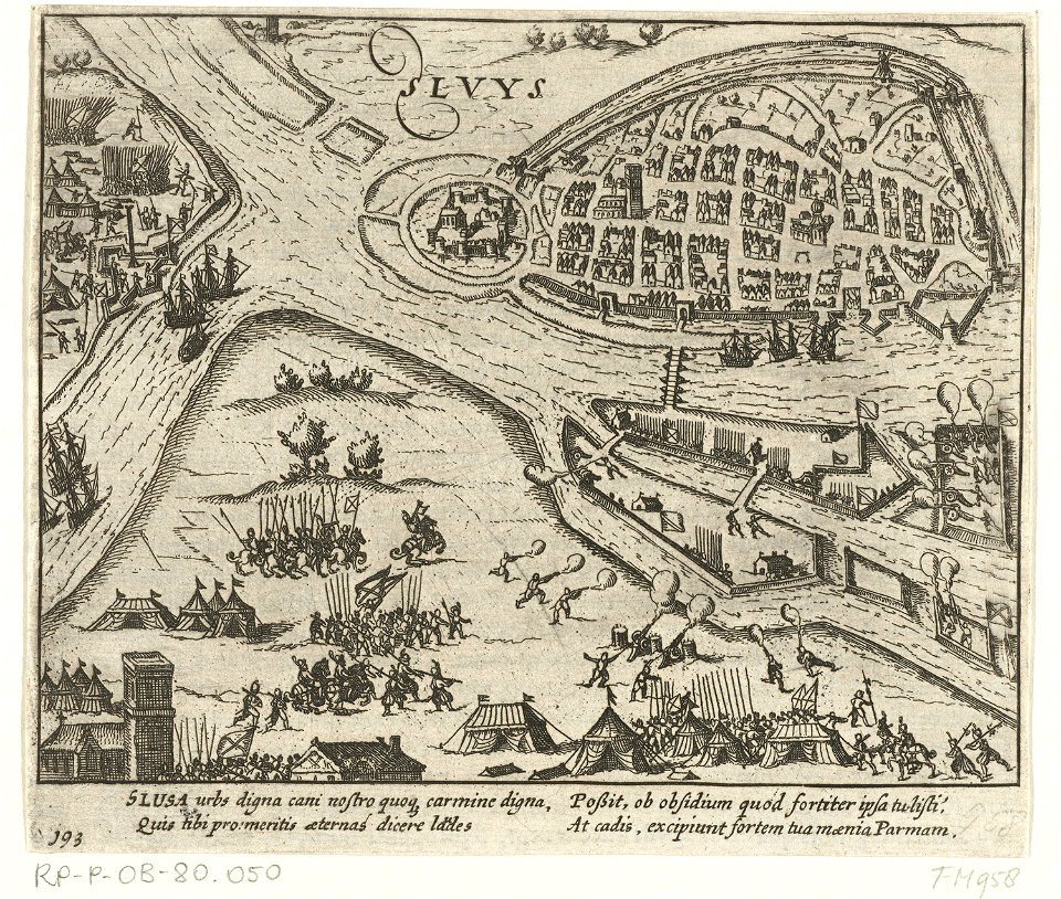
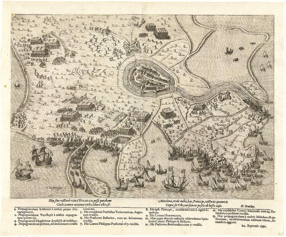
siege of moers 1597
17th-century maps of trinidad and tobago
animals on maps
17th-century maps of herefordshire
1646 maps
17th-century maps of herefordshire
old county maps of herefordshire
17th-century celestial maps
bodleian maps collection
17th-century celestial maps
bodleian maps collection
maps made in the 17th century
old maps of lindau (bodensee)
17th-century maps of the indian ocean
maps by willem and johannes blaeu
maps in the british museum
jan claesz ten hoorn
maps of paris from the david rumsey historical map collection
maps of paris by caspar merian
maps in the rijksmuseum amsterdam
maps by frederick de wit
maps of the palatinate of the rhine
maps by willem and johannes blaeu
maps of the caribbean by mercator-hondius
details of old maps
maps made in the 17th century
novi belgii, atlas maior
17th-century paintings in the amsterdam museum
paintings by pieter isaacsz
maps by willem and johannes blaeu
17th-century maps of france
maps by jodocus hondius
1610 maps of europe
maps by pieter mortier
old maps of genoa
maps by willem and johannes blaeu
maps made in the 17th century
maps by willem and johannes blaeu
maps made in the 17th century
maps in the british museum
jan claesz ten hoorn
atlas van der hagen (volume 4)
people with animals in art
17th-century maps of africa
maps from gallica
dutch 17th-century prints in the rijksmuseum amsterdam
maps by daniel stoopendaal
17th-century maps of amsterdam
1620s maps of the netherlands
lithographs in the rijksmuseum amsterdam
maps in the rijksmuseum amsterdam
dutch 17th-century prints in the rijksmuseum amsterdam
maps by daniel stoopendaal
frans hogenberg
spanish armada
maps by willem and johannes blaeu
maps made in the 17th century
cartouches by willem and johannes blaeu
maps made in the 17th century
maps in the rijksmuseum amsterdam
1627 maps
alessandro baratta
old maps of genoa
old maps of trinidad and tobago
17th-century maps of venezuela
maps in the rijksmuseum amsterdam
17th-century maps of south asia
maps by willem and johannes blaeu
maps made in the 17th century
maps by willem and johannes blaeu
maps made in the 17th century
maps in the rijksmuseum amsterdam
1627 maps
atlas van der hagen (volume 2)
1680s maps of the netherlands
maps by pieter mortier
maps from gallica
maps by willem and johannes blaeu
17th-century maps of bermuda
maps of amersfoort by braun & hogenberg
atlas de wit 1698
17th-century maps of the indian ocean
maps by willem and johannes blaeu
maps of the course of the rhine by guillaume sanson
bibliothèque nationale de france
maps by willem and johannes blaeu
17th-century maps of xaintonge
17th-century maps of the strait of magellan
maps by willem and johannes blaeu
maps in the rijksmuseum amsterdam
17th-century maps of prussia
maps of asia by mercator-hondius
bibliothèque nationale de france
1 - 100 of 329
Next page
/ 4


![[Southern celestial hemisphere], 1700](https://cdn.creazilla.com/illustrations/10000701462/southern-celestial-hemisphere-1700-sm.webp)
![[Northern celestial hemisphere], 1700](https://cdn.creazilla.com/illustrations/10000985046/northern-celestial-hemisphere-1700-md.jpg)


![Titelblad] AFRICA](https://cdn.creazilla.com/illustrations/10000408184/titelblad-africa-sm.webp)


![Xaintonge and Angoumois / [Blaeu], 1635](https://cdn.creazilla.com/illustrations/10000256086/xaintonge-and-angoumois-blaeu-1635-md.jpg)


