Log in
All resources
Create a design
27,441 Free Images of Maps
bibliothèque nationale de france
joan blaeu
copper engraving print
british library
island of california
eran laor cartographic collection
sanson maps of north america
atlas maior, vol 2 (sweden, russia, poland, eastern europe, and greece) - joan blaeu, 1667 - bl 114.h(star).2
maps from gallica
flag
sanson map of the german empire (17th century)
sanson maps of the circles of germany
sanson map of the german empire (17th century)
sanson maps of the circles of germany
prints published by claes jansz. visscher (ii) in the rijksmuseum amsterdam
maps in the rijksmuseum amsterdam
maps showing history of indigenous peoples of north america
serpent mound
etienne fessard
rococo
notatki myśliwskie z afryki : somali (1897)
1890s maps of somalia
maps from gallica
guides joanne
sanson maps of north america
1690s maps of north america
1677 maps of north america
island of california
sanson maps of north america
island of california
sanson maps of north america
island of california
sanson maps of north america
island of california
maps from gallica
old maps of rouen
old maps of edinburgh
history of edinburgh
maps of paris from bibliothèque nationale de france
plan de roussel
maps by hendrik hondius the younger
old maps of overijssel
prints by ambrogio brambilla
old maps of parma
maps
flag
maps
flag
maps
flag
maps
flag
maps in the amsterdam museum
covens en mortier
atlas maior, vol 2 (sweden, russia, poland, eastern europe, and greece) - joan blaeu, 1667 - bl 114.h(star).2
1667 maps of russia
atlas maior, vol 4 (netherlands) - joan blaeu, 1667 - bl 114.h(star).4
1667 maps
atlas maior, vol 2 (sweden, russia, poland, eastern europe, and greece) - joan blaeu, 1667 - bl 114.h(star).2
1667 maps of russia
atlas maior, vol 1 (northern europe, norway, and denmark) - joan blaeu, 1667 - bl 114.h(star).1
1667 maps
atlas maior, vol 2 (sweden, russia, poland, eastern europe, and greece) - joan blaeu, 1667 - bl 114.h(star).2
17th-century maps of the aegean sea
atlas maior, vol 2 (sweden, russia, poland, eastern europe, and greece) - joan blaeu, 1667 - bl 114.h(star).2
maps of slavonia by gerardus mercator
atlas maior, vol 2 (sweden, russia, poland, eastern europe, and greece) - joan blaeu, 1667 - bl 114.h(star).2
copper engraving print
atlas maior, vol 3 (germany) - joan blaeu, 1667 - bl 114.h(star).3
17th-century maps of silesia
1575 illustrations
1575 prints
atlas maior, vol 1 (northern europe, norway, and denmark) - joan blaeu, 1667 - bl 114.h(star).1
1667 maps
maps of husum by braun & hogenberg
schloss vor husum
rivalry between cologne and düsseldorf
maps of cologne by braun & hogenberg
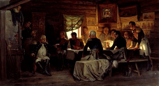
michael andreas barclay de tolly
mikhail kutuzov in portraits
japanese
engravings of topographia superioris saxoniae, thüringiae, misniae et lusatiae (merian)
baroque
description de l'universe
old maps of greece
maps from géographie illustrée de la france et de ses colonies
orientalist painting
map of paris by claes jansz. visscher - derivate files
abbaye sainte-geneviève de paris
maps of portugal by fernando álvares seco
theatrum orbis terrarum (1606 folger)
theatrum orbis terrarum (1606 folger)
maps of wales by humphrey llwyd
historical maps of crema
borgo san pietro (crema)
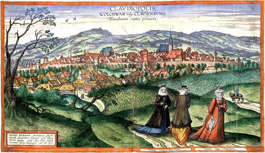
maps of cluj-napoca by braun & hogenberg
timeline of cluj-napoca
topographia franconiae (merian)
baroque
old maps of blankenberge
flandria illustrata
maps in the national library of australia
map of paris by claes jansz. visscher
atlas - voyage pittoresque à l'île-de-france, au cap de bonne-espérance et à l'île de ténériffe (1812) by milbert
maps from the mechanical curator collection
atlas - voyage pittoresque à l'île-de-france, au cap de bonne-espérance et à l'île de ténériffe (1812) by milbert
maps from the mechanical curator collection
john campbell, 2nd duke of argyll
thomas bardwell
portrait paintings in the musée thomas-henry
male portraits by robert lefèvre
17th-century maps of the americas
maps by gerard valck
1628 maps of germany
maps from gallica
map of modern syria by philippe de la rué
1650s maps of palestine
1808 in galicia (spain)
galiciana
voyage de découvertes aux terres australes
old maps of australia
old maps of finistère
maps from gallica
portsmouth earthworks maps
squier and davis images
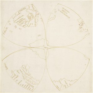
map of the northern hemisphere in four segments (rcin 991393)
high renaissance,renaissance
maps of eckernförde by braun & hogenberg
1620 in schleswig-holstein
old maps of breda, netherlands
adriaen jan bogaerts
details of images of venice by jacopo de' barbari
jacopo de' barbari
pierre lacour (voyage à rome, tome ii)
old maps of turin
maps of aragon and catalonia by mercator-hondius
spain in the 1600s
mappe-monde geo-hydrographique (sanson and jaillot, 1674)
map of maastricht by willem and johannes blaeu (1649)
sint-maartenspoort (maastricht, gate)
cornelius aurelius world map
1510s maps of south america
demolished churches in de barbari map
santa maria dell'umiltà (venezia)
full size ferraris maps of belgium
emmanuel-jean-nepomucène de ghendt
maps in the rijksmuseum amsterdam
old maps of franeker
german renaissance,northern renaissance
prints in the british museum
maps of asia by mercator-hondius
maps of asia by mercator-hondius
nouvelle géographie universelle, vol. xvi
maps of holyoke, massachusetts
nieuwe en beknopte hand-atlas (1754)
18th-century maps of martinique
maps by willem and johannes blaeu
old maps of dunkerque
maps of venlo by willem and johannes blaeu
distelmolen (venlo)
17th-century maps of mecklenburg-vorpommern
maps of rügen by eilhard lubinus
the mishmee hills. an account of a journey made in an attempt to penetrate thibet from assam to open new routes for commerce (1873)
old maps of tibet
map collection of leibniz-institut für länderkunde
1690s maps of the iberian peninsula
maps by willem and johannes blaeu
1640s maps of belgium
17th-century maps of nord (department)
maps of artois
maps of ancient italy by philipp clüver
old maps of the history of liguria
flandria illustrata
history of zottegem
ambrosio spinola, marqués de los balbases
karel bonaventura buquoy
maps from university of amsterdam special collections
atlas der neederlanden
prints by oluf olufsen bagge in the statens museum for kunst
engraving
maps by gerard valck
pieter schenk (i)
eran laor cartographic collection
johann daniel herz der ältere
louis nicolas philippe auguste de forbin
eran laor cartographic collection
eran laor cartographic collection
louis-joseph mondhare
eran laor cartographic collection
richard william seale
maps of diu by braun & hogenberg
diu, india
eran laor cartographic collection
carolus allard
eran laor cartographic collection
richard william seale
german renaissance,humanism
hartmann schedel
sardinia (galleria delle carte geografiche)
frescos in the vatican museums
map of maastricht by willem and johannes blaeu (1649)
statenkwartier (maastricht)
construction drawings in the stadsarchief amsterdam
old maps of amsterdam
gemeente atlas van nederland - south holland
maps of kethel en spaland
11301 - 11400 of 27,441
Next page
/ 275