Log in
All resources
Create a design
27,441 Free Images of Maps
eran laor cartographic collection
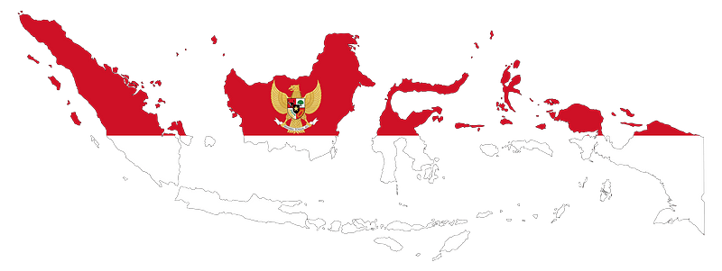
flag
maps of africa
africa in the 1890s
latin-language maps
maps from the earth and its inhabitants, vol. xii
english-language maps
willem blaeu
maps from the earth and its inhabitants, vol. xiii
bibliothèque nationale de france
geographia universalis (1545) in the british museum
german renaissance,northern renaissance
geographia universalis (1545) in the british museum
german renaissance,northern renaissance
eran laor cartographic collection
william hughes (geographer)
17th-century engravings
johannes de ram
eran laor cartographic collection
willem blaeu
eran laor cartographic collection
pieter van der keere
eran laor cartographic collection
willem blaeu
eran laor cartographic collection
willem blaeu
eran laor cartographic collection
nicolaus van aelst
eran laor cartographic collection
william dickes
eran laor cartographic collection
pieter van der keere
eran laor cartographic collection
willem blaeu
illustrations from the mysterious island by jules férat
maps of the mysterious island
eran laor cartographic collection
theodor de bry
eran laor cartographic collection
romanticism
eran laor cartographic collection
alain manesson-mallet
eran laor cartographic collection
william hughes (geographer)
eran laor cartographic collection
willem blaeu
eran laor cartographic collection
romanticism
maps of barbary coast by mercator-hondius
maps by jan janssonius
maps of ancona by braun & hogenberg
maps in the british museum
paintings by antônio parreiras in the museu antônio parreiras
landscape paintings by antônio parreiras
eran laor cartographic collection
bernardino amico
print room of the university of antwerp
kaarten van vlaanderen (prentenkabinet)
eran laor cartographic collection
willem albert bachiene
eran laor cartographic collection
giovanni maria cassini
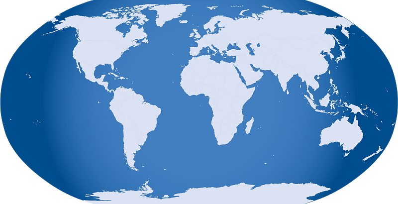
planet
maps
maps
flag
maps in the stadsarchief amsterdam
caspar philips
leo belgicus
1583 maps
furniture
maps
maps
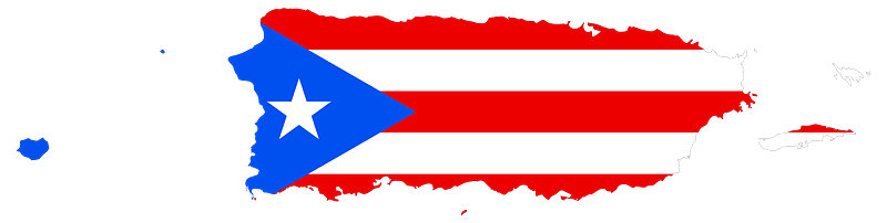
flag
maps
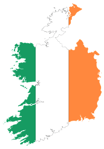
flag
maps
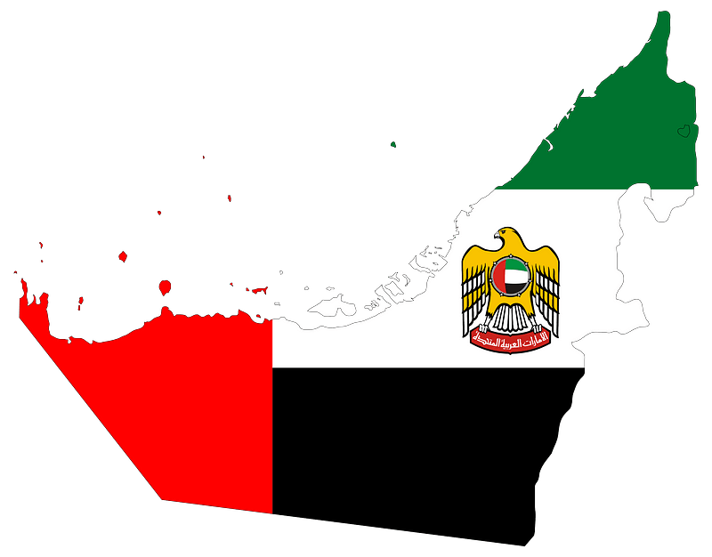
flag
maps
flag
maps
flag
maps
flag
maps
flag
maps
flag
maps
flag
maps
flag
maps
flag
maps
flag
maps
flag
nouvelle géographie universelle, vol. viii
1876 maps of india
maps from the earth and its inhabitants, vol. vi
history of uzbekistan
a picturesque tour along the river ganges and jumna in india (1824)
s. j. neele & son
maps of pangong tso
old maps of ladakh
giovanni battista rossi
1890s maps of yemen
john rocque's 1746 map of london
details of old maps of london
danubius pannonico-mysicus
luigi ferdinando marsigli
maps from the earth and its inhabitants, vol. iv
boston, england
the hand-book for travellers in italy, from london to naples (1838)
old maps of tuscany
turgot map of paris, kyoto university library – derivative files
collégiale saint-honoré
grosser deutscher atlas
old maps of england
old maps of freiburg im breisgau
gregorius sickinger
turgot map of paris – derivative files
église saint-jean-en-grève
kaart van het hoogheemraadschap van schieland, 1611-1635
17th-century maps of rotterdam
peninsula campaign
julius bien
description de l'universe
1710s maps of ethiopia
maps in the library of congress
1778 maps of new jersey
lawrence h. slaughter collection of english maps, charts, globes, books and atlases
atlas novus (blaeu)
lawrence h. slaughter collection of english maps, charts, globes, books and atlases
atlas novus (blaeu)
lawrence h. slaughter collection of english maps, charts, globes, books and atlases
atlas novus (blaeu)
maps in the library of congress
1744 maps of north america
everett d. graff collection of western americana
maps by g. w. & c. b. colton & co.
maps from the earth and its inhabitants, vol. xiii
maps of africa
maps from the earth and its inhabitants, vol. xii
africa in the 1890s
maps from the earth and its inhabitants, vol. xii
africa in the 1890s
maps from the earth and its inhabitants, vol. xii
africa in the 1890s
maps from the earth and its inhabitants, vol. xii
africa in the 1890s
maps from the earth and its inhabitants, vol. xiii
africa in the 1890s
maps from the earth and its inhabitants, vol. xii
africa in the 1890s
africa in the 1890s
maps of africa
maps from the earth and its inhabitants, vol. xiii
africa in the 1890s
maps from the earth and its inhabitants, vol. xiii
africa in the 1890s
maps from the earth and its inhabitants, vol. xi
africa in the 1890s
maps from the earth and its inhabitants, vol. xiii
africa in the 1890s
maps from the earth and its inhabitants, vol. xii
africa in the 1890s
maps from the earth and its inhabitants, vol. x
geography of egypt
maps from géographie illustrée de la france et de ses colonies
maps of isère
maps from the earth and its inhabitants, vol. xii
africa in the 1890s
curt teich postcard archives
map postcards
beschreibung der städt der welt - braun & hogenberg - btv1b52512111k
maps of konstanz by braun & hogenberg
plantae yucatanae. (regionis antillanae)
1903 in yucatán
carte de moscovie by guillaume de l'isle (1706)
1700s maps of russia
beschreibung der städt der welt - braun & hogenberg - btv1b52512111k
maps of lisbon by braun & hogenberg (1572)
maps by takeshiro matsuura
old maps of ezo
maps by nicolas sanson
maps from gallica
beschreibung der städt der welt - braun & hogenberg - btv1b52512111k
maps of burgos by braun & hogenberg
beschreibung der städt der welt - braun & hogenberg - btv1b52512111k
maps of cusco by braun & hogenberg
map of paris by claes jansz. visscher - derivate files
historical maps of les halles
maps by willem and johannes blaeu
old maps of drenthe
maps by willem and johannes blaeu
17th-century maps of the americas
maps by christian sgrothen
wurm
maps of bremen by braun & hogenberg
bremen in the 16th century
maps of asia by mercator-hondius
historical maps of crema
maps by pieter mortier
1870s maps of the atlantic ocean
the bottom of the sea (1870)
le antichità romane (piranesi)
neoclassicism
10601 - 10700 of 27,441
Next page
/ 275