Log in
All resources
Create a design
27,441 Free Images of Maps
bibliothèque nationale de france
national library of poland
willem blaeu
civitates orbis terrarvm, liber primvs (1577)
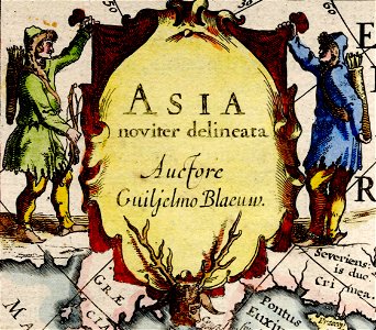
asia noviter delineata
maps from the earth and its inhabitants, vol. vii
maps from the earth and its inhabitants, vol. x
ceiling of the terrace of the geographical maps (uffizi gallery, florence)
baroque
matthäus merian
maps of agnano and grotta del cane by braun & hogenberg
maps by abraham ortelius
ceiling of the terrace of the geographical maps (uffizi gallery, florence)
cornelius aurelius world map
16th-century maps of cuba
ceiling of the terrace of the geographical maps (uffizi gallery, florence)
ceiling of the terrace of the geographical maps (uffizi gallery, florence)
adriaan schoonebeek
sestroretsky spill
17th-century maps of tartary
17th-century maps of siberia
atlas minor gerardi mercatoris (1609)
maps of asia by mercator-hondius
civitates orbis terrarvm, liber primvs (1577)
maps of groningen by braun & hogenberg
chorographia britanniae (1741-1742)
18th-century maps of sussex
civitates orbis terrarvm, liber primvs (1577)
maps of tours by braun & hogenberg
civitates orbis terrarvm, liber primvs (1577)
maps of rouen by braun & hogenberg
voyages de la commission scientifique du nord, en scandinavie, en laponie, au spitzberg et aux feröe
19th-century maps of norway
panoramic maps of seville by braun & hogenberg
civitates orbis terrarvm, liber primvs (1577)
civitates orbis terrarvm, liber primvs (1577)
maps of heidelberg by braun & hogenberg
maps of münster (westfalen) by braun & hogenberg
civitates orbis terrarvm, liber primvs (1577)
engravings of topographia helvetiae, rhaetiae et valesiae
old maps of st. gallen
old maps of schweinfurt
baroque
1740s maps of the americas
1747 maps of north america
maps from the earth and its inhabitants, vol. xv
first nations people of british columbia
maps from the earth and its inhabitants, vol. viii
british india
maps from the earth and its inhabitants, vol. x
canals in egypt
too late for gordon and khartoum (1887) by macdonald
maps of the mahdist war
maps from the earth and its inhabitants, vol. vii
targot mountains
maps from the earth and its inhabitants, vol. ii
st malo
maps from the earth and its inhabitants, vol. vii
ebi lake
maps from the earth and its inhabitants, vol. xviii
transport in south america
maps from the earth and its inhabitants, vol. xvii
french louisiana
maps from the earth and its inhabitants, vol. x
lake tana
maps from the earth and its inhabitants, vol. vi
pyatigorsk
maps from the earth and its inhabitants, vol. vi
deserts of asia
illiteracy in france
education in france
maps from the earth and its inhabitants, vol. x
rosetta (egypt)
maps from the earth and its inhabitants, vol. vii
qinghai lake
maps from the earth and its inhabitants, vol. xiii
mount kenya
maps from the earth and its inhabitants, vol. ix
adana
maps from the earth and its inhabitants, vol. v
skaptar-jokull
maps from the earth and its inhabitants, vol. xviii
oscar drude
maps from the earth and its inhabitants, vol. xvi
surveying in mexico
maps from the earth and its inhabitants, vol. vii
thomas edward gordon
maps from the earth and its inhabitants, vol. viii
ghats
maps from the earth and its inhabitants, vol. x
hannek
maps from the earth and its inhabitants, vol. xv
flora of canada
maps from the earth and its inhabitants, vol. xii
sete cidades
maps from the earth and its inhabitants, vol. vii
yarlung tsangpo
maps from the earth and its inhabitants, vol. vi
charles eugène perron
maps from the earth and its inhabitants, vol. xv
flora of alaska
maps from the earth and its inhabitants, vol. xvi
volcanism of mexico
maps from the earth and its inhabitants, vol. v
denmark in the 19th century
maps from the earth and its inhabitants, vol. xvi
jorullo
daniel friedrich sotzmann
1798 in berlin-mitte
1649 in maastricht
atlas beudeker
map of maastricht by willem and johannes blaeu (1649)
history of wyck (maastricht)
maps of duisburg by braun & hogenberg
postcards of duisburg
maps from university of amsterdam special collections
atlas der neederlanden
maps from university of amsterdam special collections
atlas der neederlanden
atlas ou representation du monde universel t. 2 (1633)
17th-century maps of southeast asia
old maps of le tréport
maps from gallica
civitates orbis terrarum. de praecipuis totius universi urbibus. liber secundus
maps of dunkerque by braun & hogenberg
civitates orbis terrarum. de praecipuis totius universi urbibus. liber secundus
maps of tunis by braun & hogenberg
civitates orbis terrarum. de praecipuis totius universi urbibus. liber secundus
maps of šibenik by braun & hogenberg
maps by jakob van der schley
old maps of stralsund
maps in the british museum
prints by albert flamen
caribbean maps in leiden university library
files uploaded at wiki techstorm 2019
old maps of syracuse
pierre-adrien pâris
cartouches by alexis-hubert jaillot
maps by guillaume sanson
caribbean maps in leiden university library
files uploaded at wiki techstorm 2019
große eschenheimer straße
baroque
cartouches by willem and johannes blaeu
asia noviter delineata
asia noviter delineata
arab people in art
asia noviter delineata
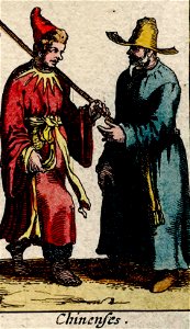
chinese people in art
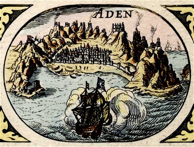
maps of aden by braun & hogenberg
asia noviter delineata
asia noviter delineata
armenians in art
asia noviter delineata
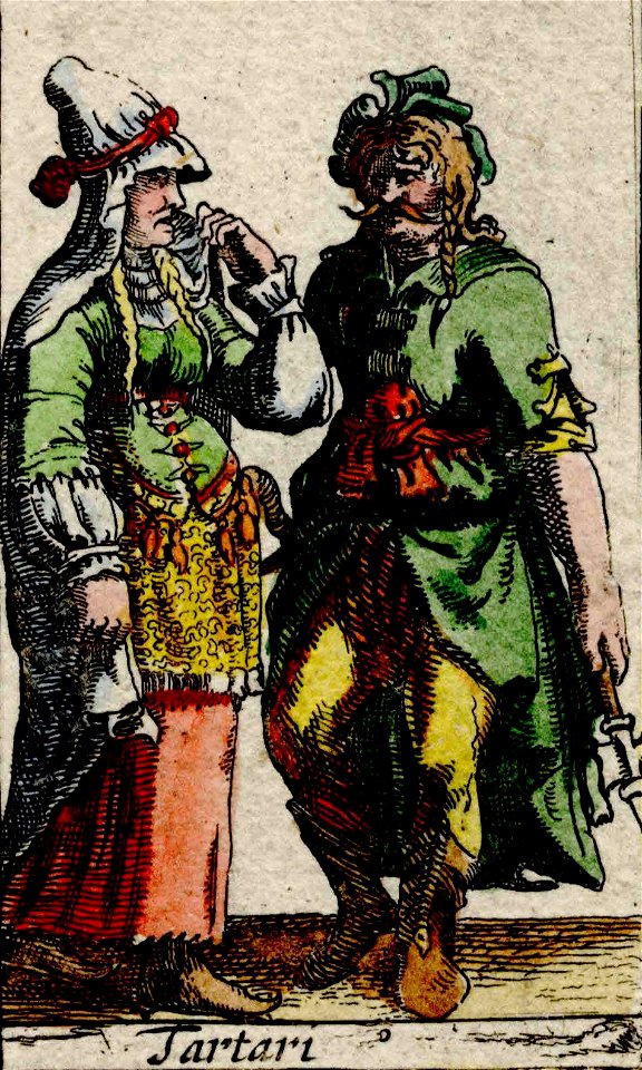
tatar people in art
engravings of charles ii of spain
description de l'universe
maps by jakob van der schley
maps of the spratly islands
travel maps of the united kingdom
australia (1873) by booth
a map of the provinces of new york and new jersey, with a part of pennsylvania and the province of quebec
maps in the library of congress
maps in the stadsarchief amsterdam
hendrik de leth
maps in the stadsarchief amsterdam
maps by carolus allard
arnold van langren map of east africa
1600 maps of africa
maps by pieter van der keere
17th-century maps of silesia
celeberrimi fluvii albis nova delineatio by willem janszoon blaeu
maps in the staats- und universitätsbibliothek hamburg
bibliothèque nationale de france
maps by thomas kitchin
john rocque's 1748 map of london and adjacent country
bibliothèque nationale de france
maps of hamburg by braun & hogenberg
maps of lübeck by braun & hogenberg
maps from university of amsterdam special collections
atlas der neederlanden
1750s maps of north america
solomon bolton
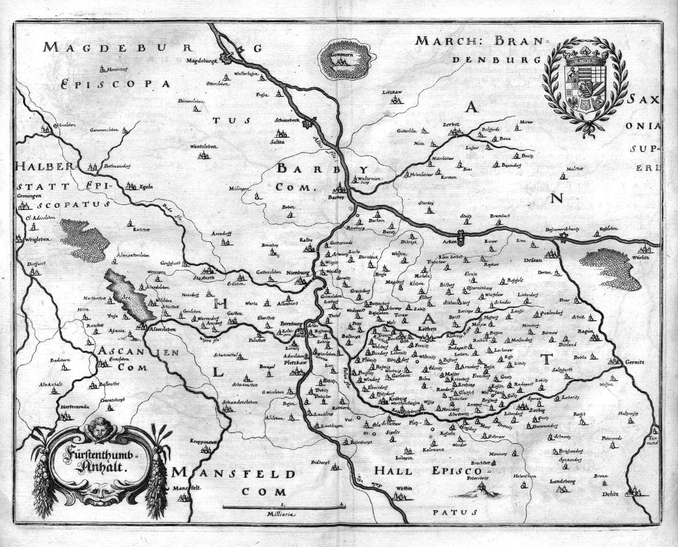
engravings of topographia superioris saxoniae, thüringiae, misniae et lusatiae (merian)
baroque
media contributed by university of illinois urbana-champaign university library
1830 maps of africa
postcards of new mexico published by petley studios
curt teich postcard archives
media contributed by university of illinois urbana-champaign university library
1830s maps of egypt
old maps of southeast asia
jacobus van der schley
bird's eye view of knoxville, tennessee, 1886
maps in the library of congress
petit atlas pittoresque des 48 quartiers de la ville de paris, bhvp
paris former 11e arrondissement
maps of the palatinate of the rhine
1692 maps of rhineland-palatinate
woodcuts by cornelis anthonisz. in the rijksmuseum amsterdam
jan ewoutsz.
bibliothèque nationale de france
sanson map of lorraine
georg balthasar probst (1732-1801)
eran laor cartographic collection
eran laor cartographic collection
johann berka
10701 - 10800 of 27,441
Next page
/ 275