Log in
All resources
Create a design
27,441 Free Images of Maps
copper engraving print
british library
joan blaeu
1667 maps
atlas maior, vol 1 (northern europe, norway, and denmark) - joan blaeu, 1667 - bl 114.h(star).1
description de l'universe
alain manesson mallet
bibliothèque nationale de france
atlas maior, vol 8 (france ii and switzerland) - joan blaeu, 1667 - bl 114.h(star).8
atlas maior, vol 9 (italy) - joan blaeu, 1667 - bl 114.h(star).9
australia (1873) by booth
1870s maps of australia
description de l'universe
alain manesson mallet
description de l'universe
alain manesson mallet
19th-century maps of victoria, australia
australia (1873) by booth
description de l'universe
cosmography
description de l'universe
alain manesson mallet
john rocque's 1748 map of london and adjacent country
a history of london (1884)
description de l'universe
africa in art
in the volcanic eifel. a holiday ramble (1896)
old maps of eifel
our arctic province, alaska and the seal islands (1886)
old maps of alaska
description de l'universe
alain manesson mallet
19th-century maps of queensland
australia (1873) by booth
our arctic province, alaska and the seal islands (1886)
old maps of alaska
description de l'universe
alain manesson mallet
bolivia in the 17th century
description de l'universe
map of italy by guillaume delisle (1700)
1700 maps of italy
maps of jerez by braun & hogenberg
maps of conil by braun & hogenberg
maps by pieter mortier
maps from gallica
map of the circle of upper saxony by sanson
1700s maps of saxony
1770s maps of morocco
maps by tomas lopez
sanson maps of the netherlands
1670s maps of the netherlands
maps of the course of the rhine by guillaume sanson
bibliothèque nationale de france
maps in the library of congress
1708 maps
maps by pieter mortier
maps from gallica
1780s maps of italy
maps by juan lopez
male portrait paintings by françois-hubert drouais
joseph hyacinthe, comte de vaudreuil
mappe-monde geo-hydrographique (sanson and jaillot, 1674)
cartography of france
travels in the interior of north america, during the years 1832–1834
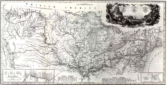
1843 maps of the united states
siege of bergen-op-zoom 1622
conflicts in 1622
old maps of the american civil war
francis d'avignon
map of modern syria by philippe de la rué
1650s maps of palestine
old maps of the hague
cornelis elandt
planet
maps
maps
flag
engravings of topographia braunschweig lüneburg
baroque
eran laor cartographic collection
guillaume sanson
eran laor cartographic collection
giovanni maria cassini
fictional galaxies
star wars maps
maps made in the 17th century
novi belgii, atlas maior
prints by frans hogenberg in the rijksmuseum amsterdam
maps in the rijksmuseum amsterdam
prints by frans hogenberg in the rijksmuseum amsterdam
maps in the rijksmuseum amsterdam
old maps of north holland
abraham deur
maps from the earth and its inhabitants, vol. xiii
africa in the 1890s
1770s maps of the caribbean
maps by thomas kitchin
a voyage to abyssinia, and travels into the interior of that country, executed under the orders of the british government in the years 1809 & 1810
john outhett
old maps of utrecht (city)
atlas van loon
maps in the aguirra collection
negative photography
maps by willem and johannes blaeu
1635 maps
atlas maior, vol 8 (france ii and switzerland) - joan blaeu, 1667 - bl 114.h(star).8
1667 maps
maps from the earth and its inhabitants, vol. xviii
1890s maps of peru
recueil d'antiquités égyptiennes, étrusques, greques et romaines (1752)
18th-century maps of paris
atlas maior, vol 4 (netherlands) - joan blaeu, 1667 - bl 114.h(star).4
1667 maps
atlas maior, vol 1 (northern europe, norway, and denmark) - joan blaeu, 1667 - bl 114.h(star).1
1667 maps
géographie générale; physique, politique et économique (1876)
19th-century maps of bretagne
atlas maior, vol 8 (france ii and switzerland) - joan blaeu, 1667 - bl 114.h(star).8
1667 maps
atlas maior, vol 2 (sweden, russia, poland, eastern europe, and greece) - joan blaeu, 1667 - bl 114.h(star).2
17th-century maps of romania
atlas maior, vol 3 (germany) - joan blaeu, 1667 - bl 114.h(star).3
17th-century maps of silesia
atlas maior, vol 7 (france i) - joan blaeu, 1667 - bl 114.h(star).7
1667 maps
atlas maior, vol 8 (france ii and switzerland) - joan blaeu, 1667 - bl 114.h(star).8
1667 maps
atlas maior, vol 5 (england) - joan blaeu, 1667 - bl 114.h(star).5
17th-century maps of the british isles
atlas maior, vol 7 (france i) - joan blaeu, 1667 - bl 114.h(star).7
1667 maps
atlas maior, vol 1 (northern europe, norway, and denmark) - joan blaeu, 1667 - bl 114.h(star).1
1667 maps
atlas maior, vol 8 (france ii and switzerland) - joan blaeu, 1667 - bl 114.h(star).8
1667 maps
atlas maior, vol 8 (france ii and switzerland) - joan blaeu, 1667 - bl 114.h(star).8
1667 maps
atlas maior, vol 9 (italy) - joan blaeu, 1667 - bl 114.h(star).9
1667 maps of italy
atlas maior, vol 3 (germany) - joan blaeu, 1667 - bl 114.h(star).3
17th-century maps of silesia
géographie générale; physique, politique et économique (1876)
old maps of the strait of gibraltar
atlas maior, vol 9 (italy) - joan blaeu, 1667 - bl 114.h(star).9
1667 maps of italy
atlas maior, vol 2 (sweden, russia, poland, eastern europe, and greece) - joan blaeu, 1667 - bl 114.h(star).2
maps of candia by ortelius and mercator
atlas maior, vol 9 (italy) - joan blaeu, 1667 - bl 114.h(star).9
1667 maps of italy
atlas maior, vol 9 (italy) - joan blaeu, 1667 - bl 114.h(star).9
1667 maps of italy
atlas maior, vol 1 (northern europe, norway, and denmark) - joan blaeu, 1667 - bl 114.h(star).1
1660s maps of norway
atlas maior, vol 4 (netherlands) - joan blaeu, 1667 - bl 114.h(star).4
1667 maps
atlas maior, vol 9 (italy) - joan blaeu, 1667 - bl 114.h(star).9
1667 maps of italy
atlas maior, vol 1 (northern europe, norway, and denmark) - joan blaeu, 1667 - bl 114.h(star).1
1667 maps
maps from the earth and its inhabitants, vol. iv
kingsmead, bath
maps from the earth and its inhabitants, vol. xviii
old maps of lima
atlas maior, vol 1 (northern europe, norway, and denmark) - joan blaeu, 1667 - bl 114.h(star).1
1667 maps
atlas maior, vol 4 (netherlands) - joan blaeu, 1667 - bl 114.h(star).4
1667 maps
atlas maior, vol 4 (netherlands) - joan blaeu, 1667 - bl 114.h(star).4
1667 maps
atlas maior, vol 1 (northern europe, norway, and denmark) - joan blaeu, 1667 - bl 114.h(star).1
1667 maps
atlas maior, vol 1 (northern europe, norway, and denmark) - joan blaeu, 1667 - bl 114.h(star).1
1667 maps
atlas maior, vol 7 (france i) - joan blaeu, 1667 - bl 114.h(star).7
17th-century maps of xaintonge
atlas maior, vol 7 (france i) - joan blaeu, 1667 - bl 114.h(star).7
1667 maps
maps from the earth and its inhabitants, vol. xiv
maps of sumbawa
maps from the earth and its inhabitants, vol. xviii
1894 in peru
maps in the amsterdam museum
1667 sanson map of africa
maps from the earth and its inhabitants, vol. iii
old maps of bonn
atlas maior, vol 3 (germany) - joan blaeu, 1667 - bl 114.h(star).3
17th-century maps of silesia
atlas maior, vol 1 (northern europe, norway, and denmark) - joan blaeu, 1667 - bl 114.h(star).1
1667 maps
atlas maior, vol 1 (northern europe, norway, and denmark) - joan blaeu, 1667 - bl 114.h(star).1
1667 maps
atlas maior, vol 1 (northern europe, norway, and denmark) - joan blaeu, 1667 - bl 114.h(star).1
1667 maps of europe
atlas maior, vol 3 (germany) - joan blaeu, 1667 - bl 114.h(star).3
17th-century maps of silesia
maps from the earth and its inhabitants, vol. iv
ragstone
atlas maior, vol 9 (italy) - joan blaeu, 1667 - bl 114.h(star).9
1667 maps of italy
atlas maior, vol 8 (france ii and switzerland) - joan blaeu, 1667 - bl 114.h(star).8
1667 maps
maps from the earth and its inhabitants, vol. xvi
1890s maps of belize
maps from the earth and its inhabitants, vol. iv
amesbury
atlas maior, vol 1 (northern europe, norway, and denmark) - joan blaeu, 1667 - bl 114.h(star).1
1667 maps
maps from the earth and its inhabitants, vol. x
19th-century maps of cairo
10401 - 10500 of 27,441
Next page
/ 275