Log in
All resources
Create a design
27,441 Free Images of Maps
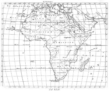
description de l'universe
alain manesson mallet
africa in the 1890s
maps of africa
bibliothèque nationale de france
beschreibung der städt der welt - braun & hogenberg - btv1b52512111k
africa in art
maps from the earth and its inhabitants, vol. xiii
maps from the earth and its inhabitants, vol. xii
maps from the earth and its inhabitants, vol. xi
maps from the earth and its inhabitants, vol. xi
africa in the 1890s
maps from the earth and its inhabitants, vol. xiii
africa in the 1890s
maps from the earth and its inhabitants, vol. xiii
africa in the 1890s
maps from the earth and its inhabitants, vol. xi
africa in the 1890s
maps from the earth and its inhabitants, vol. xii
africa in the 1890s
map of ghent by jan blaeu
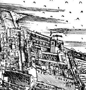
sint-lievenspoort (ghent)
maps from the earth and its inhabitants, vol. xiii
africa in the 1890s
maps from the earth and its inhabitants, vol. xii
africa in the 1890s
maps from the earth and its inhabitants, vol. xi
africa in the 1890s
maps from the earth and its inhabitants, vol. xi
africa in the 1890s
maps from the earth and its inhabitants, vol. xi
africa in the 1890s
maps from the earth and its inhabitants, vol. xiii
africa in the 1890s
maps from the earth and its inhabitants, vol. xiii
africa in the 1890s
maps from the earth and its inhabitants, vol. xii
africa in the 1890s
historical images of église saint-nicolas-du-chardonnet
map of paris by braun & hogenberg - derivative files
18th-century maps of kent
old county maps of kent
maps from the earth and its inhabitants, vol. xii
africa in the 1890s
maps from the earth and its inhabitants, vol. xii
africa in the 1890s
maps from the earth and its inhabitants, vol. xiii
africa in the 1890s
maps from the earth and its inhabitants, vol. xiii
africa in the 1890s
maps from the earth and its inhabitants, vol. xiii
africa in the 1890s
eran laor cartographic collection
evert maaskamp
maps from university of amsterdam special collections
atlas der neederlanden
civitates orbis terrarum. urbium praecipuarum totius mundi. liber quartus
maps of malmö by braun & hogenberg
civitates orbis terrarum. urbium praecipuarum totius mundi. liber quartus
maps of lund by braun & hogenberg
maps from university of amsterdam special collections
atlas der neederlanden
maps from university of amsterdam special collections
atlas der neederlanden
biblioteca di storia e cultura del piemonte "giuseppe grosso"
maps of italy
rococo,neoclassicism
elementarwerk
rococo,neoclassicism
elementarwerk
maps by jakob van der schley
1750s maps of taiwan
demolished churches in de barbari map
santi filippo e giacomo (venice)
maps of blois by braun & hogenberg
carte de partie de lithuanie (east belarus, northern ukraine) by nicolas sanson
cartouches by sanson family
cartouches by willem and johannes blaeu
joan blaeu
1660s maps of taiwan
1667 maps
beschreibung der städt der welt - braun & hogenberg - btv1b52512111k
maps of prague by braun & hogenberg
italia - di matteo greuter... - btv1b525056959
17th-century maps of istria
beschreibung der städt der welt - braun & hogenberg - btv1b52512111k
maps of conil by braun & hogenberg
beschreibung der städt der welt - braun & hogenberg - btv1b52512111k
maps of lübeck by braun & hogenberg
beschreibung der städt der welt - braun & hogenberg - btv1b52512111k
maps of heraklion by braun & hogenberg
old maps of edinburgh
maps from gallica
beschreibung der städt der welt - braun & hogenberg - btv1b52512111k
maps of barcelona by braun & hogenberg
beschreibung der städt der welt - braun & hogenberg - btv1b52512111k
maps of genoa by braun & hogenberg
beschreibung der städt der welt - braun & hogenberg - btv1b52512111k
maps of vienna by braun & hogenberg
beschreibung der städt der welt - braun & hogenberg - btv1b52512111k
maps of marburg by braun & hogenberg
beschreibung der städt der welt - braun & hogenberg - btv1b52512111k
maps of toledo by braun & hogenberg
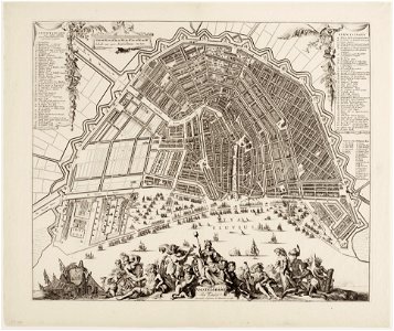
maps in the stadsarchief amsterdam
romeyn de hooghe
maps in the library of congress
1776 maps of new york (state)
1800s maps of the caribbean
charles picquet
praefectura paranambucae pars borealis, una cum praefectura de itâmaracâ
1647 maps of brazil
steinfels collection
baroque
demolished churches in de barbari map
chiesa della celestia
a voyage to abyssinia, and travels into the interior of that country, executed under the orders of the british government in the years 1809 & 1810
john outhett
a voyage to abyssinia, and travels into the interior of that country, executed under the orders of the british government in the years 1809 & 1810
john outhett
old maps of utrecht (city)
atlas van loon
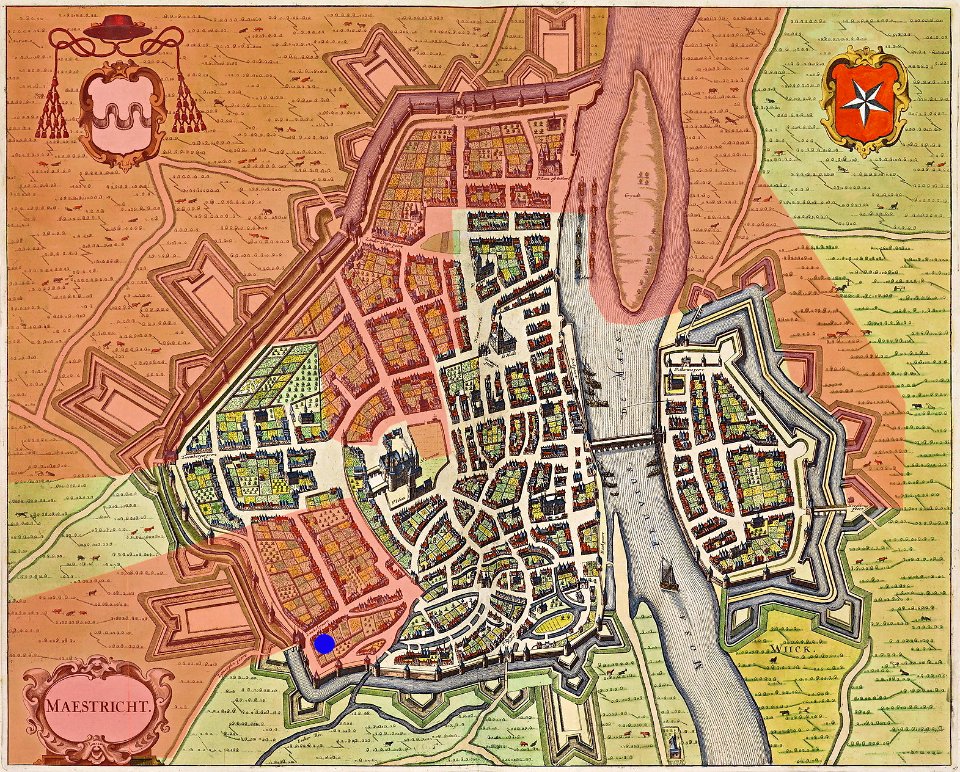
map of maastricht by willem and johannes blaeu (1649)
atlas de wit 1698
asia noviter delineata
1617 drawings
asia noviter delineata
1617 drawings
the generall historie of virginia (john smith)
old maps of new england
maps from the earth and its inhabitants, vol. xii
sokoto
maps from the earth and its inhabitants, vol. xvii
natchez
maps from the earth and its inhabitants, vol. xiv
maps of voyages
maps from the earth and its inhabitants, vol. v
nyoe
description de l'universe
africa in art
description de l'universe
alain manesson mallet
description de l'universe
alain manesson mallet
description de l'universe
alain manesson mallet
description de l'universe
alain manesson mallet
description de l'universe
alain manesson mallet
description de l'universe
africa in art
description de l'universe
alain manesson mallet
description de l'universe
africa in art
description de l'universe
alain manesson mallet
description de l'universe
solar system
description de l'universe
alain manesson mallet
description de l'universe
africa in art
description de l'universe
alain manesson mallet
john rocque's 1748 map of london and adjacent country
a history of london (1884)
the cruise of the marchesa (1889)
19th-century maps of sulawesi
map of the german empire by louis stanislas d'arcy de la rochette
1773 maps of the holy roman empire
19th-century maps of tasmania
australia (1873) by booth
description de l'universe
africa in art
description de l'universe
comets in art
description de l'universe
cosmography
description de l'universe
africa in art
description de l'universe
alain manesson mallet
description de l'universe
alain manesson mallet
asia noviter delineata
willem blaeu
19th-century maps of south australia
australia (1873) by booth
the cruise of the marchesa (1889)
19th-century maps of the moluccas
19th-century maps of new south wales
australia (1873) by booth
description de l'universe
africa in art
description de l'universe
1685 in spain
description de l'universe
africa in art
in the volcanic eifel. a holiday ramble (1896)
old maps of eifel
description de l'universe
alain manesson mallet
description de l'universe
africa in art
description de l'universe
cosmography
description de l'universe
constellations in art
10301 - 10400 of 27,441
Next page
/ 275