Log in
All resources
Create a design
27,441 Free Images of Maps
the comprehensive history of england (1876)
english-language maps showing history
1870s maps showing history
hishikawa school,ukiyo-e
国立国会図書館
maps of africa
africa in the 1890s
maps from the earth and its inhabitants, vol. xii
eran laor cartographic collection
ndl-dc 1287041 2 1287740 tōkaidō bunken ezu
eran laor cartographic collection
hendrik hondius the younger
ndl-dc 1287041 1 1287733 tōkaidō bunken ezu
hishikawa school,ukiyo-e
ndl-dc 1287041 1 1287733 tōkaidō bunken ezu
hishikawa school,ukiyo-e
ndl-dc 1287041 2 1287740 tōkaidō bunken ezu
hishikawa school,ukiyo-e
ndl-dc 1287041 2 1287740 tōkaidō bunken ezu
hishikawa school,ukiyo-e
ndl-dc 1287041 3 1287747 tōkaidō bunken ezu
hishikawa school,ukiyo-e
ndl-dc 1287041 1 1287733 tōkaidō bunken ezu
hishikawa school,ukiyo-e
ndl-dc 1287041 2 1287740 tōkaidō bunken ezu
hishikawa school,ukiyo-e
ndl-dc 1287041 2 1287740 tōkaidō bunken ezu
hishikawa school,ukiyo-e
eran laor cartographic collection
prints after jan peeters (i)
eran laor cartographic collection
william hughes (geographer)
eran laor cartographic collection
willem blaeu
ndl-dc 1287041 3 1287747 tōkaidō bunken ezu
hishikawa school,ukiyo-e
ndl-dc 1287041 4 1286884 tōkaidō bunken ezu
hishikawa school,ukiyo-e
ndl-dc 1287041 5 1286885 tōkaidō bunken ezu
hishikawa school,ukiyo-e
ndl-dc 1287041 1 1287733 tōkaidō bunken ezu
hishikawa school,ukiyo-e
ndl-dc 1287041 2 1287740 tōkaidō bunken ezu
hishikawa school,ukiyo-e
ndl-dc 1287041 2 1287740 tōkaidō bunken ezu
hishikawa school,ukiyo-e
ndl-dc 1287041 1 1287733 tōkaidō bunken ezu
hishikawa school,ukiyo-e
ndl-dc 1287041 3 1287747 tōkaidō bunken ezu
hishikawa school,ukiyo-e
ndl-dc 1287041 3 1287747 tōkaidō bunken ezu
hishikawa school,ukiyo-e
ndl-dc 1287041 3 1287747 tōkaidō bunken ezu
hishikawa school,ukiyo-e
atlas van loon
kuinderburcht
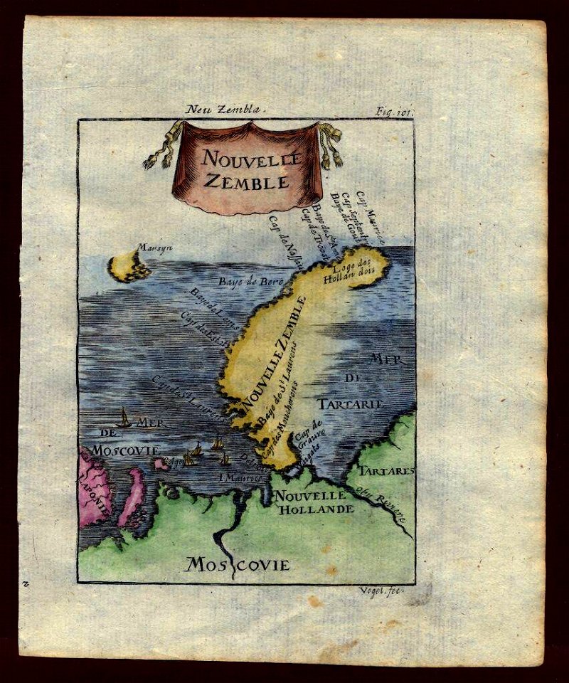
description de l'universe
maps of novaya zemlya
description de l'universe
maps of novaya zemlya
description de l'universe
old maps of iceland
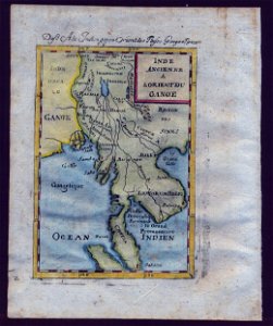
18th-century maps of southeast asia
description de l'universe
1860 valentine map of new york city
george hayward
masonic temple, boston (boylston street: 1867)
maps from university of amsterdam special collections
atlas der neederlanden
atlas ou representation du monde universel t. 2 (1633)
maps by hendrik hondius the younger
atlas ou representation du monde universel t. 2 (1633)
old maps of nuremberg
dutch 17th-century prints in the rijksmuseum amsterdam
maps by daniel stoopendaal
maps from university of amsterdam special collections
atlas der neederlanden
atlas ou representation du monde universel t. 2 (1633)
1630s maps of virginia
old maps of deventer
renaissance
1620s maps of north america
1620s maps of the caribbean
corona and coronet (1898)
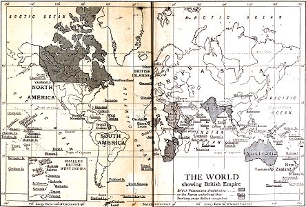
1898 maps of the world
the comprehensive history of england (1876)
english-language maps showing history
the comprehensive history of england (1876)
english-language maps showing history
the comprehensive history of england (1876)
english-language maps showing history
the comprehensive history of england (1876)
english-language maps showing history
the comprehensive history of england (1876)
english-language maps showing history
the comprehensive history of england (1876)
english-language maps showing history
the comprehensive history of england (1876)
english-language maps showing history
the comprehensive history of england (1876)
english-language maps showing history
the comprehensive history of england (1876)
english-language maps showing history
the comprehensive history of england (1876)
english-language maps showing history
the comprehensive history of england (1876)
english-language maps showing history
the comprehensive history of england (1876)
english-language maps showing history
the comprehensive history of england (1876)
english-language maps showing history
the comprehensive history of england (1876)
english-language maps showing history
1870s maps of egypt
1879 maps of africa
the comprehensive history of england (1876)
english-language maps showing history
too late for gordon and khartoum (1887) by macdonald
maps of the mahdist war
the comprehensive history of england (1876)
english-language maps showing history
the comprehensive history of england (1876)
english-language maps showing history
the comprehensive history of england (1876)
english-language maps showing history
the comprehensive history of england (1876)
english-language maps showing history
charts and maps of the royal museums greenwich
1693 maps
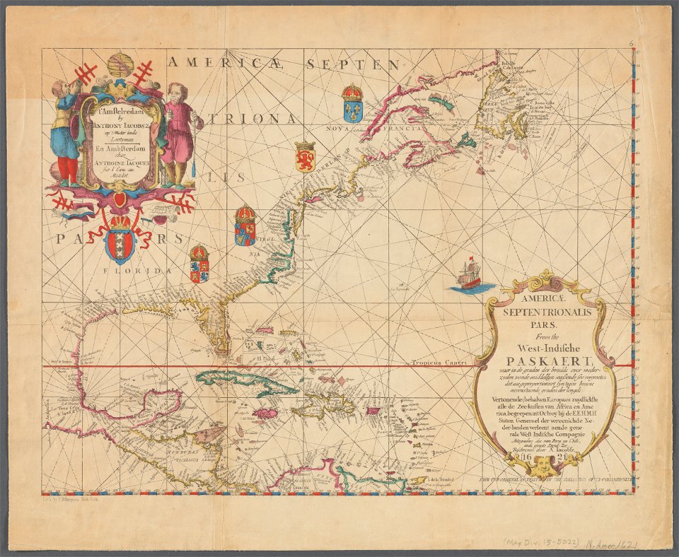
carte de l'amérique septentrionale by guillaume delisle (1700)
1700 maps of north america
maps by louis brion de la tour
1786 maps of north america
dr. wilh. junker's reisen in afrika 1875-1886
1889 maps of sudan
maps by willem and johannes blaeu
1640 maps of africa
maps by willem and johannes blaeu
1640 maps of africa
cornelius aurelius world map
1510s maps of north america
eran laor cartographic collection
guillaume sanson
eran laor cartographic collection
giovanni maria cassini
eran laor cartographic collection
giovanni maria cassini
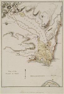
the topography of troy, and its vicinity (1804)
william gell
a history of england (1911)
henry justice ford
cartouches by willem and johannes blaeu
people of turkey in art
maps by willem and johannes blaeu
old maps of purmerend
15th-century maps of the caucasus
fra mauro map details
turgot map of paris – derivative files
café de la régence (paris)
turgot map of paris – derivative files
abbaye de montmartre
maps of paris from the university of wisconsin-milwaukee libraries
map of paris by claes jansz. visscher
maps of cairo by braun & hogenberg
matteo pagano della fede
maps of bergamo city walls
maps in the museo correr
the loyal west in the times of the rebellion (michigan)
mackinac island, michigan
old maps of oudenaarde
flandria illustrata
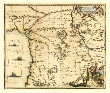
1690s maps of syria
cornelis de bruyn
maps from the earth and its inhabitants, vol. xiii
people of africa
17th-century maps of venice
baroque
maps from the earth and its inhabitants, vol. xii
africa in the 1890s
maps from the earth and its inhabitants, vol. xii
africa in the 1890s
maps from the earth and its inhabitants, vol. xii
africa in the 1890s
maps from the earth and its inhabitants, vol. xiii
africa in the 1890s
maps from the earth and its inhabitants, vol. xi
africa in the 1890s
maps from the earth and its inhabitants, vol. xii
africa in the 1890s
maps from the earth and its inhabitants, vol. xii
africa in the 1890s
maps from the earth and its inhabitants, vol. xii
africa in the 1890s
the antiquities of england and wales (1773)
18th-century maps of lancashire
maps from the earth and its inhabitants, vol. xii
africa in the 1890s
maps from the earth and its inhabitants, vol. xiii
africa in the 1890s
maps from the earth and its inhabitants, vol. xii
africa in the 1890s
maps from the earth and its inhabitants, vol. xii
africa in the 1890s
maps from the earth and its inhabitants, vol. xiii
africa in the 1890s
maps from the earth and its inhabitants, vol. xii
africa in the 1890s
maps from the earth and its inhabitants, vol. xii
africa in the 1890s
10201 - 10300 of 27,441
Next page
/ 275