Log in
All resources
Create a design
1,538 Free Artworks of Municipalities In The Netherlands
gemeente atlas van nederland - south holland
1860s maps of south holland
gemeente atlas van nederland - north brabant
netherlands in the 1860s
gemeente atlas van nederland - zeeland
delft municipal museums
gemeente atlas van nederland - north holland
1860s maps of north holland
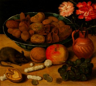
oil on canvas
oil on panel
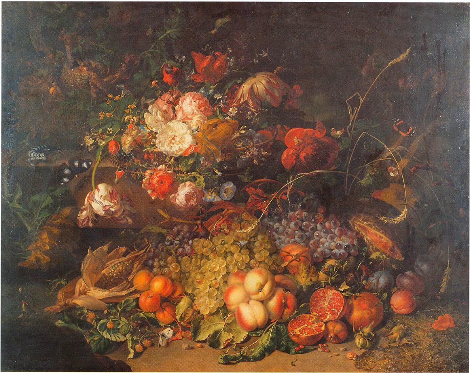
fruit still life paintings by rachel ruysch
rococo
portrait paintings of frederick henry, prince of orange
portrait paintings of men by michiel van mierevelt
paintings by allaert van everdingen in the rijksmuseum amsterdam
paintings by allaert van everdingen
svg flags of former municipalities of north holland
anna paulowna
paintings by gillis gillisz. de bergh
1630s paintings in the netherlands
gemeente atlas van nederland - south holland
maps of alblasserdam
dutch golden age painting
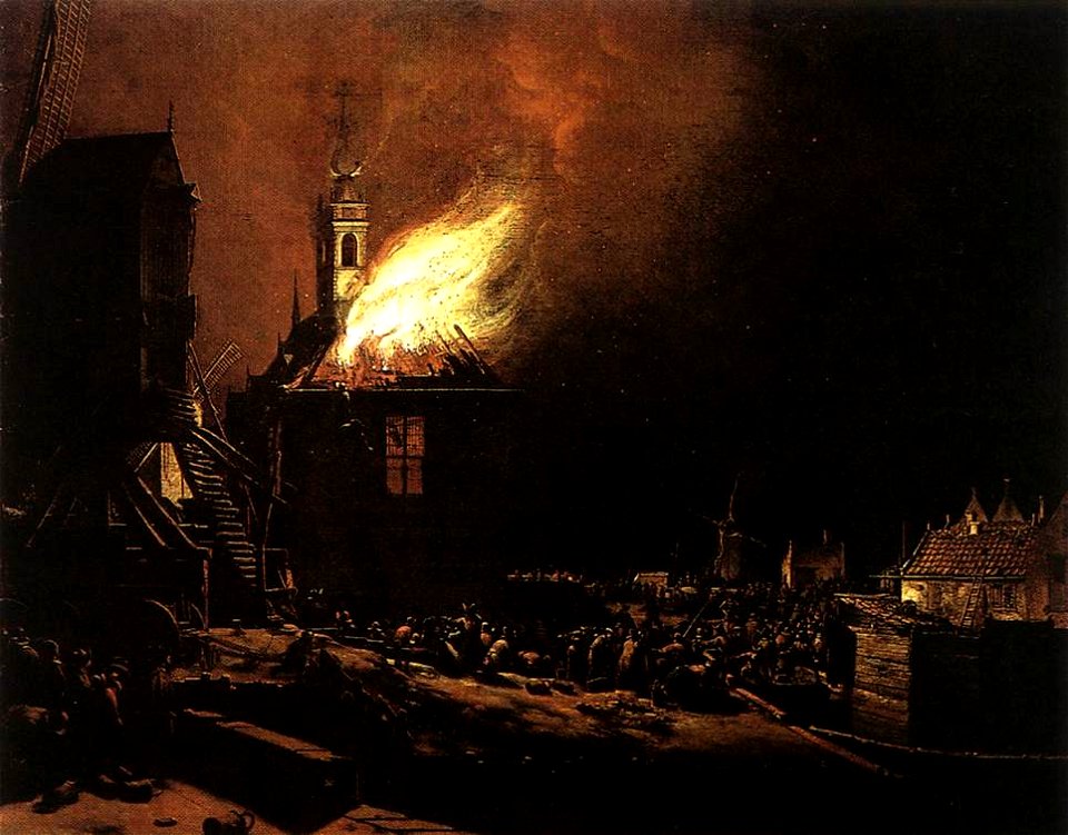
people with fire in art
gemeente atlas van nederland - utrecht
maps of houten
gemeente atlas van nederland - gelderland
netherlands in the 1860s
maps of landgraaf
rimburg
gemeente atlas van nederland - south holland
1860s maps of south holland
gemeente atlas van nederland - south holland
maps of peursum
gemeente atlas van nederland - south holland
maps of heenvliet
19th-century maps of south holland
maps of veur
gemeente atlas van nederland - south holland
maps of alkemade
gemeente atlas van nederland - south holland
maps of noordeloos
gemeente atlas van nederland - limburg
19th-century maps of maastricht
gemeente atlas van nederland - south holland
maps of zuidland
hoogheemraadschap van rijnland
maps of woubrugge
maps of aa en hunze
anloo
beatrix of the netherlands in 1956
mayoral uniforms
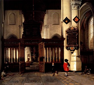
paintings by hendrick cornelisz van vliet
interior of nieuwe kerk delft in art
maps of aa en hunze
gieten
paintings by egbert van der poel
dutch golden age painting
gemeente atlas van nederland - south holland
maps of zoeterwoude
gemeente atlas van nederland - south holland
1860s maps of south holland
municipal cleaning services in the netherlands
media from regionaal archief alkmaar
svg coats of arms of former municipalities of north holland
anna paulowna
gemeente atlas van nederland - gelderland
maps of ophemert
17th-century oil on canvas paintings in the netherlands
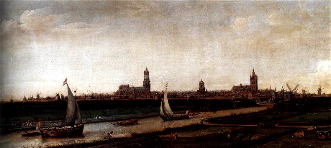
paintings by hendrik cornelisz. vroom
gemeente atlas van nederland - groningen
maps of noordbroek
gemeente atlas van nederland - south holland
maps of abbenbroek
19th-century maps of south holland
netherlands in the 1860s
gemeente atlas van nederland - groningen
maps of winschoten
gemeente atlas van nederland - utrecht
old maps of amersfoort
gemeente atlas van nederland - south holland
maps of geervliet
gemeente atlas van nederland - groningen
maps of appingedam
gemeente atlas van nederland - south holland
1860s maps of south holland
gemeente atlas van nederland - zeeland
retranchement
gemeente atlas van nederland - groningen
maps of hoogezand
gemeente atlas van nederland - north brabant
vessem
history of alphen aan den rijn
maps of aarlanderveen
1866 in the netherlands
maps of almelo
maps of uithuizermeeden
oldenzijl
gemeente atlas van nederland - north brabant
maps of deurne, netherlands
gemeente atlas van nederland - south holland
maps of stompwijk
1918 exhibitions in the netherlands
1918 posters of the netherlands
gemeente atlas van nederland - north brabant
duizel en steensel
gemeente atlas van nederland - overijssel
netherlands in the 1860s
gemeente atlas van nederland - friesland
old maps of leeuwarden
gemeente atlas van nederland - south holland
maps of heerjansdam
wedding ceremonies in the netherlands
raadhuis schaijk
gemeente atlas van nederland - south holland
1860s maps of south holland
maps of waterways in the netherlands
maps of nieuwe merwede
gemeente atlas van nederland - north brabant
zeelst
gemeente atlas van nederland - north brabant
nuland
gemeente atlas van nederland - north brabant
maps of asten, netherlands
gemeente atlas van nederland - north brabant
old maps of grave, netherlands
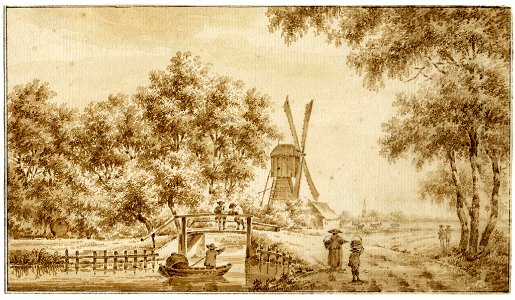
landscape drawings of the netherlands
george pieter westenberg
noordzeekanaal
maps of velsen
gemeente atlas van nederland - south holland
1860s maps of south holland
media from regionaal archief alkmaar
oudkarspel
gemeente atlas van nederland - north holland
maps of aalsmeer
gemeentelijke monumenten in nijmegen
van schevichavenstraat (nijmegen)
still-life paintings by frans snyders
flemish baroque painting
still-life paintings of flowers in vases
still-life paintings by georg flegel
gemeentelijke monumenten in rotterdam
houses in oude westen
gemeente atlas van nederland - zeeland
dreischor
gemeente atlas van nederland - zeeland
wolphaartsdijk
gemeente atlas van nederland - zeeland
schoondijke
gemeente atlas van nederland - north holland
old maps of haarlem
gemeente atlas van nederland - north brabant
dieden
maps of hooge zwaluwe
maps of lage zwaluwe
portrait paintings of actresses in theatrical costumes
paintings in stadsschouwburg amsterdam
gemeente atlas van nederland - zeeland
maps of oostkapelle
gemeente atlas van nederland - zeeland
maps of zoutelande
old maps of schagen
maps of zijpe
gemeente atlas van nederland - south holland
1860s maps of south holland
gemeente atlas van nederland - north brabant
beugen
gemeente atlas van nederland - north brabant
maps of werkendam
gemeente atlas van nederland - north brabant
wouw
gemeente atlas van nederland - zeeland
old maps of sluis
gemeente atlas van nederland - north brabant
heeze
gemeente atlas van nederland - north brabant
stiphout
gemeente atlas van nederland - north brabant
besoijen
gemeente atlas van nederland - zeeland
old maps of zierikzee
gemeente atlas van nederland - south holland
1860s maps of south holland
de eenhoorn, haarlem
1798 in haarlem
gemeente atlas van nederland - zeeland
maps of sint-maartensdijk
gemeente atlas van nederland - south holland
maps of wateringen
gemeente atlas van nederland - south holland
1860s maps of south holland
gemeente atlas van nederland - south holland
1860s maps of south holland
gemeente atlas van nederland - south holland
maps of groote lindt
gemeente atlas van nederland - north brabant
maps of vlijmen
gemeente atlas van nederland - north brabant
maps of haaren
gemeente atlas van nederland - north brabant
berkel-enschot
gemeente atlas van nederland - zeeland
serooskerke (schouwen-duiveland)
collection drawings and prints from het utrechts archief
windmills in the netherlands in art
photographs by rob mieremet in amsterdam (1974)
sint-nicolaaskerk (amsterdam)
gemeente atlas van nederland - north holland
old maps of haarlem
1 - 100 of 1,538
Next page
/ 16