Log in
All resources
Create a design
72 Free Artworks of Maps Of New Mexico
bibliothèque nationale de france
maps in the library of congress
a map of the british empire in america with the french and spanish settlements adjacent thereto
english-language maps
old maps of new mexico
university of texas at arlington
carte du mexique et de la floride by guillaume delisle (1703)
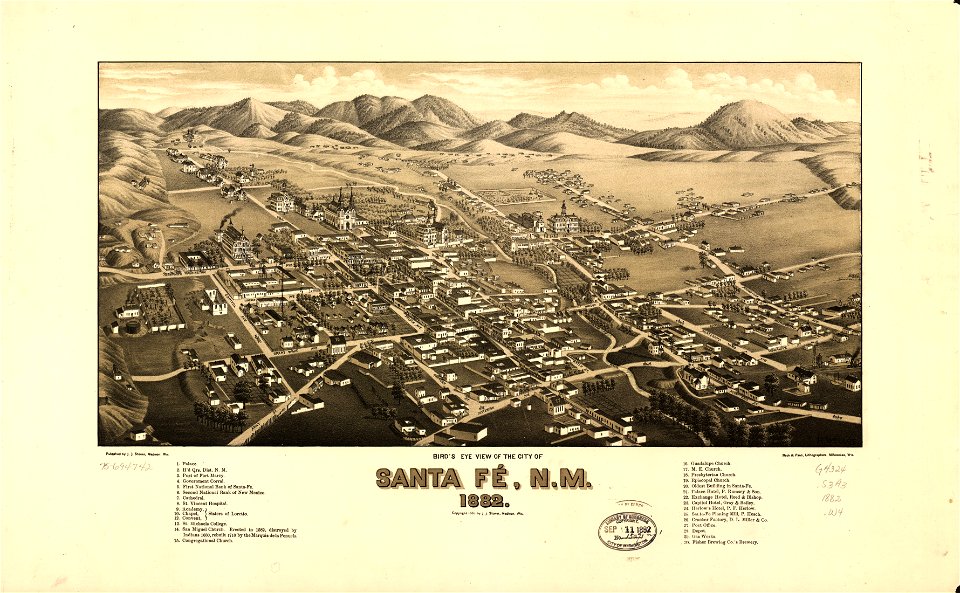
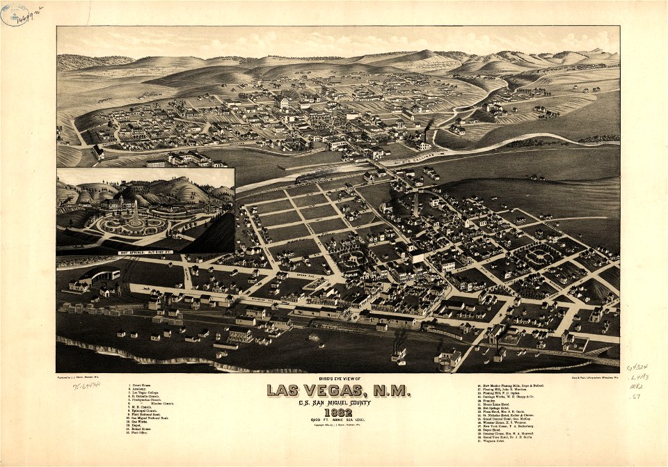
1882 maps
curt teich postcard archives
19th-century maps of yucatán
maps of del norte county, california
1866 maps of california
english-language maps
1752
maps by joseph hutchins colton
1855 maps of new mexico
maps in the library of congress
old maps of new mexico
maps in the library of congress
old maps of new mexico
18th-century maps of the spanish empire
dien (printer)
maps in the library of congress
old maps of new mexico
maps in the library of congress
old maps of new mexico
islands of california
nicolas de fer
maps by jacques-nicolas bellin
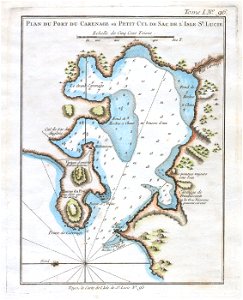
old maps of saint lucia
charles frederick cheffins
1841 maps of texas
curt teich postcard archives
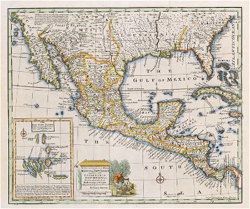
maps of new mexico
maps by william home lizars
1836 maps of mexico
1560s maps of north america
paolo forlani
postcards of new mexico published by petley studios
curt teich postcard archives
jan karel donatus van beecq
hernán cortés
maps by william home lizars
1836 maps of mexico
18th-century maps of north america
1708 maps of north america
restaurants and food in gallup, new mexico
curt teich postcard archives
old maps of the viceroyalty of new spain
1570s maps of mexico
juan de la cruz cano y olmedilla
1755 maps of north america
backs of postcards in curt teich postcard archives
maps of mexico city by braun & hogenberg
maps of cusco by braun & hogenberg
1750s maps of central america
maps by tomas lopez
backs of postcards in curt teich postcard archives
18th-century maps of central america
1760s maps of the caribbean
the loyal west in the times of the rebellion
1803 maps of the united states
maps by william home lizars
1836 maps of texas
carta hydrographica y chorographica de las yslas filipinas
baroque painting
maps in the library of congress
1765 maps
1750s maps of central america
maps by tomas lopez
17th-century maps of mexico
maps by gerard valck
1790s maps of central america
1790s maps of cuba
carte du mexique et de la floride by guillaume delisle (1703)
french-language maps of mexico
juan de la cruz cano y olmedilla
1750s maps of the caribbean
maps in the library of congress
old maps of latin america
everett d. graff collection of western americana
maps of the united states
maps of mexico by mercator-hondius
backs of postcards in curt teich postcard archives
postcards of motels in gallup, new mexico
curt teich postcard archives
a map of the british empire in america with the french and spanish settlements adjacent thereto
bibliothèque nationale de france
a map of the british empire in america with the french and spanish settlements adjacent thereto
bibliothèque nationale de france
a map of the british empire in america with the french and spanish settlements adjacent thereto
bibliothèque nationale de france
a map of the british empire in america with the french and spanish settlements adjacent thereto
bibliothèque nationale de france
a map of the british empire in america with the french and spanish settlements adjacent thereto
bibliothèque nationale de france
maps of mexico by mercator-hondius
bibliothèque nationale de france
chicago and the midwest, newberry library
old maps of the mississippi river
carte du mexique et de la floride by guillaume delisle (1703)
bibliothèque nationale de france
bibliothèque nationale de france
cartouches by tomas lópez
atlas sive cosmographicae (gerardus mercator, 1623)
maps of mexico by mercator-hondius
maps by gouverneur k. warren
maps by edwin freyhold
dinosaur
fossil
incidents of travel in central america, chiapas, and yucatan (1858)
romanticism
carte du mexique et de la floride by guillaume delisle (1703)
bibliothèque nationale de france
maps of mexico by mercator-hondius
bibliothèque nationale de france
1696 maps of the caribbean
1690s maps of mexico
carte du mexique et de la floride by guillaume delisle (1703)
bibliothèque nationale de france
1740s maps of the americas
1747 maps of north america
salt river, arizona
john e. weyss
carta hydrographica y chorographica de las yslas filipinas
baroque painting
baroque painting
animals on maps
incidents of travel in central america, chiapas, and yucatan (1858)
romanticism
1650s maps of the americas
1658 maps
mappe-monde geo-hydrographique (sanson and jaillot, 1674)
cartography of france
maps by louis brion de la tour
1786 maps of north america
carte du mexique et de la floride by guillaume delisle (1703)
bibliothèque nationale de france
18th-century double hemisphere world maps
1730s maps of the world
18th-century double hemisphere world maps
1730s maps of the world
atlas to accompany the official records of the union and confederate armies
everett d. graff collection of western americana
mappe-monde geo-hydrographique (sanson and jaillot, 1674)
a map of the british empire in america with the french and spanish settlements adjacent thereto
bibliothèque nationale de france
geocentric model
1730 maps
1 - 72 of 72
/ 1


![Hispaniae novae nova descriptio / [Mercator], 1628](https://cdn.creazilla.com/illustrations/10001520275/hispaniae-novae-nova-descriptio-mercator-1628-md.jpg)


