Log in
All resources
Create a design
93 Free Artworks of Maps Of Eastern Europe
atlas maior, vol 2 (sweden, russia, poland, eastern europe, and greece) - joan blaeu, 1667 - bl 114.h(star).2
copper engraving print
british library
joan blaeu
catalan atlas, 1959 reproduction
bibliothèque nationale de france
1667 maps of russia
personifications of nations
19th-century satirical maps
1877 cartoons
maps by martin waldseemüller
1513 maps of europe
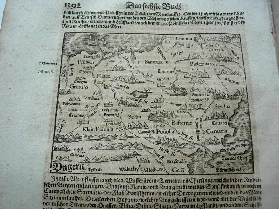
illustrations of cosmographia (münster)
old map
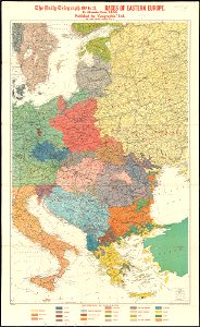
maps of world war i by the daily telegraph
maps by martin waldseemüller
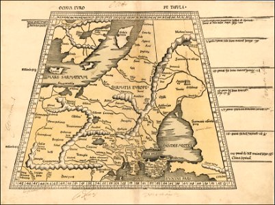
ptolemy's 8th european map
maps of world war i by the daily telegraph
maps
sea
australia
maps
old maps of the ottoman empire
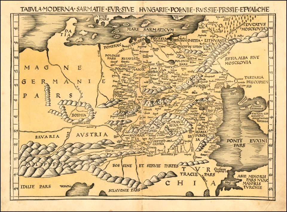
old maps of poland
russo-turkish war (1877–1878)
old maps of europe
russo-turkish war (1877–1878) in art
great eastern crisis (1875–78)
russo-turkish war (1877–1878) in art
great eastern crisis (1875–78)
maps of eastern europe
french-language maps
1690s maps of eastern europe
maps by carolus allard
1370s maps of the balkans
catalan atlas
1370s maps of egypt
catalan atlas
catalan atlas, 1959 reproduction
old maps of the sea of marmara
catalan atlas, 1959 reproduction
cartography of ukraine
catalan atlas, 1959 reproduction
abraham cresques
1490s maps of the holy roman empire
german renaissance
1710s maps of eastern europe
1710s maps of the balkans
catalan atlas, 1959 reproduction
catalan atlas, 1959 reproduction
catalan atlas, 1959 reproduction
catalan atlas, 1959 reproduction
catalan atlas, 1959 reproduction
catalan atlas, 1959 reproduction
1690s maps of grand duchy of lithuania
maps by carolus allard
catalan atlas, 1959 reproduction
catalan charts
catalan atlas, 1959 reproduction
star of david
catalan atlas, 1959 reproduction
catalan charts
description de l'universe
1685 maps of europe
russo-turkish war (1877–1878) in art
great eastern crisis (1875–78)
ptolemy's 8th european map
bologna ptolemy
rus' (eastern europe)
1747 maps of russia
1710s maps of eastern europe
muscovy
maps by john cary
1801 maps
1690s maps of the tsardom of russia
jacob von sandrart
tresor des cartes geographiques (1659)
1650s maps of eastern europe
tresor des cartes geographiques (1659)
1650s maps of the tsardom of russia
atlas maior, vol 2 (sweden, russia, poland, eastern europe, and greece) - joan blaeu, 1667 - bl 114.h(star).2
17th-century maps of estonia
atlas maior, vol 2 (sweden, russia, poland, eastern europe, and greece) - joan blaeu, 1667 - bl 114.h(star).2
1667 maps of russia
catalan atlas, 1959 reproduction
catalan atlas, 1959 reproduction
maps by louis brion de la tour
french-language maps of europe
atlas maior, vol 2 (sweden, russia, poland, eastern europe, and greece) - joan blaeu, 1667 - bl 114.h(star).2
1667 maps of russia
1700s maps of the tsardom of russia
1700s maps of eastern europe
atlas maior, vol 2 (sweden, russia, poland, eastern europe, and greece) - joan blaeu, 1667 - bl 114.h(star).2
17th-century maps of prussia
atlas maior, vol 2 (sweden, russia, poland, eastern europe, and greece) - joan blaeu, 1667 - bl 114.h(star).2
17th-century maps of scandinavia
atlas maior, vol 2 (sweden, russia, poland, eastern europe, and greece) - joan blaeu, 1667 - bl 114.h(star).2
old maps of macedonia
atlas maior, vol 2 (sweden, russia, poland, eastern europe, and greece) - joan blaeu, 1667 - bl 114.h(star).2
1667 maps of russia
atlas maior, vol 2 (sweden, russia, poland, eastern europe, and greece) - joan blaeu, 1667 - bl 114.h(star).2
17th-century maps of hungary
atlas maior, vol 2 (sweden, russia, poland, eastern europe, and greece) - joan blaeu, 1667 - bl 114.h(star).2
17th-century maps of greece
atlas maior, vol 2 (sweden, russia, poland, eastern europe, and greece) - joan blaeu, 1667 - bl 114.h(star).2
17th-century maps of finland
maps by willem and johannes blaeu
1640s maps of ukraine
atlas maior, vol 2 (sweden, russia, poland, eastern europe, and greece) - joan blaeu, 1667 - bl 114.h(star).2
magni ducatus lithuaniae
atlas maior, vol 2 (sweden, russia, poland, eastern europe, and greece) - joan blaeu, 1667 - bl 114.h(star).2
17th-century maps of romania
atlas maior, vol 2 (sweden, russia, poland, eastern europe, and greece) - joan blaeu, 1667 - bl 114.h(star).2
maps of candia by ortelius and mercator
1650s maps of the balkans
philippe de la rué
atlas maior, vol 2 (sweden, russia, poland, eastern europe, and greece) - joan blaeu, 1667 - bl 114.h(star).2
copper engraving print
atlas maior, vol 2 (sweden, russia, poland, eastern europe, and greece) - joan blaeu, 1667 - bl 114.h(star).2
copper engraving print
atlas maior, vol 2 (sweden, russia, poland, eastern europe, and greece) - joan blaeu, 1667 - bl 114.h(star).2
17th-century maps of poland
atlas maior, vol 2 (sweden, russia, poland, eastern europe, and greece) - joan blaeu, 1667 - bl 114.h(star).2
17th-century maps of the aegean sea
atlas maior, vol 2 (sweden, russia, poland, eastern europe, and greece) - joan blaeu, 1667 - bl 114.h(star).2
1667 maps of russia
maps by willem and johannes blaeu
1630s maps of the caucasus
franz müller
carl schütz
atlas maior, vol 2 (sweden, russia, poland, eastern europe, and greece) - joan blaeu, 1667 - bl 114.h(star).2
copper engraving print
atlas maior, vol 2 (sweden, russia, poland, eastern europe, and greece) - joan blaeu, 1667 - bl 114.h(star).2
copper engraving print
atlas maior, vol 2 (sweden, russia, poland, eastern europe, and greece) - joan blaeu, 1667 - bl 114.h(star).2
copper engraving print
atlas maior, vol 2 (sweden, russia, poland, eastern europe, and greece) - joan blaeu, 1667 - bl 114.h(star).2
copper engraving print
atlas maior, vol 2 (sweden, russia, poland, eastern europe, and greece) - joan blaeu, 1667 - bl 114.h(star).2
copper engraving print
atlas maior, vol 2 (sweden, russia, poland, eastern europe, and greece) - joan blaeu, 1667 - bl 114.h(star).2
17th-century maps of scandinavia
atlas maior, vol 2 (sweden, russia, poland, eastern europe, and greece) - joan blaeu, 1667 - bl 114.h(star).2
1667 maps of russia
atlas maior, vol 2 (sweden, russia, poland, eastern europe, and greece) - joan blaeu, 1667 - bl 114.h(star).2
maps of slavonia by gerardus mercator
atlas maior, vol 2 (sweden, russia, poland, eastern europe, and greece) - joan blaeu, 1667 - bl 114.h(star).2
1667 maps of russia
atlas maior, vol 2 (sweden, russia, poland, eastern europe, and greece) - joan blaeu, 1667 - bl 114.h(star).2
17th-century maps of the aegean sea
atlas maior, vol 2 (sweden, russia, poland, eastern europe, and greece) - joan blaeu, 1667 - bl 114.h(star).2
copper engraving print
atlas maior, vol 2 (sweden, russia, poland, eastern europe, and greece) - joan blaeu, 1667 - bl 114.h(star).2
copper engraving print
atlas maior, vol 2 (sweden, russia, poland, eastern europe, and greece) - joan blaeu, 1667 - bl 114.h(star).2
copper engraving print
atlas maior, vol 2 (sweden, russia, poland, eastern europe, and greece) - joan blaeu, 1667 - bl 114.h(star).2
copper engraving print
atlas maior, vol 2 (sweden, russia, poland, eastern europe, and greece) - joan blaeu, 1667 - bl 114.h(star).2
1667 maps of russia
atlas maior, vol 2 (sweden, russia, poland, eastern europe, and greece) - joan blaeu, 1667 - bl 114.h(star).2
copper engraving print
atlas maior, vol 2 (sweden, russia, poland, eastern europe, and greece) - joan blaeu, 1667 - bl 114.h(star).2
copper engraving print
a class-book of modern geography (1898)
east european plain
atlas maior, vol 2 (sweden, russia, poland, eastern europe, and greece) - joan blaeu, 1667 - bl 114.h(star).2
copper engraving print
atlas maior, vol 2 (sweden, russia, poland, eastern europe, and greece) - joan blaeu, 1667 - bl 114.h(star).2
coats of arms of the tsardom of russia
maps by girolamo ruscelli
maps by girolamo porro
atlas maior, vol 2 (sweden, russia, poland, eastern europe, and greece) - joan blaeu, 1667 - bl 114.h(star).2
copper engraving print
atlas maior, vol 2 (sweden, russia, poland, eastern europe, and greece) - joan blaeu, 1667 - bl 114.h(star).2
copper engraving print
atlas maior, vol 2 (sweden, russia, poland, eastern europe, and greece) - joan blaeu, 1667 - bl 114.h(star).2
copper engraving print
maps by john cary
1799 maps
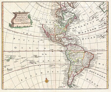
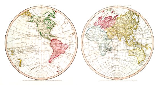
1740s maps of the world
maps by emanuel bowen
1650s maps of the americas
1658 maps
1740s maps of the americas
1747 maps of north america
1 - 93 of 93
/ 1


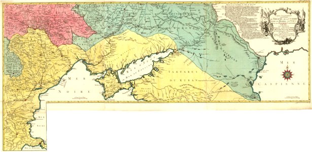


![Treasure of geographical maps of the main states of the universe [...], 1659](https://cdn.creazilla.com/illustrations/10000594631/treasure-of-geographical-maps-of-the-main-states-of-the-universe-1659-md.jpg)
![Treasure of geographical maps of the main states of the universe [...], 1659](https://cdn.creazilla.com/illustrations/10000302483/treasure-of-geographical-maps-of-the-main-states-of-the-universe-1659-md.jpg)