Log in
All resources
Create a design
26,489 Free Artworks of Map
topographic map of france, 1864
lemercier & cie.
baroque
maps from university of amsterdam special collections
atlas der neederlanden
copperplate print
special collections of the university of amsterdam
eran laor cartographic collection
nouvelle géographie universelle, vol. xii
charles eugène perron
église notre-dame-des-blancs-manteaux (paris)
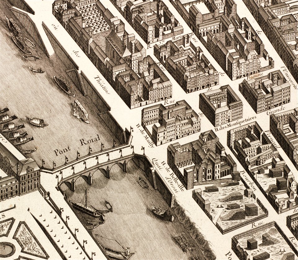
turgot map of paris – derivative files
maps of los palacios by braun & hogenberg
maps of las cabezas by braun & hogenberg
neues rathaus (bamberg)
maps of bamberg
maps in the library of congress
1776 maps of new jersey
eran laor cartographic collection
william hughes (geographer)
maps of brielle by braun & hogenberg
eran laor cartographic collection
historical images of havana
old maps of havana
maps by christian sgrothen
maps of rur
the loyal west in the times of the rebellion
1865 maps of the united states
maps of the ottoman empire by mercator-hondius
map of bruges by marcus gheeraerts (i)
old maps of sluis
media from accademia delle scienze di torino
1574 illustrations
engravings of topographia braunschweig lüneburg
baroque
topographia braunschweig lüneburg (merian)
baroque
topographischer atlas der schweiz
old maps of zollikerberg
engravings of topographia braunschweig lüneburg
baroque
history of the province of león
maps by tomas lopez
cecil calvert, 2nd baron baltimore
works by gerard soest
old maps of southeast asia
maps by thomas starling
americae 1562 by diego gutiérrez and hieronymus cock
renaissance
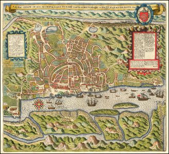
maps of goa by linschoten
theodor de bry
adventure films
action films
voyages and travels to india, ceylon, the red sea, abyssinia, and egypt, vol. 3
henry cooper (engraver)
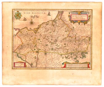
old maps of mecklenburg
powell library
turgot map of paris – derivative files
île de la cité
eran laor cartographic collection
jacob peeters
eran laor cartographic collection
guillaume sanson
17th-century maps of lower saxony
atlas novus (blaeu)
old maps of the polish-lithuanian commonwealth
coats of arms on maps
1780s maps of the americas
1786 maps
1807 maps of south america
maps by john cary
topographic map of france, 1864
lemercier & cie.
topographic map of france, 1864
lemercier & cie.
topographic map of france, 1864
lemercier & cie.
topographic map of france, 1864
lemercier & cie.
topographic map of france, 1864
lemercier & cie.
topographic map of france, 1864
lemercier & cie.
topographic map of france, 1864
lemercier & cie.
topographic map of france, 1864
lemercier & cie.
topographic map of france, 1864
lemercier & cie.
topographic map of france, 1864
lemercier & cie.
topographic map of france, 1864
lemercier & cie.
topographic map of france, 1864
lemercier & cie.
topographic map of france, 1864
lemercier & cie.
topographic map of france, 1864
lemercier & cie.
topographic map of france, 1864
lemercier & cie.
topographic map of france, 1864
lemercier & cie.
topographic map of france, 1864
lemercier & cie.
topographic map of france, 1864
lemercier & cie.
topographic map of france, 1864
lemercier & cie.
topographic map of france, 1864
lemercier & cie.
topographic map of france, 1864
lemercier & cie.
topographic map of france, 1864
lemercier & cie.
topographic map of france, 1864
lemercier & cie.
topographic map of france, 1864
lemercier & cie.
topographic map of france, 1864
lemercier & cie.
topographic map of france, 1864
lemercier & cie.
topographic map of france, 1864
lemercier & cie.
topographic map of france, 1864
lemercier & cie.
topographic map of france, 1864
lemercier & cie.
topographic map of france, 1864
lemercier & cie.
topographic map of france, 1864
lemercier & cie.
topographic map of france, 1864
lemercier & cie.
topographic map of france, 1864
lemercier & cie.
maps in the library of congress
augustus kollner
topographic map of france, 1864
lemercier & cie.
abraham cresques
catalan atlas
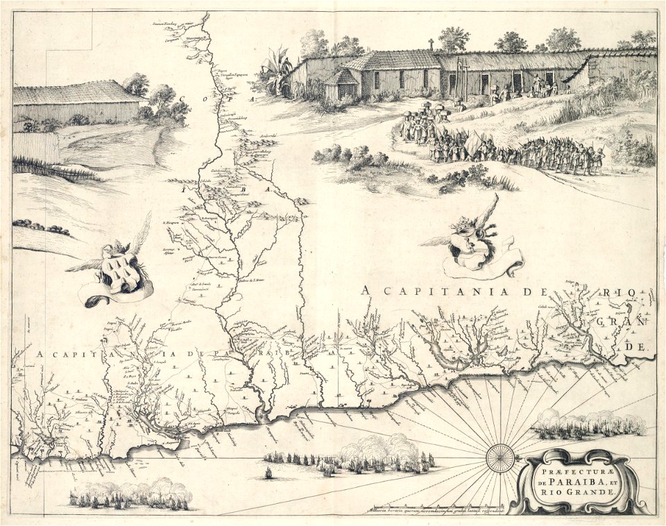
carta hydrographica y chorographica de las yslas filipinas
baroque painting
nouvelle géographie universelle, vol. xii
charles eugène perron
bibliothèque municipale de reims, rès. g 152
old maps of abbeville
corbulo canal
1750 maps
james meadows tract
james meadows
nouvelle géographie universelle, vol. xii
charles eugène perron
buildings in wilhelma zoo
schloss rosenstein
nouvelle géographie universelle, vol. xii
charles eugène perron
nouvelle géographie universelle, vol. xii
charles eugène perron
heriot row, edinburgh
maps of edinburgh
old maps of north rhine-westphalia
baroque
curt teich postcard archives
map postcards
maps of goa by linschoten
portuguese india
gemeente atlas van nederland - zeeland
maps of poortvliet
maps by willem and johannes blaeu
copper engravings
elizabeth ii on stamps of aden
1953 stamps of aden
maps in the rijksmuseum amsterdam
1627 maps
turgot map of paris – derivative files
musketeers of the guard
engravings of topographia saxoniae inferioris
baroque
gemeente atlas van nederland - zeeland
maps of sint-maartensdijk
maps of impact craters on mars
fontana (martian crater)
maps of kingdom of westphalia
1808 in germany
17th-century maps of moscow
atlas van loon
topographia franconiae (merian)
baroque
leipzig in the 17th century
baroque
maps of the west-indische compagnie
1647
maps from university of amsterdam special collections
atlas der neederlanden
maps from university of amsterdam special collections
atlas der neederlanden
maps from university of amsterdam special collections
atlas der neederlanden
maps from the earth and its inhabitants, vol. xvii
history of florida
maps from university of amsterdam special collections
atlas der neederlanden
maps from university of amsterdam special collections
atlas der neederlanden
maps from university of amsterdam special collections
atlas der neederlanden
6301 - 6400 of 26,489
Next page
/ 265