Log in
All resources
Create a design
26,489 Free Artworks of Map
atlas ou representation du monde universel t. 1 (1633)
national library of poland
bibliothèque nationale de france
british library - off the map alice collection
british library - off the map alice collection - wonderland
the nursery alice (1890)
british library
john tenniel
maps by hendrik hondius the younger
baroque
maps of île-de-france by françois de la guillotière
atlas minor gerardi mercatoris (1614, maps)
maps of emden by braun & hogenberg
bibliothèque nationale de france
maps from gallica
guides joanne
1667 map of madagascar by guillaume sanson
bibliothèque nationale de france
sketchbook of northwest american and canadian scenery
hudson river school
maps of the islands of greece by marco boschini (1658)
old maps of astypalaia
map of the circle of franconia by sanson
1680s maps of bavaria
le royaume de france distingué by guillaume sanson
1724 maps of france
1670s maps of the iberian peninsula
georg widmann
maps from university of amsterdam special collections
atlas der neederlanden
pierre alexander tardieu
delaval (surname)
old maps of katwijk, south holland
brittenburg
eran laor cartographic collection
claes jansz. visscher (ii)
anthonisz., cornelis - gezicht op amsterdam in vogelvlucht - amsterdam museum
oil on panel
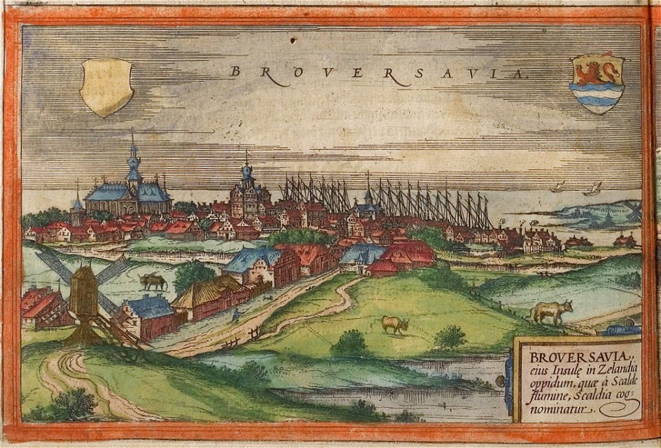
maps of brouwershaven by braun & hogenberg
history of brouwershaven
gemeente atlas van nederland - zeeland
burgh-haamstede
topographia braunschweig lüneburg (merian)
baroque
maps of amersfoort by braun & hogenberg
atlas van loon
gemeente atlas van nederland - north brabant
maps of woudrichem
gemeente atlas van nederland - north brabant
maps of vught
gemeente atlas van nederland - north brabant
maps of woudrichem
topographia braunschweig lüneburg (merian)
baroque
engravings of topographia palatinatus rheni
baroque
gemeente atlas van nederland - north brabant
meeuwen, netherlands
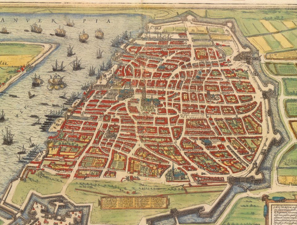
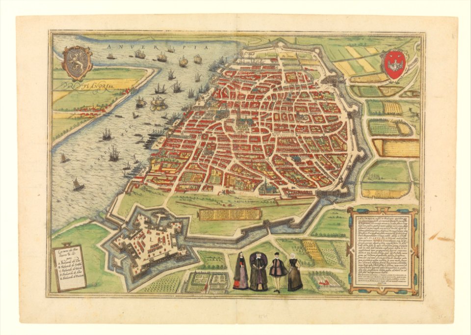
maps of antwerp by braun & hogenberg
maps of antwerp city walls
maps of antwerp by braun & hogenberg
maps of antwerp city walls
atlas ou representation du monde universel t. 1 (1633)
old maps of beauvais
british library - off the map alice collection - wonderland
british library - off the map alice collection
british library - off the map alice collection - wonderland
british library - off the map alice collection
atlas ou representation du monde universel t. 1 (1633)
maps by hendrik hondius the younger
british library - off the map alice collection - wonderland
british library - off the map alice collection
atlas ou representation du monde universel t. 1 (1633)
maps of france by hendrik hondius
atlas ou representation du monde universel t. 1 (1633)
1630s maps of the netherlands
atlas ou representation du monde universel t. 1 (1633)
1630s maps of the netherlands
atlas ou representation du monde universel t. 1 (1633)
maps by hendrik hondius the younger
british library - off the map alice collection - wonderland
british library - off the map alice collection
british library - off the map alice collection - wonderland
british library - off the map alice collection
british library - off the map alice collection - wonderland
british library - off the map alice collection
atlas ou representation du monde universel t. 1 (1633)
1630s maps of portugal
atlas ou representation du monde universel t. 1 (1633)
1630s maps of the netherlands
british library - off the map alice collection - wonderland
british library - off the map alice collection
atlas ou representation du monde universel t. 1 (1633)
1630s maps of the netherlands
atlas ou representation du monde universel t. 1 (1633)
17th-century maps of scandinavia
british library - off the map alice collection - wonderland
british library - off the map alice collection
atlas ou representation du monde universel t. 1 (1633)
1630s maps of the netherlands
atlas ou representation du monde universel t. 1 (1633)
old maps of languedoc
cartouche (cartography)
jean-claude dezauche
british library - off the map alice collection - wonderland
british library - off the map alice collection
atlas ou representation du monde universel t. 1 (1633)
1630s maps of belgium
van langren map of southeast asia
renaissance
topographischer atlas der schweiz
kraftwerk wildegg
turgot map of paris, kyoto university library – derivative files
plans of the palais des tuileries
maps of flensburg by braun & hogenberg
dammhofareal
bibliothèque municipale de reims, rès. g 153
historical images of montélimar
grand théâtre d'angers
postcards of angers
former castles in germany
castles in kreis düren
bibliothèque municipale de reims, rès. g 153
baroque
maps of hrodna by braun & hogenberg
historical images of hrodna
carte de barbarie, nigritie, guinée par guillaume delisle (1707)
university of washington
maps in the rijksmuseum amsterdam
17th-century celestial maps
19th-century portrait paintings in the musée de l'armée
nicolas gosse
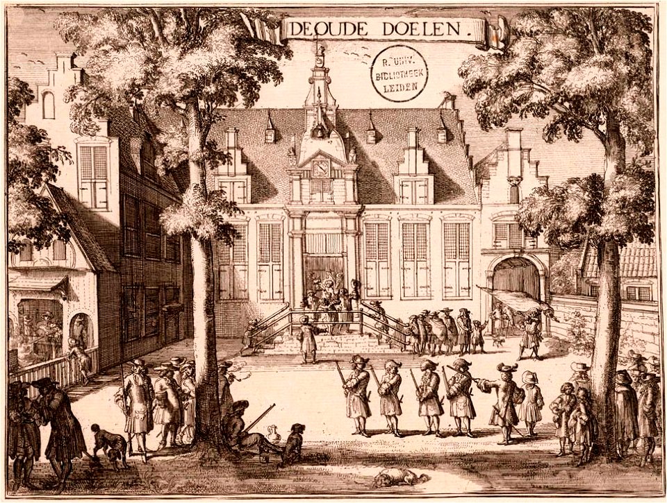
kloveniersdoelen (haarlem)
1689 map of haarlem
baupläne der kunstakademie düsseldorf
1873 in düsseldorf
maps from the earth and its inhabitants, vol. iv
severn estuary
the atlantic islands as resorts of health and pleasure (1878)
isles of shoals
blandt nordpolens naboer (1895)
inglefield gulf
atlas des anciens plans de paris by imprimerie nationale, 1880 from bhvp
map of paris by françois quesnel
maps from the earth and its inhabitants, vol. iv
mount merrick
atlas des anciens plans de paris by imprimerie nationale, 1880 from bhvp
map of paris by françois quesnel
17th-century maps of london
kennington, london
maps of the arctic ocean
maps of the north pole
description des principales villes (1690)
old maps of athens
drawings by jacob toorenvliet in the rijksmuseum amsterdam
pen and ink drawings in the rijksmuseum amsterdam
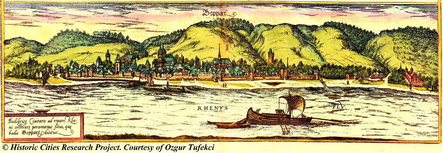
maps of boppard by braun & hogenberg
gemeente atlas van nederland - north brabant
maps of vlijmen
gemeente atlas van nederland - north brabant
maps of haaren
maps of znojmo by braun & hogenberg
views of znojmo
gemeente atlas van nederland - groningen
maps of termunten
maps of portugal by fernando álvares seco
old maps of rions
léo drouyn
topographia braunschweig lüneburg (merian)
baroque
plano nuevo de madrid 1930
old maps of rions
léo drouyn
old maps of veliky novgorod
erik palmqvist
maps by willem and johannes blaeu
cadzand
maps by willem and johannes blaeu
recueil d'antiquités égyptiennes, étrusques, greques et romaines (1756)
18th-century maps of paris
kantharos harbour (piraeus)
maps of piraeus
bodleian library, notitia dignitatum 1436
roman dacia
bodleian library, notitia dignitatum 1436
dacian towns
maps of aden by braun & hogenberg
thesaurus philopoliticus
bibliothèque municipale de reims, chg 22
maps of cierges
postcards with 2 images
map postcards
bodleian library, notitia dignitatum 1436
dacian towns
maps of haderslev by braun & hogenberg
haderslevhus
dutch 17th-century prints in the rijksmuseum amsterdam
siege of groenlo 1627
pieter nason
baroque
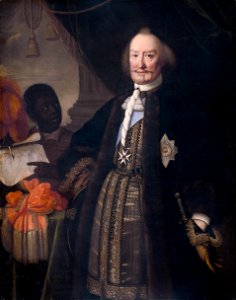
18th-century portraits in the national museum in poznań
józef wall
18th-century maps of the malay archipelago
1790s maps of china
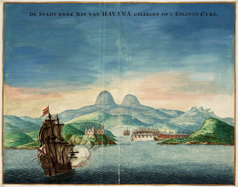
old maps of havana
1665 maps
15301 - 15400 of 26,489
Next page
/ 265