Log in
All resources
Create a design
26,489 Free Artworks of Map
maps from the earth and its inhabitants, vol. iv
civitates orbis terrarum. urbium praecipuarum totius mundi. liber quartus
drawing
digital library of university of wroclaw
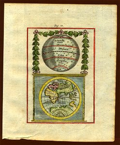
description de l'universe
alain manesson mallet
1880s maps of the british isles
maps in the rijksmuseum amsterdam
old maps of delfland
nicolaas samuel crucquius
asia noviter delineata
old goa
maps from the earth and its inhabitants, vol. iv
1880s maps of the british isles
maps from the earth and its inhabitants, vol. iv
maps of the firth of clyde
maps from the earth and its inhabitants, vol. iv
19th-century maps of county durham
maps from the earth and its inhabitants, vol. iv
19th-century maps of the isle of man
maps from the earth and its inhabitants, vol. iv
maps of ben nevis
history of hormuz island
asia noviter delineata
maps from the earth and its inhabitants, vol. iv
1880s maps of the british isles
maps from the earth and its inhabitants, vol. iv
1880s maps of ireland
maps from the earth and its inhabitants, vol. iv
19th-century maps of kent
ghosts & ghoulish scenes
maps from the earth and its inhabitants, vol. iv
old maps of the firth of forth
maps from the earth and its inhabitants, vol. iv
old maps of liverpool
maps from the earth and its inhabitants, vol. iv
1880s maps of scotland
maps from the earth and its inhabitants, vol. iv
old maps of the hebrides
maps from the earth and its inhabitants, vol. iv
1880s maps of the british isles
maps from the earth and its inhabitants, vol. iv
old maps of hartlepool
maps from the earth and its inhabitants, vol. iv
19th-century maps of lincolnshire
maps from the earth and its inhabitants, vol. iv
1880s maps of the british isles
maps from the earth and its inhabitants, vol. iv
old maps of derby
maps from the earth and its inhabitants, vol. iv
old maps of hadrian's wall
maps from the earth and its inhabitants, vol. iv
old maps of glasgow
maps from the earth and its inhabitants, vol. iv
1880s maps of the british isles
maps from the earth and its inhabitants, vol. iv
1880s maps of the british isles
maps from the earth and its inhabitants, vol. iv
19th-century maps of lancashire
maps from the earth and its inhabitants, vol. iv
old maps of leeds
maps from the earth and its inhabitants, vol. iv
old maps of york
maps from the earth and its inhabitants, vol. iv
1880s maps of the british isles
maps from the earth and its inhabitants, vol. iv
maps of loch lomond
maps from the earth and its inhabitants, vol. iv
1880s maps of the british isles
maps from the earth and its inhabitants, vol. iv
old maps of sheffield
maps from the earth and its inhabitants, vol. iv
19th-century maps of lancashire
maps from the earth and its inhabitants, vol. iv
1880s maps of the british isles
maps from the earth and its inhabitants, vol. iv
old maps of the isle of arran
maps from the earth and its inhabitants, vol. iv
1880s maps of the british isles
maps of lyon by braun & hogenberg
nicolaas samuel crucquius
old maps of delfland
maps of büdingen by braun & hogenberg
nicolaas samuel crucquius
old maps of delfland
nicolaas samuel crucquius
old maps of delfland
nicolaas samuel crucquius
old maps of delfland
nederlandse en buitenlandse gebeurtenissen
album met historieprenten van hogenberg
18th-century maps of the iberian peninsula
maps in the rijksmuseum amsterdam
1640s maps of bavaria
atlas novus (blaeu)
old maps of utrecht
atlas novus (blaeu)
the sick child by gabriël metsu
baroque
jean-michel moreau
the troelfth cake
civitates orbis terrarum. urbium praecipuarum totius mundi. liber quartus
16th-century maps showing history
civitates orbis terrarum. urbium praecipuarum totius mundi. liber quartus
maps of husum by braun & hogenberg
civitates orbis terrarum. urbium praecipuarum totius mundi. liber quartus
maps of eisleben by braun & hogenberg
civitates orbis terrarum. urbium praecipuarum totius mundi. liber quartus
maps of mâcon by braun & hogenberg
civitates orbis terrarum. urbium praecipuarum totius mundi. liber quartus
maps of dortmund by braun & hogenberg
maps of bergen op zoom by braun & hogenberg
atlas beudeker
civitates orbis terrarum. urbium praecipuarum totius mundi. liber quartus
maps of oberwesel by braun & hogenberg
civitates orbis terrarum. urbium praecipuarum totius mundi. liber quartus
16th-century maps showing history
civitates orbis terrarum. urbium praecipuarum totius mundi. liber quartus
maps of krempe by braun & hogenberg
civitates orbis terrarum. urbium praecipuarum totius mundi. liber quartus
maps of sulmona by braun & hogenberg
civitates orbis terrarum. urbium praecipuarum totius mundi. liber quartus
maps of itzehoe by braun & hogenberg
civitates orbis terrarum. urbium praecipuarum totius mundi. liber quartus
maps of marchena by braun & hogenberg
civitates orbis terrarum. urbium praecipuarum totius mundi. liber quartus
maps of hamburg by braun & hogenberg
civitates orbis terrarum. urbium praecipuarum totius mundi. liber quartus
1590s maps of denmark
18th-century maps of the aegean sea
jean-fréderic phélypeaux
civitates orbis terrarum. urbium praecipuarum totius mundi. liber quartus
maps of brixen by braun & hogenberg
augustus kollner
pictorial maps
maps in the rijksmuseum amsterdam
maps by willem and johannes blaeu
prints by jan luyken in the rijksmuseum amsterdam
maps in the rijksmuseum amsterdam
genre paintings by albert anker
realism,impressionism
dutch 17th-century prints in the rijksmuseum amsterdam
old maps of roermond
dutch 17th-century prints in the rijksmuseum amsterdam
old maps of roermond
maps in the rijksmuseum amsterdam
maps of pompeii
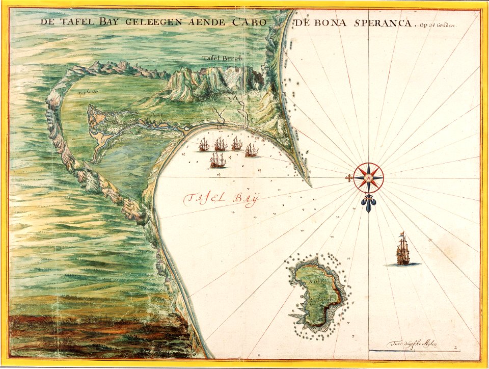
maps of the dutch east india company - south africa
1665
fonds ancely - bibliothèque municipale de toulouse - maps
19th-century maps of calvados
philippe de la rué
maps of mysia
maps of komárom by braun & hogenberg
károly cserna
maps of groningen by braun & hogenberg
history of groningen (city)
engravings of topographia braunschweig lüneburg
baroque
frans post
baroque
old submaps of paris 5e arrondissement
turgot map of paris – derivative files
ceiling of the terrace of the geographical maps (uffizi gallery, florence)
mannerism
17th-century maps of paris
nicolaus person
merian sueviae
baroque
1590s maps of transylvania
1590s maps of hungary
kadasterkaarten maastricht (ca 1823-1830)
1830 maps
broadsheet prints from koninklijke bibliotheek - maps
broadsheet prints from koninklijke bibliotheek
paris depuis charles v jusqu'à charles ix d'après le plan de l'abbaye st-victor
maps of paris from paris musées
maps of ghent by braun & hogenberg
flandria illustrata
maps of tönning by braun & hogenberg
maps of husum by braun & hogenberg
broadsheet prints from koninklijke bibliotheek - maps
broadsheet prints from koninklijke bibliotheek
description de l'universe
saudi arabia
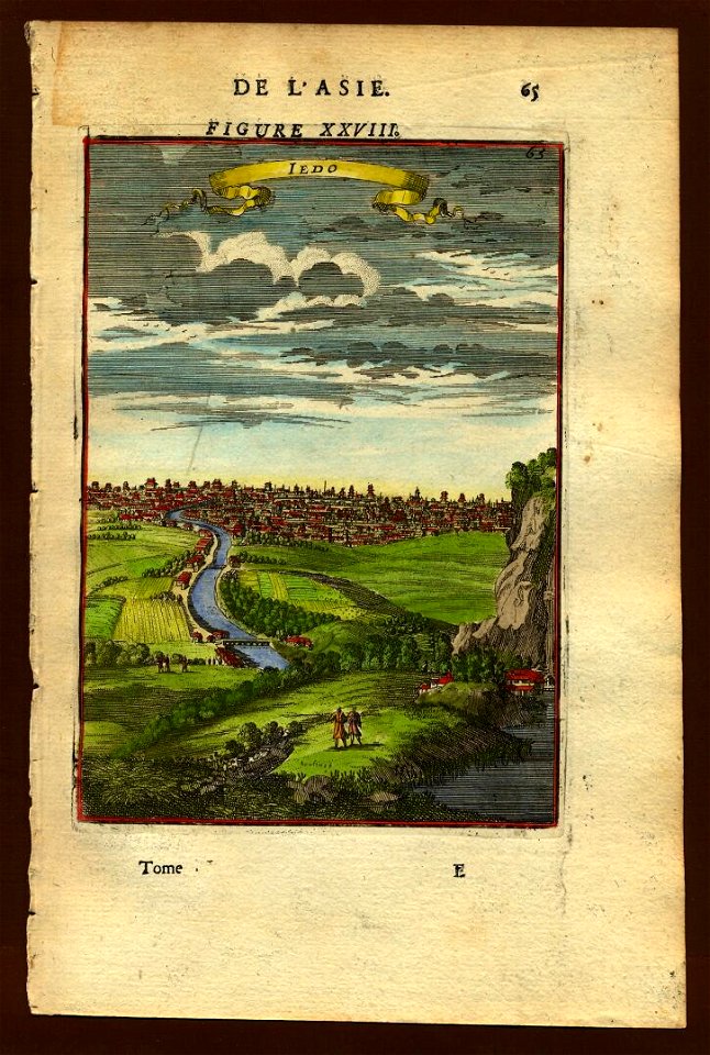
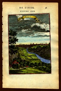
description de l'universe
old maps of japan
description de l'universe
old maps of japan
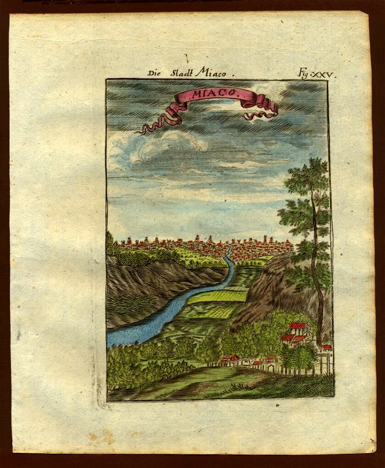
description de l'universe
old maps of japan
description de l'universe
1710s maps of the world
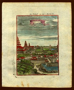
description de l'universe
old maps of japan
description de l'universe
art of mauritius
description de l'universe
art of réunion
description de l'universe
old maps of valletta
description de l'universe
saudi arabia
map of amsterdam by gerrit de broen (ii)
gerrit de broen
description de l'universe
art of réunion
14001 - 14100 of 26,489
Next page
/ 265