Log in
All resources
Create a design
26,489 Free Artworks of Map
paper
british museum
john rocque 1746 london map in the british museum
john rocque
baroque
bibliothèque nationale de france
eran laor cartographic collection
metropolitan museum of art
maps by willem and johannes blaeu
dutch-language maps
drawings in the metropolitan museum of art
jan anthonie coxie
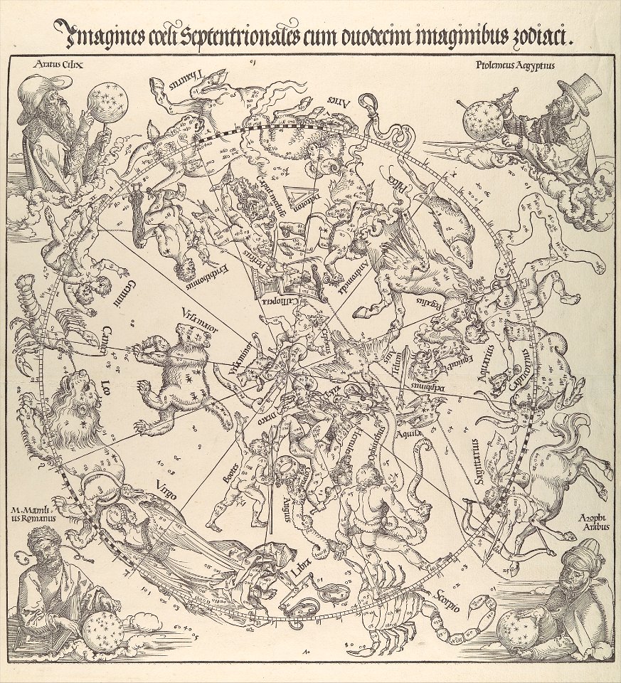
the northern hemisphere of the celestial globe by albrecht dürer
german renaissance
the northern hemisphere of the celestial globe by albrecht dürer
german renaissance
johann friedrich steffenhagen und sohn
linguistic maps of baltic languages
eran laor cartographic collection
baroque
high renaissance,renaissance
codex windsor
eran laor cartographic collection
philippe de la rué
prints by oluf olufsen bagge in the statens museum for kunst
etching print
1750s maps of saxony
old maps of leipzig
old maps of gdańsk
baroque
prints by mary cassatt in the metropolitan museum of art
impressionism
eran laor cartographic collection
alain manesson-mallet
eran laor cartographic collection
claes jansz. visscher (ii)
eran laor cartographic collection
johannes van den aveelen
eran laor cartographic collection
claes jansz. visscher (ii)
john rocque 1746 london map in the british museum
paper
john rocque 1746 london map in the british museum
paper
john rocque 1746 london map in the british museum
paper
john rocque 1746 london map in the british museum
paper
john rocque 1746 london map in the british museum
paper
john rocque 1746 london map in the british museum
paper
john rocque 1746 london map in the british museum
paper
john rocque 1746 london map in the british museum
paper
john rocque 1746 london map in the british museum
paper
john rocque 1746 london map in the british museum
paper
john rocque 1746 london map in the british museum
paper
john rocque 1746 london map in the british museum
paper
john rocque 1746 london map in the british museum
paper
john rocque 1746 london map in the british museum
paper
john rocque 1746 london map in the british museum
paper
john rocque 1746 london map in the british museum
paper
john rocque 1746 london map in the british museum
paper
john rocque 1746 london map in the british museum
paper
john rocque 1746 london map in the british museum
paper
john rocque 1746 london map in the british museum
paper
john rocque 1746 london map in the british museum
paper
john rocque 1746 london map in the british museum
paper
john rocque 1746 london map in the british museum
paper
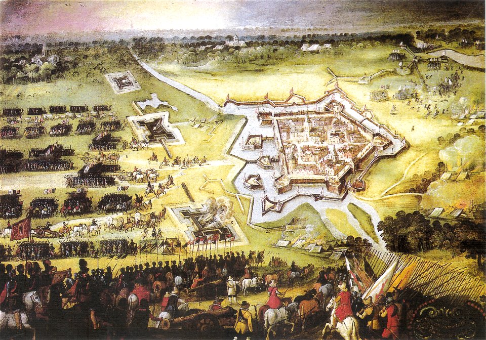
paintings of battles by peter snayers
cityscapes in art
topographia bohemiae moraviae et silesiae (merian)
baroque
1650s maps of italy
geographia blaviana
tavole schiavoni
baroque
arnold's geographical handbook (1899)
1899 maps of india
lithographs in the rijksmuseum amsterdam
maps in the rijksmuseum amsterdam
tavole schiavoni
baroque
maps from gallica
maps of antwerp
arnold's geographical handbook (1899)
1899 maps of the caribbean
maps of kraków
planty
engravings of topographia braunschweig lüneburg
baroque
engravings of topographia braunschweig lüneburg
baroque
voyages and travels to india, ceylon, the red sea, abyssinia, and egypt, vol. 3
henry cooper (engraver)
stamps of russia, 1995
yalta conference
gemeente atlas van nederland - north brabant
wijk en aalburg
19th-century caricatures
people with maps in art
old maps of deventer
ijssel at deventer
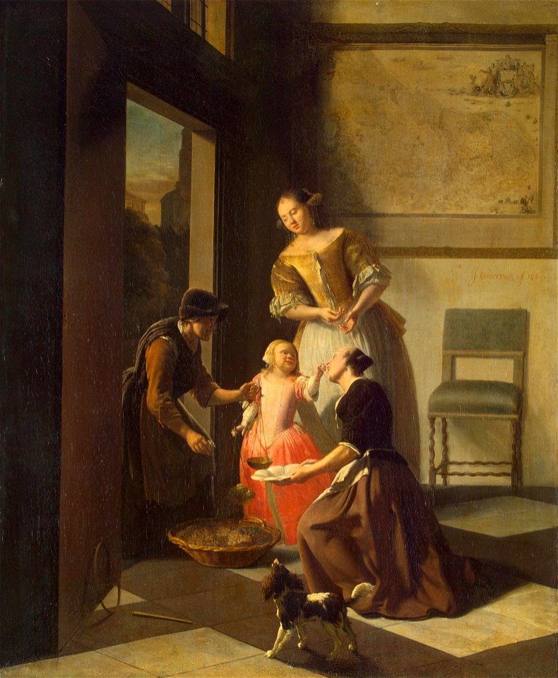
17th-century paintings in the hermitage
jacob ochtervelt
portrait paintings of james francis edward stuart
antonio david
topographia westphaliae (merian)
baroque
maps in the rijksmuseum amsterdam
old maps of the ottoman empire
incidents of travel in central america, chiapas, and yucatan (book)
romanticism
views of dinant
dinant in art
maps by willem and johannes blaeu
oostershuis
description de l'universe
china in art
map of maastricht by willem and johannes blaeu (1649)
jekerkwartier (maastricht)
kurtze beschreibung von republick venedig
17th-century engravings of towns
description de l'universe
china in art
prints in the yale center for british art
william bernard cooke
illustrations from the english at the north pole by riou and montaut
orientalist painting
eran laor cartographic collection
18th-century maps of jerusalem
maps of the magellan straits by lambert cornelis
maps in the library of congress
18th-century maps of stockholm
realism
old maps of the kingdom of naples
1700s maps of italy
maps of london by braun & hogenberg
st martin-in-the-fields
arnold van langren map of east africa
1596 maps of africa
maps in the rijksmuseum amsterdam
18th-century maps of gibraltar
topographia braunschweig lüneburg (merian)
baroque
engravings of topographia braunschweig lüneburg
baroque
peter schwingen
peter de weerth
map of maastricht by willem and johannes blaeu (1649)
tongersestraat (maastricht)
the topography of troy, and its vicinity (1804)
william gell
maps by christian sgrothen
maps by george w. boynton
1838 maps of boston
maps of country estates in the netherlands
het zegepralent kennemerlant
satirical prints in the british museum
works after robert dighton
lord burghley's atlas (1579) - bl royal ms 18 d iii
maps of wales by humphrey llwyd
maps by willem and johannes blaeu
1690s maps of indonesia
17th-century maps of the indian ocean
maps by willem and johannes blaeu
maps by willem and johannes blaeu
1690s maps of indonesia
maps of the course of the rhine by guillaume sanson
bibliothèque nationale de france
sanson maps of south america
1719 maps of south america
bibliothèque nationale de france
sanson map of lorraine
merian mainz trier köln
baroque
nicolaas samuel crucquius
old maps of delfland
historical images of hawaii (island)
hawaii in the 1810s
biblioteca di storia e cultura del piemonte "giuseppe grosso"
1700s maps of liguria
prints by matteo greuter in the statens museum for kunst
copper
admiralty charts region b: england wales ireland english channel southern north sea
admiralty charts 1001-1200
maps in the stadsarchief amsterdam
daniel stoopendaal
siege of schenkenschans 1636
atlas van loon
topographischer atlas der schweiz
weiach
13101 - 13200 of 26,489
Next page
/ 265