Log in
All resources
Create a design
26,489 Free Artworks of Map
bibliothèque nationale de france
orientalist painting
maps from géographie illustrée de la france et de ses colonies
baroque
paper
british museum
guillaume sanson
engravings of topographia braunschweig lüneburg
maps in the library of congress
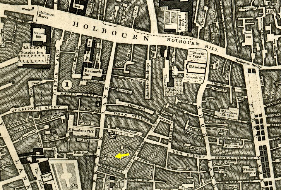
john rocque
merian mainz trier köln
baroque
coats of arms of the roman catholic diocese of liège
1645 maps of belgium
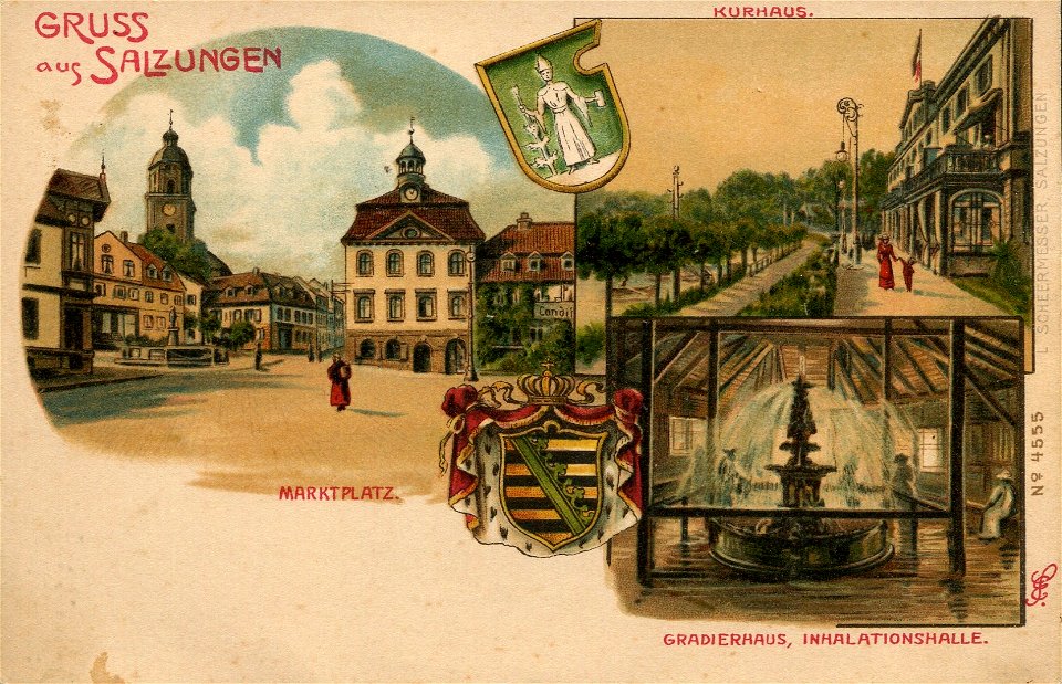
postcards of bad salzungen
bad salzungen
prints by matteo greuter in the statens museum for kunst
copper
eran laor cartographic collection
jacques chiquet
eran laor cartographic collection
giovanni maria cassini
tremper mound and earthworks
squier and davis images
john rocque 1746 crops from library of congress
maps in the library of congress
manners, customs, and condition of the north american indians (1841)
realism
maps from the earth and its inhabitants, vol. iv
queensferry crossing
maps by willem and johannes blaeu
1630s maps of the world
too late for gordon and khartoum (1887) by macdonald
1880s maps of sudan
maps from the earth and its inhabitants, vol. iv
peterborough
too late for gordon and khartoum (1887) by macdonald
maps of the mahdist war
john rocque's 1746 map of london
old and new london (book)
maps from the earth and its inhabitants, vol. iv
dumbarton
2006 stamps of lithuania
magni ducatus lithuaniae
satirical prints in the british museum
works after robert dighton
satirical prints in the british museum
works after robert dighton
1640s maps of the americas
maps by jodocus hondius
bibliothèque nationale de france
sanson map of lorraine
maps by willem and johannes blaeu
1680s maps of indonesia
maps by willem and johannes blaeu
1680s maps of indonesia
bibliothèque nationale de france
dheulland map of paris
kriegspressequartier alben 1914-1918 (conrad v. hötzendorf)
austria
1670s maps of greece
guillaume sanson
maps by pieter mortier
maps from gallica
bibliothèque nationale de france
maps by tomas lopez
maps from gallica
guides joanne
sanson maps of south america
1670s maps of south america
shadows of the east; or, slight sketches of scenery, persons and customs, from observations during a tour in 1853 and 1854, in egypt, palestine, syria, turkey, and greece (1855) by tobin
19th-century maps of the mediterranean sea
prints by pieter hendricksz. schut in the rijksmuseum amsterdam
maps in the rijksmuseum amsterdam
1878 in switzerland
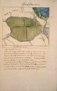
maps of bremgarten
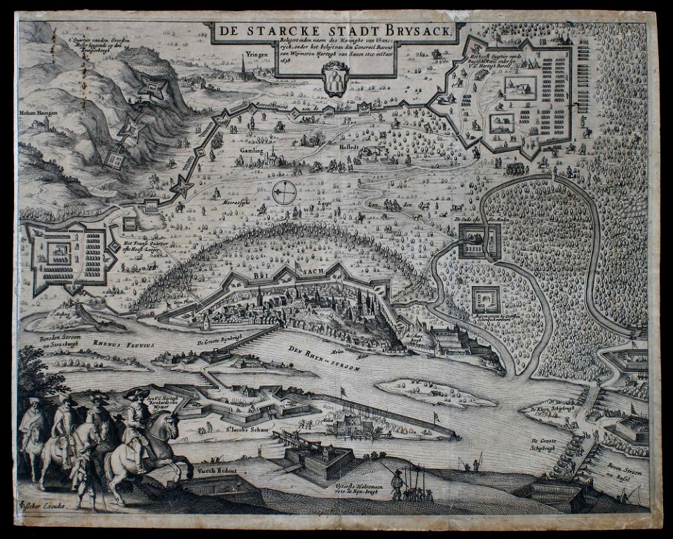
1630s maps of baden-württemberg
claes jansz. visscher (ii)
old maps of south africa
emil holub
voyage pittoresque ou description des royaumes de naples et de sicile
views of syracuse by claude-louis châtelet
plan de roussel - derivative files
maps in the library of congress
maps of prague by braun & hogenberg
maps of cheb by braun & hogenberg
maps of île-de-france by françois de la guillotière
atlas minor gerardi mercatoris (1621, maps)
grigory anikiyevich kachalov
mikhail makhaev
coats of arms on maps
atlas maior
engravings of topographia braunschweig lüneburg
baroque
british library - off the map alice collection - wonderland
british library - off the map alice collection
maps of the caribbean by mercator-hondius
maps of bamberg by braun & hogenberg
maps of bamberg by braun & hogenberg
maps of bamberg by braun & hogenberg
claes jansz. visscher (ii)
maps by abraham goos
old maps of haarlem
haarlemmerhout
maps in the stadsarchief amsterdam
daniël veelwaard (i)
cartouche (cartography)
maps by john rocque
korte beschryvinghe (1686)
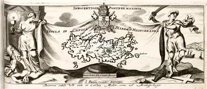
old maps of candia
description de l'universe
antipodes islands
maps from géographie illustrée de la france et de ses colonies
orientalist painting
maps from géographie illustrée de la france et de ses colonies
orientalist painting
maps from géographie illustrée de la france et de ses colonies
orientalist painting
maps from géographie illustrée de la france et de ses colonies
orientalist painting
maps from géographie illustrée de la france et de ses colonies
orientalist painting
maps of liège by johannes blaeu
lucas janszoon waghenaer
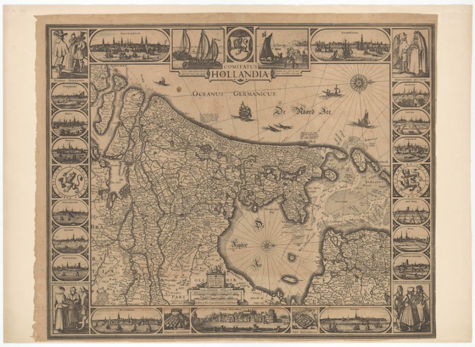
old maps of zeeland
maps from géographie illustrée de la france et de ses colonies
orientalist painting
maps from géographie illustrée de la france et de ses colonies
orientalist painting
naturalism,realism
maps of venus
map of maastricht by willem and johannes blaeu (1649)
first medieval city wall of maastricht
maps from géographie illustrée de la france et de ses colonies
orientalist painting
maps from géographie illustrée de la france et de ses colonies
orientalist painting
geographia universalis (1545) in the british museum
german renaissance,northern renaissance
geographia universalis (1545) in the british museum
german renaissance,northern renaissance
maps in the library of congress
old maps of veracruz (city)
maps of the mamluk sultanate (cairo)
catalan atlas
engravings of topographia braunschweig lüneburg
baroque
engravings of topographia braunschweig lüneburg
baroque
topographia braunschweig lüneburg (merian)
baroque
engravings of topographia braunschweig lüneburg
baroque
senefelderstraße 45 (stuttgart)
theodor von landauer
renaissance,mannerism
palazzo zuccari, rome
maps of ghent by petrus schenck
copper engravings
bibliothèque nationale de france
guillaume sanson
topographia braunschweig lüneburg (merian)
engravings of hannover
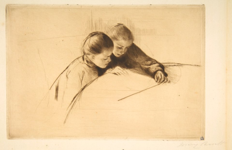
prints by mary cassatt in the metropolitan museum of art
impressionism
beschreibung der städt der welt - braun & hogenberg - btv1b52512111k
maps of orléans by joris hoefnagel
maps made in the 17th century
maps of the duchy of bremen
old maps of norway
guillaume sanson
1760 works
prints
old maps of norway
guillaume sanson
map of the circle of bavaria by sanson
pierre moullart-sanson
patrimonium 2 (project)
realism
bisset's magnificent guide (1808 edition)
old maps of birmingham
maria theresa of austria by martin van meytens
maria theresa in hungarian coronation robes
atlas schoemaker-noord-holland, amsterdam
buikslotermeer
the story of the map of europe, its making and its changing (1916)
orientalism
the cruise of the marchesa (1889)
mapun
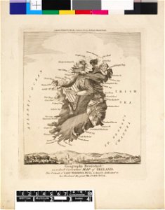
19th-century maps of the british isles
19th-century maps of the north sea
a class-book of modern geography (1898)
east european plain
maps of paris in the 1700s
1700s maps of paris
maps of rivers of south america
orientalist painting
16th-century maps of indonesia
old maps of bali
historical collections of the state of new jersey (1845)
maps facing west
portraits by charles-philippe larivière
neoclassicism
new york state supreme court 60 centre street
columbus park (manhattan)
13001 - 13100 of 26,489
Next page
/ 265