Log in
All resources
Create a design
26,489 Free Artworks of Map
maps from géographie illustrée de la france et de ses colonies
eran laor cartographic collection
bibliothèque nationale de france
latin-language maps
english-language maps
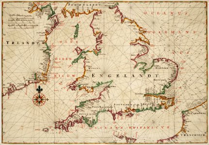
chorographia britanniae (1741-1742)
prints by johan frederik clemens in the statens museum for kunst
statens museum for kunst
johan frederik clemens
1860 maps
turgot map of paris, kyoto university library – derivative files
abbaye de port-royal de paris
maps from géographie illustrée de la france et de ses colonies
gemeente atlas van nederland - north holland
maps of heiloo
maps from géographie illustrée de la france et de ses colonies
maps from géographie illustrée de la france et de ses colonies
maps from géographie illustrée de la france et de ses colonies
maps from géographie illustrée de la france et de ses colonies
maps from géographie illustrée de la france et de ses colonies
maps from géographie illustrée de la france et de ses colonies
maps from géographie illustrée de la france et de ses colonies
maps from géographie illustrée de la france et de ses colonies
maps from géographie illustrée de la france et de ses colonies
maps from géographie illustrée de la france et de ses colonies
maps from géographie illustrée de la france et de ses colonies
maps from géographie illustrée de la france et de ses colonies
maps from géographie illustrée de la france et de ses colonies
hotels in chicago
map postcards
maps from géographie illustrée de la france et de ses colonies
maps from géographie illustrée de la france et de ses colonies
maps from géographie illustrée de la france et de ses colonies
maps from géographie illustrée de la france et de ses colonies
maps from géographie illustrée de la france et de ses colonies
maps from géographie illustrée de la france et de ses colonies
maps from géographie illustrée de la france et de ses colonies
maps from géographie illustrée de la france et de ses colonies
maps from géographie illustrée de la france et de ses colonies
maps from géographie illustrée de la france et de ses colonies
maps from géographie illustrée de la france et de ses colonies
gemeente atlas van nederland - north holland
old maps of castricum
eran laor cartographic collection
gerard valck
eran laor cartographic collection
cornelis de bruyn
eran laor cartographic collection
hendrik hondius the younger
eran laor cartographic collection
william hole (engraver)
prints by johan frederik clemens in the statens museum for kunst
etching print
eran laor cartographic collection
joan blaeu
eran laor cartographic collection
william hughes (geographer)
eran laor cartographic collection
william henry toms
eran laor cartographic collection
joseph schwarz
prints by johan frederik clemens in the statens museum for kunst
etching print
eran laor cartographic collection
edward weller
atlas des anciens plans de paris by imprimerie nationale, 1880 from bhvp
proletarian literature
eran laor cartographic collection
gerard valck
eran laor cartographic collection
william hughes (geographer)
eran laor cartographic collection
gottfried hensel
prints by johan frederik clemens in the statens museum for kunst
engraving
eran laor cartographic collection
edward weller
prints by johan frederik clemens in the statens museum for kunst
engraving
atlas des anciens plans de paris by imprimerie nationale, 1880 from bhvp
dheulland map of paris
eran laor cartographic collection
edward weller
prints by johan frederik clemens in the statens museum for kunst
etching print
admiralty charts 1001-1200
avacha bay
nova typis transacta navigatio
saint brendan in art
eran laor cartographic collection
william hughes (geographer)
eran laor cartographic collection
gottfried hensel
prints by johan frederik clemens in the statens museum for kunst
engraving
eran laor cartographic collection
baroque
rue louis majorelle (nancy)
école de nancy,art nouveau
maps from the earth and its inhabitants, vol. iv
turlough
didier robert de vaugondy
philippe buache
atlas maior, vol 1 (northern europe, norway, and denmark) - joan blaeu, 1667 - bl 114.h(star).1
1667 maps
atlas maior, vol 1 (northern europe, norway, and denmark) - joan blaeu, 1667 - bl 114.h(star).1
1667 maps
engravings in the rijksmuseum amsterdam
maps in the rijksmuseum amsterdam
books published in saint petersburg
boris andreevich dorn
nicolas sanson. “mappe-monde, ou carte generale du monde.”
1667 map of madagascar by guillaume sanson
nicolas sanson. “mappe-monde, ou carte generale du monde.”
map of the bosphorus strait by guillaume sanson (1665)
maps of portugal by fernando álvares seco
maps by abraham ortelius
drawings (documentary) collection in the library of congress
drawings by alfred waud
siege of breda 1624-1625
atlas van loon
siege of breda 1624-1625
atlas van loon
siege of breda 1624-1625
atlas van loon
coat of arms of gregorius xiii (galleria delle carte geografiche)
reliefs of coats of arms in rome
maps of paris from the university of wisconsin-milwaukee libraries
maps of paris by braun & hogenberg
drawings of soldiers
jan anthonie coxie
internet archive document dayswaysinoldbos00ross 0
days and ways in old boston (1915)
eran laor cartographic collection
philippe de la rué
maps of dorsoduro (venice)
rio di san vio (venice)
ager puteolanus, siue, prospectus eiusdem insigniores (1620)
ancient roman villas in campania
arnold van langren map of southwest africa
1596 maps of africa
geometrischer grundriss von frankfurt am mayn (1811)
maps of frankfurt-innenstadt
maps by willem and johannes blaeu
old maps of middelburg, zeeland
topographia helvetiae, rhaetiae et valesiae (1654) engravings
history of appenzell
animal migration maps
nikolay karazin
old maps of zürich
heinrich keller
construction drawings in the stadsarchief amsterdam
daniel stoopendaal
atlas vingboons
1665
maps by claude joseph sauthier
old maps of new york (state)
chorographia britanniae (1741-1742)
18th-century maps of hampshire
chorographia britanniae (1741-1742)
18th-century maps of rutland
geographia universalis (1545) in the british museum
german renaissance,northern renaissance
chorographia britanniae (1741-1742)
18th-century maps of suffolk
maps and topographical views by joris hoefnagel
1580s maps of spain
chorographia britanniae (1741-1742)
18th-century maps of yorkshire
de praecipvis totivs vniversi vrbibvs, liber secvndvs (1575)
maps of vejer by braun & hogenberg
old maps of the rhineland
maps by gerard de jode
chorographia britanniae (1741-1742)
18th-century maps of staffordshire
18th-century maps of england and wales
chorographia britanniae (1741-1742)
chorographia britanniae (1741-1742)
18th-century maps of lincolnshire
17th-century maps of carmarthenshire
17th-century maps of pembrokeshire
17th-century maps of the strait of magellan
maps by willem and johannes blaeu
18th-century maps of norfolk, england
chorographia britanniae (1741-1742)
12801 - 12900 of 26,489
Next page
/ 265