Log in
All resources
Create a design
26,489 Free Artworks of Map
bibliothèque nationale de france
maps by nicolas sanson
sanson maps of asia
maps from géographie illustrée de la france et de ses colonies
baroque
physical geography (1899) by davis
maps of bamberg by braun & hogenberg
maps in the rijksmuseum amsterdam
1866 maps
joseph swain
old maps of the bay of gibraltar
carolus allard
henri le roy (1579-)
diocese of aire
topographia westphaliae (merian)
baroque
maps from university of amsterdam special collections
atlas der neederlanden
maps from university of amsterdam special collections
atlas der neederlanden
engravings of topographia saxoniae inferioris
baroque
maritime history of india
sailing ships of india
coats of arms verteidigungsbezirkskommandos (bundeswehr)
hermannsdenkmal
prints by jan luyken in the rijksmuseum amsterdam
maps in the rijksmuseum amsterdam
renold elstracke
renaissance
old maps of the holy land
1866 maps
physical geography (1899) by davis
monsoon maps of india
john rocque's 1746 map of london
old and new london (book)
physical geography (1899) by davis
1899 maps of new york (state)
nouveau cours d'instruction primaire de géographie (1886)
1886 maps of africa
maps of the gulf of suez
1866 maps
1890s maps of north carolina
1899 maps of south carolina
19th-century maps of cairo
1866 maps
physical geography (1899) by davis
1890s maps of hungary
physical geography (1899) by davis
19th-century maps of normandie
old maps of the holy land
1866 maps
london and its environs - a practical guide to the metropolis and its vicinity, illustrated by maps, plans and views (1862)
crystal palace in sydenham
maps of the universiteit van franeker
maps in the rijksmuseum amsterdam
källtorp, nacka kommun
sandasjön
maps by willem and johannes blaeu
collections of limburgs museum
plenilunii lumina austriaca philippica
maps from gallica
adam gottlieb schneider
1812 maps of germany
prints by johan frederik clemens in the statens museum for kunst
copper
eran laor cartographic collection
louis-françois cassas
eran laor cartographic collection
michel van lochom
maps from university of amsterdam special collections
atlas der neederlanden
eran laor cartographic collection
jacques chereau
cornell: persuasive cartography: the pj mode collection
cartoons by joseph keppler
18th-century maps of the malay archipelago
maps in the rijksmuseum amsterdam
everett d. graff collection of western americana
maps by g. w. & c. b. colton & co.
gemeente atlas van nederland - gelderland
merian sueviae
baroque
media contributed by university of illinois urbana-champaign university library
1623 maps of africa
algiers in the 19th century
old maps of algiers
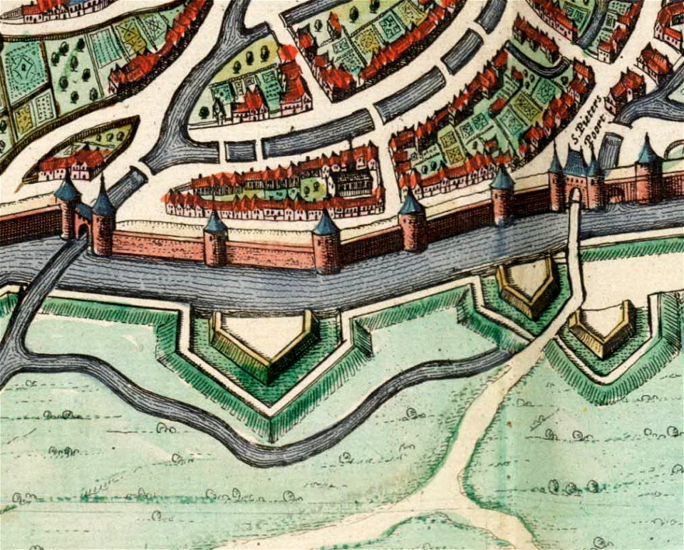
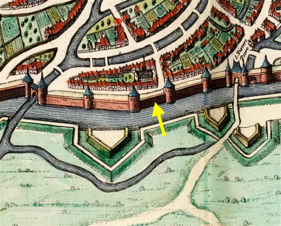
map of maastricht by willem and johannes blaeu (1649)
first medieval city wall of maastricht
palau in the 18th century
old maps of palau
maps of paris from paris musées
baroque
maps in the stadsarchief amsterdam
romeyn de hooghe
maps of lisbon by braun & hogenberg (1572)
maps of cascais by braun & hogenberg
bibliothèque nationale de france
maps by thomas kitchin
charles william meredith van de velde
al-dalhamiyya
old maps of amsterdam
evert maaskamp
cartouches by tomas lópez
published in madrid
maps in the stadsarchief amsterdam
daniël veelwaard (i)
old maps of north holland
maps by isaak tirion
description de l'universe
arabia petraea
maps by nicolas sanson
sanson maps of asia
maps by nicolas sanson
sanson maps of asia
maps by nicolas sanson
sanson maps of asia
maps by nicolas sanson
sanson maps of asia
maps by nicolas sanson
sanson maps of asia
maps by nicolas sanson
sanson maps of asia
maps of alexandria by braun & hogenberg
maps in the british museum
maps by nicolas sanson
sanson maps of asia
16th-century maps of amsterdam
amsterdam in the 1590s
maps by nicolas sanson
sanson maps of asia
maps by nicolas sanson
sanson maps of asia
maps by nicolas sanson
sanson maps of asia
maps by nicolas sanson
sanson maps of asia
sanson maps of north america
1719 maps of north america
maps by nicolas sanson
sanson maps of asia
maps by nicolas sanson
sanson maps of asia
carte de l'isle de ceylan by guillaume delisle (1722)
eran laor cartographic collection
saint paul island (alaska)
old maps of alaska
maps of paris from the barry lawrence ruderman antique maps inc.
maps of paris by braun & hogenberg
dutch 17th-century prints in the rijksmuseum amsterdam
maps in the rijksmuseum amsterdam
17th-century fortress plans
atlas van loon
1876 paintings
academic art
john rocque's 1748 map of london and adjacent country
remigius parr
sanson maps of the holy land
old maps of canaan
maps by pieter mortier
maps from gallica
admiranda narratio, fida tamen, de commodis et incolarvm ritibvs virginiae anglico scripta sermone à thoma hariot nvnc avtem primvm latio donata à c.c.a (1608)
theodor de bry
maps of the course of the rhine by guillaume sanson
maps by nicolas sanson
atlas minor gerardi mercatoris (1621, maps)
maps of provence by pierre-jean de bompar
paris vers 1530 (plan de georges braun, "aux trois personnages")
maps of paris from bibliothèque nationale de france
allgemeiner postatlas von der ganzen welt
old maps of england
15th-century maps of rome
alessandro strozzi
plan de la ville et faubourg de paris, divisé en ses 48 sections by mondhare & jean
maps of paris from paris musées
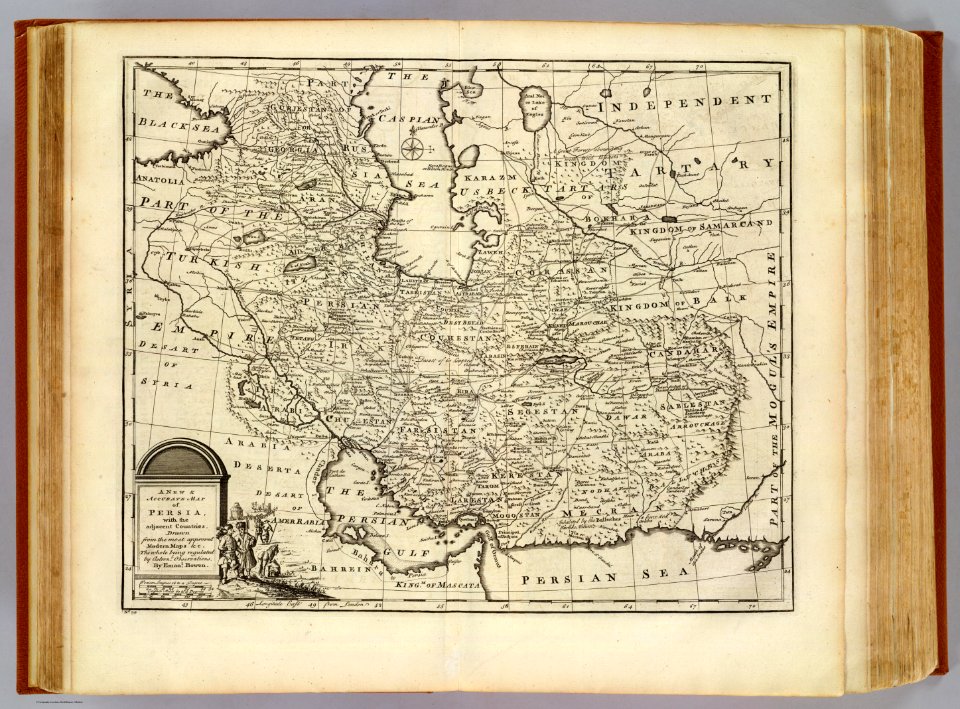
1747 persia map by emanuel bowen
richard ware (bookseller)
maps of the malay archipelago by mercator-hondius
maps by emanuel bowen
1747 maps of africa
maps of bamberg by braun & hogenberg
maps of bamberg by braun & hogenberg
maps of bamberg by braun & hogenberg
maps of bamberg by braun & hogenberg
maps of bamberg by braun & hogenberg
map of maastricht by willem and johannes blaeu (1649)
jekerkwartier (maastricht)
map of maastricht by willem and johannes blaeu (1649)
jekerkwartier (maastricht)
maps from géographie illustrée de la france et de ses colonies
maps from géographie illustrée de la france et de ses colonies
maps from géographie illustrée de la france et de ses colonies
engravings of topographia superioris saxoniae, thüringiae, misniae et lusatiae (merian)
baroque
maps from géographie illustrée de la france et de ses colonies
maps from géographie illustrée de la france et de ses colonies
maps from géographie illustrée de la france et de ses colonies
12701 - 12800 of 26,489
Next page
/ 265