Log in
All resources
Create a design
123 Free Artworks of 1790 Maps
maps in portrait paintings
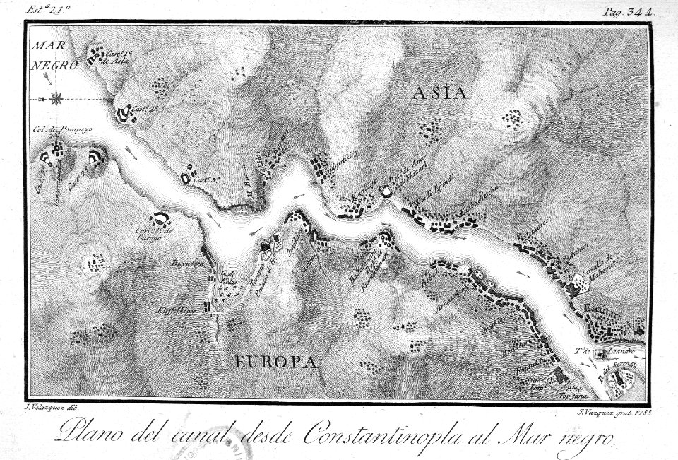
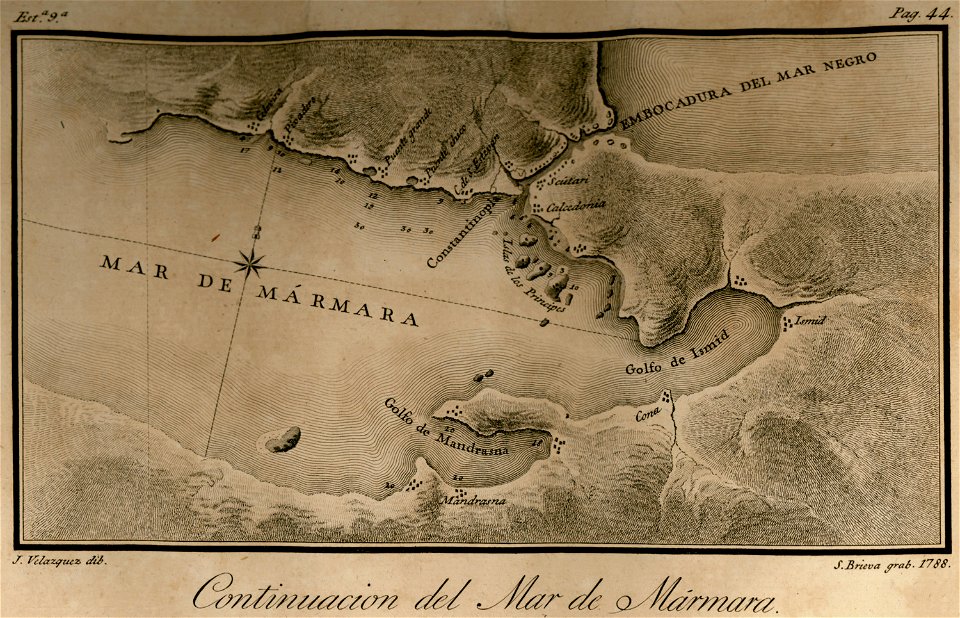
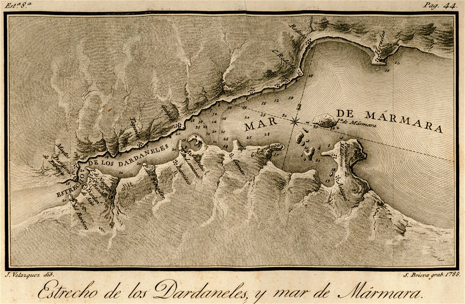
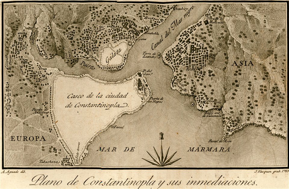
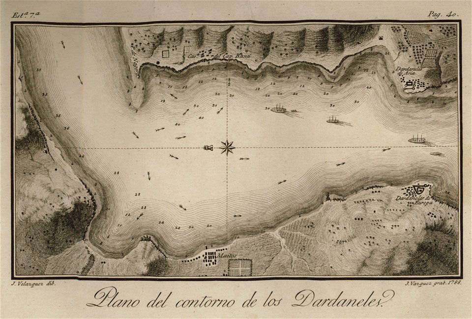
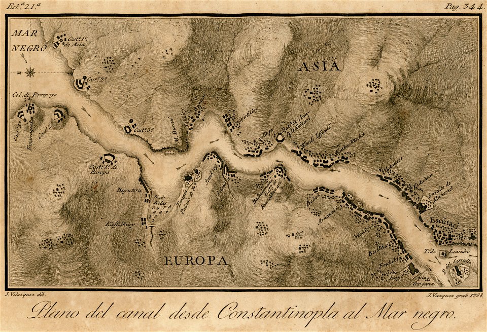
viage á constantinopla
en el año de 1784 (1790)
maps by john cary
1799 maps
john cary
maps of paris in the 1790s
oil on canvas
david rumsey historical map collection
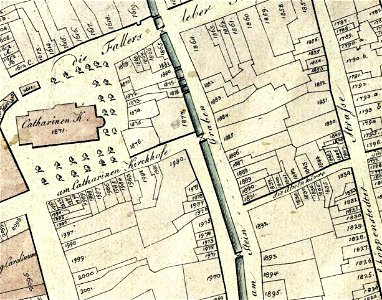
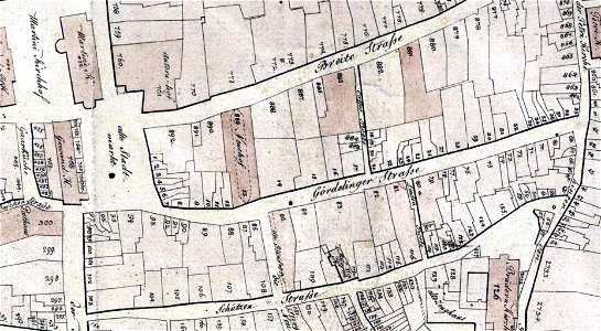
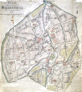
old maps of braunschweig
portrait paintings by élisabeth vigée-lebrun (italian royalty)
portraits of children by élisabeth vigée-lebrun
james william edmund doyle
owen bailey
paintings by joseph dorffmeister in the kunsthistorisches museum
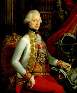
portrait paintings of ferdinand iii, grand duke of tuscany
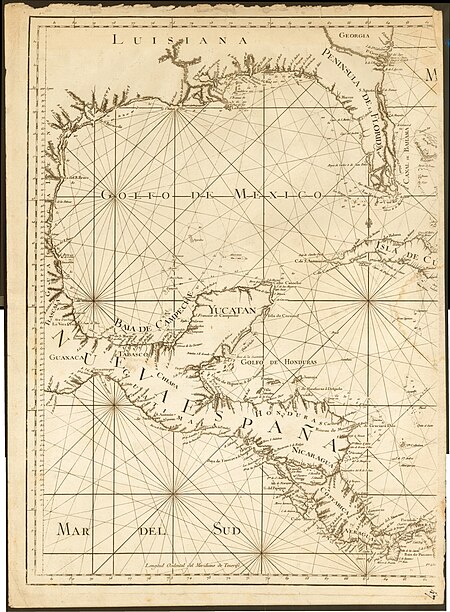
18th-century maps of the spanish empire
maps made in the 18th century
1790s drawings
palace park
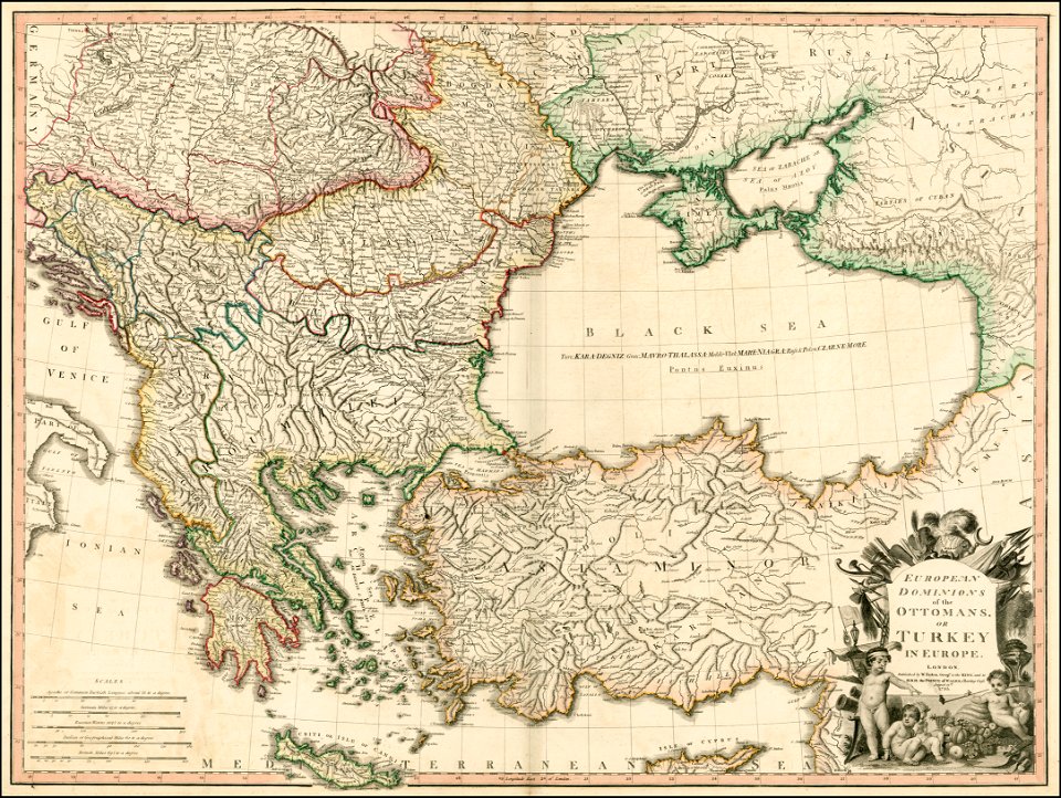
maps of the sea of marmara
maps of the bosphorus
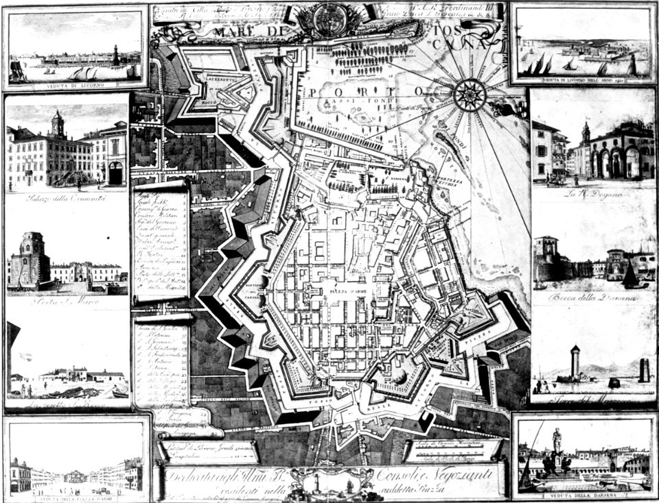
old maps of livorno
maps of the sea of marmara
viage á constantinopla
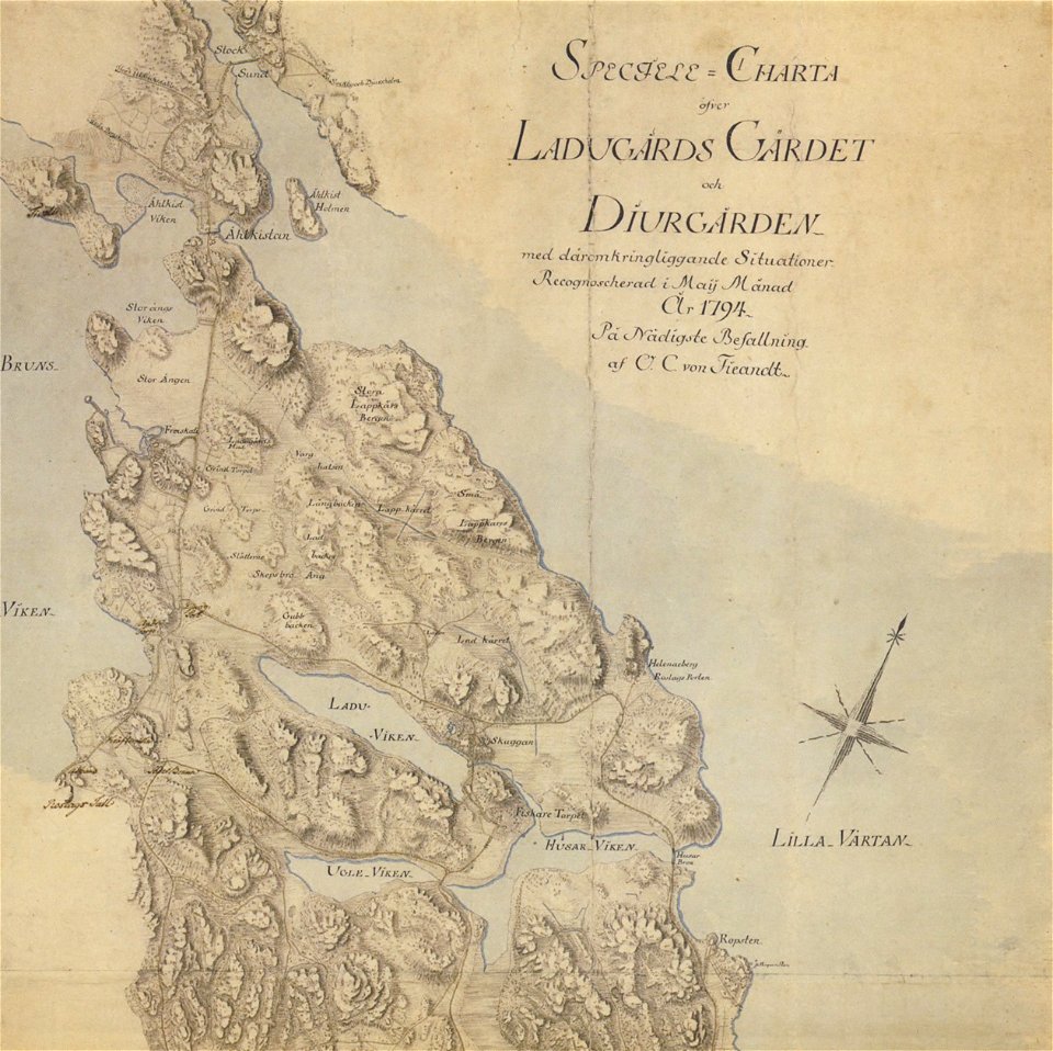
18th-century maps of stockholm
maps of gärdet
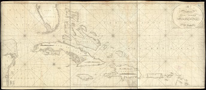
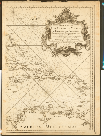
1790s maps of the caribbean
1797 maps
old maps of constantinople
viage á constantinopla
charles françois delamarche
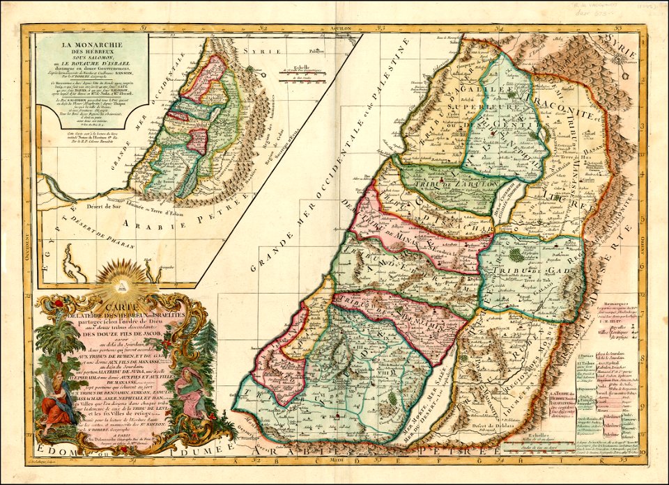
old maps of the holy land
island of love
gatchina
australia
maps
en el año de 1784 (1790)
viage á constantinopla
david rumsey historical map collection
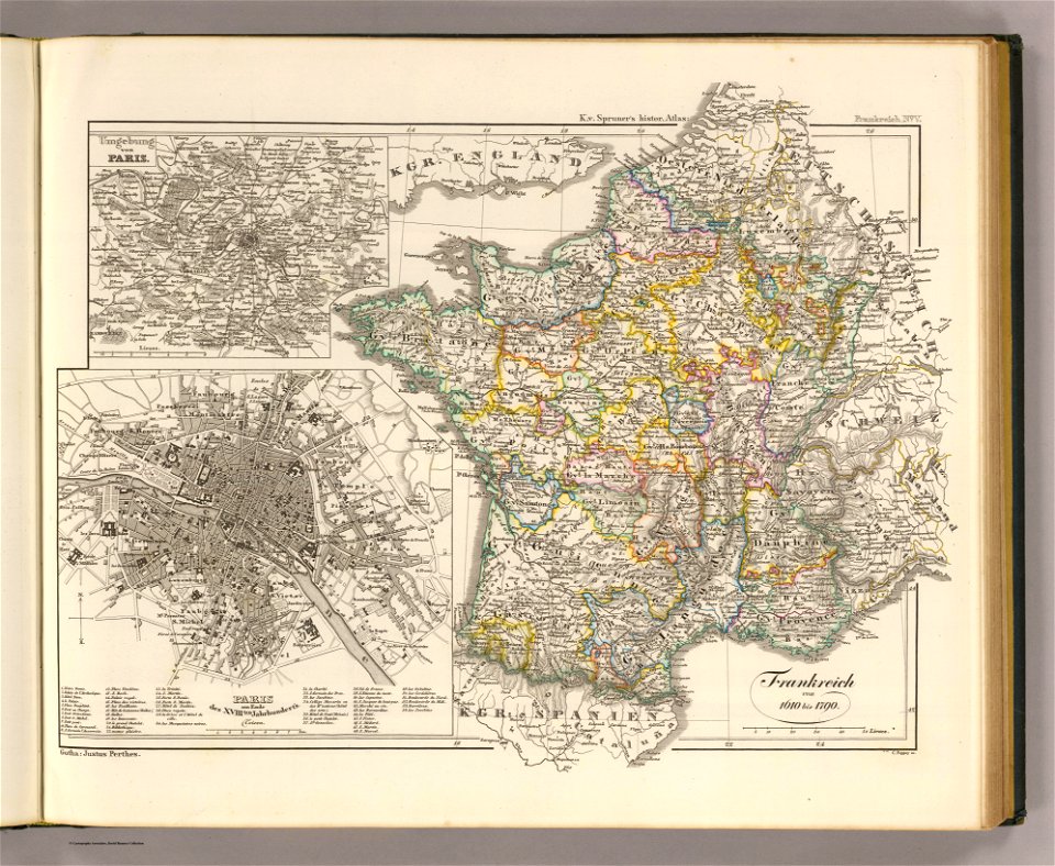
old maps of france
viage á constantinopla
maps of the bosphorus
viage á constantinopla
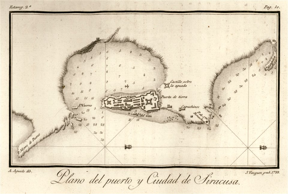
old maps of syracuse
maps by william faden
maps with cartouches
viage á constantinopla
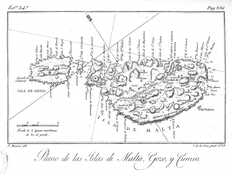
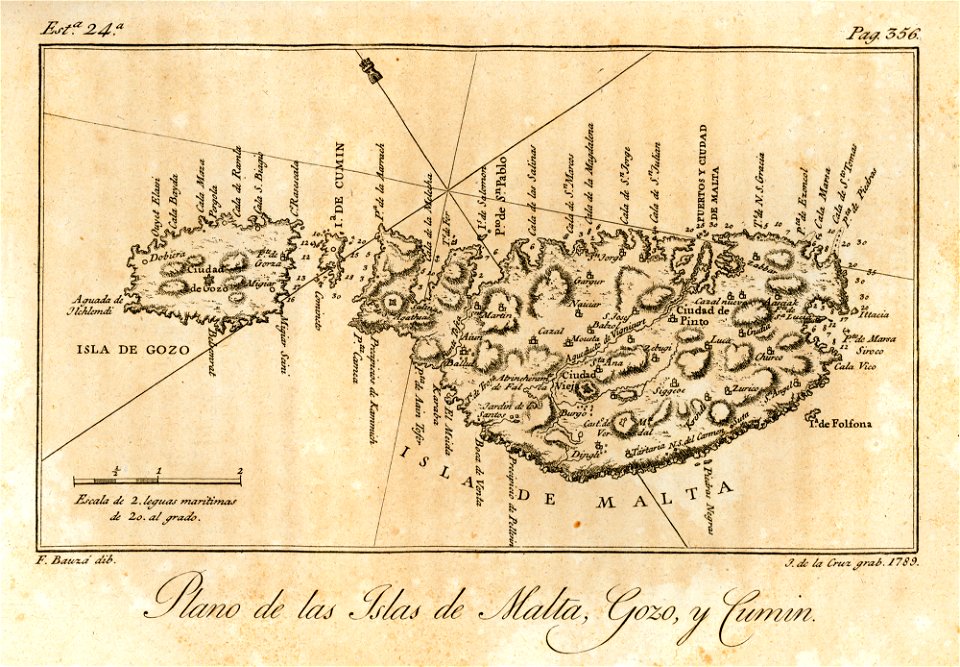
old maps of malta
historical maps of lüneburg
1793
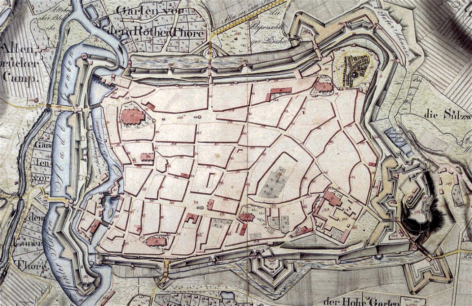
collections of stadtarchiv braunschweig
old maps of braunschweig
collections of stadtarchiv braunschweig
old maps of braunschweig
battles of the french revolutionary wars in 1793
historical maps of mainz
collections of stadtarchiv braunschweig
old maps of braunschweig
collections of stadtarchiv braunschweig
old maps of braunschweig
prints & drawings in rhcl (maastricht)
18th-century maps of maastricht
oil paintings of the royal museums greenwich
1820 in art
collections of stadtarchiv braunschweig
old maps of braunschweig
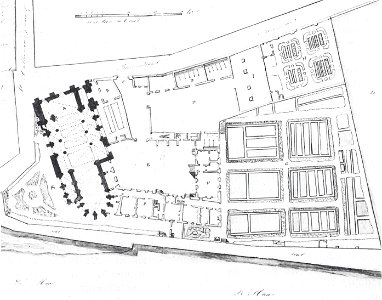
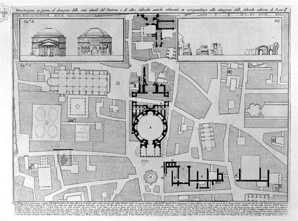
plans of the pantheon (rome)
old maps of rome
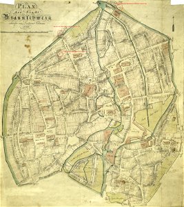
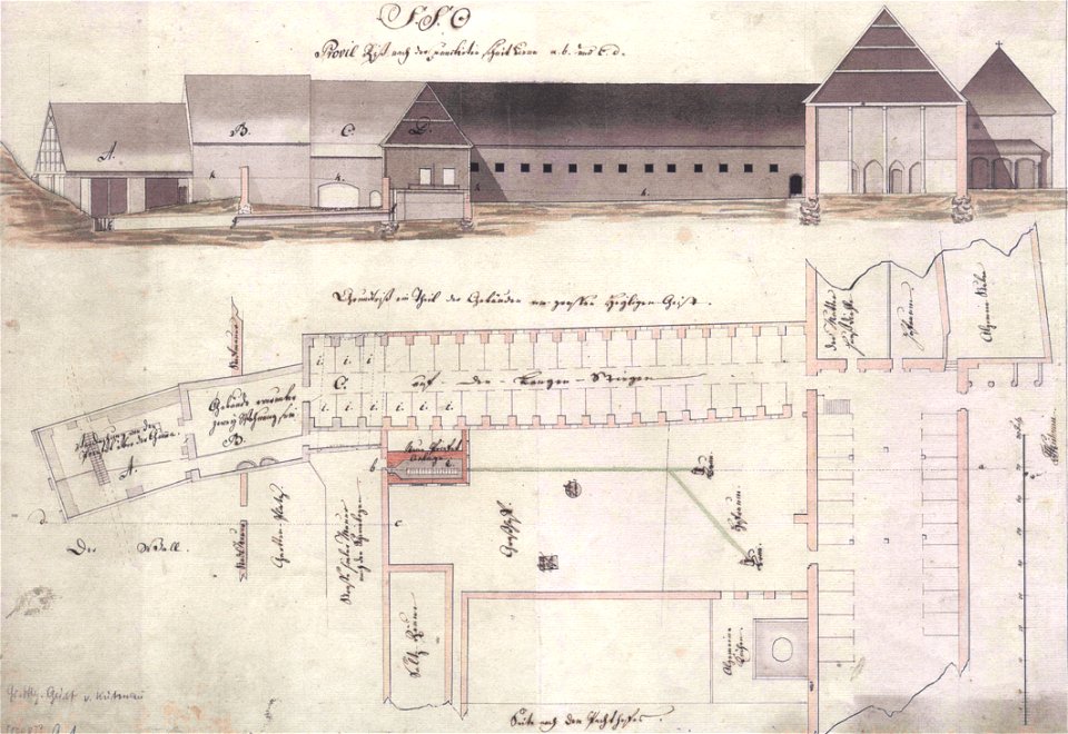
floor plans of buildings in lower saxony
stadtarchiv lüneburg
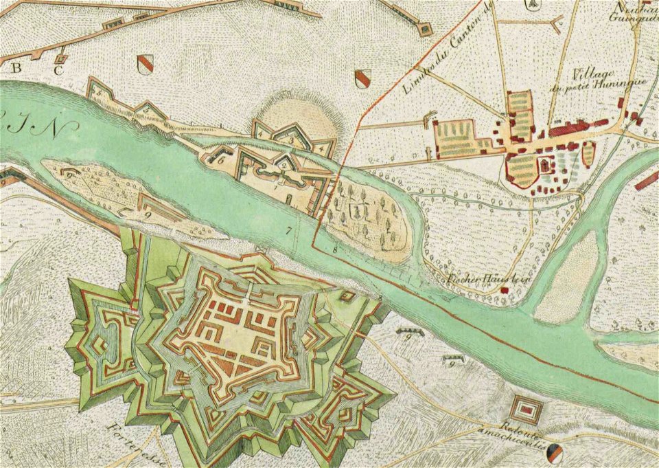
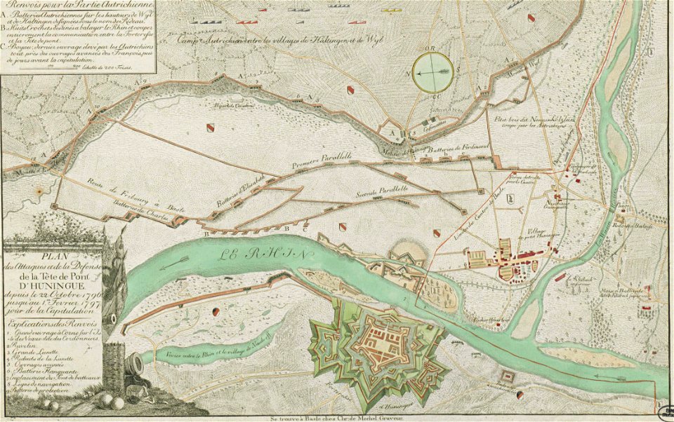
christian von mechel
huningue fortress
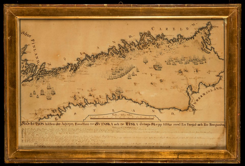
naval battles involving sweden
russo-swedish war (1788–1790)
collections de la bibliothèque nationale et universitaire de strasbourg
christian von mechel
old constellation maps
maps by samuel dunn
grand duke of tuscany
bookcases in art
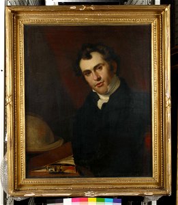
18th-century three-quarter view portrait paintings of men
1794 oil on canvas paintings in germany
portrait paintings in the crystal bridges museum of american art
male
lorens pasch the younger
rococo
carte de l'égypte (description de l'égypte)
maps of nazareth
green drapery in portrait paintings
catherine the great
george washington
male
maps of paris from bibliothèque nationale de france
maps of paris by louis-joseph mondhare
plan de la ville et faubourg de paris, divisé en ses 48 sections by mondhare & jean
maps of paris from bibliothèque nationale de france
david rumsey historical map collection
1790s maps of the holy roman empire
maps of paris in the 1790s
1797 maps
maps of paris from paris musées
maps of paris by jean lattré
eran laor cartographic collection
william henry toms
1790s maps of central america
1790s maps of cuba
plan de la ville et faubourg de paris, divisé en ses 48 sections by mondhare & jean
maps of paris from the stanford libraries
maps of goa by linschoten
portuguese india
maps of paris from bibliothèque nationale de france
nouveau plan de paris by louis brion de la tour
old maps of japan
kimura kenkado
david rumsey historical map collection
1790s maps of the holy roman empire
old maps of wales
hugh hughes
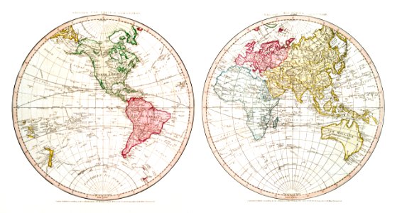
1790s maps of the world
rangaku
david rumsey historical map collection
1790s maps of the holy roman empire
maps by john cary
1799 maps
portraits of maria pavlovna (grand duchess of saxe-weimar-eisenach)
female portraits by dmitry levitzky
works after polidoro da caravaggio
maps in the british museum
maps in the library of congress
1790 maps
grosser deutscher atlas
old maps of portugal
eran laor cartographic collection
maps by tomas lopez
old maps of regions of france
pierre françois tardieu
maps of paris in the 1790s
1792 maps
daniel friedrich sotzmann
grosser deutscher atlas
plan de la ville et faubourg de paris, divisé en ses 48 sections by mondhare & jean
maps of paris from paris musées
british library king's topographical collection
robert dodd
portrait of george washington by giuseppe perovani
1790s maps of washington, d.c.
grosser deutscher atlas
1790s maps of ireland
david rumsey historical map collection
1790s maps of the holy roman empire
british library king's topographical collection
robert dodd
antoine-françois tardieu
maps from gallica
old maps of the polish-lithuanian commonwealth
1790s maps of poland
maps in the british museum
john cooke
map of the german empire by louis stanislas d'arcy de la rochette
1782 maps of the holy roman empire
old maps of the russian empire
1790s maps of alaska
maps of the dutch east india company - sri lanka
1790
drawings in the stadsarchief amsterdam
drawings by jurriaan andriessen
old maps of north holland
zaandam
eran laor cartographic collection
johann berka
grenzkarte der preussischen, russischen und oestreichischen monarchien (1796)
maps of kovno governorate
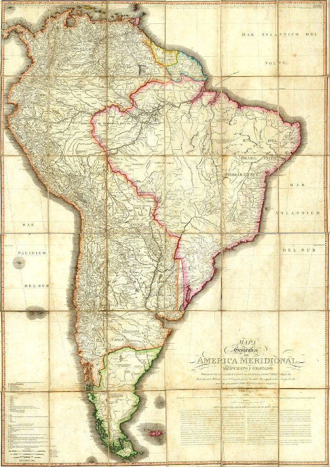
juan de la cruz cano y olmedilla
maps by tomas lopez
juan de la cruz cano y olmedilla
maps by tomas lopez
maps by john cary
1799 maps
maps by john cary
1799 maps
old maps of swabia
maps by john cary
maps by john cary
1799 maps
viage á constantinopla, en el año de 1784 (1790)
18th-century maps of malta
maps by john cary
1799 maps
maps by john cary
1799 maps
maps in the stadsarchief amsterdam
engravings by cornelis bogerts
picturesque views, on the river medway, from the nore to the vicinity of its source in sussex (1793)
maps of the river medway
maps of hunsrück
jean hardy
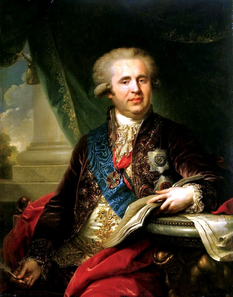
1770s portrait paintings from austria (male)
johann georg weikert
cartography
maps
cartography
maps
1790s maps of france
johann martin will
cartography
maps
italian drawings in the rijksmuseum amsterdam
neoclassicism
1 - 100 of 123
Next page
/ 2


![A literary party at Sir Joshua Reynolds', James William Edmund Doyle, 1851[1]](https://cdn.creazilla.com/illustrations/10001566600/a-literary-party-at-sir-joshua-reynolds-james-william-edmund-doyle-18511.jpg)


![Carta Plana desde Cartag[e]na á Constantinopla con los der…](https://cdn.creazilla.com/illustrations/5593681/carta-plana-desde-cartag-e-na-a-constantinopla-con-los-der-illustration-md.jpeg)