Log in
All resources
Create a design
229 Free Artworks of 1660 Maps
joan blaeu
maps by willem and johannes blaeu
1660s maps of the world
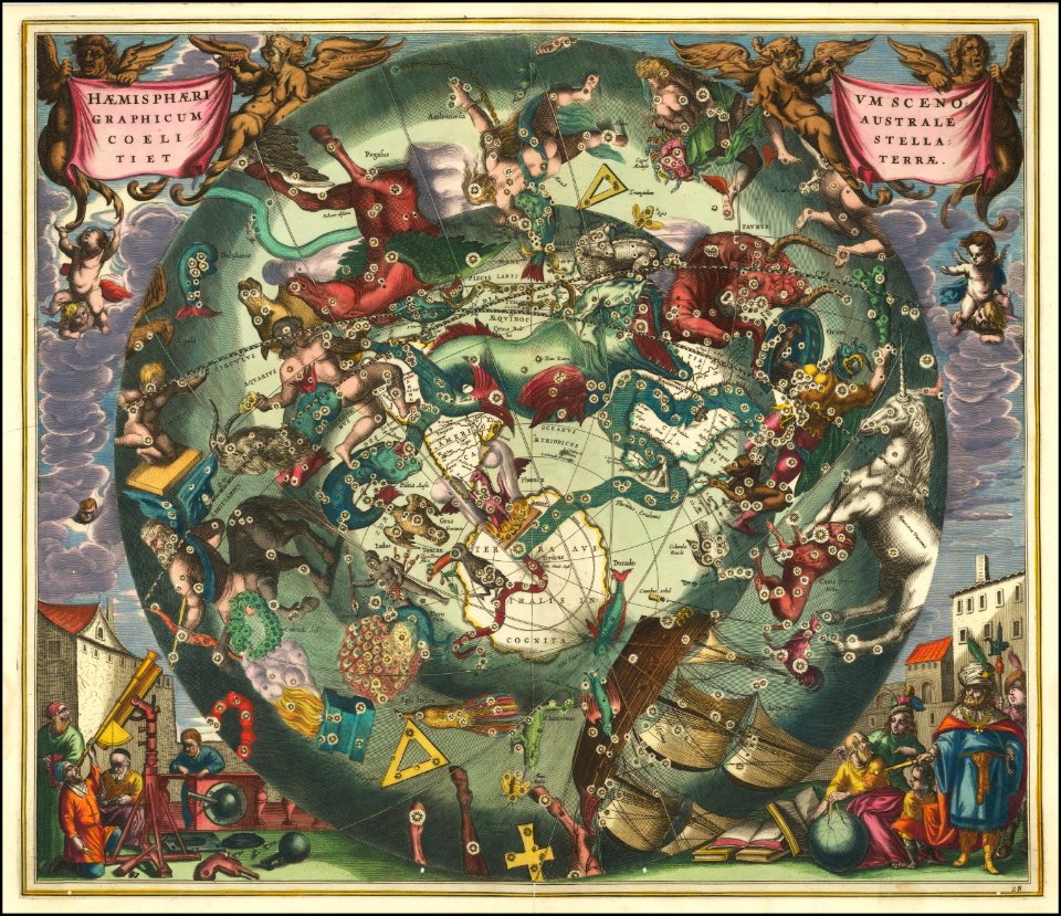
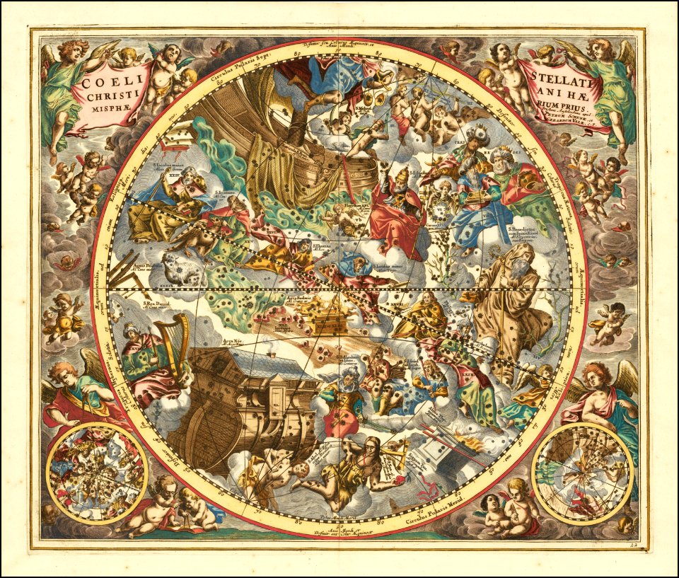
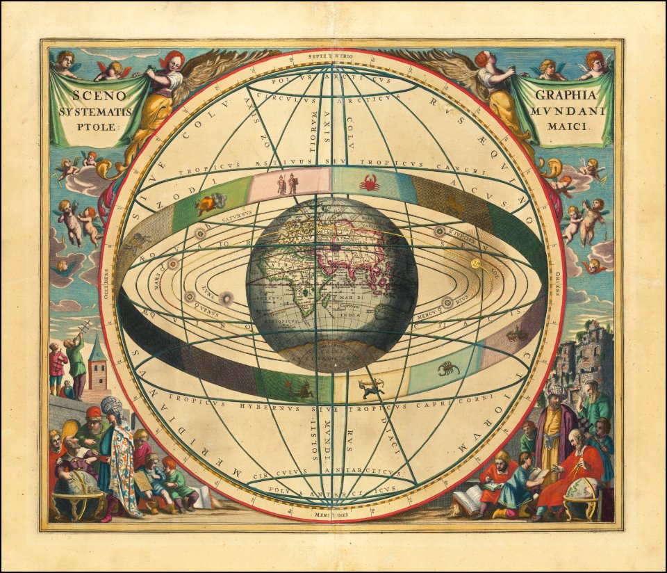
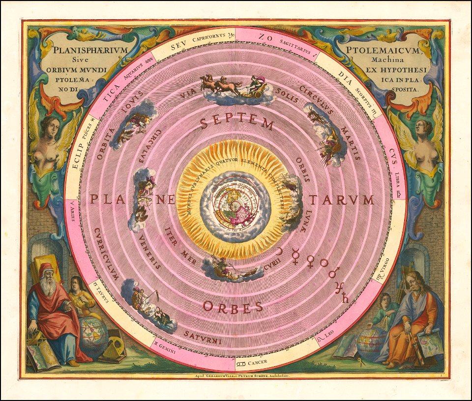
andreas cellarius
copper engraving print
british library
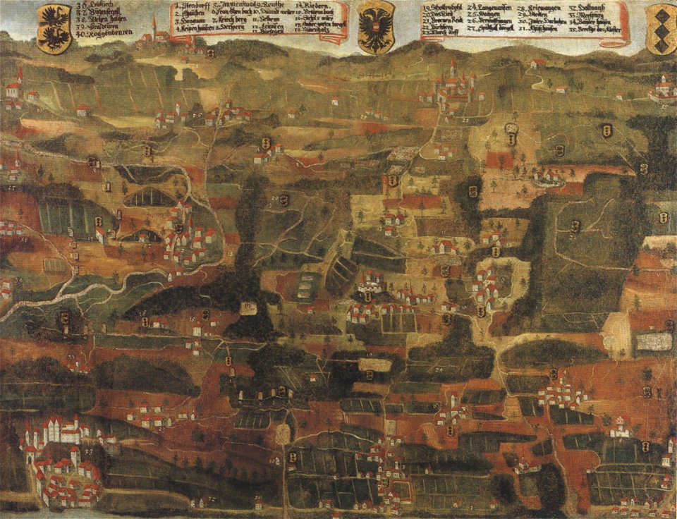
1660s maps of baden-württemberg
johannes vingboons
atlas van loon
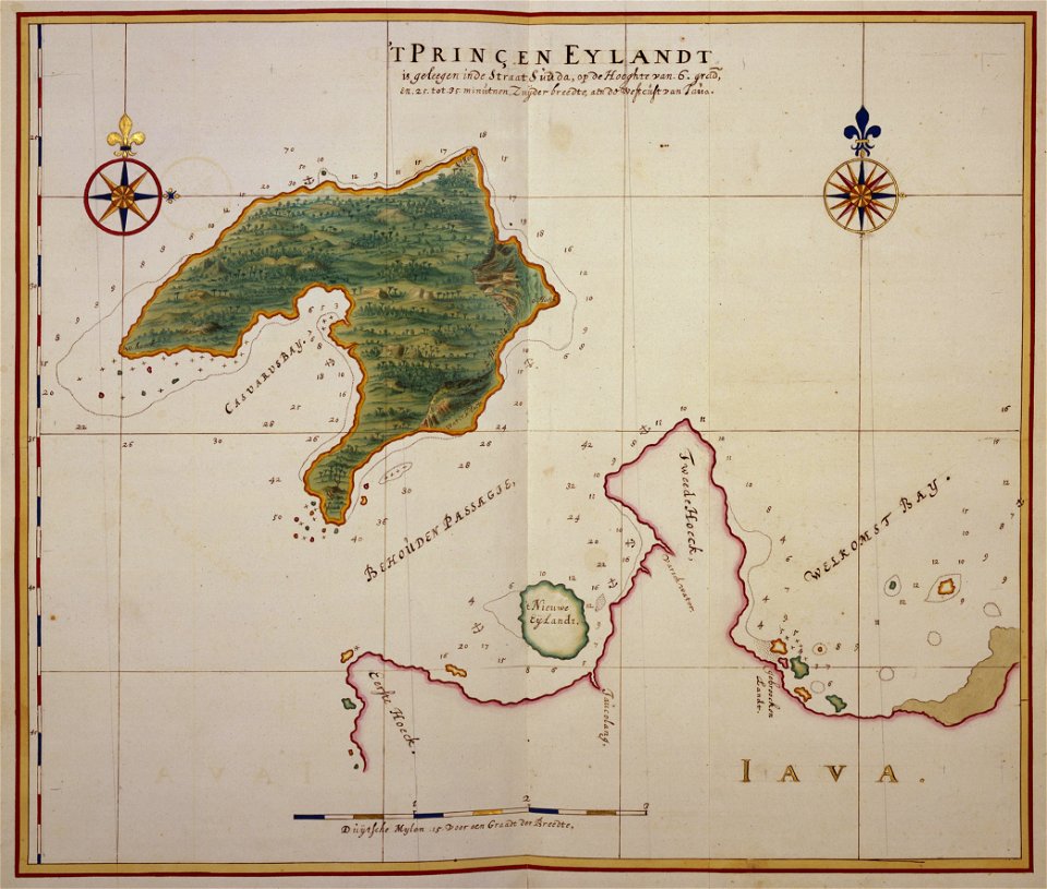
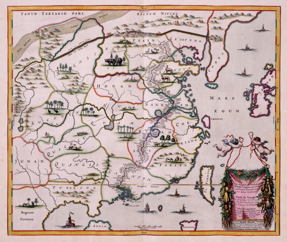
1660s maps of taiwan
135th meridian east
tasman map
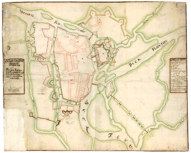
1660 in new york city
fort amsterdam
maps by nicolaes visscher i
maps with cartouches
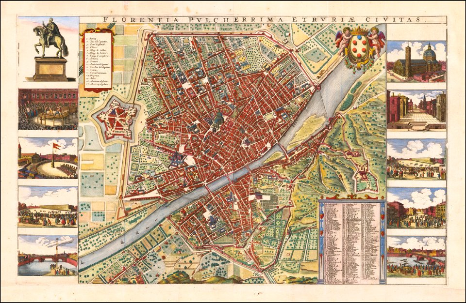
florence in the 1660s
wenzel hollar
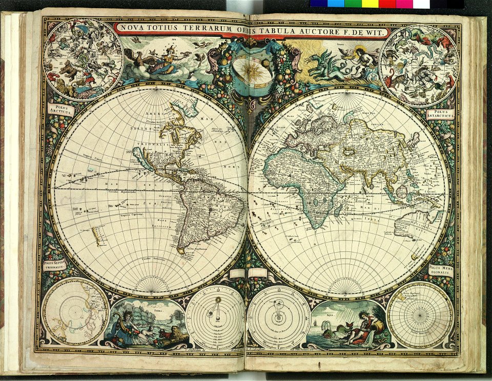
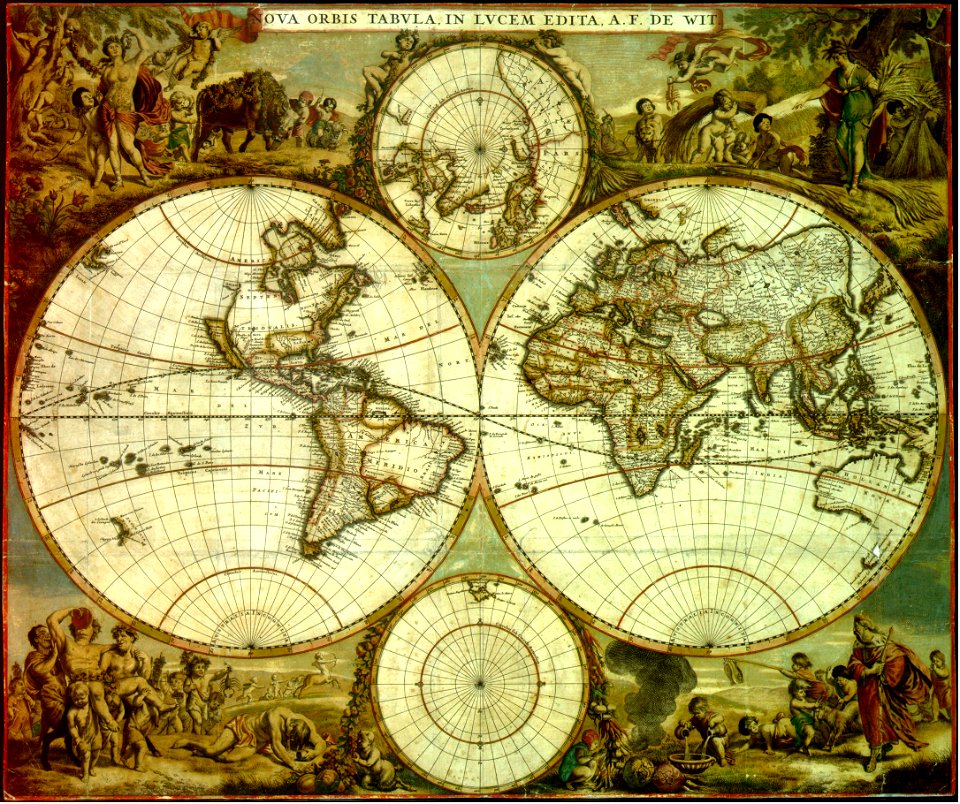
maps by frederick de wit
copper engraving
maps by frederick de wit
1660s maps of the world
maps by willem and johannes blaeu
atlas van loon
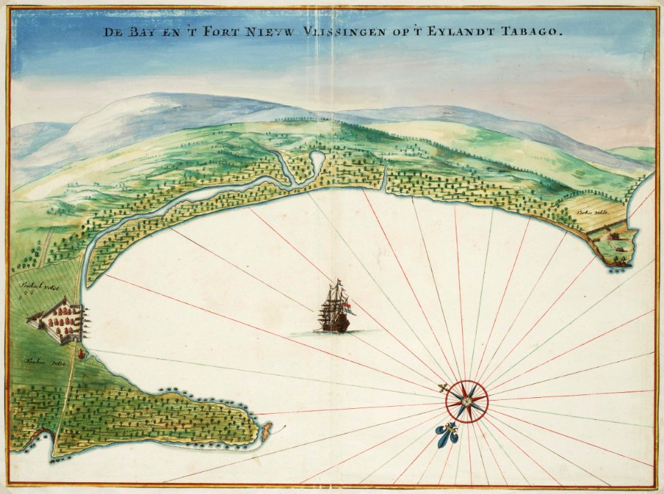
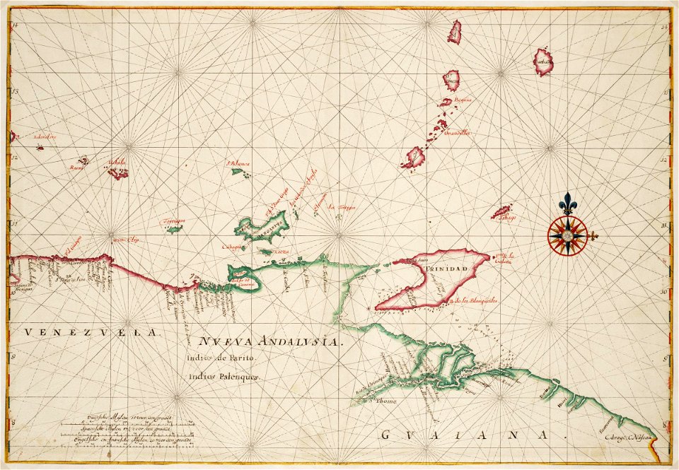
tobago
1665
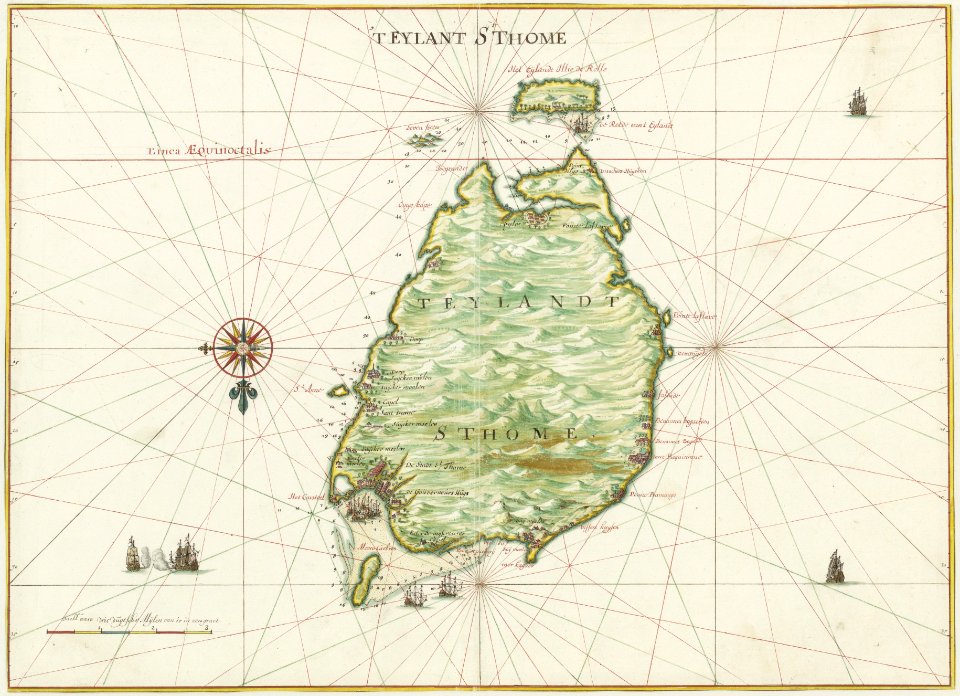
17th-century maps of indonesia
johannes vingboons
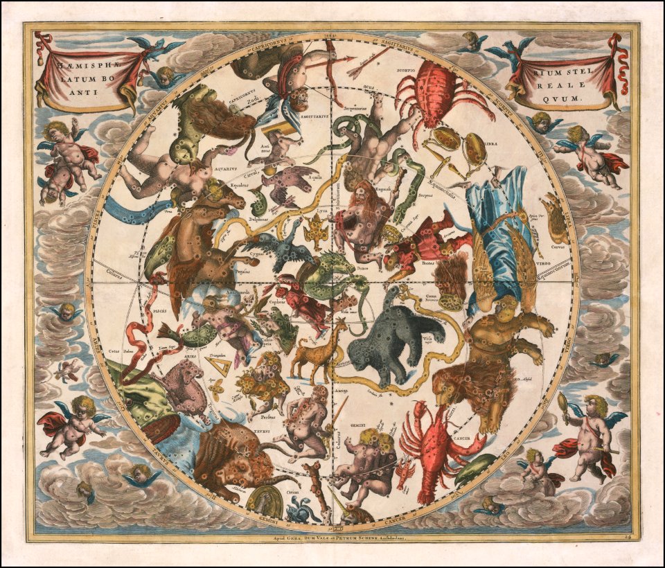
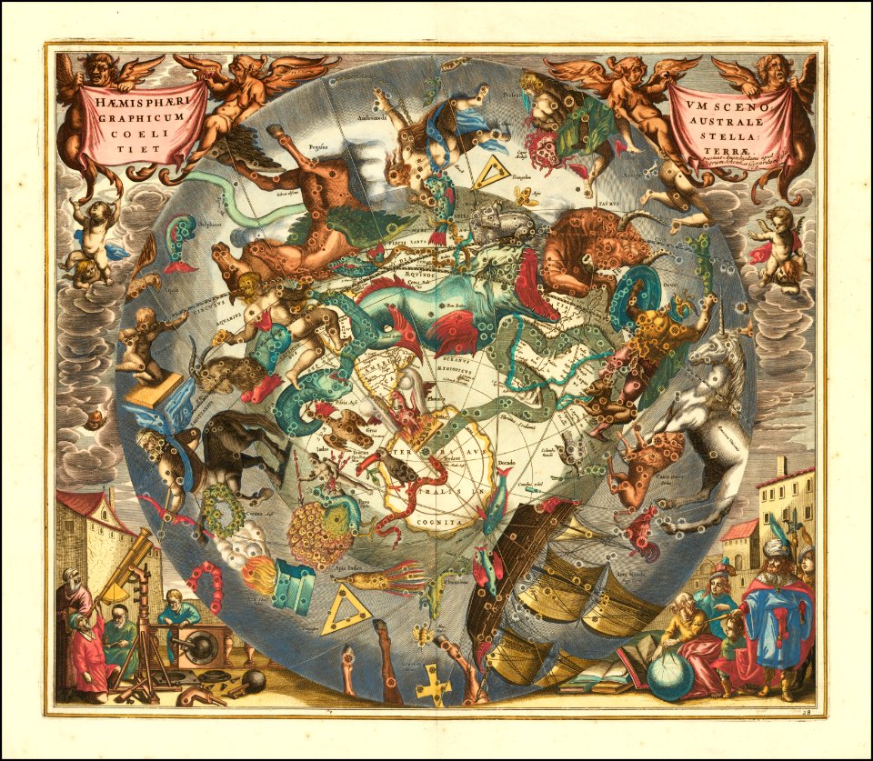
star location maps
andreas cellarius
david rumsey historical map collection
joan blaeu
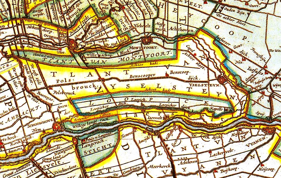
17th-century maps of the netherlands
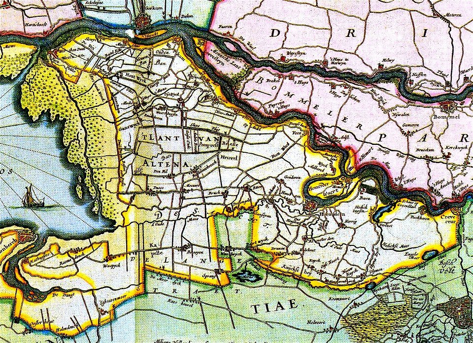
old maps of north brabant
old maps of pernambuco
1665
maps with cartouches
joan blaeu
maps of the west-indische compagnie
1665
andreas cellarius
netherlands in the 1660s
old maps of utrecht
globe
maps
maps of the west-indische compagnie
1665
andreas cellarius
andreas cellarius
maps by frederick de wit
copper engraving
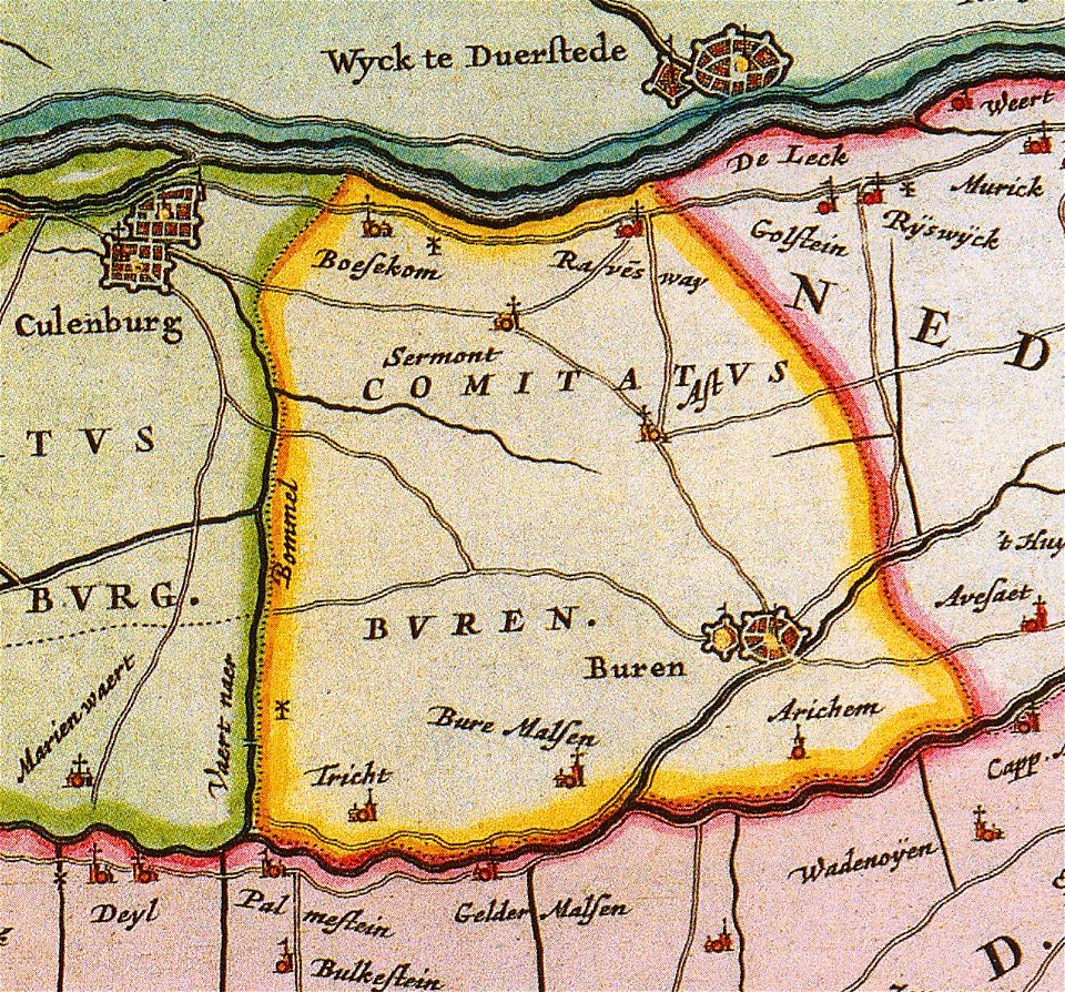
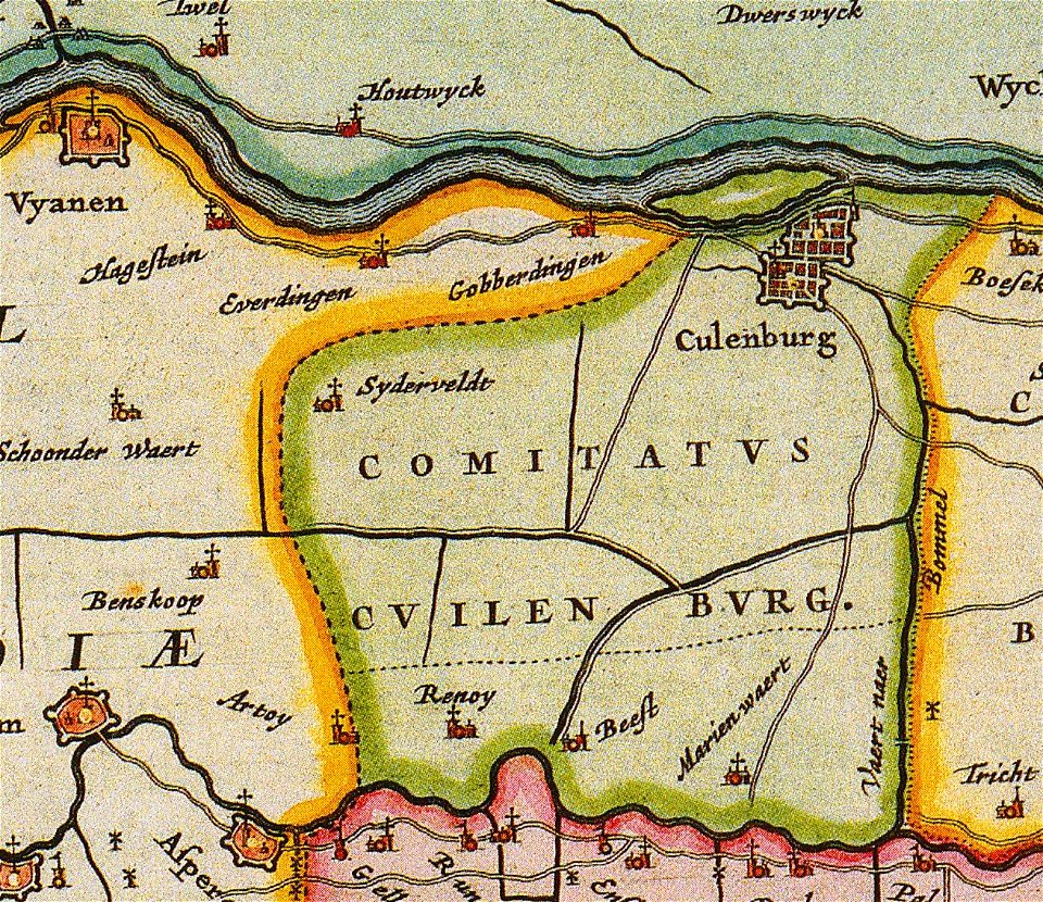
old maps of gelderland
gelderland
1660s maps of baden-württemberg
ittendorf
old maps of the dutch east india company
1660s
andreas cellarius
andreas cellarius
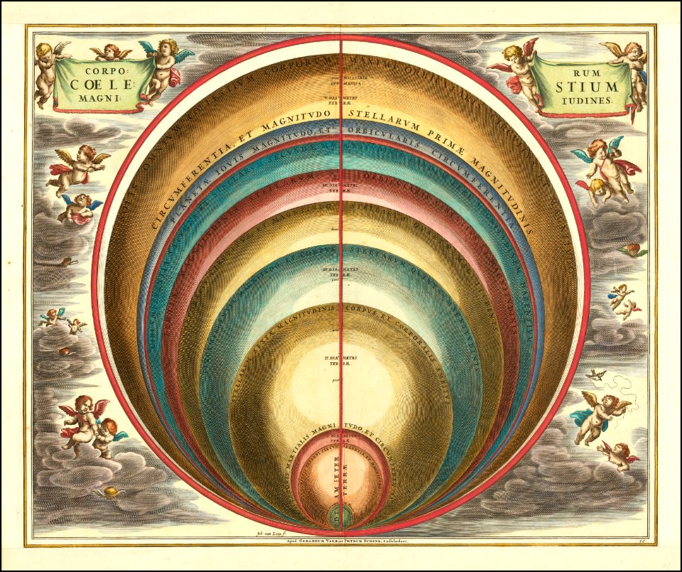
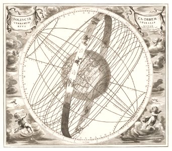
geocentric model
andreas cellarius
netherlands in the 1660s
old maps of gelderland
maps by frederick de wit
1662
andreas cellarius
geocentric model
old maps of taiwan
1665
andreas cellarius
globe
maps
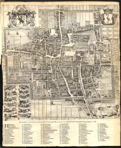
old maps of the hague
1668
erik dahlbergh
belarus
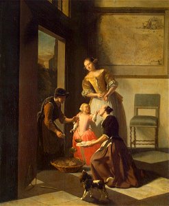
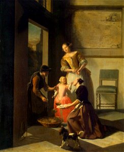
17th-century paintings of people with dogs
1660s genre paintings
17th-century paintings of people with dogs
1660s genre paintings
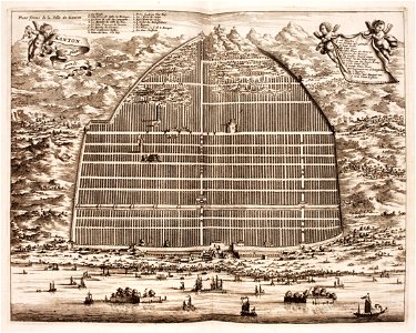
guangzhou
pagoda
fort zeelandia, taiwan in art
siege of fort zeelandia
1660s genre paintings
maps in art
maps by willem and johannes blaeu
atlas van loon
maps by willem and johannes blaeu
maps of livonia
1660s maps of the ottoman empire
old maps of the danube
fort zeelandia, taiwan in art
siege of fort zeelandia
1640s maps of the world
1660s maps of the world
atlas maior, vol 11 (asia) - joan blaeu, 1667 - bl 114.h(star).11
17th-century maps of korea
1660s maps of belgium
old maps of bruges
atlas maior, vol 11 (asia) - joan blaeu, 1667 - bl 114.h(star).11
1660s maps of china
17th-century maps of istanbul
maps by jan janssonius
bridge gw 39 scheveningsebrug
old maps of the hague
1660s maps of the caribbean
tobago
fort zeelandia, taiwan in art
siege of fort zeelandia
topographia alsatiae (merian)
baroque
fort zeelandia, taiwan in art
siege of fort zeelandia
fort zeelandia, taiwan in art
siege of fort zeelandia
atlas maior, vol 10 (spain and africa) - joan blaeu, 1667 - bl 114.h(star).10
1667 maps of europe
old maps of the stations of the exodus
joan blaeu
old maps of the holy land
joan blaeu
1660 paintings
baroque
maps of bruges by jacques harrewijn
old maps of the holy land
joan blaeu
1660s maps of belgium
old maps of bruges
17th-century maps of sweden
1660s maps of norway
maps by willem and johannes blaeu
1660s maps of the world
17th-century maps of andalusia
old maps of the alboran sea
atlas maior, vol 11 (asia) - joan blaeu, 1667 - bl 114.h(star).11
1660s maps of china
maps of paris from the david rumsey historical map collection
maps of paris by caspar merian
maps of alsace by guillaume sanson
1660s maps of baden-württemberg
maps by willem and johannes blaeu
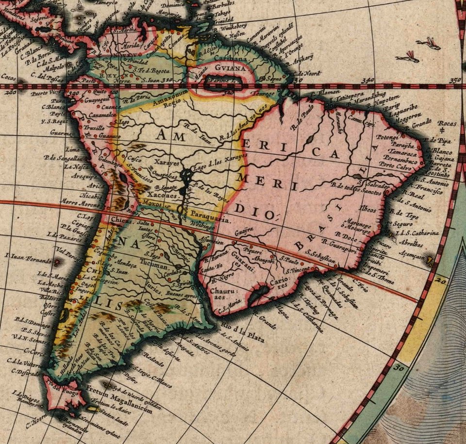
1660s maps of the americas
maps by willem and johannes blaeu
maps of the duchy of limburg
maps of paris from the david rumsey historical map collection
maps of paris by caspar merian
1660s maps of pernambuco
1660s maps of brazil
atlas van loon
1664 maps
maps by nicolaes visscher i
1660s maps of europe
seventeen provinces
1664 maps
17th-century paintings in unidentified private collections
baroque
maps in the library of congress
1660s maps of the americas
old maps of french guiana
1630s maps of brazil
genre paintings by gerard ter borch (ii)
baroque
maps of alsace by guillaume sanson
1660s maps of alsace
1660s maps of the world
atlas maior
maps by willem and johannes blaeu
old maps of the republic of genoa
david rumsey historical map collection
maps of rügen by eilhard lubinus
maps by willem and johannes blaeu
novus atlas blaeu
maps of lithuania by gerardus mercator
1660s maps of lithuania
1660s maps of spain
1667 maps
atlas maior, vol 1 (northern europe, norway, and denmark) - joan blaeu, 1667 - bl 114.h(star).1
17th-century double hemisphere world maps
maps of alsace by guillaume sanson
1660s maps of alsace
maps of alsace by guillaume sanson
1660s maps of baden-württemberg
maps of alsace by guillaume sanson
1660s maps of alsace
old maps of the hague
cornelis elandt
dutch baroque architecture
nieuwe kerk, haarlem
maps in the library of congress
1664 maps
old maps of dutch brazil
recife in the 1660s
atlas maior, vol 5 (england) - joan blaeu, 1667 - bl 114.h(star).5
old county maps of pembrokeshire
eran laor cartographic collection
joan blaeu
bibliothèque municipale de reims, rès. g 153
baroque
17th-century maps of iceland
iceland map by joris carolus
atlas maior, vol 10 (spain and africa) - joan blaeu, 1667 - bl 114.h(star).10
1667 maps
1 - 100 of 229
Next page
/ 3


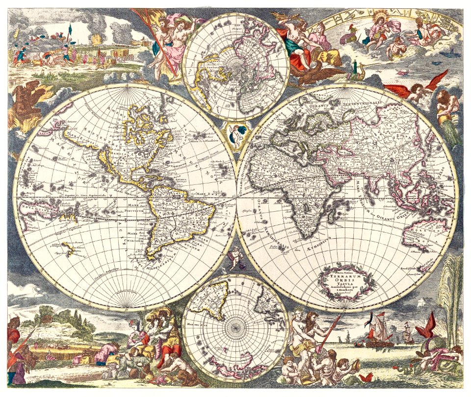


![[Nova et accuratissima totius terrarum orbis tabula]., Joan Blaeu, 1664](https://cdn.creazilla.com/illustrations/10001308540/nova-et-accuratissima-totius-terrarum-orbis-tabula-joan-blaeu-1664-md.jpg)


