Log in
All resources
Create a design
103 Free Artworks of 1600s Maps Of France
bibliothèque nationale de france
maps by pieter van der keere
maps by pieter mortier
philippe de la rué
maps by abraham ortelius
maps with cartouches
maps from gallica
maps by willem and johannes blaeu
maps of ancient italy by philipp clüver
context files from gallica
enceinte of philippe-auguste on old maps
1610s maps of paris
abraham cresques
catalan atlas
enceinte of philippe-auguste on old maps
1610s maps of paris
hendrik van langren map of south asia
1600 maps of asia
maps by pieter van der keere
maps by abraham ortelius
maps by pieter van der keere
1600s maps of norway
17th-century maps of africa
maps from gallica
arnold van langren map of southwest africa
1600 maps of africa
maps by pieter van der keere
maps by abraham ortelius
1600s maps of belgium
old maps of flanders
maps by pieter van der keere
old maps of north brabant
1570s maps of africa
1570s maps of egypt
17th-century maps of xaintonge
maps by jodocus hondius
maps of the ottoman empire by mercator-hondius
eran laor cartographic collection
maps of the ottoman empire by mercator-hondius
eran laor cartographic collection
old maps of nassau
salomon rogiers
17th-century maps of the british isles
maps by abraham ortelius
old maps of westphalia
johannes gigas
maps by pieter van der keere
maps with cartouches
17th-century maps of the mediterranean sea
ships on maps
arnold van langren map of east africa
1600 maps of africa
17th-century maps of switzerland
maps by pieter van der keere
maps by jodocus hondius
old maps of nassau
maps by pieter van der keere
maps by abraham ortelius
1640s maps of hesse
old maps of nassau
17th-century maps of xaintonge
maps by jodocus hondius ii
maps and topographical views by joris hoefnagel
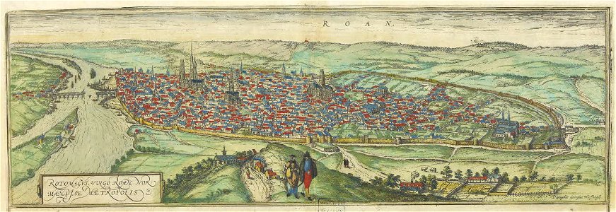
maps of rouen by braun & hogenberg
maps of the magellan straits by lambert cornelis
bibliothèque nationale de france
old maps of the republic of genoa
maps by willem and johannes blaeu
maps by pieter mortier
maps from gallica
17th-century maps of the netherlands
maps by pieter van der keere
maps by pieter mortier
maps from gallica
17th-century maps of africa
maps from gallica
maps by hendrik hondius the younger
maps of the duchy of milan
maps by pieter mortier
maps from gallica
1600 maps of africa
benjamin wright
maps of saint paul's journeys
maps by pieter van der keere
maps by pieter van der keere
old maps of bohemia
maps of ancient italy by philipp clüver
old maps of the history of liguria
maps by hendrik hondius the younger
maps of the county of mansfeld
claes jansz. visscher (ii)
maps of amsterdam
magni ducatus lithuaniae
maps facing west
maps of ancient italy by philipp clüver
old maps of samnium
maps of ancient italy by philipp clüver
old maps of marche
maps of the principality of erbach
maps by pieter van der keere
descriptio daciarum (17th-century map)
maps by pieter van der keere
maps of provence by pierre-jean de bompar
bibliothèque nationale de france
maps of portugal by fernando álvares seco
bibliothèque nationale de france
maps of liège by baptista van doetecum
maps by abraham ortelius
maps by willem and johannes blaeu
old maps of capitanata
17th-century maps of the holy roman empire
maps by pieter van der keere
arnold van langren map of southwest africa
renaissance
maps of japan by mercator-hondius
bibliothèque nationale de france
maps by willem and johannes blaeu
bibliothèque nationale de france
maps of japan by mercator-hondius
bibliothèque nationale de france
philippe de la rué
maps of mysia
bibliothèque nationale de france
guillaume sanson
carte particulière des costes de l'afrique qui comprend le royaume de gualata ... - btv1b8595466g
maps by pieter mortier
carte particulière des costes de l'afrique qui comprend le royaume de gualata ... - btv1b8595466g
maps by pieter mortier
bibliothèque nationale de france
maps of limousin by jean fayen
territorium argentoratense (1652 map)
bibliothèque nationale de france
pieter verbiest (ii)
maps from gallica
bibliothèque nationale de france
guillaume sanson
maps of morocco by mercator-hondius
bibliothèque nationale de france
maps of morocco by mercator-hondius
bibliothèque nationale de france
maps of morocco by mercator-hondius
bibliothèque nationale de france
bibliothèque nationale de france
guillaume sanson
maps of south america by mercator-hondius
bibliothèque nationale de france
limousin (province) in the 17th century
context files from gallica
maps of lake geneva by jacques goulart
bibliothèque nationale de france
maps of lake geneva by jacques goulart
bibliothèque nationale de france
maps of lake geneva by jacques goulart
bibliothèque nationale de france
maps of ancient italy by philipp clüver
bibliothèque nationale de france
maps of ancient italy by philipp clüver
bibliothèque nationale de france
maps of liège by baptista van doetecum
bibliothèque nationale de france
maps of rügen by eilhard lubinus
bibliothèque nationale de france
magni ducatus lithuaniae
radziwiłł (surname)
context files from gallica
history of rügen
carte particulière des costes de l'afrique qui comprend le royaume de cacheo, le province de gelofo etc. - btv1b8595501g
maps by pieter mortier
17th-century maps of egypt
philippe de la rué
bibliothèque nationale de france
maps of limousin by jean fayen
maps of formia by braun & hogenberg
bibliothèque nationale de france
map of modern syria by philippe de la rué
bibliothèque nationale de france
maps of ancient israel by philippe de la rué
old maps of the stations of the exodus
atlas minor gerardi mercatoris (1609)
maps of europe by mercator-hondius
17th-century maps of egypt
philippe de la rué
maps of agnano and grotta del cane by braun & hogenberg
bibliothèque nationale de france
maps of formia by braun & hogenberg
bibliothèque nationale de france
maps of agnano and grotta del cane by braun & hogenberg
context files from gallica
17th-century maps of lorraine
bussemacher (surname)
maps of ancient israel by philippe de la rué
old maps of the united monarchy
maps of ports and fortresses of the mediterranean by marco boschini (1651)
bibliothèque nationale de france
maps of agnano and grotta del cane by braun & hogenberg
bibliothèque nationale de france
17th-century maps of rhineland-palatinate
maps by nicolaes visscher i
maps of agnano and grotta del cane by braun & hogenberg
context files from gallica
maps of agnano and grotta del cane by braun & hogenberg
context files from gallica
maps of ceylon by nicolaes visscher
bibliothèque nationale de france
maps of ancient israel by philippe de la rué
jean pruthenus somer
maps of brno by braun & hogenberg
bibliothèque nationale de france
maps of east flanders by pieter van der keere
bibliothèque nationale de france
1 - 100 of 103
Next page
/ 2