Log in
All resources
Create a design
3,175 Free Images of Ravenstein
maps from the earth and its inhabitants, vol. iv
1880s maps of the british isles
history
historical
cc-zero
fotocollectie nederlandse heidemaatschappij
images from nationaal archief
maps from the earth and its inhabitants, vol. xiv
maps from the earth and its inhabitants, vol. xv
maps from the earth and its inhabitants, vol. x
maps from the earth and its inhabitants, vol. x
19th-century maps of egypt
maps from the earth and its inhabitants, vol. iv
loch etive
maps from the earth and its inhabitants, vol. xv
circumpolar maps
maps from the earth and its inhabitants, vol. iv
1870s maps of london
maps from the earth and its inhabitants, vol. iv
old maps of the isle of arran
maps from the earth and its inhabitants, vol. iv
19th-century maps of kent
historical
history
historical
history
historical
history
maps from the earth and its inhabitants, vol. iv
maps of the firth of clyde
maps from the earth and its inhabitants, vol. iv
1880s maps of ireland
maps from the earth and its inhabitants, vol. iv
old maps of hadrian's wall
maps from the earth and its inhabitants, vol. iv
old maps of york
maps from the earth and its inhabitants, vol. iv
old maps of leeds
maps from the earth and its inhabitants, vol. iv
1880s maps of the british isles
maps from the earth and its inhabitants, vol. iv
1880s maps of the british isles
maps from the earth and its inhabitants, vol. iv
old maps of sheffield
maps from the earth and its inhabitants, vol. iv
maps of ben nevis
maps from the earth and its inhabitants, vol. iv
19th-century maps of kent
maps from the earth and its inhabitants, vol. iv
19th-century maps of county durham
maps from the earth and its inhabitants, vol. iv
old maps of the hebrides
maps from the earth and its inhabitants, vol. iv
19th-century maps of lancashire
maps from the earth and its inhabitants, vol. iv
1880s maps of the british isles
maps from the earth and its inhabitants, vol. iv
19th-century maps of lancashire
maps from the earth and its inhabitants, vol. iv
maps of loch lomond
maps from the earth and its inhabitants, vol. iv
old maps of glasgow
maps from the earth and its inhabitants, vol. iv
old maps of the isle of arran
maps from the earth and its inhabitants, vol. x
maps with nicolosi globular projection
maps from the earth and its inhabitants, vol. xiv
maps of voyages
maps from the earth and its inhabitants, vol. iv
19th-century maps of the isle of man
maps from the earth and its inhabitants, vol. iv
old maps of hartlepool
maps from the earth and its inhabitants, vol. iv
1880s maps of the british isles
maps from the earth and its inhabitants, vol. iv
old maps of the firth of forth
maps from the earth and its inhabitants, vol. iv
1880s maps of the british isles
maps from the earth and its inhabitants, vol. iv
19th-century maps of lincolnshire
maps from the earth and its inhabitants, vol. iv
1880s maps of the british isles
maps from the earth and its inhabitants, vol. iv
1880s maps of the british isles
maps from the earth and its inhabitants, vol. iv
old maps of derby
maps from the earth and its inhabitants, vol. iv
1880s maps of the british isles
maps from the earth and its inhabitants, vol. iv
1880s maps of scotland
maps from the earth and its inhabitants, vol. iv
old maps of liverpool
maps from the earth and its inhabitants, vol. iv
1880s maps of the british isles
maps from the earth and its inhabitants, vol. iv
1880s maps of the british isles
maps from the earth and its inhabitants, vol. xiv
maps of the southern ocean
maps from the earth and its inhabitants, vol. xvii
natchez
maps from the earth and its inhabitants, vol. xii
sokoto
maps from the earth and its inhabitants, vol. v
nyoe
gemeente atlas van nederland - north brabant
huisseling
gemeente atlas van nederland - north brabant
herpen
historical
history
historical
history
historical
history
historical
history
historical
history
historical
history
maps from the earth and its inhabitants, vol. ix
old maps of the holy land
maps from the earth and its inhabitants, vol. iv
topographic maps of the united kingdom
old maps of la gomera
1878 maps of spain
maps from the earth and its inhabitants, vol. iv
old maps of newcastle upon tyne
maps from the earth and its inhabitants, vol. xii
19th-century maps of senegal
maps from the earth and its inhabitants, vol. iv
old maps of the lake district
maps from the earth and its inhabitants, vol. vii
women of the world from the british library mechanical curator collection
the earth and its inhabitants, vol. v: europe, vol. v
maps from the earth and its inhabitants, vol. xiii
maps of weather and climate of south africa
maps from the earth and its inhabitants, vol. xv
maps of native american tribal territories
maps from the earth and its inhabitants, vol. xv
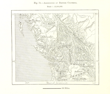
19th-century maps of british columbia
maps from the earth and its inhabitants, vol. xiv
1870s maps of new zealand
maps from the earth and its inhabitants, vol. xiv
maps of the southern ocean
maps from the earth and its inhabitants, vol. iv
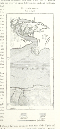
maps of dumbartonshire
maps from the earth and its inhabitants, vol. iv
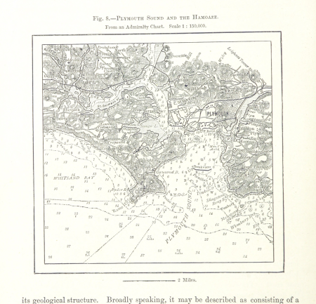
charts of plymouth sound
maps from the earth and its inhabitants, vol. x
rosetta (egypt)
maps from the earth and its inhabitants, vol. iv
peterborough
maps from the earth and its inhabitants, vol. xiv
1870s maps of australia
maps from the earth and its inhabitants, vol. x
maps of lake victoria
maps from the earth and its inhabitants, vol. x
canals in egypt
maps from the earth and its inhabitants, vol. iv
bathymetric maps of the irish sea
maps from the earth and its inhabitants, vol. iv
19th-century maps of derbyshire
rivers of the western cape
maps of the western cape
maps from the earth and its inhabitants, vol. vii
qinghai lake
maps from the earth and its inhabitants, vol. xii
19th-century maps of the azores
maps from the earth and its inhabitants, vol. xv
first nations people of british columbia
maps from the earth and its inhabitants, vol. iv
1870s maps of london
maps from the earth and its inhabitants, vol. xv
1870s maps of quebec
maps from the earth and its inhabitants, vol. xviii
transport in south america
maps from the earth and its inhabitants, vol. xviii
maps of indigenous territories of colombia
1870s maps of venezuela
1878 in venezuela
maps from the earth and its inhabitants, vol. xi
oases of libya
maps from the earth and its inhabitants, vol. v
1870s maps of finland
maps from the earth and its inhabitants, vol. xvii
linguistic maps of north america
maps from the earth and its inhabitants, vol. v
maps of spitsbergen
maps from the earth and its inhabitants, vol. xv
temperature maps of north america
maps from the earth and its inhabitants, vol. xvi
maps of the mexican war of independence
maps from the earth and its inhabitants, vol. ii
st malo
maps from the earth and its inhabitants, vol. vii
provinces of japan
maps of the districts of the canton of bern
biel/bienne (administrative district)
maps from the earth and its inhabitants, vol. xiv
old maps of sydney
maps from the earth and its inhabitants, vol. iv
old maps of the firth of forth
maps from the earth and its inhabitants, vol. xiv
1870s maps of australia
maps from the earth and its inhabitants, vol. v
maps of the north atlantic
maps from the earth and its inhabitants, vol. xiii
maps indicating exploration
301 - 400 of 3,175
Next page
/ 32