Log in
All resources
Create a design
27,441 Free Images of Maps
maps of africa
africa in the 1890s
eran laor cartographic collection
maps from the earth and its inhabitants, vol. xii
maps from the earth and its inhabitants, vol. xiii
latin-language maps
english-language maps
bibliothèque nationale de france
maps from the earth and its inhabitants, vol. xi
willem blaeu
blaeu atlas of scotland 1654
timothy pont
maps from the earth and its inhabitants, vol. xiii
africa in the 1890s
maps from the earth and its inhabitants, vol. xi
africa in the 1890s
maps from the earth and its inhabitants, vol. xi
africa in the 1890s
maps from the earth and its inhabitants, vol. xii
africa in the 1890s
maps from the earth and its inhabitants, vol. xii
africa in the 1890s
maps from the earth and its inhabitants, vol. xii
africa in the 1890s
maps from the earth and its inhabitants, vol. xiii
africa in the 1890s
maps from the earth and its inhabitants, vol. xii
africa in the 1890s
maps from the earth and its inhabitants, vol. xi
africa in the 1890s
maps from the earth and its inhabitants, vol. xii
africa in the 1890s
maps from the earth and its inhabitants, vol. xiii
africa in the 1890s
maps from the earth and its inhabitants, vol. xii
africa in the 1890s
maps from the earth and its inhabitants, vol. xii
africa in the 1890s
maps from the earth and its inhabitants, vol. xii
africa in the 1890s
gemeente atlas van nederland - south holland
1860s maps of south holland
maps from the earth and its inhabitants, vol. xi
africa in the 1890s
maps from the earth and its inhabitants, vol. xii
africa in the 1890s
maps from the earth and its inhabitants, vol. xiii
africa in the 1890s
maps from the earth and its inhabitants, vol. xii
africa in the 1890s
maps from the earth and its inhabitants, vol. xiii
africa in the 1890s
maps from the earth and its inhabitants, vol. xii
africa in the 1890s
maps from the earth and its inhabitants, vol. xii
africa in the 1890s
maps from the earth and its inhabitants, vol. xi
africa in the 1890s
maps from the earth and its inhabitants, vol. xii
africa in the 1890s
maps from the earth and its inhabitants, vol. xii
africa in the 1890s
maps from the earth and its inhabitants, vol. xii
africa in the 1890s
maps from the earth and its inhabitants, vol. xii
africa in the 1890s
maps from the earth and its inhabitants, vol. xiii
africa in the 1890s
maps from the earth and its inhabitants, vol. xii
africa in the 1890s
maps from the earth and its inhabitants, vol. xiii
africa in the 1890s
maps from the earth and its inhabitants, vol. x
rosetta branch
maps from the earth and its inhabitants, vol. xi
africa in the 1880s
maps from the earth and its inhabitants, vol. xiii
africa in the 1890s
maps from the earth and its inhabitants, vol. xiii
africa in the 1890s
maps from the earth and its inhabitants, vol. xi
africa in the 1890s
maps from the earth and its inhabitants, vol. xiii
maps of africa
engravings of topographia saxoniae inferioris
baroque
eran laor cartographic collection
emery walker
eran laor cartographic collection
high renaissance
eran laor cartographic collection
john cary
eran laor cartographic collection
german renaissance,humanism
eran laor cartographic collection
étienne dupérac
eran laor cartographic collection
william henry toms
gardens in the vatican city
high renaissance
eran laor cartographic collection
william hole (engraver)
eran laor cartographic collection
william hole (engraver)
eran laor cartographic collection
german renaissance,humanism
eran laor cartographic collection
willem blaeu
eran laor cartographic collection
hendrik hondius the younger
eran laor cartographic collection
cornelis de bruyn
eran laor cartographic collection
alain manesson-mallet
media from the national library of finland
classicism
eran laor cartographic collection
joan blaeu
eran laor cartographic collection
cornelis de bruyn
eran laor cartographic collection
william hole (engraver)
eran laor cartographic collection
james basire
eran laor cartographic collection
willem blaeu
eran laor cartographic collection
joan blaeu
eran laor cartographic collection
william hole (engraver)
eran laor cartographic collection
alain manesson-mallet
maps in the library of congress
1660s maps of the americas
maps by pieter van der keere
old maps of gelderland
maps of the hague by braun & hogenberg
the hague in the 1690s
maps of heidelberg by braun & hogenberg
maps of speyer by braun & hogenberg
1660s maps of france
old maps of nevers
maps by willem and johannes blaeu
old maps of flanders
map of ancient assyria by philippe de la rué
old maps of mesopotamia
maps by pieter van der keere
1598 maps of italy
tinted lithographs in the british museum
victorian architecture
tinted lithographs in the british museum
victorian architecture
1730s maps of the philippines
baroque painting
cartouches by willem and johannes blaeu
maps made in the 17th century
the gazetteer of scotland (1838)
william home lizars
siberia and the exile system (1891)
19th-century maps of siberia
van langren map of southeast asia
renaissance
siberia and the exile system (1891)
19th-century maps of siberia
guida illustrata di montepiano e sue adiacenze (1892)
books from biblioteca lazzerini di prato
maps in the library of congress
1777 maps of new york (state)
18th-century maps of kent
maps by thomas kitchin
a map of the provinces of new york and new jersey, with a part of pennsylvania and the province of quebec
maps in the library of congress
maps of westmorland and man by gerardus mercator
ateliers bmb mercator
maps in the stadsarchief amsterdam
works after map of amsterdam, 1544
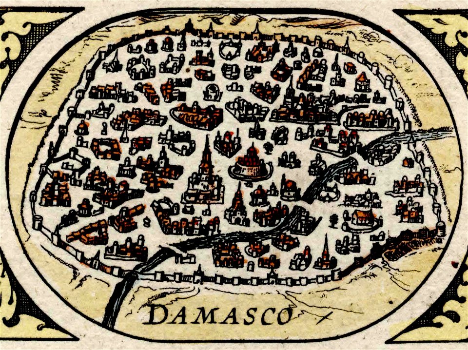
maps of damascus by braun & hogenberg
asia noviter delineata
asia noviter delineata
1617 drawings
description de l'universe
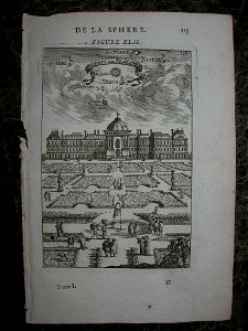
jardin des tuileries
historical images of macau
asia noviter delineata
description de l'universe
1685 in spain
asia noviter delineata
1617 drawings
our arctic province, alaska and the seal islands (1886)
old maps of alaska
the story of geographical discovery
maps from books
maps from the earth and its inhabitants, vol. iv
maps of cheltenham
illustrations de histoire naturelle - tome i - de seve 1749
maps of afro-eurasia
maps from the earth and its inhabitants, vol. iv
1870s maps of london
illustrations de histoire naturelle - tome i - de seve 1749
1740s maps of the americas
asia noviter delineata
1617 drawings
illustrations from découverte de la terre
jacques cartier by théophile hamel
pamir mountains
hindu kush
pamir mountains
hindu kush
19th-century maps of normandie
la normandie (jules janin)
9001 - 9100 of 27,441
Next page
/ 275