Log in
All resources
Create a design
27,441 Free Images of Maps
maps of africa
africa in the 1890s
maps from the earth and its inhabitants, vol. xii
maps from the earth and its inhabitants, vol. xi
maps from the earth and its inhabitants, vol. xiii
eran laor cartographic collection
maps from the earth and its inhabitants, vol. x
19th-century maps of africa
1773 fleurons
the antiquities of england and wales (1773)
the antiquities of england and wales (1773)
1773 fleurons
maps of dordrecht by braun & hogenberg
eran laor cartographic collection
17th-century maps of herefordshire
llancillo
the antiquities of england and wales (1773)
1773 fleurons
maps by willem and johannes blaeu
fort-mardyck
old kievan fortress
old maps of kyiv
the antiquities of england and wales (1773)
1773 fleurons
dutch golden age painting
regulierspoort, amsterdam
maps of hrodna by braun & hogenberg
eran laor cartographic collection
strasbourg in the 17th century
old maps of strasbourg
dutch golden age painting
regulierspoort, amsterdam
eran laor cartographic collection
pierre aveline
1878 maps of europe
augusto grossi
old maps of naples
mannerism
eran laor cartographic collection
nicolaus van aelst
maps of strasbourg in the 17th century
works by johann adam seupel
eran laor cartographic collection
cornelis de bruyn
eran laor cartographic collection
pierre françois tardieu
turgot map of paris, kyoto university library – derivative files
lycée henri-iv
eran laor cartographic collection
isaak tirion
gemeente atlas van nederland - north holland
19th-century maps of amsterdam
maps of naples
mannerism
romanticism,neoclassicism
jacques nompar de caumont
old maps of the canadian arctic region
victory expedition
engravings from the adventures of three englishmen and three russians in south africa by françois pannemaker
illustrations from the adventures of three englishmen and three russians in south africa by jules férat
bird's eye view of knoxville, tennessee, 1886
maps in the library of congress
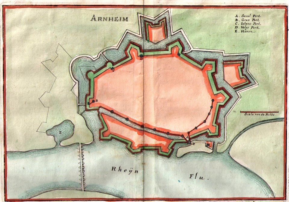
old maps of arnhem
baroque
cartouches by willem and johannes blaeu
maps from the earth and its inhabitants, vol. x
19th-century maps of africa
the adventure of the priory school
illustrations by c. r. macauley
maps from the earth and its inhabitants, vol. x
19th-century maps of africa
maps from the earth and its inhabitants, vol. x
19th-century maps of africa
maps from the earth and its inhabitants, vol. x
19th-century maps of africa
maps from the earth and its inhabitants, vol. x
19th-century maps of africa
maps from the earth and its inhabitants, vol. x
19th-century maps of africa
maps by willem and johannes blaeu
ducatus holsatiæ nova tabula
maps of bamberg by braun & hogenberg
torschuster
maps of bamberg by braun & hogenberg
st. gangolf (bamberg)
illustrations from the archipelago on fire by léon benett
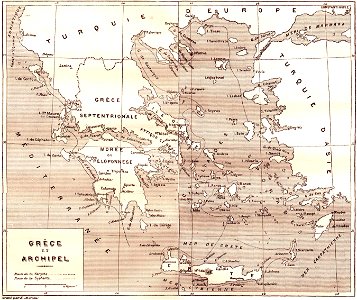
old maps of greece
maps of schleswig-holstein in the atlas maior
maps by johannes mejer
cartes de franz schrader
old maps of the alps
pedemontium et monsferratus (galleria delle carte geografiche)
old maps of liguria
flandria illustrata
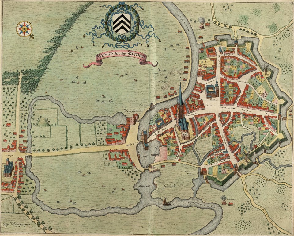
old maps of menen
maps of paris from the stanford libraries
maps of paris by braun & hogenberg
truscott map of st-petersburg 1753
german quarter
maps of constantine (algeria)
cartes de franz schrader
maps of metz city walls
old maps of metz
maps of the history of czechia
engravings by wolfgang kilian
19th-century maps of senegal
orientalist painting
maps from the earth and its inhabitants, vol. ix
darah nur
maps from the earth and its inhabitants, vol. xvii
archaeological sites in ohio
old maps of lake titicaca
maps of lake titicaca
19th-century maps of senegal
orientalist painting
the comprehensive history of england (1876)
english-language maps showing history
maps from the earth and its inhabitants, vol. v
charles eugène perron
maps from the earth and its inhabitants, vol. vii
yarlung tsangpo
maps from the earth and its inhabitants, vol. viii
british raj
maps from the mechanical curator collection available to georeference
maps from the mechanical curator collection
maps from the earth and its inhabitants, vol. xii
africa in the 1890s
maps from the earth and its inhabitants, vol. xii
africa in the 1890s
maps from the earth and its inhabitants, vol. xi
africa in the 1890s
africa in the 1890s
maps of africa
maps from the earth and its inhabitants, vol. xiii
africa in the 1890s
africa in the 1890s
maps of africa
maps from the earth and its inhabitants, vol. xi
africa in the 1890s
maps from the earth and its inhabitants, vol. xi
africa in the 1890s
maps from the earth and its inhabitants, vol. xi
africa in the 1890s
maps from the earth and its inhabitants, vol. xi
africa in the 1890s
maps from the earth and its inhabitants, vol. xii
africa in the 1890s
maps from the earth and its inhabitants, vol. xii
africa in the 1890s
maps from the earth and its inhabitants, vol. xi
africa in the 1880s
maps from the earth and its inhabitants, vol. xii
africa in the 1890s
maps from the earth and its inhabitants, vol. xi
africa in the 1890s
maps from the earth and its inhabitants, vol. xii
africa in the 1890s
maps from the earth and its inhabitants, vol. xii
africa in the 1890s
maps from the earth and its inhabitants, vol. xi
africa in the 1890s
maps from the earth and its inhabitants, vol. xi
africa in the 1890s
maps from the earth and its inhabitants, vol. xi
africa in the 1890s
maps from the earth and its inhabitants, vol. xiii
maps of africa
maps from the earth and its inhabitants, vol. xii
africa in the 1890s
maps from the earth and its inhabitants, vol. xi
africa in the 1890s
maps from the earth and its inhabitants, vol. xi
africa in the 1890s
maps from the earth and its inhabitants, vol. xiii
africa in the 1890s
maps from the earth and its inhabitants, vol. xi
africa in the 1890s
maps from the earth and its inhabitants, vol. xii
africa in the 1890s
maps from the earth and its inhabitants, vol. xiii
africa in the 1890s
maps from the earth and its inhabitants, vol. xii
africa in the 1890s
chicago and the midwest, newberry library
cartographic reliefs
maps from the earth and its inhabitants, vol. xiii
maps of africa
maps from the earth and its inhabitants, vol. xi
africa in the 1890s
maps from the earth and its inhabitants, vol. xiii
africa in the 1890s
maps from the earth and its inhabitants, vol. xii
africa in the 1890s
maps from the earth and its inhabitants, vol. xiii
africa in the 1890s
maps from the earth and its inhabitants, vol. xii
africa in the 1890s
maps from the earth and its inhabitants, vol. xii
africa in the 1890s
maps from the earth and its inhabitants, vol. xiii
africa in the 1890s
maps from the earth and its inhabitants, vol. xiii
maps of africa
maps from the earth and its inhabitants, vol. xii
africa in the 1890s
maps from the earth and its inhabitants, vol. xii
africa in the 1890s
maps from the earth and its inhabitants, vol. xii
africa in the 1890s
8901 - 9000 of 27,441
Next page
/ 275