Log in
All resources
Create a design
27,441 Free Images of Maps
topographic map of france, 1864
lemercier & cie.
maps from university of amsterdam special collections
atlas der neederlanden
copperplate print
special collections of the university of amsterdam
bibliothèque nationale de france
baroque
nouvelle géographie universelle, vol. xii
charles eugène perron
topographic map of france, 1864
lemercier & cie.
topographic map of france, 1864
lemercier & cie.
topographic map of france, 1864
lemercier & cie.
topographic map of france, 1864
lemercier & cie.
topographic map of france, 1864
lemercier & cie.
topographic map of france, 1864
lemercier & cie.
topographic map of france, 1864
lemercier & cie.
topographic map of france, 1864
lemercier & cie.
topographic map of france, 1864
lemercier & cie.
topographic map of france, 1864
lemercier & cie.
topographic map of france, 1864
lemercier & cie.
topographic map of france, 1864
lemercier & cie.
topographic map of france, 1864
lemercier & cie.
topographic map of france, 1864
lemercier & cie.
topographic map of france, 1864
lemercier & cie.
topographic map of france, 1864
lemercier & cie.
topographic map of france, 1864
lemercier & cie.
topographic map of france, 1864
lemercier & cie.
topographic map of france, 1864
lemercier & cie.
topographic map of france, 1864
lemercier & cie.
topographic map of france, 1864
lemercier & cie.
maps in the library of congress
augustus kollner
topographic map of france, 1864
lemercier & cie.
abraham cresques
catalan atlas
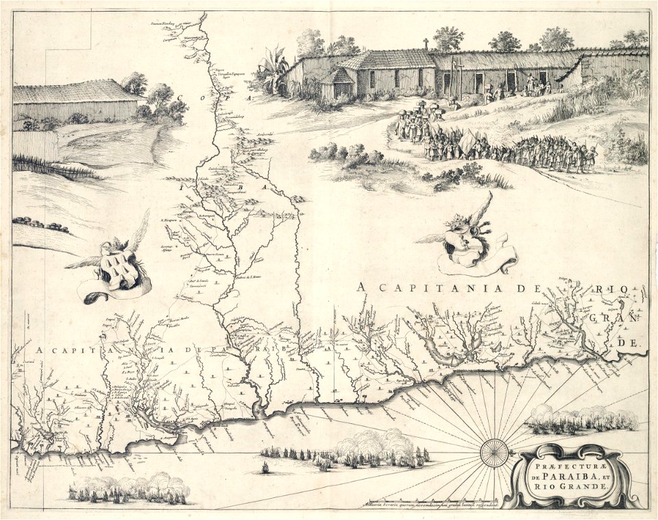
carta hydrographica y chorographica de las yslas filipinas
baroque painting
nouvelle géographie universelle, vol. xii
charles eugène perron
bibliothèque municipale de reims, rès. g 152
old maps of abbeville
corbulo canal
1750 maps
james meadows tract
james meadows
nouvelle géographie universelle, vol. xii
charles eugène perron
buildings in wilhelma zoo
schloss rosenstein
nouvelle géographie universelle, vol. xii
charles eugène perron
nouvelle géographie universelle, vol. xii
charles eugène perron
heriot row, edinburgh
maps of edinburgh
old maps of north rhine-westphalia
baroque
curt teich postcard archives
map postcards
maps of goa by linschoten
portuguese india
gemeente atlas van nederland - zeeland
maps of poortvliet
maps by willem and johannes blaeu
copper engravings
elizabeth ii on stamps of aden
1953 stamps of aden
maps in the rijksmuseum amsterdam
1627 maps
turgot map of paris – derivative files
musketeers of the guard
engravings of topographia saxoniae inferioris
baroque
gemeente atlas van nederland - zeeland
maps of sint-maartensdijk
maps of impact craters on mars
fontana (martian crater)
maps of kingdom of westphalia
1808 in germany
17th-century maps of moscow
atlas van loon
topographia franconiae (merian)
baroque
leipzig in the 17th century
baroque
maps of the west-indische compagnie
1647
maps from university of amsterdam special collections
atlas der neederlanden
maps from university of amsterdam special collections
atlas der neederlanden
maps from university of amsterdam special collections
atlas der neederlanden
maps from the earth and its inhabitants, vol. xvii
history of florida
maps from university of amsterdam special collections
atlas der neederlanden
maps from university of amsterdam special collections
atlas der neederlanden
maps from university of amsterdam special collections
atlas der neederlanden
maps from university of amsterdam special collections
atlas der neederlanden
maps from university of amsterdam special collections
atlas der neederlanden
maps from university of amsterdam special collections
atlas der neederlanden
maps from university of amsterdam special collections
atlas der neederlanden
maps from university of amsterdam special collections
atlas der neederlanden
maps from university of amsterdam special collections
atlas der neederlanden
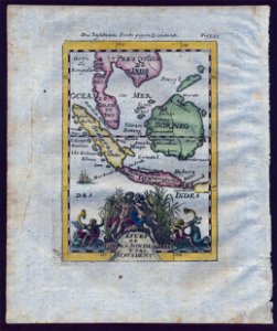
18th-century maps of southeast asia
description de l'universe
daniel de la feuille
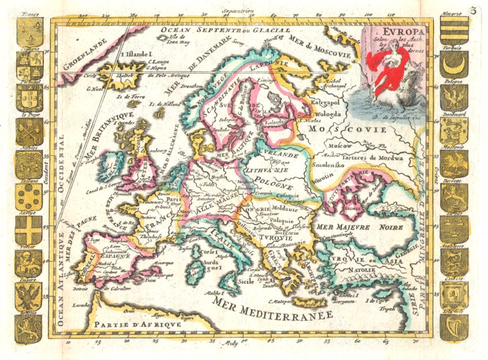
1706 maps of europe
old maps of the batavian republic
cornelis van baarsel
old maps of the republic of genoa
baroque
eran laor cartographic collection
richard william seale
maps by tomas lopez
1791 maps of europe
maps by tomas lopez
1769 maps of europe
hamburgische elbkarte von melchior lorichs
parts of old maps of hamburg
hamburgische elbkarte von melchior lorichs
parts of old maps of hamburg
maps in the library of congress
1734 maps of north america
hamburgische elbkarte von melchior lorichs
parts of old maps of hamburg
17th-century maps of xaintonge
maps by jodocus hondius
dutch paintings in the hermitage
jacob ochtervelt
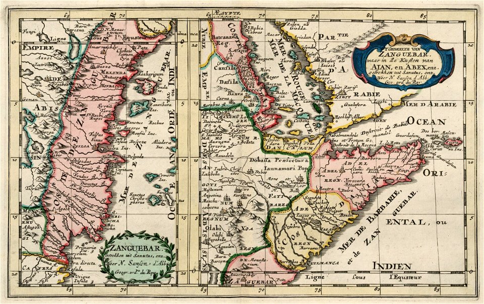
old maps of the dutch east india company - africa
1705
1570s maps of africa
1570s maps of egypt
plan routier de la ville et faubourg de paris by jean lattré
maps of paris from the stanford libraries
vrbivm praecipvarvm mvndi theatrvm qvintvm (1617)
maps of zell (mosel) by braun & hogenberg
maps by willem and johannes blaeu
chami empire
vrbivm praecipvarvm mvndi theatrvm qvintvm (1617)
maps of los palacios by braun & hogenberg
plan de la ville et faubourg de paris, divisé en ses 48 sections by mondhare & jean
maps of paris from the stanford libraries
description de l'universe
old maps of greece
map of ghent by jan blaeu
flandria illustrata
john rocque's 1748 map of london and adjacent country
maps in the british museum
maps of haarlemmerhout
old maps of haarlem
maps in the library of congress
1753 maps
maps of flensburg by braun & hogenberg
city gates in flensburg
maps by emanuel bowen
old maps of peru
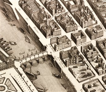
old submaps of paris 5e arrondissement
turgot map of paris – derivative files
bibliothèque municipale de reims, rès. g 153
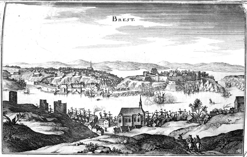
brest (france) in the 1650s
abbaye de longchamp
bac de suresnes
illustrations from césar cascabel by george roux
1890s maps of asia
lucas janszoon waghenaer
old maps of the arctic
turgot map of paris, kyoto university library – derivative files
hôtel de mortemart
turgot map of paris, david rumsey historical map collection – derivative files
bastille
old maps of oldenzaal
atlas van loon
maps of ghent by hendrik hondius
old maps of spanjaardenkasteel
maps by willem and johannes blaeu
old maps of diksmuide
7101 - 7200 of 27,441
Next page
/ 275