Two maps of the African east coast, circa 1705

Two maps of the African east coast, circa 1705

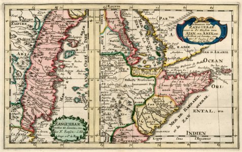
Two maps of the african east coast. Zanguebar. / 't gedeelte van zanguebar waar in de kusten van ajan, en abex, enz. Date: circa 1705. Dimensions: height: 19 cm (7.4 in); width: 30.5 cm (12 in). Medium: coloured engraving on paper. Collection: Koninklijke Bibliotheek.
Edit image
Published by:
Creazilla
Author: François HalmaSource: commons.wikimedia.org

Loading...

0 downloads
Loading...
old maps of the dutch east india company - africa1705anthonie de wintercoloured engraving on paperkoninklijke bibliotheek

MORE LIKE THIS

Creazilla logo
Over 10 million free graphic resources for content creators and designers.
© 2018 - 2025 Creazilla
Our resourcesAll imagesPhotosDigital illustrationsClipartIconsPNG ImagesEmojisSilhouettesTraditional Art3D ModelsVectorsFontsColor namesColor palettesGradientsAudioAnimationVideosTemplates
InformationAbout CreazillaTerms of useTech teamPrivacy policyLicence Information
FeedbackContact Us