Log in
All resources
Create a design
80 Free Images of Maps Of The Palatinate
bibliothèque nationale de france
old maps of rhineland-palatinate
maps of vangiones by sanson
map of the circle of the rhineland by sanson
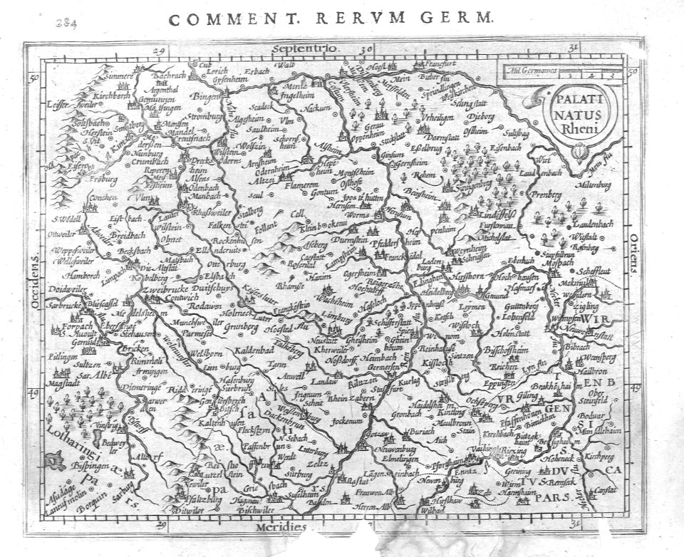
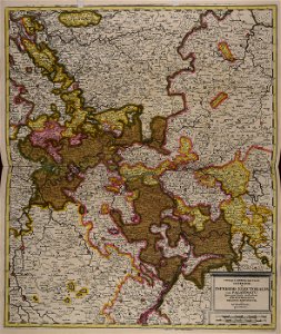
maps of the palatinate of the rhine
baroque
1670s maps of rhineland-palatinate
1730s maps of rhineland-palatinate
1700s maps of rhineland-palatinate
1680s maps of rhineland-palatinate
old maps of rhineland-palatinate
maps of the palatinate
old maps of rhineland-palatinate
maps of the palatinate
maps in the library of congress
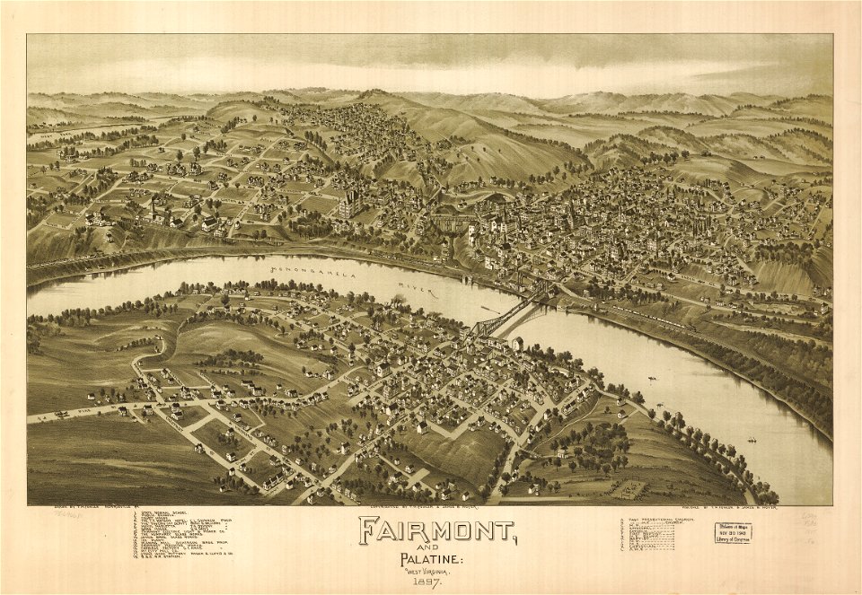
west virginia
maps in the library of congress
west virginia
1751 maps of rhineland-palatinate
neuwied in the 18th century
old maps of rhineland-palatinate
old maps of bas-rhin
maps with cartouches
atlas van der hagen
maps by homannsche erben
latin-language maps
old maps of rhineland-palatinate
old maps of hesse
maps made in the 17th century
gerard valck
old maps of rhineland-palatinate
maps made in the 17th century
atlantis magni tomus tertius (biblioteca comunale di trento)
maps of territories in the electoral rhenish circle
old maps of the electorate of trier
maps with cartouches
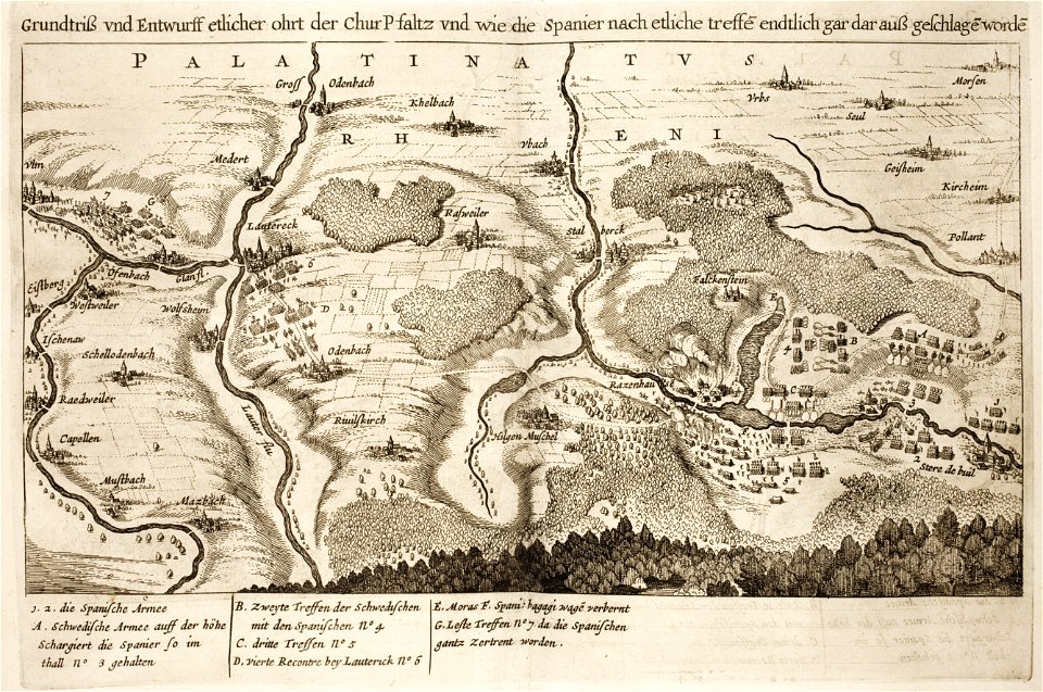
battles of the thirty years' war
burg falkenstein (pfalz)
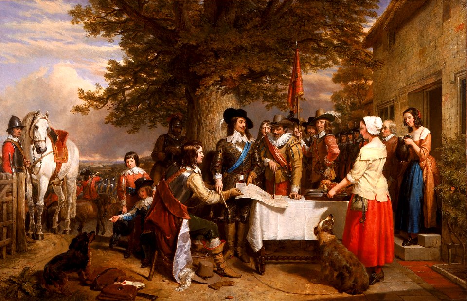
charles landseer
fairy painting
collections of generallandesarchiv karlsruhe
hagenbach
old maps of rhineland-palatinate
old maps of alsace
maps of the palatinate of the rhine
maps by willem and johannes blaeu
engravings by matthäus merian
baroque
maps of vangiones by sanson
1670s maps of hesse
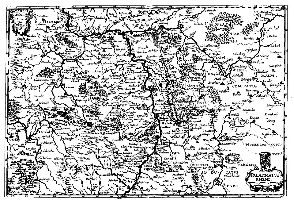
palatinatus rheni (merian)
baroque
maps of vangiones by sanson
maps by nicolas sanson
maps of upper palatinate
old maps of bavaria
maps in the british museum
udenheim
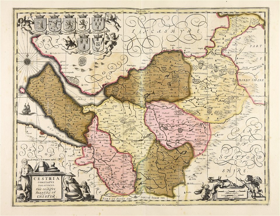
17th-century maps of cheshire
old county maps of cheshire
merian mainz trier köln
baroque
1680s maps of rhineland-palatinate
maps of vangiones by sanson
old maps of the rhine
neuburg am rhein
old maps of rhineland-palatinate
baroque
1700s maps of rhineland-palatinate
maps of vangiones by sanson
maps of vangiones by sanson
1670s maps of hesse
1680s maps of rhineland-palatinate
maps of vangiones by sanson
1690s maps of rhineland-palatinate
maps of east palatinate by sanson
1770s maps of rhineland-palatinate
maps of east palatinate by sanson
old maps of rhineland-palatinate
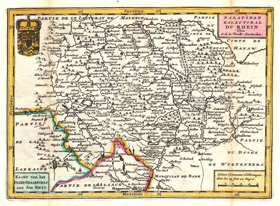
daniel de la feuille
1700s maps of rhineland-palatinate
maps of east palatinate by sanson
1660s maps of rhineland-palatinate
maps of vangiones by sanson
engravings by matthäus merian
baroque
friedrich wilhelm delkeskamp
old maps of the rhineland
baroque painting
maps of journeys
1670s maps of rhineland-palatinate
maps of vangiones by sanson
le antichità romane (piranesi)
neoclassicism
1670s maps of rhineland-palatinate
maps of vangiones by sanson
map of the circle of the rhineland by sanson
1730s maps of rhineland-palatinate
map of the circle of the rhineland by sanson
1680s maps of rhineland-palatinate
map of the circle of the rhineland by sanson
1680s maps of rhineland-palatinate
old maps of rhineland-palatinate
nicolaus person
le antichità romane (piranesi)
neoclassicism
1670s maps of rhineland-palatinate
maps of vangiones by sanson
map of the circle of the rhineland by sanson
1700s maps of rhineland-palatinate
maps of the course of the rhine by guillaume sanson
guillaume sanson
map of the circle of the rhineland by sanson
1670s maps of rhineland-palatinate
maps by alexis-hubert jaillot
maps by guillaume sanson
map of the circle of the rhineland by sanson
1730s maps of rhineland-palatinate
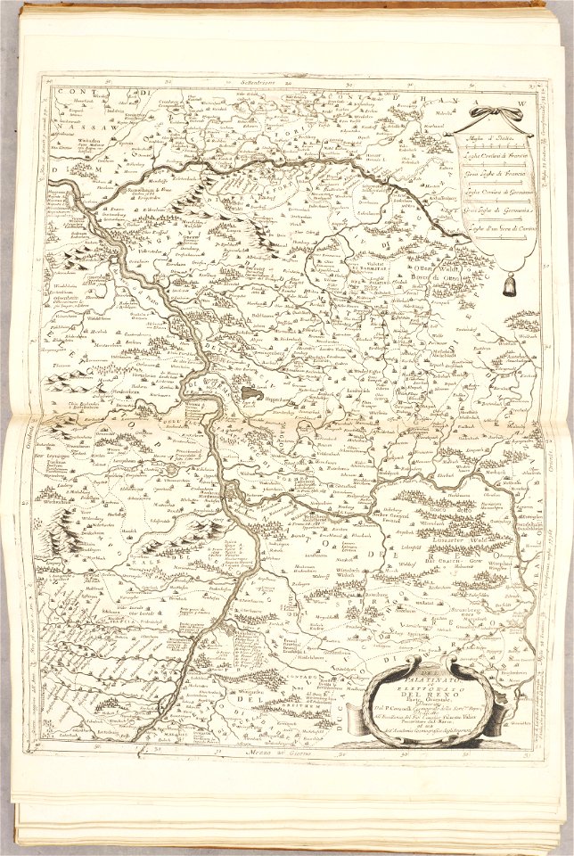
maps of the palatinate of the rhine
1692 maps of rhineland-palatinate
demolished castles in landkreis germersheim
neuburg am rhein
a history of the town and parish of nantwich, or wich-malbank, in the county palatine of chester (1883)
floor plans of churches in england
maps of the palatinate of the rhine
pieter van der keere
sanson maps of the circles of germany
1670s maps of baden-württemberg
map of the circle of the rhineland by sanson
1730s maps of rhineland-palatinate
map of the circle of the rhineland by sanson
1700s maps of rhineland-palatinate
maps of heidelberg by braun & hogenberg
maps of speyer by braun & hogenberg
maps of bernkastel-kues by braun & hogenberg
maps of zell (mosel) by braun & hogenberg
bibliothèque nationale de france
maps by thomas kitchin
maps of bernkastel-kues by braun & hogenberg
maps of zell (mosel) by braun & hogenberg
maps of heidelberg by braun & hogenberg
maps of speyer by braun & hogenberg
1640s maps of hesse
old maps of nassau
map of the circle of the rhineland by sanson
1730s maps of rhineland-palatinate
maps of oberwesel by braun & hogenberg
maps of boppard by braun & hogenberg
atlas sive cosmographicae (gerardus mercator, 1623)
maps of rhenian palatinate by gerardus mercator
sanson maps of the circles of germany
1670s maps of baden-württemberg
1630s maps of rhineland-palatinate
nicolaes visscher i
atlas sive cosmographicae (gerardus mercator, 1630)
maps of rhenian palatinate by gerardus mercator
maps of münstermaifeld by braun & hogenberg
maps of cochem by braun & hogenberg
17th-century maps of rhineland-palatinate
maps by nicolaes visscher i
cartography
maps
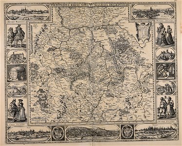
territorium argentoratense (1652 map)
bibliothèque nationale de france
territorium argentoratense (1652 map)
context files from gallica
maps in the library of congress
1700s maps of ukraine
old maps of mainz
baroque
1 - 80 of 80
/ 1


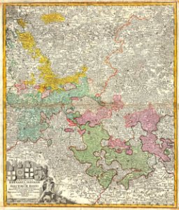


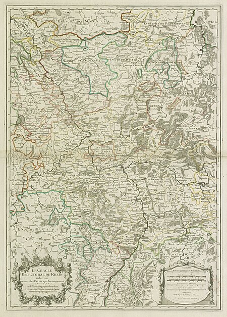


![The Electoral Circle of the Rhine subdivided into all the Estates which compose it... / by Sanson, ,... Geometric Miles or Miles of Italy [30 = 12] common leagues of France, 1734](https://cdn.creazilla.com/illustrations/10001532968/the-electoral-circle-of-the-rhine-subdivided-into-all-the-estates-which-compose-it-by-sanson-geometric-miles-or-miles-of-italy-30-12-common-leagues-of-france-1734-sm.jpg)