Log in
All resources
Create a design
171 Free Images of Maps By Gerard Valck
municipal library of trento
maps by pieter schenk (i)
atlantis magni tomus quartus (biblioteca comunale di trento)
atlantis magni tomus secundus (biblioteca comunale di trento)
maps made in the 17th century
atlantis magni tomus tertius (biblioteca comunale di trento)
latin-language maps
18th-century celestial maps
17th-century maps of france
eran laor cartographic collection
1690s maps of the world
copper engravings
maps of the west-indische compagnie
old maps of the dutch gold coast
old county maps of hampshire
old county maps of berkshire
maps by pieter schenk (i)
maps by gerard valck
1680s maps of france
valois (ducato)
old maps of north america from the norman b. leventhal map center
old maps of south america from the norman b. leventhal map center
1702 maps of france
1702 in guyenne
maps of mecklenburg-schwerin
old maps of mecklenburg
maps by gerard valck
atlas beudeker
18th-century celestial maps
1708 maps
maps by gerard valck
copper engravings
old county maps of staffordshire
old county maps of shropshire
17th-century maps of lorraine
old maps of pays messin
17th-century maps of lower saxony
maps of the duchy of oldenburg
maps by pieter schenk (i)
maps by gerard valck
17th-century maps of france
old maps of loiret
old county maps of gloucestershire
old county maps of monmouthshire
old county maps of leicestershire
old county maps of rutland
17th-century maps of cumberland
old county maps of cumberland
17th-century maps of dordogne
sarlat-la-canéda
maps made in the 17th century
rethel (territorio)
17th-century maps of ireland
maps of munster, ireland
17th-century maps of ireland
old maps of connaught
17th-century maps of bordeaux
17th-century maps of dordogne
old maps of charente-maritime
maps by nicolas sanson
17th-century maps of xaintonge
old maps of charente-maritime
17th-century maps of france
maps of touraine
maps by pieter schenk (i)
maps by gerard valck
maps made in the 17th century
nivernais (ducato)
17th-century maps of france
loudun (territorio)
maps of the electorate of cologne
maps made in the 18th century
maps of the duchy of berg
maps by gerard valck
17th-century maps of sumatra
maps by gerard valck
eran laor cartographic collection
gerard valck
17th-century maps of bourgogne
17th-century maps of france
maps made in the 17th century
old county maps of cornwall
maps of ischia by mario cartaro
old maps of procida
maps made in the 17th century
bourbonnais (ducato)
maps made in the 17th century
beauvais (contea)
maps made in the 17th century
angoumois (ducato)
old maps of ravenstein, germany
maps made in the 17th century
17th-century maps of radnorshire
old county maps of radnorshire
17th-century maps of corsica
maps by gerard valck
17th-century maps of devon
old county maps of devon
17th-century maps of essex
old county maps of essex
17th-century maps of lancashire
old county maps of lancashire
17th-century maps of france
old maps of île de ré
1680s maps of the netherlands
copper engravings
17th-century maps of xaintonge
maps by gerard valck
1646-1680 middelsexiae cum hertfordiae comitatu
maps by gerard valck
maps made in the 17th century
africa settentrionale
maps made in the 17th century
ancona (marca)
18th-century celestial maps
lunar phase diagrams
maps made in the 17th century
cambrai (arcidiocesi)
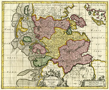
17th-century maps of schleswig-holstein
maps by pieter schenk (i)
17th-century maps of france
history of perche
maps made in the 17th century
berry (ducato)
old county maps of the north riding of yorkshire
maps made in the 17th century
17th-century maps of cheshire
old county maps of cheshire
old maps of piedmont
maps by gerard valck
old maps of capitanata
puglia settentrionale
old county maps of the west riding of yorkshire
17th-century maps of yorkshire
old county maps of the east riding of yorkshire
17th-century maps of yorkshire
17th-century maps of lombardy
17th-century maps of piedmont
17th-century maps of saxony
1690s maps of saxony
maps made in the 17th century
lazio
17th-century maps of nord (department)
maps by gerard valck
17th-century maps of mexico
maps by gerard valck
17th-century maps of sardinia
maps by gerard valck
maps in the library of congress
18th-century maps of sumatra
maps by gerard valck
pieter schenk (i)
eran laor cartographic collection
gerard valck
17th-century maps of bourgogne
maps by gerard valck
17th-century maps of the americas
maps by gerard valck
eran laor cartographic collection
gerard valck
17th-century maps of malta
maps by gerard valck
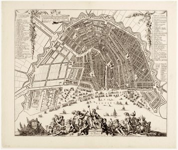
maps in the stadsarchief amsterdam
romeyn de hooghe
17th-century maps of cambridgeshire
old county maps of cambridgeshire
eran laor cartographic collection
gerard valck
eran laor cartographic collection
gerard valck
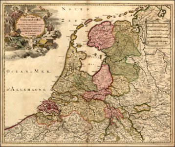
17th-century maps of the netherlands
maps of the wadden sea
maps made in the 18th century
old maps of dauphine
maps of the history of franche-comté
18th-century maps of bourgogne
17th-century maps of the mediterranean sea
maps in the library of congress
maps in the stadsarchief amsterdam
romeyn de hooghe
old maps of southeast asia
maps by gerard valck
old maps of vermandois
maps by gerard valck
old maps of vermandois
maps by gerard valck
maps in the library of congress
1708 maps
maps in the rijksmuseum amsterdam
gerard valck
map of the caspian sea by guillaume delisle (1720s)
maps by gerard valck
old maps of southeast asia
maps by gerard valck
eran laor cartographic collection
gerard valck
maps in the rijksmuseum amsterdam
17th-century celestial maps
maps in the rijksmuseum amsterdam
17th-century celestial maps
maps in the rijksmuseum amsterdam
maps by gerard valck
maps in the rijksmuseum amsterdam
17th-century celestial maps
evert simonsz hamersvelt
salomon rogiers
17th-century maps of saxony
old maps of vogtland
maps of bremen
maps of weser
1 - 100 of 171
Next page
/ 2