Log in
All resources
Create a design
54 Free Artworks of Maps Of Romania
maps of the history of early modern romania
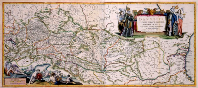
danubius pannonico-mysicus
latin-language maps
17th-century engravings of towns
maps and topographical views by joris hoefnagel
1617 engravings
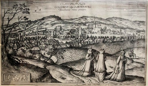
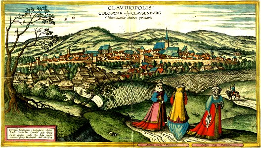
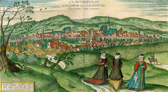
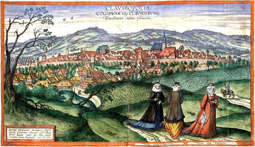
engravings of cluj-napoca
fortification of cluj-napoca
1617 in romania
1617 in cluj-napoca
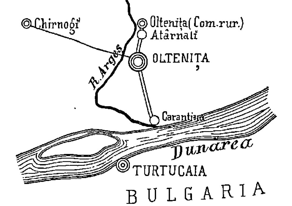
quarantine facilities in romania
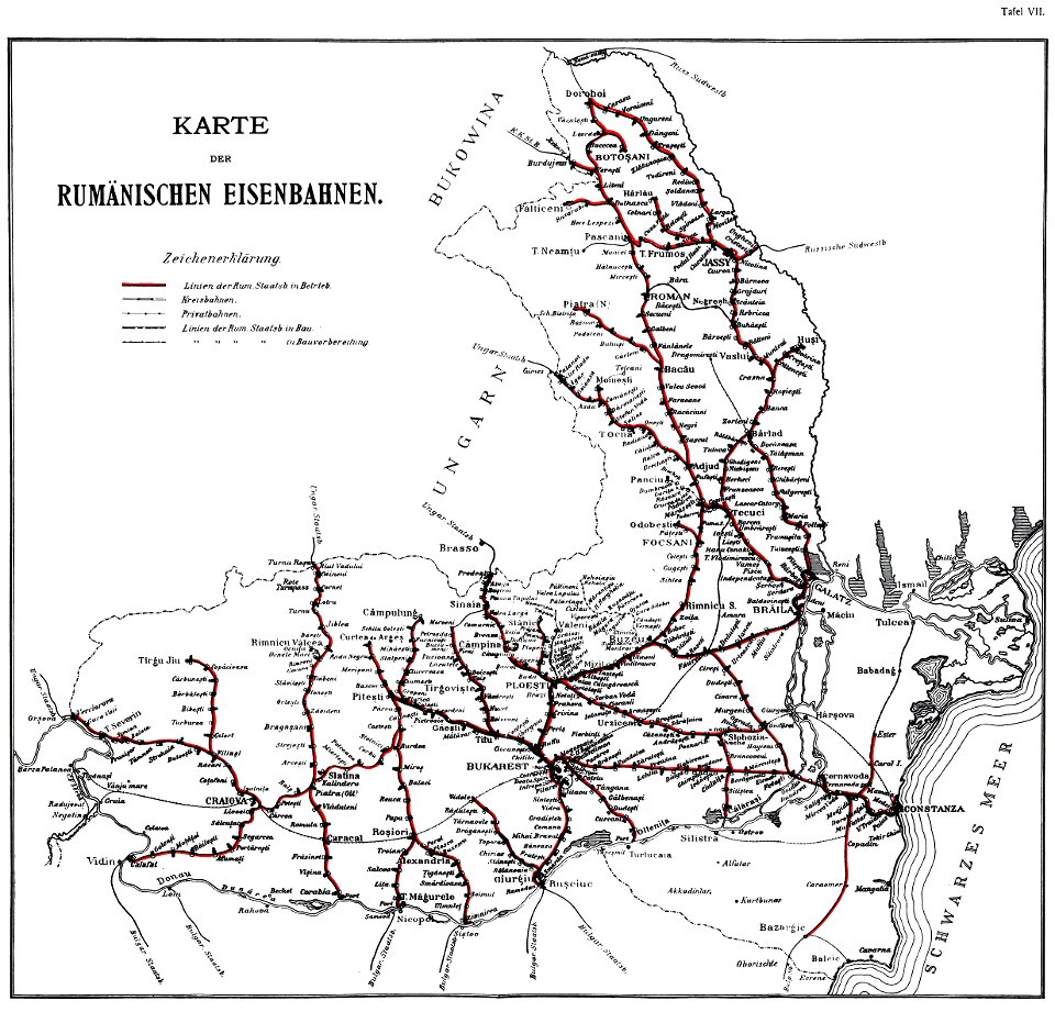
1895 in romania
old maps of romania
old maps of moldova
coats of arms on maps
1750 maps
hand-drawn maps and views of world war i battlefields by h.m.
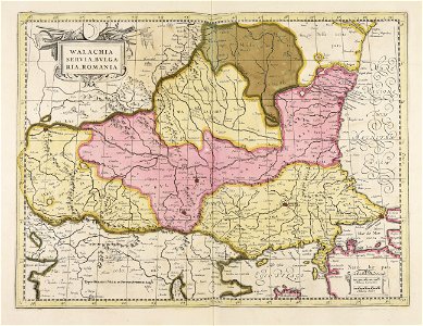
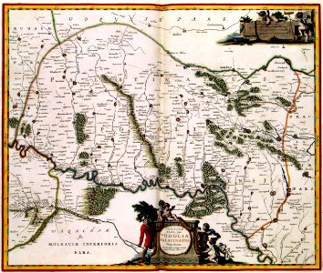
old maps of wallachia
maps of romania
gerard valck
history of rail transport in romania
enzyklopädie des eisenbahnwesens
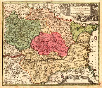
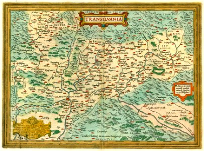
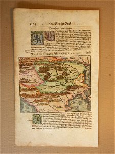
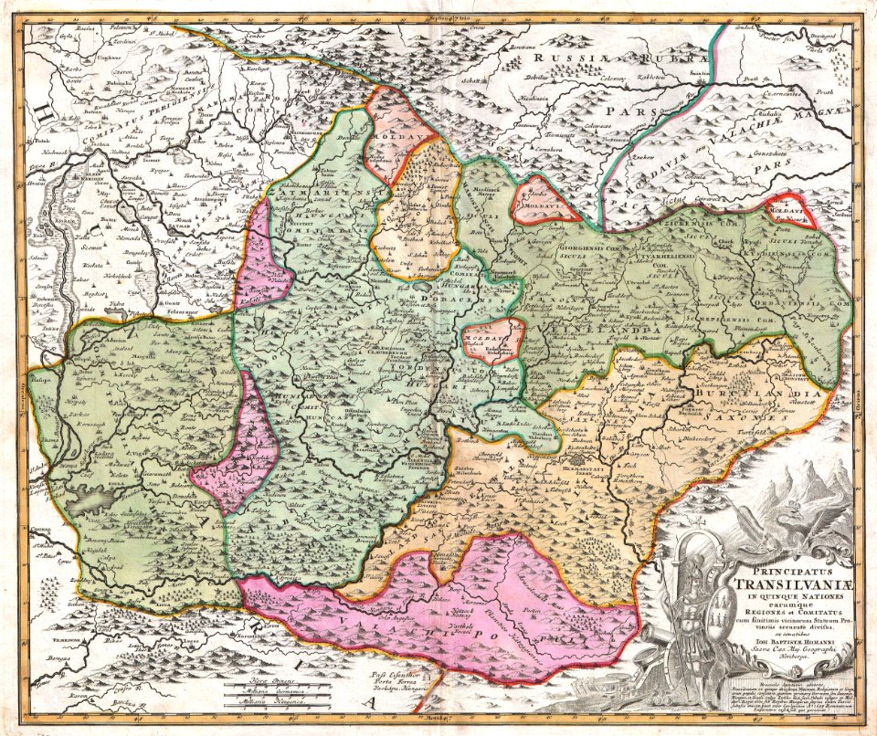
1612 maps of transylvania
maps by abraham ortelius
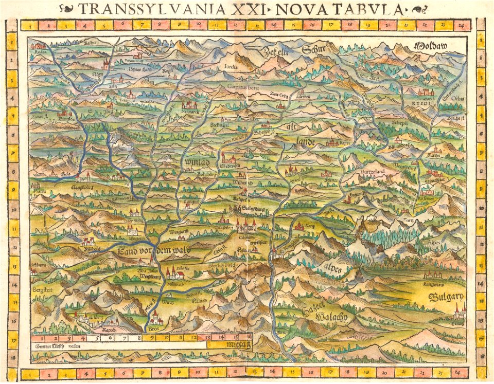
cosmographia (1600) by sebastian münster
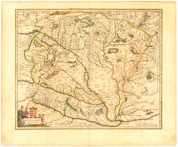
1600 maps of transylvania
maps by sebastian münster
1552 maps of ukraine
old maps of the peloponnese
maps by coronelli
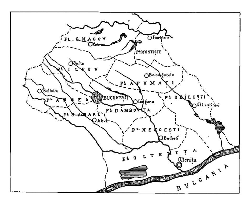
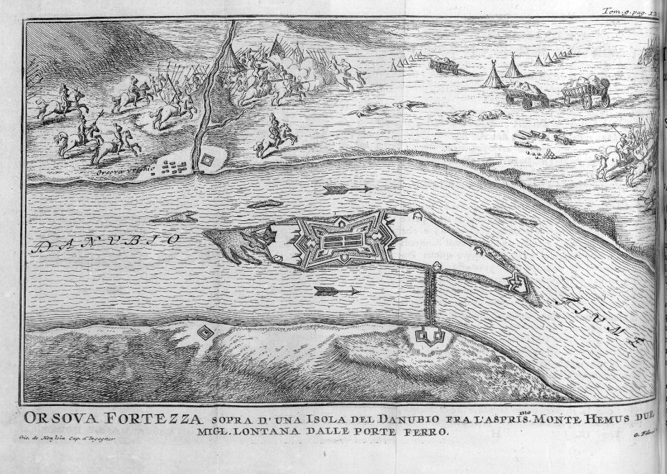
history of oltenița
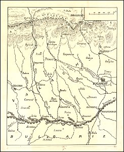
ilfov
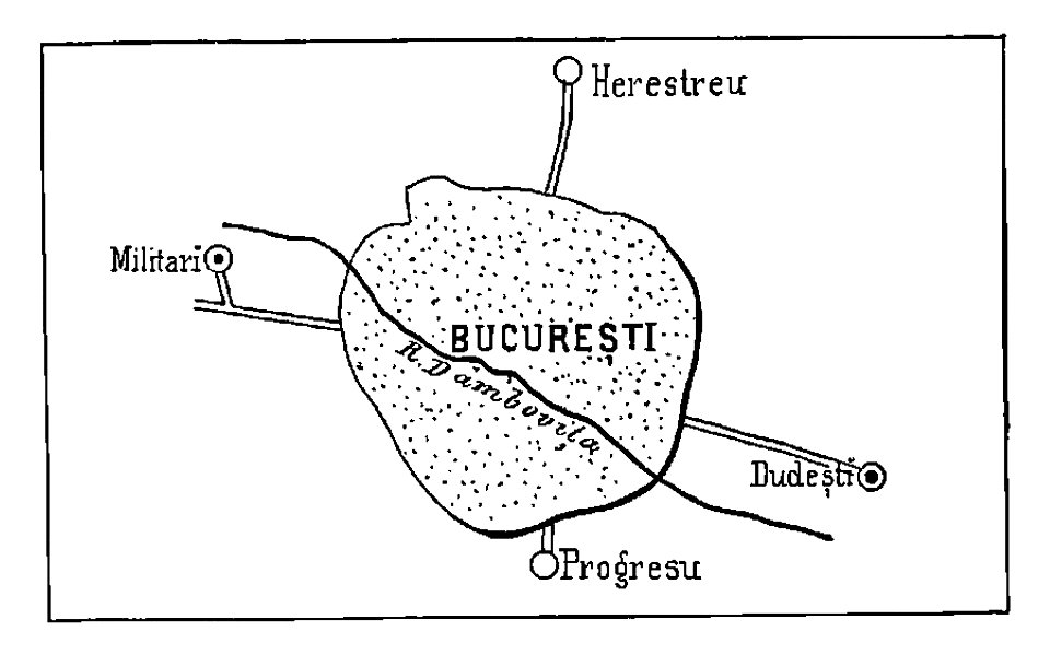
bucharest
military
johann baptist homann
latin-language maps
17th-century engravings of towns
romania in the 17th century
maps in the library of congress
1720 maps
maps with cartouches
atlas van der hagen
maps in the library of congress
1720 maps
derivatives of the coats of arms of the árpád family
historical national coats of arms of hungary
romania in the 17th century
cluj-napoca
old maps of the danube
french-language maps
maps with cartouches
atlas van der hagen
maps and topographical views by joris hoefnagel
17th-century engravings of towns
maps and topographical views by joris hoefnagel
17th-century engravings of towns
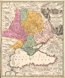
danubius pannonico-mysicus
1720s maps of transylvania
danubius pannonico-mysicus
1720s maps of transylvania
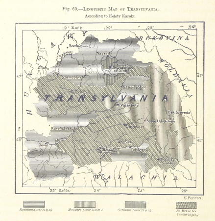
historical maps of ethnic groups in romania
nouvelle géographie universelle
nouvelle géographie universelle, vol. i
maps showing 19th-century history
romania in the 17th century
danubius pannonico-mysicus
maps by jan janssonius
1650s maps of romania
danubius pannonico-mysicus
1726 maps
1660s maps of the ottoman empire
old maps of the danube
danubius pannonico-mysicus
drobeta
mannerism,high renaissance
stamps of romania, 2006
14th-century maps of the black sea
catalan atlas
stamps of romania, 2006
post-impressionism
eran laor cartographic collection
giovanni maria cassini
national museum of maps and rare books, bucharest
maps by abraham ortelius
atlas maior, vol 2 (sweden, russia, poland, eastern europe, and greece) - joan blaeu, 1667 - bl 114.h(star).2
17th-century maps of romania
maps of wallachia by gerardus mercator
atlas novus (blaeu)
locator maps of countries of europe (gray and green scheme)
maps of tintin
latin-language maps
bologna ptolemy
maps by john cary
1799 maps
maps by john cary
1836 maps
maps of wallachia by gerardus mercator
maps by willem and johannes blaeu
maps of wallachia by gerardus mercator
maps by willem and johannes blaeu
eran laor cartographic collection
gerard valck
maps from the earth and its inhabitants, vol. iii
linguistic maps of the balkans
johannes honterus
renaissance
maps of cluj-napoca by braun & hogenberg
bibliothèque nationale de france
17th-century maps of transylvania
maps by willem and johannes blaeu
cartography
maps
maps of oradea by braun & hogenberg
bibliothèque nationale de france
voyage dans la russie méridionale et la crimée (1840-1842) par anatolii nikolaevich demidov
library of congress
map of europe by guillaume delisle (1700)
university of washington
1 - 54 of 54
/ 1


![Varadinum, vulgo Gros Wardein, Transilvaniae oppidum, cum munitissimo propugnaculo [...] / Communicavit Georgius Houfnaglius, 1635](https://cdn.creazilla.com/illustrations/10000526818/varadinum-vulgo-gros-wardein-transilvaniae-oppidum-cum-munitissimo-propugnaculo-communicavit-georgius-houfnaglius-1635-sm.webp)

