Log in
All resources
Create a design
38 Free Artworks of Old Maps Of Cities In The Netherlands
maps in the rijksmuseum amsterdam
old maps of utrecht (city)
old maps of breda, netherlands
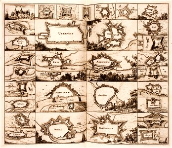
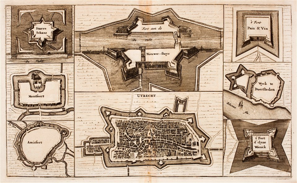
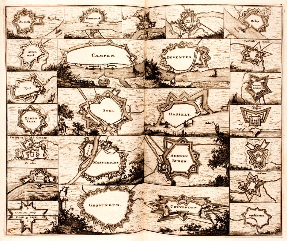
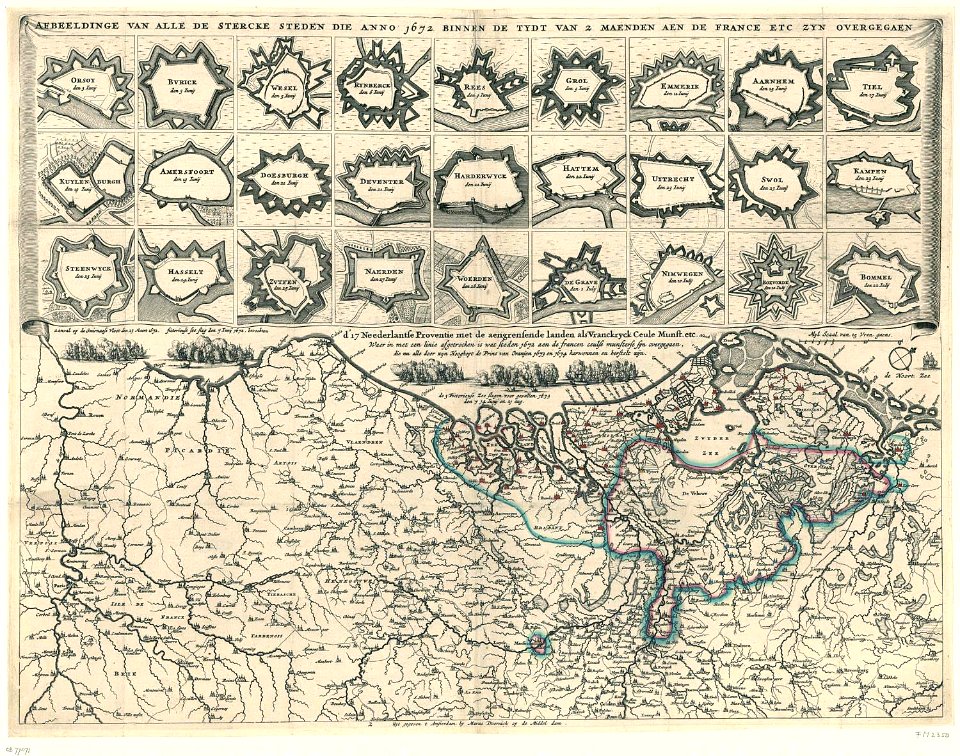
fortifications in the netherlands
maps by willem and johannes blaeu
old maps of deventer
17th-century fortress plans
prints of cartouches in the rijksmuseum amsterdam
old maps of culemborg
old maps of harderwijk
1639 maps
1670 maps
old maps of cities in the netherlands
maps by jacob van deventer
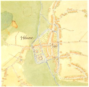
elburg
wesel
maps by willem and johannes blaeu
hudson valley
fortifications in the netherlands
wijk bij duurstede
netherlands
gorredijk
büderich (wesel)
netherlands
netherlands
the hague
topographical paintings in the centraal museum
16th-century paintings in the centraal museum
17th-century paintings of soldiers
lambert de hondt (ii)
maps made in the 17th century
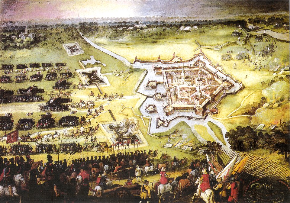
siege of groenlo
sieges of the eighty years' war
conflicts in 1583
gemeente atlas van nederland - groningen
old maps of groningen (city)
1866 in the netherlands
maps of almelo
old maps of grave, netherlands
atlas van loon
gemeente atlas van nederland - overijssel
netherlands in the 1860s
media from atlas of mutual heritage on dutch east india company
1665
1645 maps of belgium
tournaisis
maps by willem and johannes blaeu
old maps of breda, netherlands
gemeente atlas van nederland - north holland
old maps of haarlem
paintings of battles by peter snayers
cityscapes in art
map of maastricht by willem and johannes blaeu (1649)
city gates in maastricht
maps by willem and johannes blaeu
old maps of dordrecht
old maps of breda, netherlands
adriaen jan bogaerts
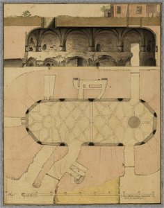
collection technical drawings from het utrechts archief
fortifications in the netherlands
old maps of groningen (city)
baroque
colonial history of the united states
old maps of new york (state)
old maps of utrecht (city)
baroque
prints of cartouches in the rijksmuseum amsterdam
maps in the rijksmuseum amsterdam
fortifications of charleroi
old maps of charleroi
prints of cartouches in the rijksmuseum amsterdam
maps in the rijksmuseum amsterdam
drawings by pieter jansz. saenredam in the beeldcollectie van de gemeente haarlem
siege of haarlem
maps in the library of congress
1849 maps
maps in the rijksmuseum amsterdam
old maps of vlissingen
maps in the rijksmuseum amsterdam
baroque
prints by claes jansz. visscher (ii) in the rijksmuseum amsterdam
siege of breda 1624-1625
dutch 17th-century prints in the rijksmuseum amsterdam
siege of breda 1624-1625
prints published by claes jansz. visscher (ii) in the rijksmuseum amsterdam
maps in the rijksmuseum amsterdam
1 - 38 of 38
/ 1