Log in
All resources
Create a design
512 Free Artworks of Maps Of Sieges
atlas van loon
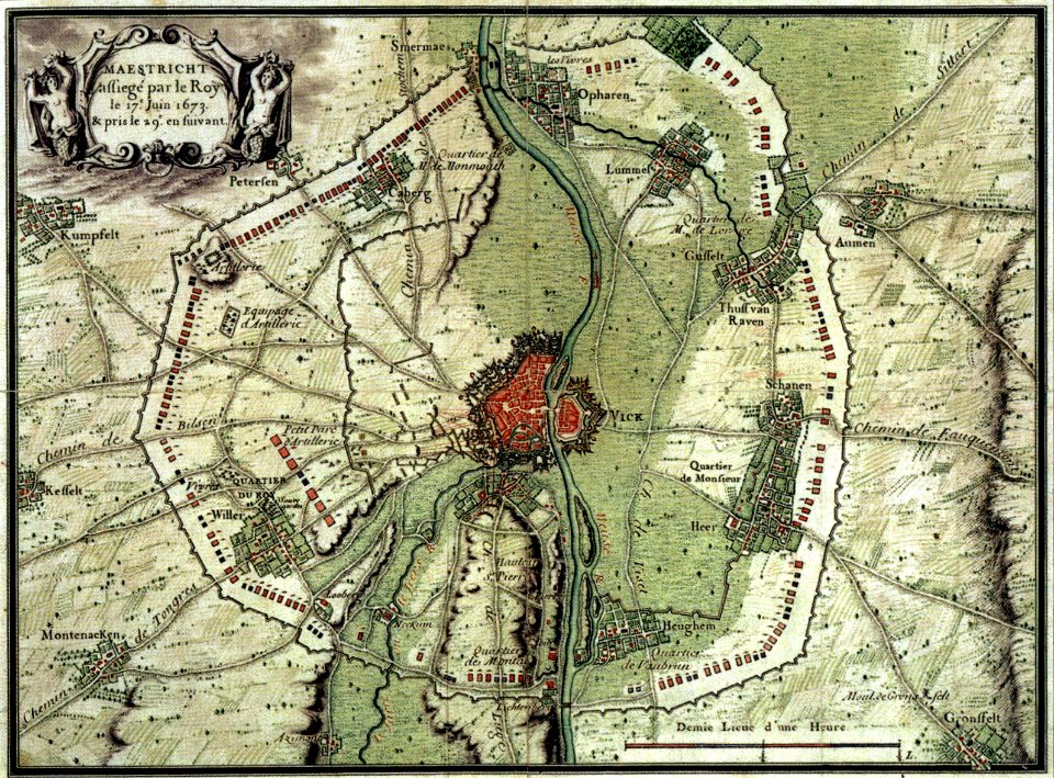
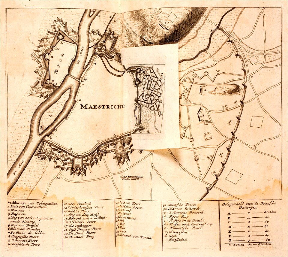
17th-century maps of maastricht
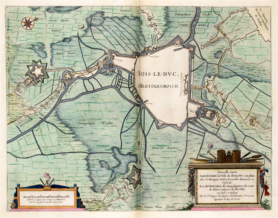
maps by willem and johannes blaeu
prints from dankaerts historis at the peace palace library
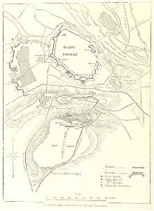
17th-century fortress plans
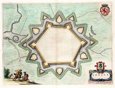
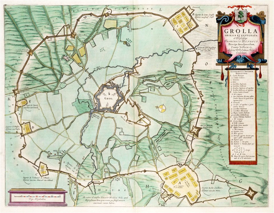
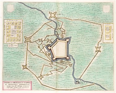
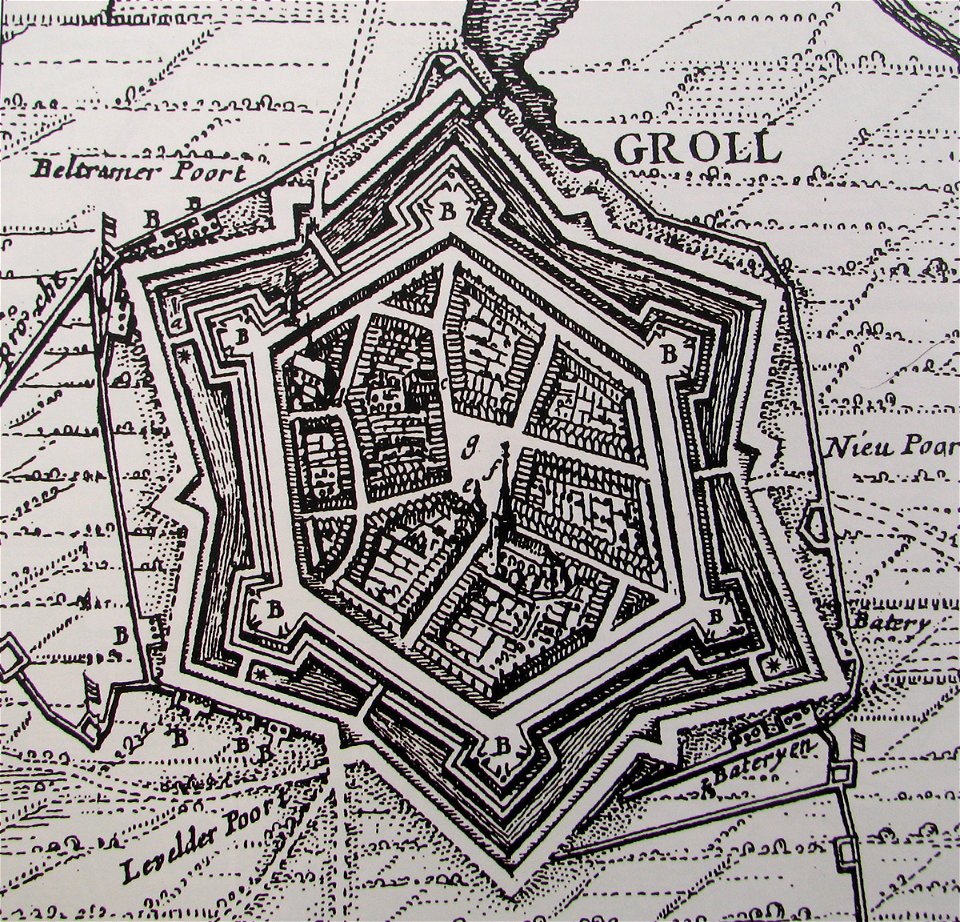
old maps of groenlo
dutch 17th-century prints in the rijksmuseum amsterdam
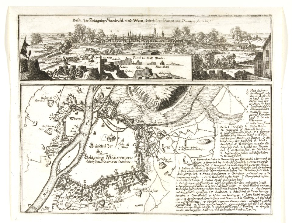
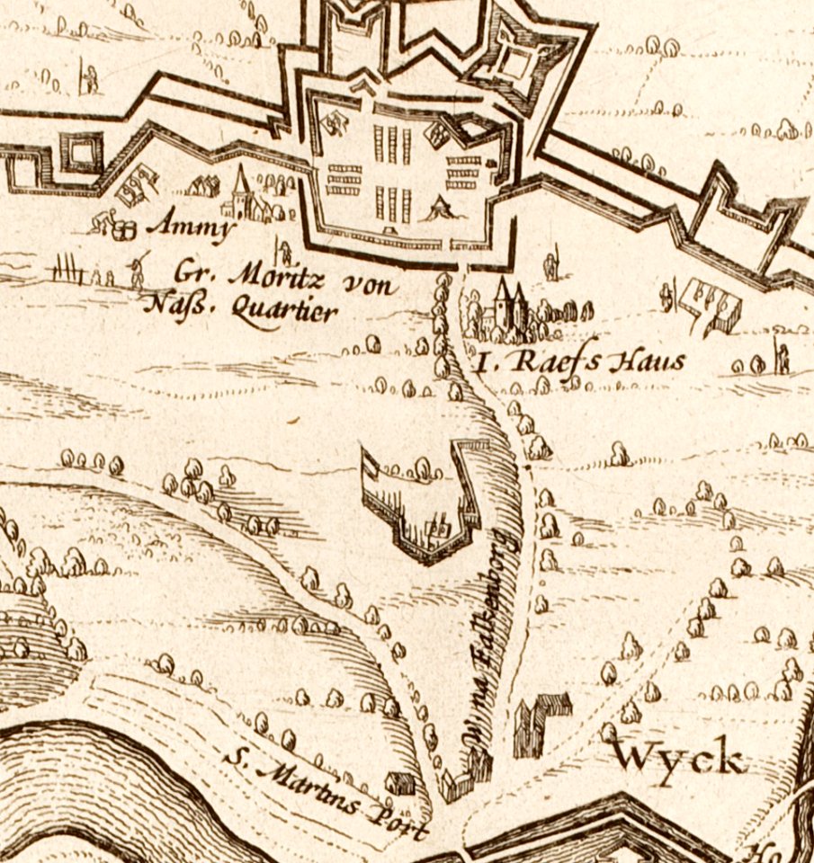
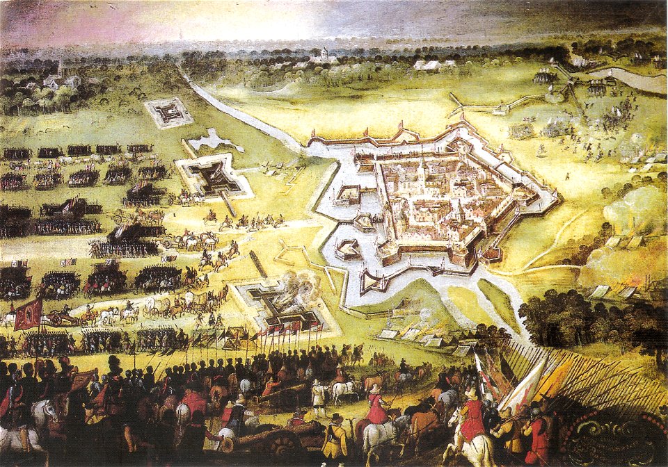
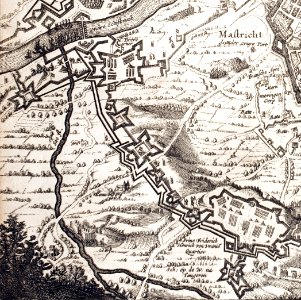
siege of maastricht (1632)
circumvallation
sconces in the netherlands
european interpretation of islamic art
old maps of baghdad
maps of hesdin city walls
circumvallation
old maps of the american revolution
siege of savannah (1779)
maps by willem and johannes blaeu
circumvallation
old maps of the hague
siege of leiden
maps by willem and johannes blaeu
ravelins
maps from the mechanical curator collection
british battles on land and sea
hand-drawn maps and views of world war i battlefields by h.m.
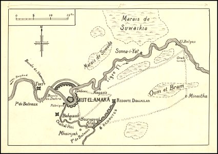
siege of kut
maps from the mechanical curator collection
british battles on land and sea
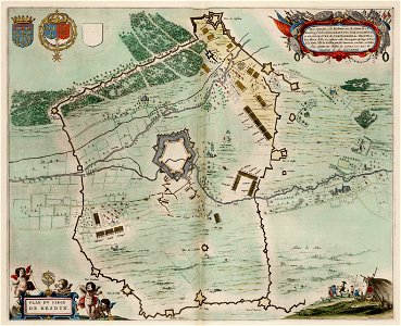
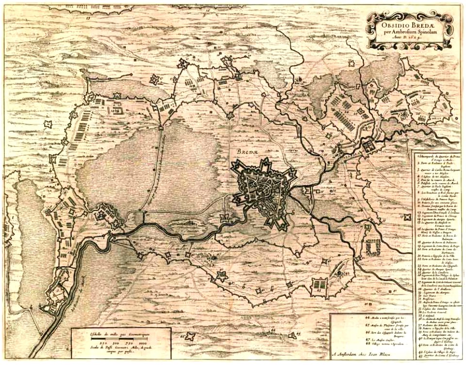
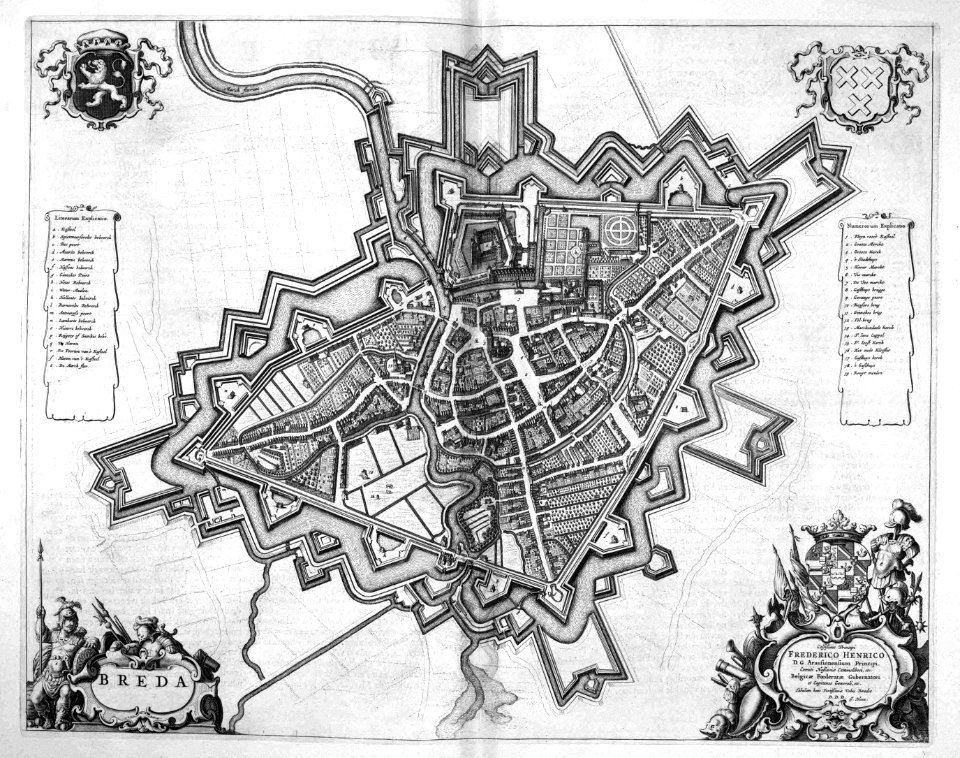
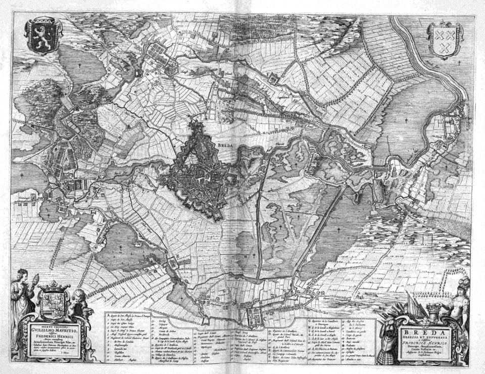
coats of arms of breda
netherlands
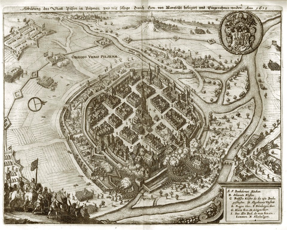
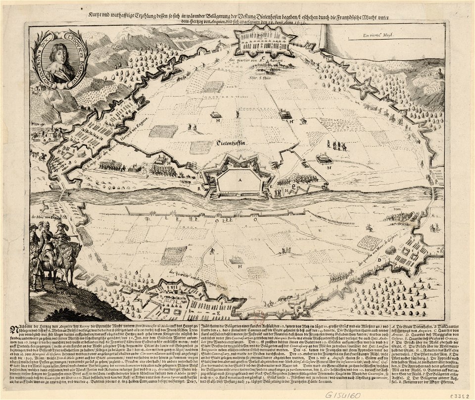
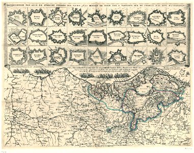
maps of battles of the thirty years' war
1618
maps of paris from the norman b. leventhal map center
siege of paris, 1870-1871
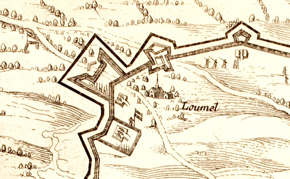
circumvallatielinie (groenlo)
coats of arms on maps
17th-century maps of maastricht
maps of the franco-dutch war
17th-century fortress plans
military trenches
maps by willem and johannes blaeu
circumvallation
prints in the royal collection of the united kingdom
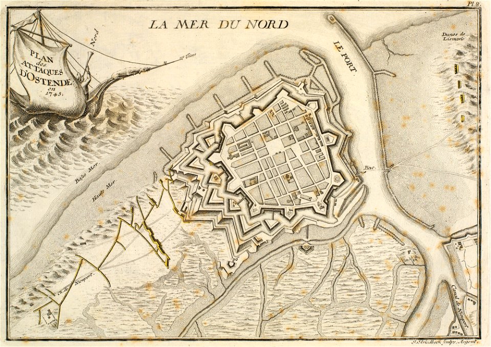
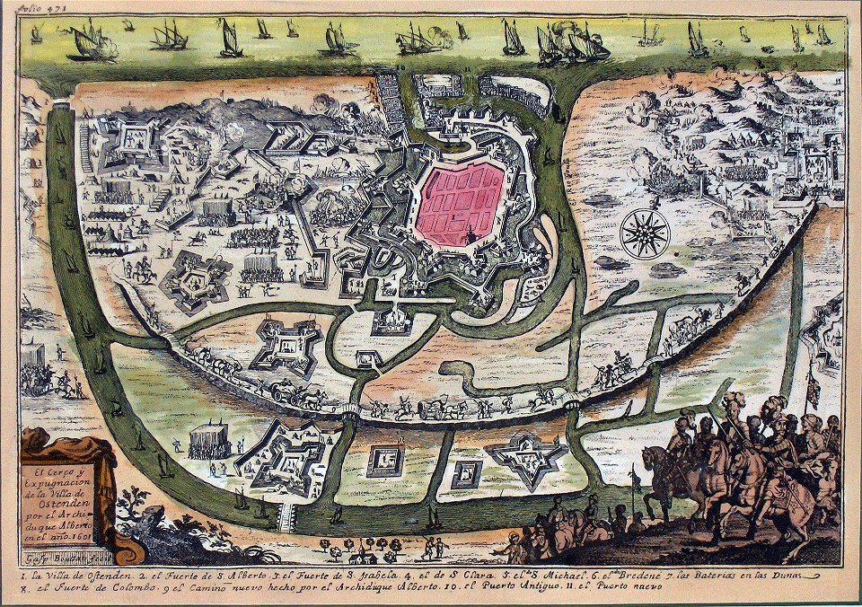
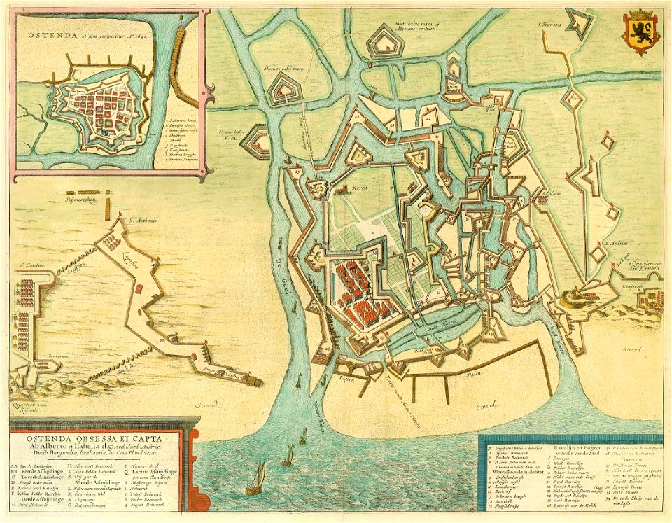
history of ostend
old maps of the carolingian empire
old maps of europe
western pomerania
maps of stralsund
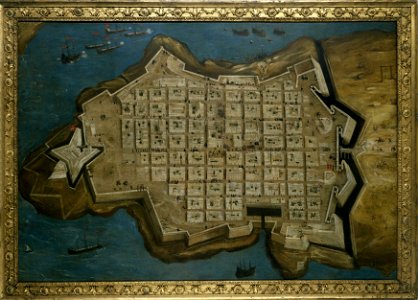
great siege of malta paintings at the royal museums greenwich
old maps of valletta
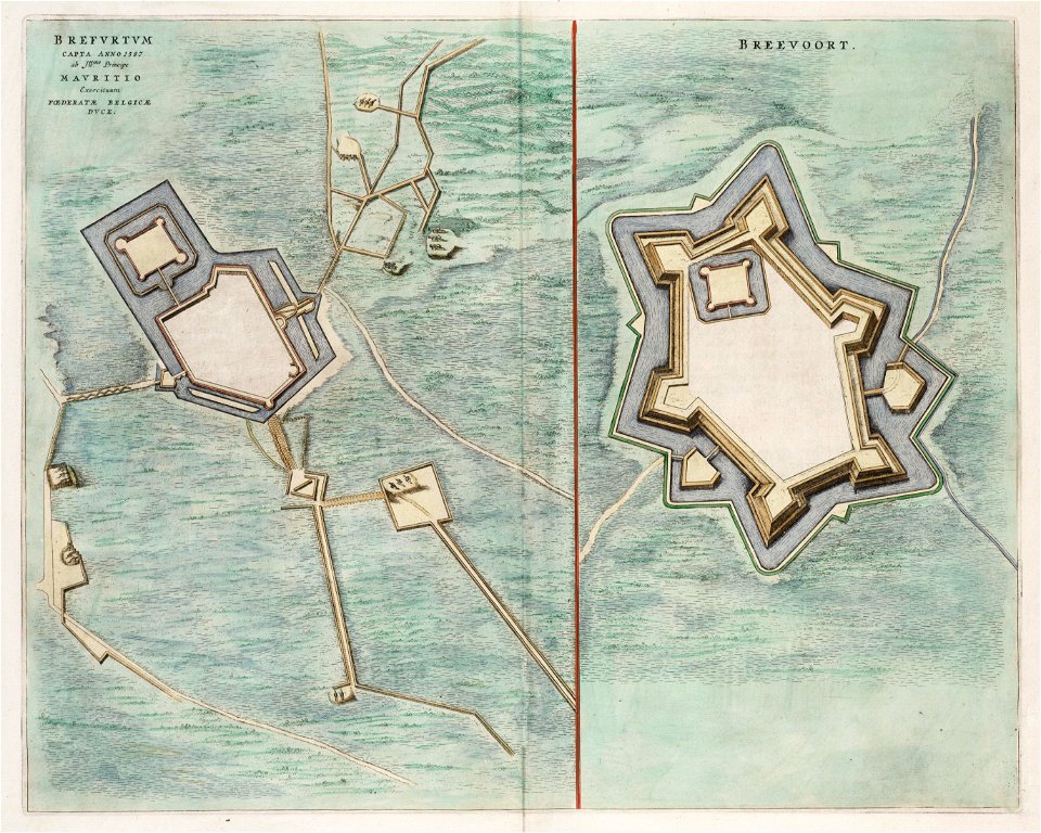
old maps of bredevoort
atlas van loon
atlas van loon
atlas beudeker
siege
leith
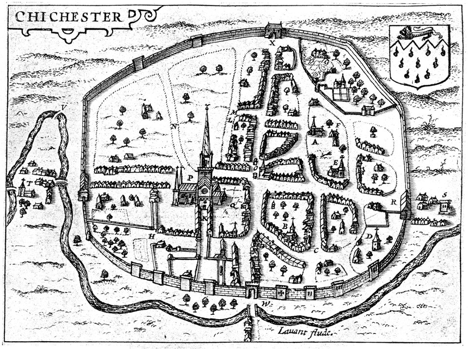
west sussex
chichester
siege of vienna
wien museum
siege of ostend
low country
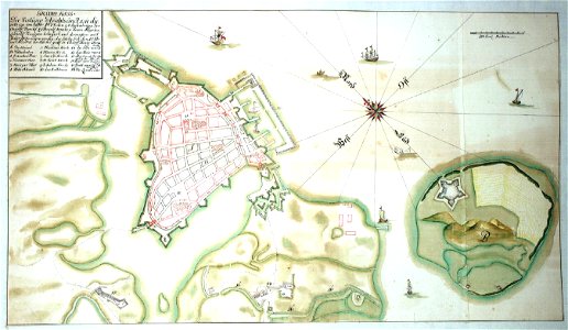
17th-century maps of schleswig-holstein
tönning
dutch 17th-century prints in the rijksmuseum amsterdam
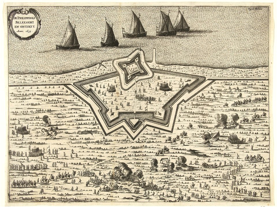
old maps of the philippines
batavia castle
1753
old maps of bredevoort
pikemen
maps by willem and johannes blaeu
1649
maps by willem and johannes blaeu
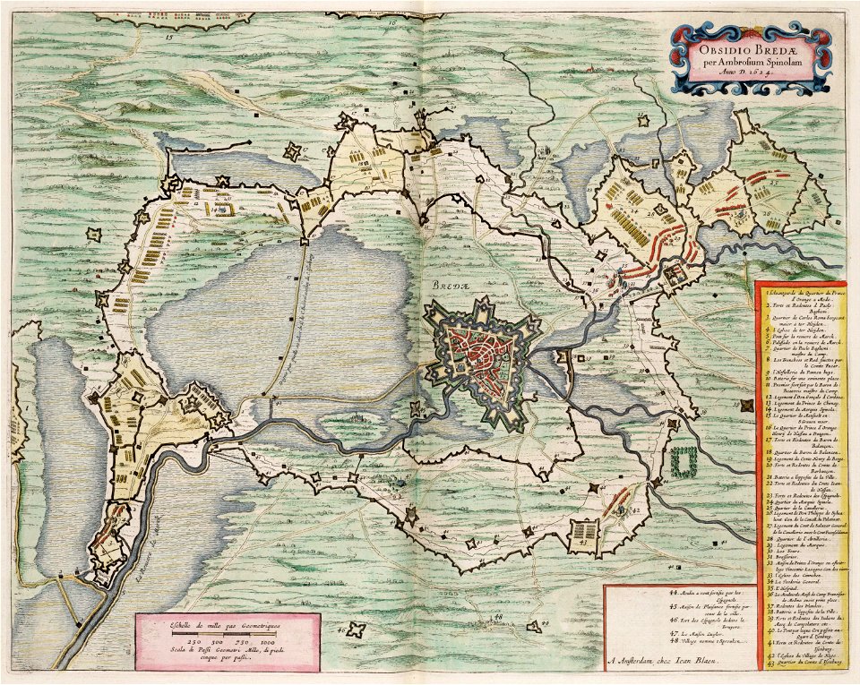
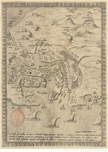
siege of breda 1624-1625
university of toronto wenceslas hollar digital collection
maps by wenzel hollar
17th-century maps of maastricht
maps of the franco-dutch war
flemish 17th-century prints in the rijksmuseum amsterdam
frans hogenberg
claes jansz. visscher (ii)
circumvallation
history of eindhoven
eindhoven
engravings by matthäus merian
kassel
german prints in the rijksmuseum amsterdam
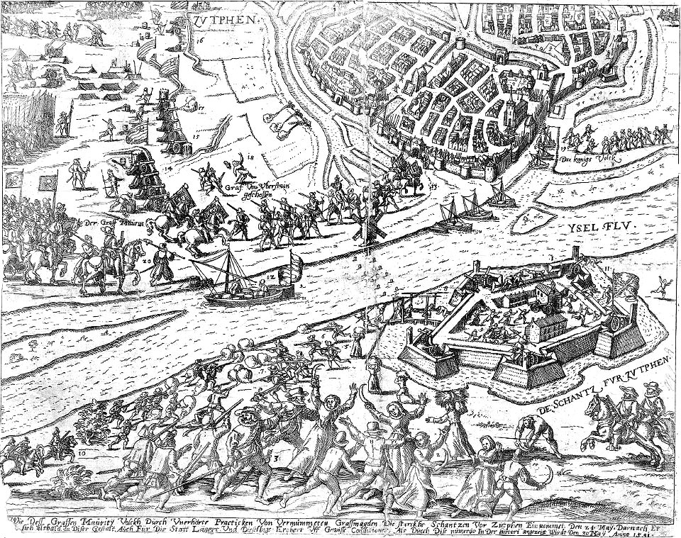
old maps of zutphen
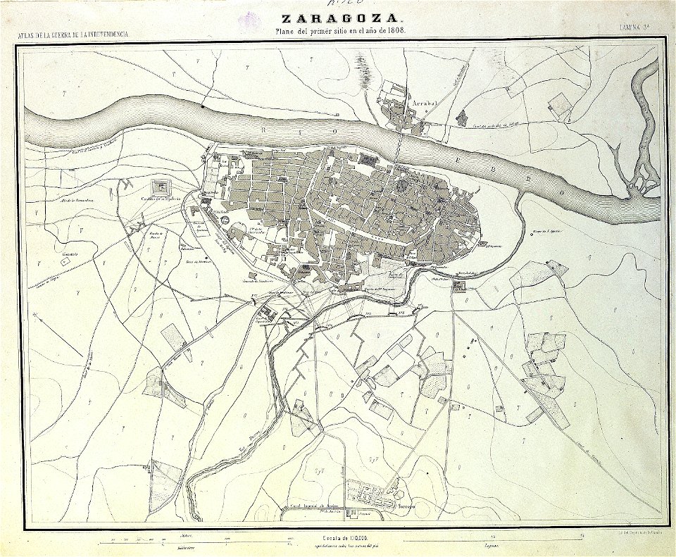
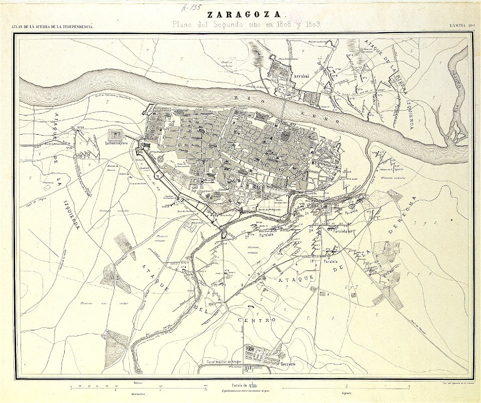
sitio de zaragoza (1808)
1868
claes jansz. visscher (ii)
siege
engravings of theatrum europaeum
1645 maps
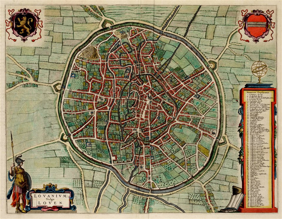
old maps of leuven
atlas van loon
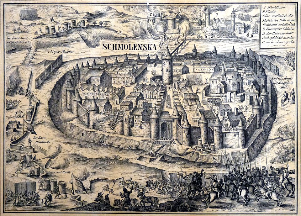
old maps of smolensk
willem hondius
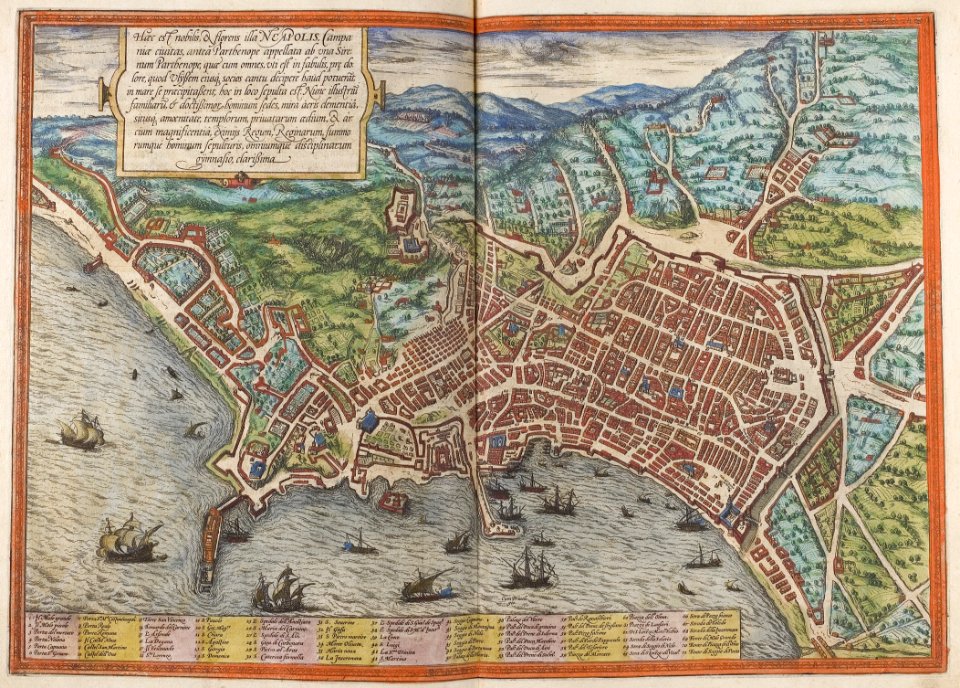
old maps of naples
braun & hogenberg
maps of thionville city walls
louis
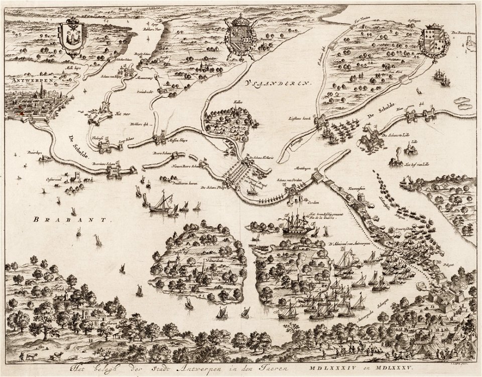
antwerp
hoboken
second siege of zaragoza
1868
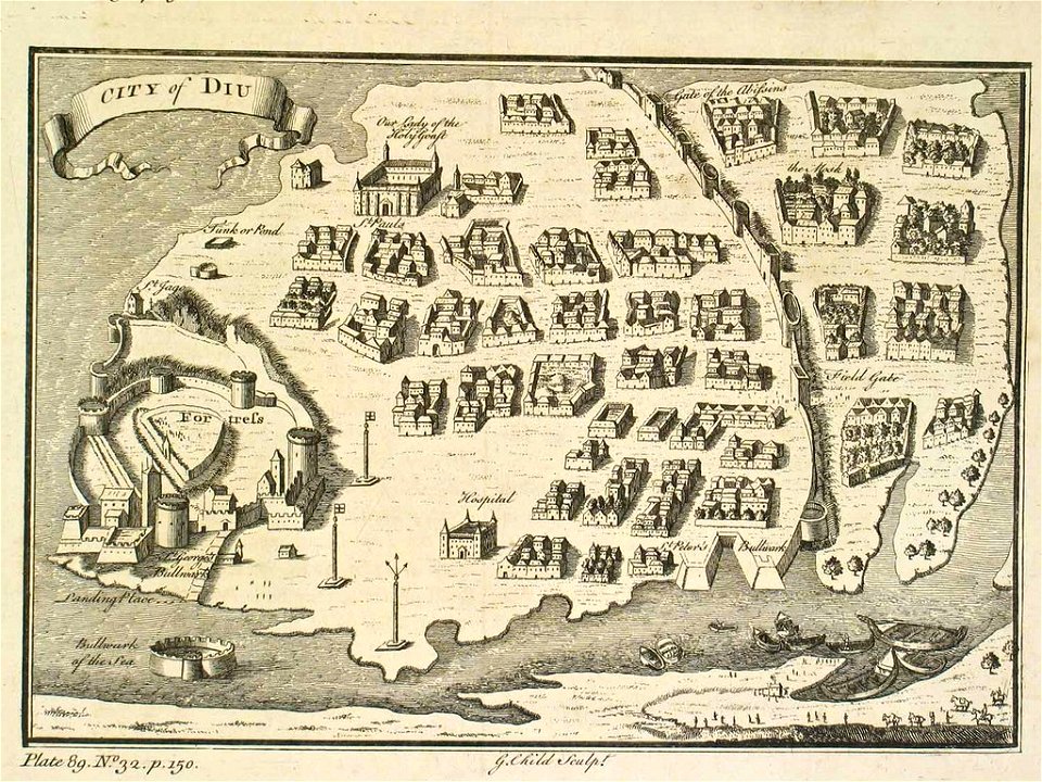
india
diu
17th-century maps of maastricht
pontoon bridge
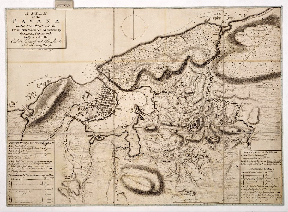
morro castle (havana)
london
broad street
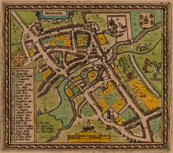
reading
great siege of malta
old maps of malta
old maps of breda
atlas beudeker
dutch 17th-century prints in the rijksmuseum amsterdam
ijssel
university of toronto wenceslas hollar digital collection
english civil war
17th-century maps of maastricht
limmel (maastricht)
claes jansz. visscher (ii)
1627
maps
land
17th-century maps of maastricht
amby (maastricht)
flemish 16th-century prints in the rijksmuseum amsterdam
1599
17th-century fortress plans
cityscapes in art
paintings of windmills
boats in art
büderich (wesel)
netherlands
prints from dankaerts historis at the peace palace library
17th-century maps of maastricht
images from akg-images
siege of vienna
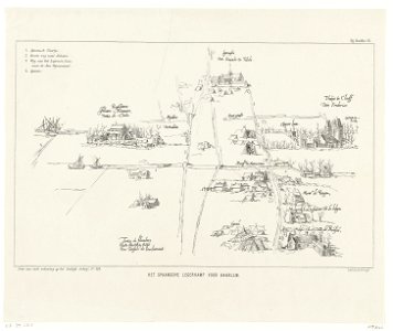
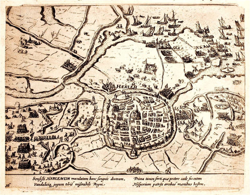
history of haarlem
huis ter kleef
old maps of gibraltar
history of gibraltar
battle of the alte veste
1642 works in germany
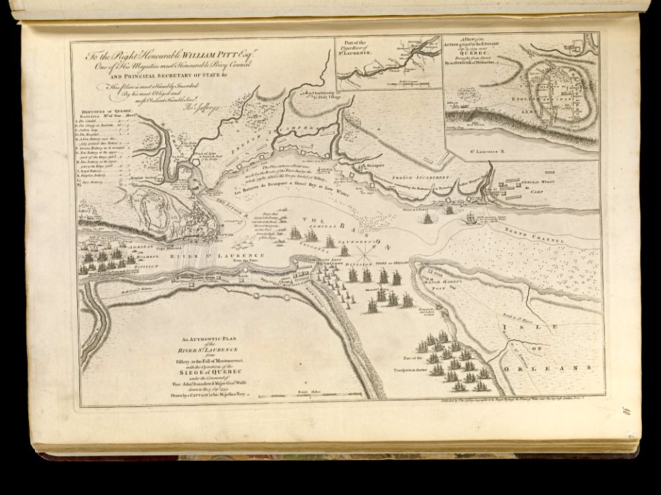
maps of the battle of the plains of abraham
1768 maps
17th-century maps of maastricht
geography of maastricht
dutch 17th-century prints in the rijksmuseum amsterdam
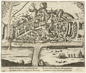
history of neuss
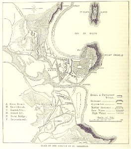
siege of the acropolis (1687)
old maps of athens
history of haarlem
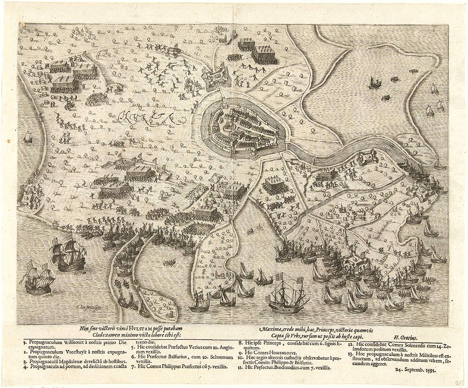
siege of haarlem
johann baptist homann
maps
old maps of bredevoort
1597
architectural prints by wenzel hollar
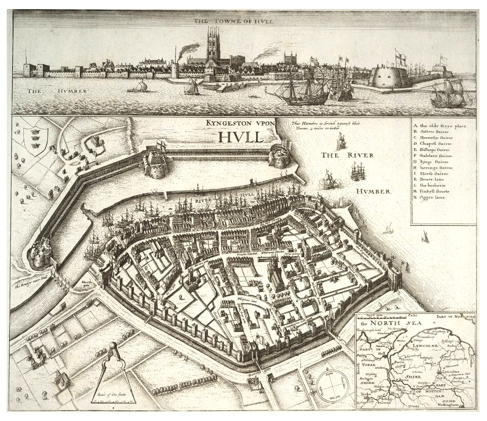
fortifications of kingston upon hull
battles involving brandenburg
sieges in 1686
dutch 17th-century prints in the rijksmuseum amsterdam
zeeland in art
old maps of slovakia
great turkish war
collections de la bibliothèque nationale et universitaire de strasbourg
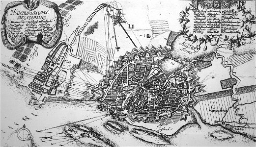
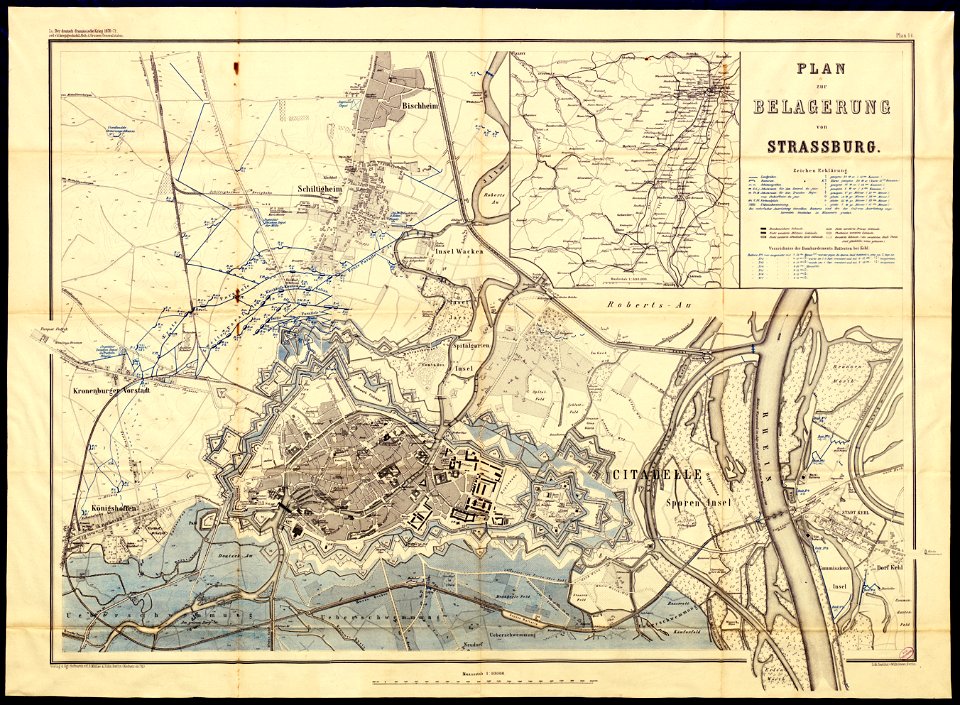
siege of strasbourg
17th-century maps of maastricht
maps of the franco-dutch war
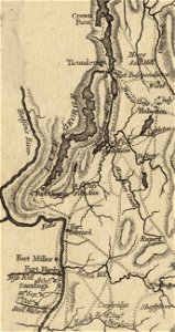
fort ticonderoga
john burgoyne
maps by willem and johannes blaeu
17th-century fortress plans
17th-century maps of maastricht
maastricht
archduke of austria
albert vii
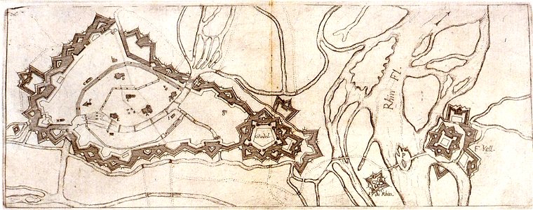
history of rhine river in germany
vauban
prints from manesson travaux de mars at the peace palace library
artillery of the ottoman empire
maps showing history
corfu
netherlands
the hague
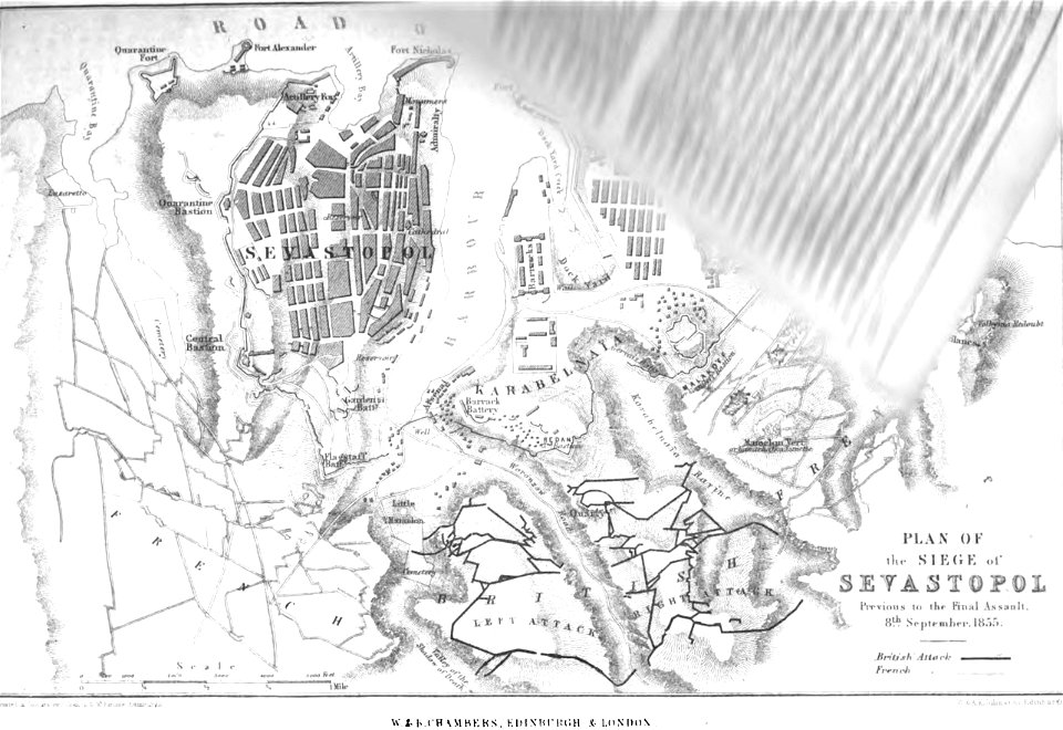
pictorial history of the russian war 1854-5-6 by george dodd
old maps of sevastopol
claes jansz. visscher (ii)
waal
french prints in the rijksmuseum amsterdam
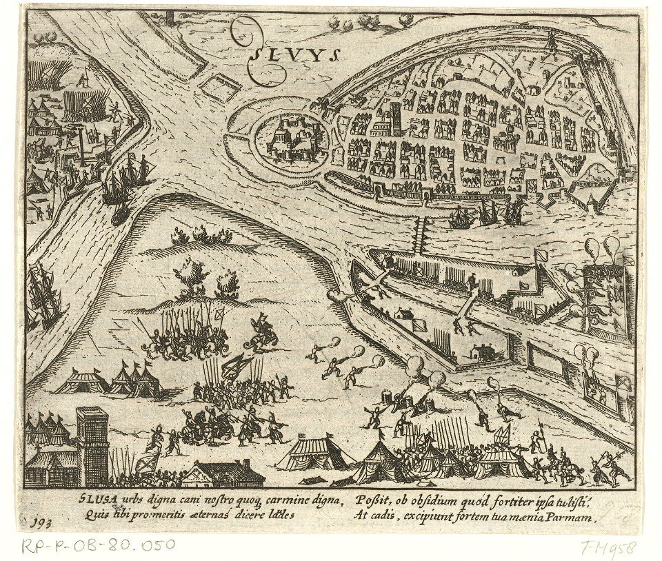
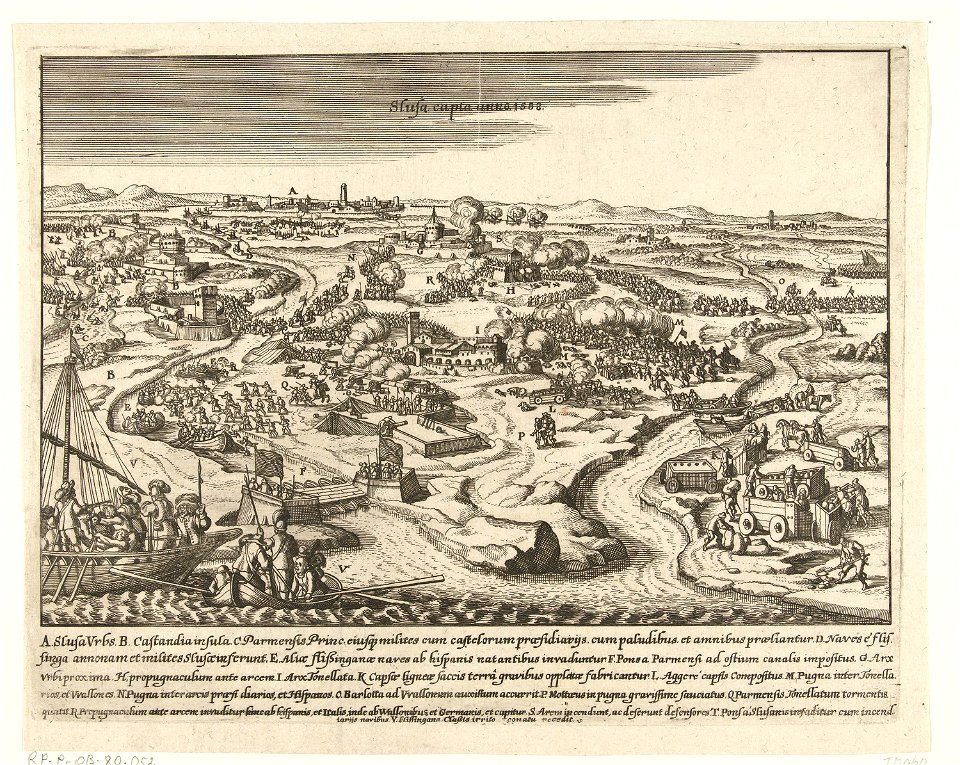
sluis
17th-century maps of maastricht
maps of the franco-dutch war
pictorial history of the russian war 1854-5-6 by george dodd
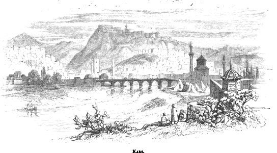
old pictures and maps of kars
old maps of goa
1596
old maps of breda
atlas beudeker
fort zeelandia, taiwan in art
siege of fort zeelandia
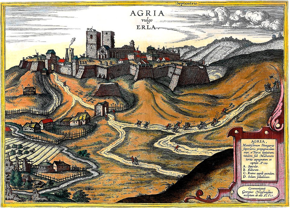
maps and topographical views by joris hoefnagel
eger
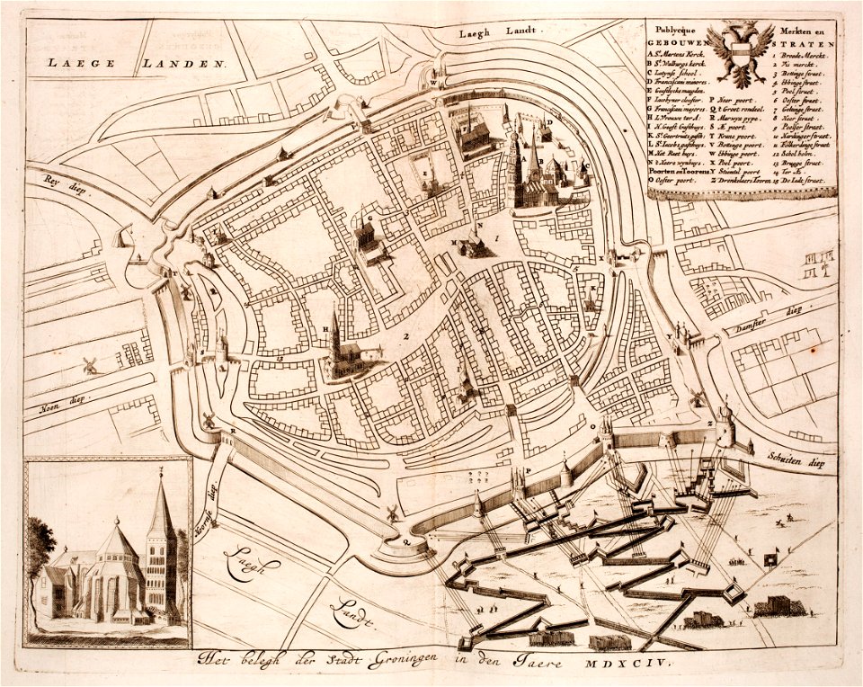
old maps of groningen (city)
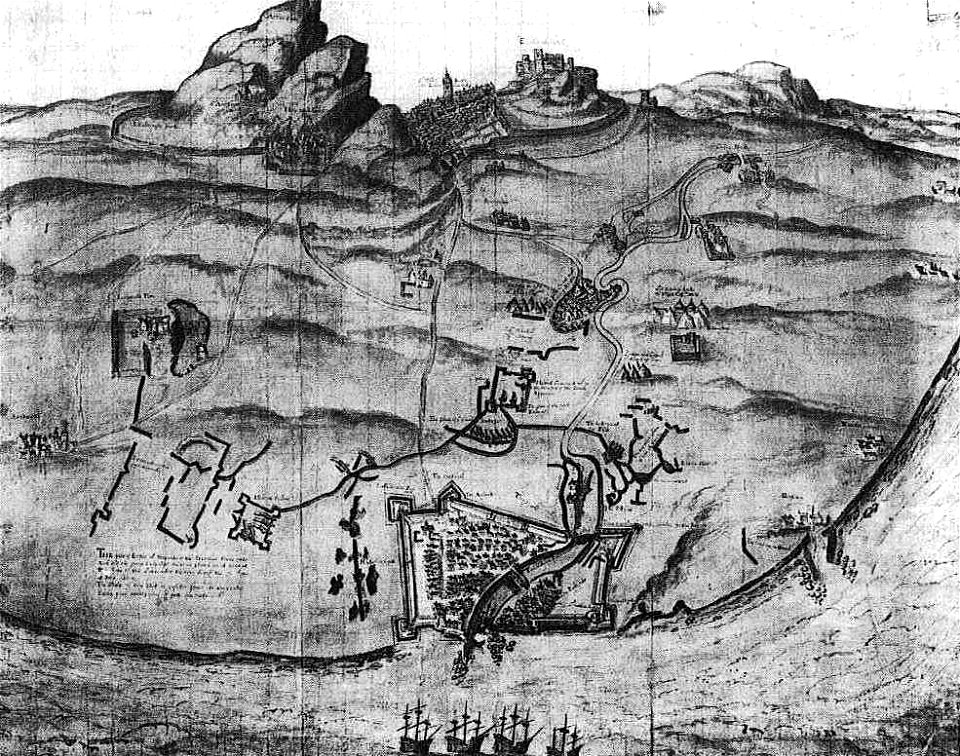
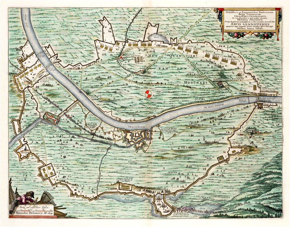
siege of groningen (1594)
1 - 100 of 512
Next page
/ 6