Log in
All resources
Create a design
157 Free Artworks of Maps Of Leiden
maps in the rijksmuseum amsterdam
old maps of leiden
maps by carolus allard
cornelius aurelius world map
maps by willem and johannes blaeu
leiden gunpowder disaster
media contributed by erfgoed leiden en omstreken
collections of erfgoed leiden
abraham allard
prints by reinier vinkeles in the rijksmuseum amsterdam
maps by willem and johannes blaeu
atlas van loon
joan blaeu
old map
old maps of the hague
siege of leiden
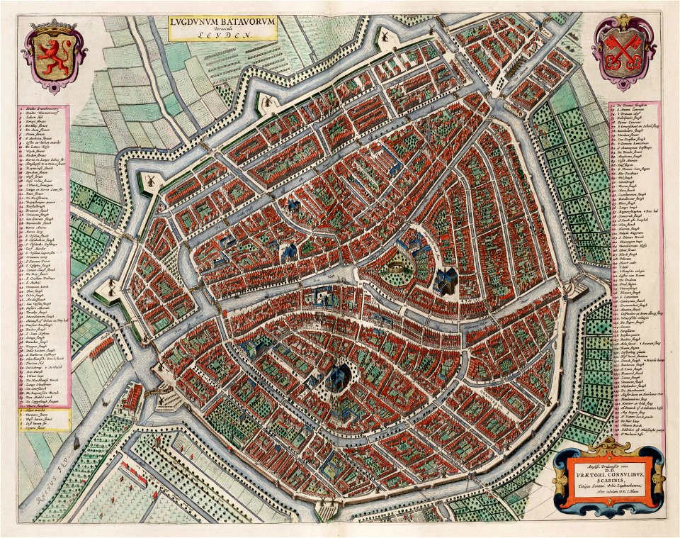
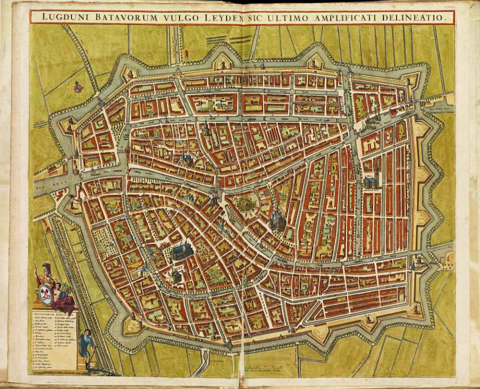
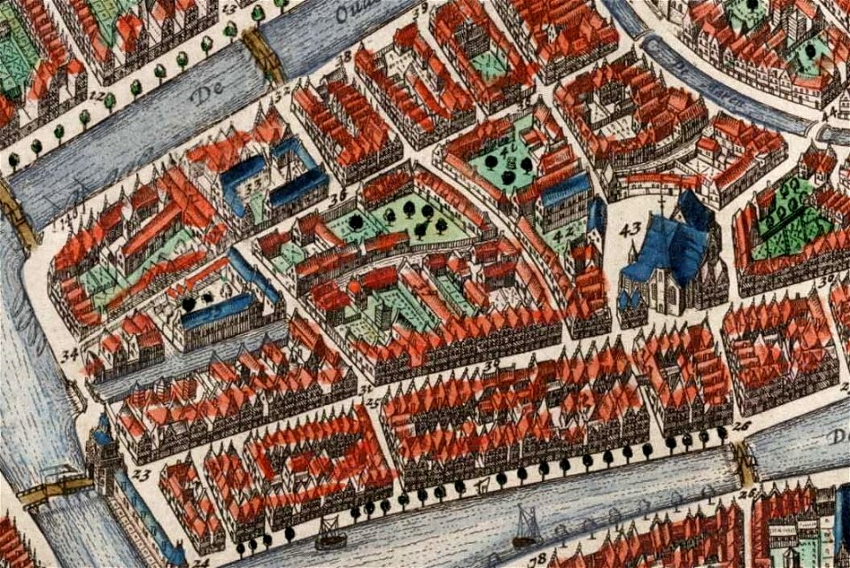
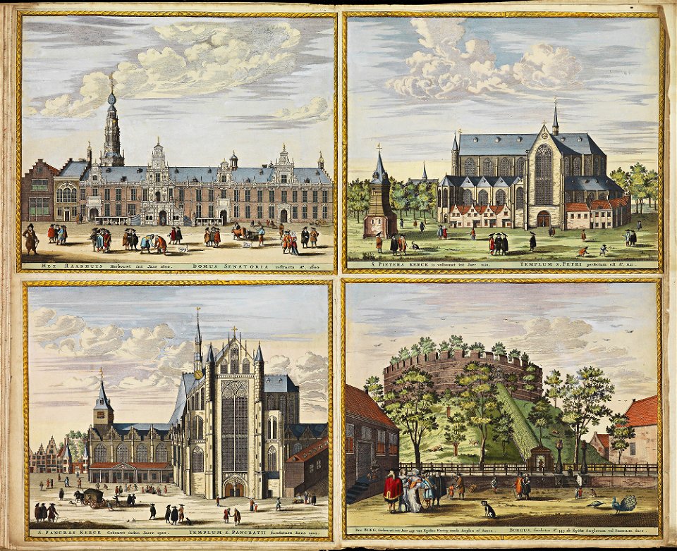
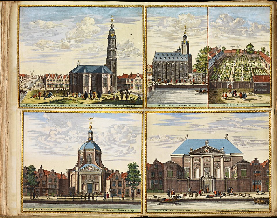
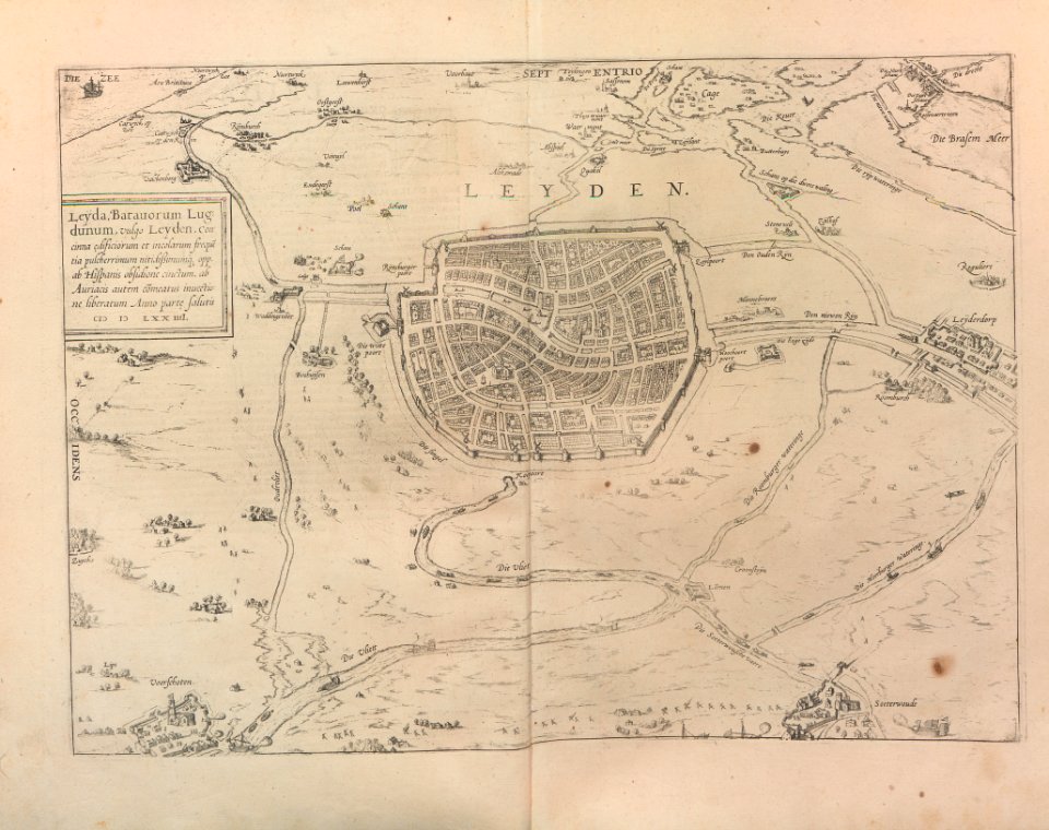
old maps of leiden
atlas de wit 1698
old maps of leiden
atlas de wit 1698
frederick de wit
atlas de wit 1698
frederick de wit
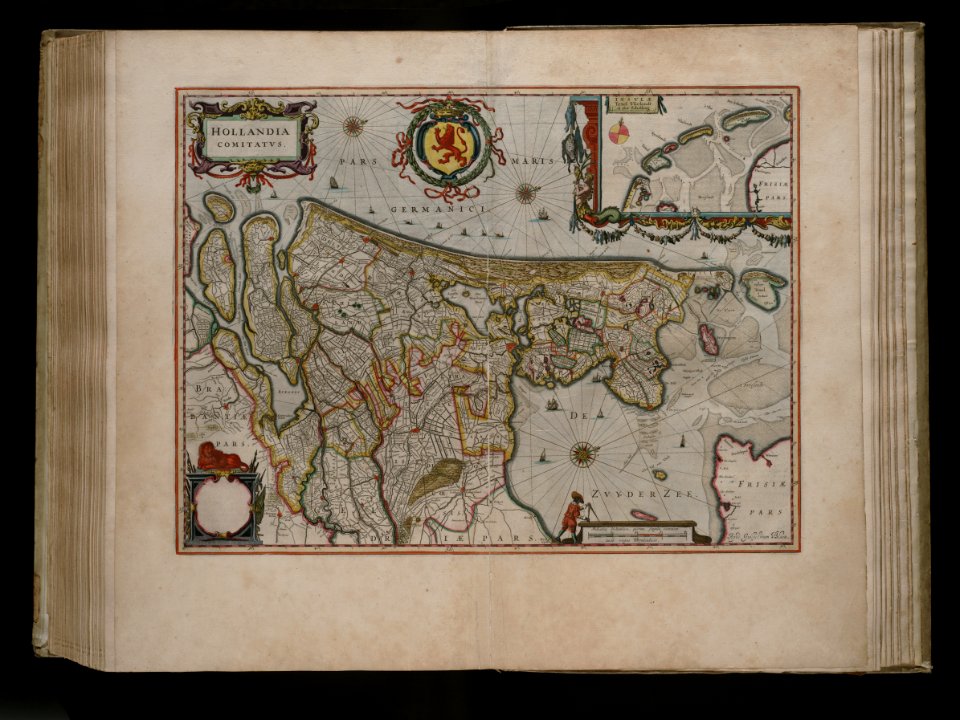
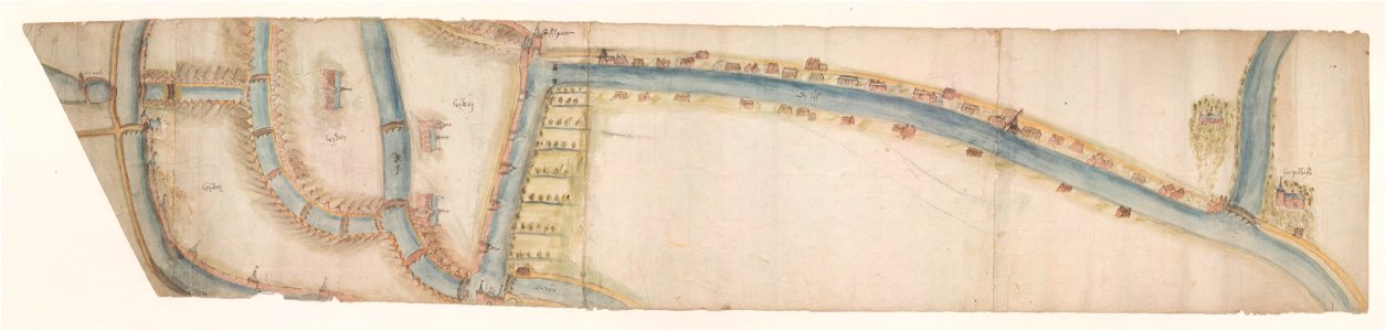
maps of waterways in the netherlands
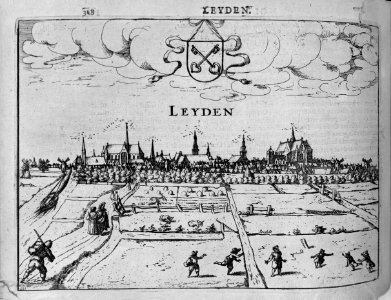
leiden
maps by willem and johannes blaeu
old maps of leiden
herenpoort (leiden)
old maps of leiden
maps by willem and johannes blaeu
old maps of leiden
adriaan justus enschedé
old maps of haarlem
gemeente atlas van nederland - south holland
old maps of leiden
caribbean maps in leiden university library
files uploaded at wiki techstorm 2019
caribbean maps in leiden university library
files uploaded at wiki techstorm 2019
maps by willem and johannes blaeu
old maps of leiden
media contributed by erfgoed leiden en omstreken
photographs by jan goedeljee
media contributed by erfgoed leiden en omstreken
photographs by jan goedeljee
media contributed by erfgoed leiden en omstreken
photographs by jan goedeljee
siege of leiden
maps of leiden
gemeente atlas van nederland - south holland
1860s maps of south holland
cornelius aurelius world map
1916 maps
media contributed by erfgoed leiden en omstreken
photographs by jan goedeljee
maps of ancient italy by philipp clüver
maps of ancient latium
media contributed by erfgoed leiden en omstreken
photographs by jan goedeljee
old maps of leiden
views of leiden
old maps of leiden
baroque
cornelius aurelius world map
ptolemaic taprobana
maps of oslofjorden
1584 maps of norway
joost jansz lanckaert
hans liefrinck (ii)
cornelius aurelius world map
16th-century maps of cuba
cornelius aurelius world map
1510s maps of north america
onze gouden eeuw. de republiek der vereenigde nederlanden in haar bloeitijd
willem isaacsz. van swanenburg
cornelius aurelius world map
1510s maps of south america
maps in the rijksmuseum amsterdam
leidens ontzet
16th-century maps of hispaniola
cornelius aurelius world map
1580s maps of portugal
old maps of portugal
cornelius aurelius world map
parrots in engravings
maps in the rijksmuseum amsterdam
maps by isaak tirion
herman diederik joan van schevichaven
maps of the history of belgium
herman diederik joan van schevichaven
revolt of the batavi
maps in the rijksmuseum amsterdam
maps by isaak tirion
maps in the rijksmuseum amsterdam
siege of leiden
holy roman empire
pierre mortier
cornelius aurelius world map
eran laor cartographic collection
frans van bleyswijck
beschreibung der städt der welt - braun & hogenberg - btv1b52512111k
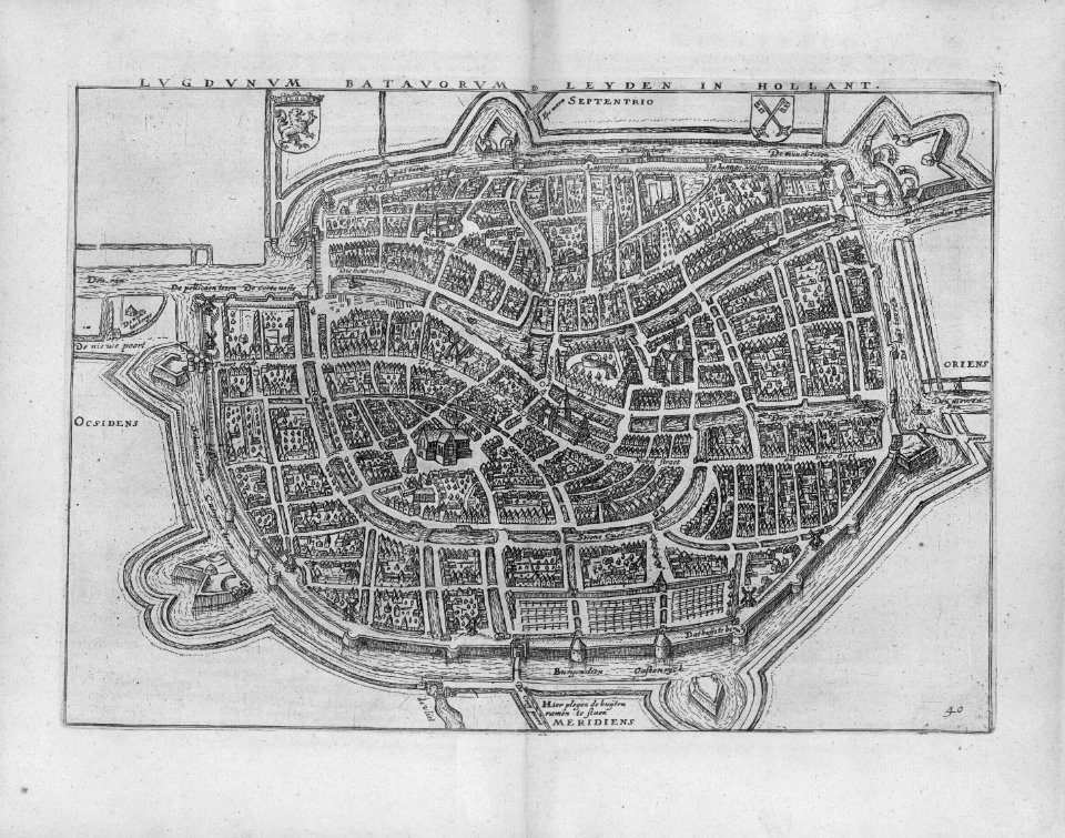
maps of leiden by braun & hogenberg
gemeente atlas van nederland - south holland
maps of alkemade
prints of cartouches in the rijksmuseum amsterdam
maps in the rijksmuseum amsterdam
prints by coenraet decker in the rijksmuseum amsterdam
maps in the rijksmuseum amsterdam
old maps of haarlem
ideal city
maps
city
cartography
maps
maps
city
lithographs in the rijksmuseum amsterdam
conrad leemans
prints published by pieter van der aa
nieuwe cronyk van zeeland
leonard schenk jansz.
maps from gallica
prints by coenraet decker in the rijksmuseum amsterdam
maps in the rijksmuseum amsterdam
prints by coenraet decker in the rijksmuseum amsterdam
maps in the rijksmuseum amsterdam
prints by abraham allard in the rijksmuseum amsterdam
maps in the rijksmuseum amsterdam
prints by françois van bleyswijck in the rijksmuseum amsterdam
maps in the rijksmuseum amsterdam
lithographs in the rijksmuseum amsterdam
siege of 's-hertogenbosch
maps in the rijksmuseum amsterdam
baroque
old maps of new england
william henry bartlett
prints by wenceslaus hollar in the rijksmuseum amsterdam
maps by wenzel hollar
400 years the netherlands – japan (memory of the netherlands)
portraits from koninklijke bibliotheek
oud-nederlandsche steden in haar ontstaan, groei en ontwikkeling (1909)
old maps of delft
oud-nederlandsche steden in haar ontstaan, groei en ontwikkeling (1909)
maps of enkhuizen by braun & hogenberg
oud-nederlandsche steden in haar ontstaan, groei en ontwikkeling (1909)
maps of amersfoort by braun & hogenberg
civitates orbis terrarum. de praecipuis totius universi urbibus. liber secundus
maps of leiden by braun & hogenberg
prints by reinier vinkeles in the rijksmuseum amsterdam
daniël vrijdag
maps in the rijksmuseum amsterdam
baptista van doetecum
prints by christiaan hagen in the rijksmuseum amsterdam
maps in the rijksmuseum amsterdam
prints by reinier vinkeles in the rijksmuseum amsterdam
daniël vrijdag
prints by reinier vinkeles in the rijksmuseum amsterdam
daniël vrijdag
prints by reinier vinkeles in the rijksmuseum amsterdam
daniël vrijdag
prints by reinier vinkeles in the rijksmuseum amsterdam
daniël vrijdag
prints by abraham allard in the rijksmuseum amsterdam
1700s maps of spain
maps in the rijksmuseum amsterdam
nieuwe cronyk van zeeland
onze gouden eeuw. de republiek der vereenigde nederlanden in haar bloeitijd
capture of delfzijl 1591
lucas janszoon waghenaer
1588 maps of norway
etchings in the rijksmuseum amsterdam
maps in the rijksmuseum amsterdam
etchings in the rijksmuseum amsterdam
maps in the rijksmuseum amsterdam
prints by christiaan hagen in the rijksmuseum amsterdam
maps in the rijksmuseum amsterdam
maps of 's-hertogenbosch by braun & hogenberg
maps in the rijksmuseum amsterdam
prints by abraham allard in the rijksmuseum amsterdam
maps in the rijksmuseum amsterdam
onze gouden eeuw. de republiek der vereenigde nederlanden in haar bloeitijd
dutch baroque architecture
old maps of västra götaland county
old maps of göteborg
prints by reinier vinkeles in the rijksmuseum amsterdam
etchings of bridges
maps in the rijksmuseum amsterdam
maps by carolus allard
maps in the rijksmuseum amsterdam
maps by willem and johannes blaeu
cádiz in the 18th century
old maps of cádiz
prints by abraham allard in the rijksmuseum amsterdam
1726 maps of spain
prints by christiaan hagen in the rijksmuseum amsterdam
maps in the rijksmuseum amsterdam
maps in the rijksmuseum amsterdam
maps by carolus allard
dutch 18th-century prints in the rijksmuseum amsterdam
old maps of roermond
prints by claes jansz. visscher (ii) in the rijksmuseum amsterdam
maps in the rijksmuseum amsterdam
maps in the rijksmuseum amsterdam
maps by carolus allard
maps in the rijksmuseum amsterdam
maps by carolus allard
maps in the rijksmuseum amsterdam
old maps of barcelona
1 - 100 of 157
Next page
/ 2