Log in
All resources
Create a design
67 Free Artworks of Maps Of Flanders
bibliothèque nationale de france
old maps of flanders
maps by willem and johannes blaeu
atlas novus (blaeu)
joan blaeu
maps from gallica
pieter verbiest (ii)
maps of east flanders by pieter van der keere
coats of arms on maps
1645 maps of belgium
elizabeth i of england by marcus gheeraerts the younger
elizabeth i of england (the ditchley portrait)
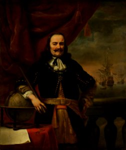
portrait paintings of michiel de ruyter
portrait paintings by ferdinand bol
maps by willem and johannes blaeu
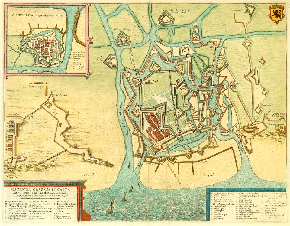
old maps of aalst
1645 maps of belgium
tournaisis
old maps of flanders
copper engravings
daniel de la feuille
dutch-language maps
1600s maps of belgium
old maps of flanders
old maps of flanders
1635 maps
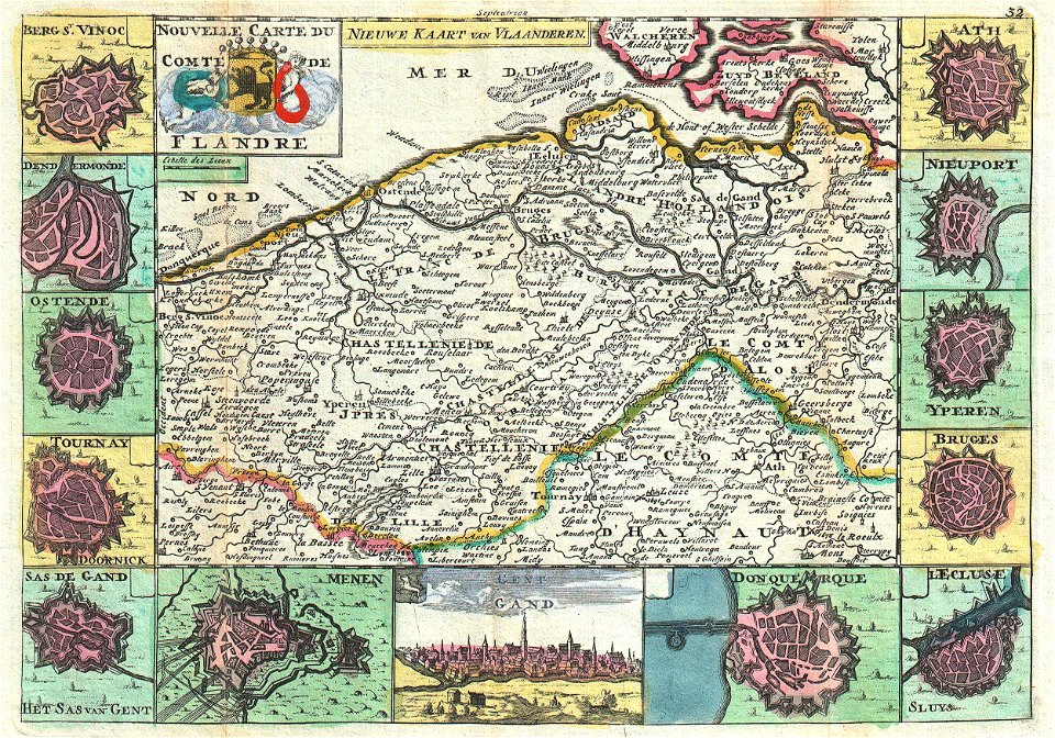
maps of the county of flanders
county of zeeland
henricus hondius ii, nova totius terrarum orbis geographica ac hydrographica tabula, 1630
eran laor cartographic collection
maps by willem and johannes blaeu
1649
1645 maps of belgium
ships on maps
maps by willem and johannes blaeu
1640s maps of belgium
illustrated title pages from the netherlands
joan blaeu
maps by pieter van der keere
old maps of flanders
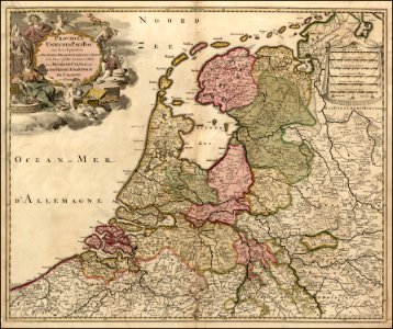
old maps of zeeland
old maps of holland
ambrosio spinola, marqués de los balbases
engravings by jacques callot
maps of flanders by gerardus mercator
maps in the phoebus foundation
maps by willem and johannes blaeu
old maps of flanders
maps by willem and johannes blaeu
old maps of flanders
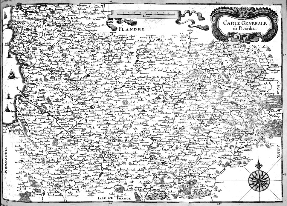
maps of french flanders
atlas van loon
coats of arms on maps
1645 maps of belgium
1680s maps of the netherlands
copper engravings
pieter verbiest (ii)
maps from gallica
maps by pieter van der keere
1610s maps of belgium
atlas maior, vol 4 (netherlands) - joan blaeu, 1667 - bl 114.h(star).4
1667 maps
maps from university of amsterdam special collections
atlas der neederlanden
maps of the county of flanders
de moeren
atlas maior, vol 4 (netherlands) - joan blaeu, 1667 - bl 114.h(star).4
1667 maps
print room of the university of antwerp
kaarten van vlaanderen (prentenkabinet)
bibliothèque municipale de reims, rès. g 152
baroque
pieter verbiest (ii)
maps from gallica
pieter verbiest (ii)
maps from gallica
maps by john cary
1799 maps
sanson maps of the netherlands
robert cordier (engraver)
maps of bruges by braun & hogenberg
bibliothèque nationale de france
maps of ghent by braun & hogenberg
bibliothèque nationale de france
atlas sive cosmographicae (gerardus mercator, 1607)
maps of east flanders by pieter van der keere
maps made in the 17th century
old maps of flanders
atlas sive cosmographicae (gerardus mercator, 1623)
maps of flanders by gerardus mercator
maps of ghent by braun & hogenberg
bibliothèque nationale de france
pieter verbiest (ii)
maps from gallica
atlas sive cosmographicae (gerardus mercator, 1623)
maps of east flanders by pieter van der keere
maps of east flanders by pieter van der keere
bibliothèque nationale de france
atlas sive cosmographicae (gerardus mercator, 1630)
maps of flanders by gerardus mercator
le royaume de france distingué by guillaume sanson
maps by nicolas sanson
cartouches by alexis-hubert jaillot
cartouches by sanson family
pieter verbiest (ii)
maps from gallica
atlas sive cosmographicae (gerardus mercator, 1630)
maps of east flanders by pieter van der keere
sanson maps of the netherlands
alexis-hubert jaillot
atlas sive cosmographicae (gerardus mercator, 4th edition 1613)
maps of east flanders by pieter van der keere
maps of ghent by braun & hogenberg
expeditionis hispanorum in angliam vera descriptio anno domini mdlxxxviii
paper
expeditionis hispanorum in angliam vera descriptio anno domini mdlxxxviii
paper
maps of aalst by braun & hogenberg
peter von brachel
nederlandse en buitenlandse gebeurtenissen
album met historieprenten van hogenberg
maps of ghent by braun & hogenberg
17th-century maps of the spanish empire
maps of the spanish netherlands
nederlandse en buitenlandse gebeurtenissen
album met 345 prenten van hogenberg
beschrijvinghe vande zeeusche eijlanden, soe die op hare stromen geleghen zijn, met een deel vande zee custen van vlaenderen ennde hollant - btv1b532255648
bibliothèque nationale de france
beschrijvinghe vande zeeusche eijlanden, soe die op hare stromen geleghen zijn, met een deel vande zee custen van vlaenderen ennde hollant - btv1b532255648
bibliothèque nationale de france
beschrijvinghe vande zeeusche eijlanden, soe die op hare stromen geleghen zijn, met een deel vande zee custen van vlaenderen ennde hollant - btv1b532255648
bibliothèque nationale de france
maps in the rijksmuseum amsterdam
johann martin will
beschrijvinghe van de zee custen van vlanderen, ende picardien, beghijnnende van nijeupoort tot diepen, met de vlaemsche bancken, begrepen de engte tusschen engelandt ende vranckrijk, twelckmen de hooffden... - btv1b53211568c
bibliothèque nationale de france
beschrijvinghe van de zee custen van vlanderen, ende picardien, beghijnnende van nijeupoort tot diepen, met de vlaemsche bancken, begrepen de engte tusschen engelandt ende vranckrijk, twelckmen de hooffden... - btv1b53211568c
bibliothèque nationale de france
beschrijvinghe van de zee custen van vlanderen, ende picardien, beghijnnende van nijeupoort tot diepen, met de vlaemsche bancken, begrepen de engte tusschen engelandt ende vranckrijk, twelckmen de hooffden... - btv1b53211568c
bibliothèque nationale de france
drawings by patricq kroon in the rijksmuseum amsterdam
donation j. kroon
1 - 67 of 67
/ 1