Log in
All resources
Create a design
126 Free Artworks of 1640s Maps Of France
bibliothèque nationale de france
maps by willem and johannes blaeu
context files from gallica
1640 maps of africa
1640s maps of belgium
maps by pieter van der keere
atlas novus (blaeu)
maps of caprarola by braun & hogenberg
maps of heide by braun & hogenberg
maps of brazil by hendrik hondius
old maps of the spanish empire
old maps of regions of france
1640s maps of france
jan janssonius
old maps of regions of france
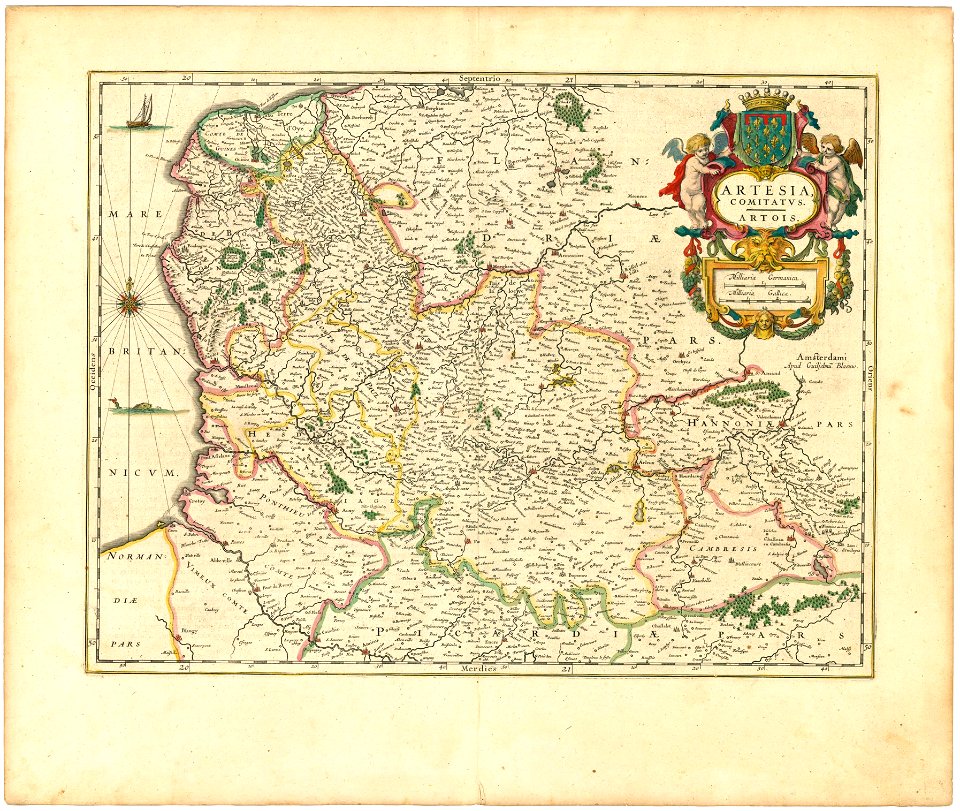
county of artois
maps of franconia by gerardus mercator
1640s maps of bavaria
atlas novus (blaeu)
1640s maps of paris
maps by willem and johannes blaeu
1640s maps of ukraine
maps of bernkastel-kues by braun & hogenberg
maps of zell (mosel) by braun & hogenberg
maps of acquapendente by braun & hogenberg
acquapendente
maps of bernkastel-kues by braun & hogenberg
maps of zell (mosel) by braun & hogenberg
maps of paris from bibliothèque nationale de france
maps of paris by braun & hogenberg
17th-century maps of southern africa
maps by willem and johannes blaeu
maps by willem and johannes blaeu
laurens reael
maps of alcanerilla by braun & hogenberg
context files from gallica
maps of tönning by braun & hogenberg
maps of husum by braun & hogenberg
maps of vienne by braun & hogenberg
maps of lyon by braun & hogenberg
maps by willem and johannes blaeu
17th-century maps of bermuda
maps of the peloponnese by gerardus mercator
1640s maps of greece
maps by willem and johannes blaeu
1640s maps of asia
maps of tönning by braun & hogenberg
maps of husum by braun & hogenberg
maps of los palacios by braun & hogenberg
maps of las cabezas by braun & hogenberg
maps of peñón de vélez by braun & hogenberg
maps of tunis by braun & hogenberg
maps of alexandria by braun & hogenberg
bibliothèque nationale de france
1640s maps of the netherlands
maps by nicolaes visscher i
maps of jerez by braun & hogenberg
maps of conil by braun & hogenberg
17th-century maps of nord (department)
maps of artois
maps by willem and johannes blaeu
1640s maps of belgium
maps by willem and johannes blaeu
1640 maps of africa
maps by willem and johannes blaeu
1640 maps of africa
maps of caprarola by braun & hogenberg
bibliothèque nationale de france
maps of ardales by braun & hogenberg
maps of cártama by braun & hogenberg
maps of windsor by braun & hogenberg
maps of oxford by braun & hogenberg
maps of bornos by braun & hogenberg
maps of zahara by braun & hogenberg
maps of tønder by braun & hogenberg
maps of eutin by braun & hogenberg
maps of fondi by braun & hogenberg
bibliothèque nationale de france
maps by willem and johannes blaeu
17th-century maps of lorraine
maps of antequera by braun & hogenberg
bibliothèque nationale de france
maps of braga by braun & hogenberg
bibliothèque nationale de france
maps of castelnuovo by braun & hogenberg
bibliothèque nationale de france
maps of caiazzo by braun & hogenberg
bibliothèque nationale de france
maps of caprarola by braun & hogenberg
context files from gallica
maps of caprarola by braun & hogenberg
context files from gallica
maps of münstermaifeld by braun & hogenberg
maps of cochem by braun & hogenberg
maps of nové zámky by braun & hogenberg
maps of visegrád by braun & hogenberg
17th-century maps of the strait of magellan
maps by willem and johannes blaeu
maps of damascus by braun & hogenberg
bibliothèque nationale de france
maps of meldorf by braun & hogenberg
maps of heide by braun & hogenberg
maps of fondi by braun & hogenberg
context files from gallica
maps by willem and johannes blaeu
old maps of quercy
1640s maps of the world
maps from gallica
maps of coimbra by braun & hogenberg
bibliothèque nationale de france
maps of meldorf by braun & hogenberg
maps of heide by braun & hogenberg
maps by willem and johannes blaeu
17th-century maps of xaintonge
maps of komárom by braun & hogenberg
bibliothèque nationale de france
maps by pieter van der keere
old maps of liège (province)
maps by willem and johannes blaeu
17th-century maps of dombes
maps by pieter van der keere
old maps of flanders
17th-century maps of tartary
17th-century maps of siberia
maps of granada and albaicín by braun & hogenberg
bibliothèque nationale de france
maps of esztergom by braun & hogenberg
bibliothèque nationale de france
maps of győr by braun & hogenberg
bibliothèque nationale de france
maps of catania by braun & hogenberg
mount etna in the 16th century
maps of île-de-france by françois de la guillotière
bibliothèque nationale de france
maps of île-de-france by françois de la guillotière
bibliothèque nationale de france
maps by willem and johannes blaeu
1640s maps of scotland
maps by willem and johannes blaeu
1640s maps
maps of prague by braun & hogenberg
maps of cheb by braun & hogenberg
maps of brazil by hendrik hondius
bibliothèque nationale de france
old maps of whole wales (alone)
1640s maps of wales
maps of innsbruck by braun & hogenberg
bibliothèque nationale de france
maps of cambridge by braun & hogenberg
bibliothèque nationale de france
maps by willem and johannes blaeu
1640 maps of africa
maps by willem and johannes blaeu
1640s maps of the americas
paraguay, o prov. de rio de la plata cum regionibus adiacentibus tucuman et sta cruz de la sierra - (blaeu) - btv1b8596658x
1640s maps of south america
maps by willem and johannes blaeu
1640 maps of africa
old maps of vermandois
maps of capelle (nord)
maps of brazil by hendrik hondius
bibliothèque nationale de france
maps of brazil by hendrik hondius
bibliothèque nationale de france
lionnois, forest, beauiolois et masconnois (old maps)
maps by willem and johannes blaeu
maps of archidona by braun & hogenberg
bibliothèque nationale de france
maps of lizarrate by braun & hogenberg
bibliothèque nationale de france
maps of lizarrate by braun & hogenberg
bibliothèque nationale de france
17th-century maps of transylvania
maps by willem and johannes blaeu
17th-century maps of the strait of magellan
1640 maps of south america
maps by willem and johannes blaeu
maps of the duchy of montferrat
1640s maps of the americas
maps by jodocus hondius
maps by jodocus hondius
old maps of nassau
old maps of namur (province)
1640s maps of belgium
maps by willem and johannes blaeu
1640s maps of ireland
maps of eckernförde by braun & hogenberg
bibliothèque nationale de france
maps of cadiz by braun & hogenberg
bibliothèque nationale de france
17th-century maps of luxembourg
maps by pieter van der keere
maps by willem and johannes blaeu
17th-century maps of abruzzo
maps of huy by braun & hogenberg
bibliothèque nationale de france
maps of innsbruck by braun & hogenberg
alexandre colyn
maps of gmunden by braun & hogenberg
bibliothèque nationale de france
maps of alhama de granada by braun & hogenberg
bibliothèque nationale de france
maps of dordrecht by braun & hogenberg
bibliothèque nationale de france
maps of algiers by braun & hogenberg
algiers in the 17th century
maps of heide by braun & hogenberg
bibliothèque nationale de france
old maps of nova belgica et anglia nova
maps by willem and johannes blaeu
1 - 100 of 126
Next page
/ 2


![Oxonium [...]; Vindesorium [...], between 1640 and 1645](https://cdn.creazilla.com/illustrations/10001544887/oxonium-vindesorium-between-1640-and-1645-md.jpg)


![Owar, germanice Nieuhuisel; Vizzegrad, germanice Plindeburg / Communicavit G. Houfnaglius depict. a filio a[nn]o 1595, between 1595 and 1640](https://cdn.creazilla.com/illustrations/10001244849/owar-germanice-nieuhuisel-vizzegrad-germanice-plindeburg-communicavit-g-houfnaglius-depict-a-filio-anno-1595-between-1595-and-1640-md.jpg)


![Comorra / Communicavit G. Houf. A[nn]o 1595 depict. a filio, between 1595 and 1640](https://cdn.creazilla.com/illustrations/10001304655/comorra-communicavit-g-houf-anno-1595-depict-a-filio-between-1595-and-1640-md.jpg)


![Strigonium. Gran / Communicavit G. Houfnaglius depict. a filio a[nn]o 1595, between 1595 and 1640](https://cdn.creazilla.com/illustrations/10000990089/strigonium-gran-communicavit-g-houfnaglius-depict-a-filio-anno-1595-between-1595-and-1640-md.jpg)
![Javerinum vulgo Rab / [...] communicat Georgius Houfnaglius MDXCVII, between 1597 and 1640](https://cdn.creazilla.com/illustrations/10000798898/javerinum-vulgo-rab-communicat-georgius-houfnaglius-mdxcvii-between-1597-and-1640-md.jpg)

![Ager parisiensis vulgo l'Isle de France. Fr. Guilloterius, ... describ[ebat]. CI V Petro Pithoeo I.C., 1640](https://cdn.creazilla.com/illustrations/10001256161/ager-parisiensis-vulgo-lisle-de-france-fr-guilloterius-describebat-ci-v-petro-pithoeo-ic-1640-md.jpg)
![Ager parisiensis vulgo l'Isle de France. Fr. Guilloterius, ... describ[ebat]. CI V Petro Pithoeo I.C., 1640](https://cdn.creazilla.com/illustrations/10001594612/ager-parisiensis-vulgo-l-isle-de-france-fr-guilloterius-describ-ebat-ci-v-petro-pithoeo-i-c-1640-md.jpg)


![Wallia principatus, vulgo Wales. Serenmo Domino Carolo, Magnae Britanniae, etc. principi Joh. Blaeu / [Excudit J. Blaeu.], 1645](https://cdn.creazilla.com/illustrations/10001591803/wallia-principatus-vulgo-wales-serenmo-domino-carolo-magnae-britanniae-etc-principi-joh-blaeu-excudit-j-blaeu-1645-md.jpg)

![Cantebrigia [...], between 1635 and 1640](https://cdn.creazilla.com/illustrations/10001014687/cantebrigia-between-1635-and-1640-md.jpg)


![Paraguay, o prov. de Rio de La Plata cum regionibus adiacentibus Tucuman et Sta Cruz de la Sierra / [Blaeu], 1640s](https://cdn.creazilla.com/illustrations/10001055781/paraguay-o-prov-de-rio-de-la-plata-cum-regionibus-adiacentibus-tucuman-et-sta-cruz-de-la-sierra-blaeu-1640s-md.jpg)


![The Sierra de Sant Adrian in Vizcaya / by Georgio Houfnaglio painting. Anno Domini M.D.LXVII [1567], between 1567 and 1640](https://cdn.creazilla.com/illustrations/10001412555/the-sierra-de-sant-adrian-in-vizcaya-by-georgio-houfnaglio-painting-anno-domini-m-d-lxvii-1567-between-1567-and-1640-sm.jpg)
![The Sierra de Sant Adrian in Vizcaya / by Georgio Houfnaglio painting. Anno Domini M.D.LXVII [1567], between 1567 and 1640](https://cdn.creazilla.com/illustrations/10001429518/the-sierra-de-sant-adrian-in-vizcaya-by-georgio-houfnaglio-painting-anno-domini-mdlxvii-1567-between-1567-and-1640-md.jpg)


![Gades ab occiduis insulae partibus: captus hic anno 1564 / Depingebat Georg[ius] Houfnaglius, between 1564 and 1640](https://cdn.creazilla.com/illustrations/10001498652/gades-ab-occiduis-insulae-partibus-captus-hic-anno-1564-depingebat-georg-ius-houfnaglius-between-1564-and-1640-md.jpg)


![Huum opp. Condrusorum Caput [...] Anno partae salutis. M. D. LXXIIII., between 1574 and 1640](https://cdn.creazilla.com/illustrations/10001498653/huum-opp-condrusorum-caput-anno-partae-salutis-m-d-lxxiiii-between-1574-and-1640-md.jpg)


![Amoenissimus castri Granatensis, vulgo Alhambre dicti, ab Oriente prospectus / Effigiabat Georgius Hufnagli[us] anno dnj 1564, between 1564 and 1640](https://cdn.creazilla.com/illustrations/10000300894/amoenissimus-castri-granatensis-vulgo-alhambre-dicti-ab-oriente-prospectus-effigiabat-georgius-hufnaglius-anno-dnj-1564-between-1564-and-1640-md.jpg)

![Algerii Saracenorum urbis fortissimae, in Numidia Africae provincia structae, juxta Balearicos fluctus Maediterranei aequoris Hispaniam contra, Othomanor pri[n]cipu[m] imperio redactae, imago, between 1635 and 1640](https://cdn.creazilla.com/illustrations/10000616816/algerii-saracenorum-urbis-fortissimae-in-numidia-africae-provincia-structae-juxta-balearicos-fluctus-maediterranei-aequoris-hispaniam-contra-othomanor-principum-imperio-redactae-imago-between-1635-and-1640-md.jpg)
