Log in
All resources
Create a design
26,489 Free Artworks of Map
copper engraving print
british library
joan blaeu
truscott map of st-petersburg 1753
ivan sokolov
atlas maior, vol 5 (england) - joan blaeu, 1667 - bl 114.h(star).5
bibliothèque nationale de france
1667 maps
maps by willem and johannes blaeu
maps of spain by tomas lopez
map of amsterdam by julius milheuser after daniël stalpaert, 1662
engraving
map of the circle of the rhineland by sanson
1730s maps of rhineland-palatinate
1750s maps of central america
maps by tomas lopez
map of the circle of the rhineland by sanson
1700s maps of rhineland-palatinate
1750s maps of central america
maps by tomas lopez
maps of raucourt
maps of sedan
daniel de la feuille
1708 maps
maps by alain manesson-mallet
1683 maps of russia
gloucester, massachusetts, in the 19th century
massachusetts in the 1850s
maps from the earth and its inhabitants, vol. xi
1890s maps of morocco
gemeente atlas van nederland - south holland
1860s maps of south holland
maps from the earth and its inhabitants, vol. xiii
africa in the 1890s
maps from the earth and its inhabitants, vol. xiii
africa in the 1890s
maps by alain manesson-mallet
description de l'universe
maps from the earth and its inhabitants, vol. xii
canary islands in the 1890s
gemeente atlas van nederland - south holland
maps of hazerswoude
1600s maps of the world
copper engravings
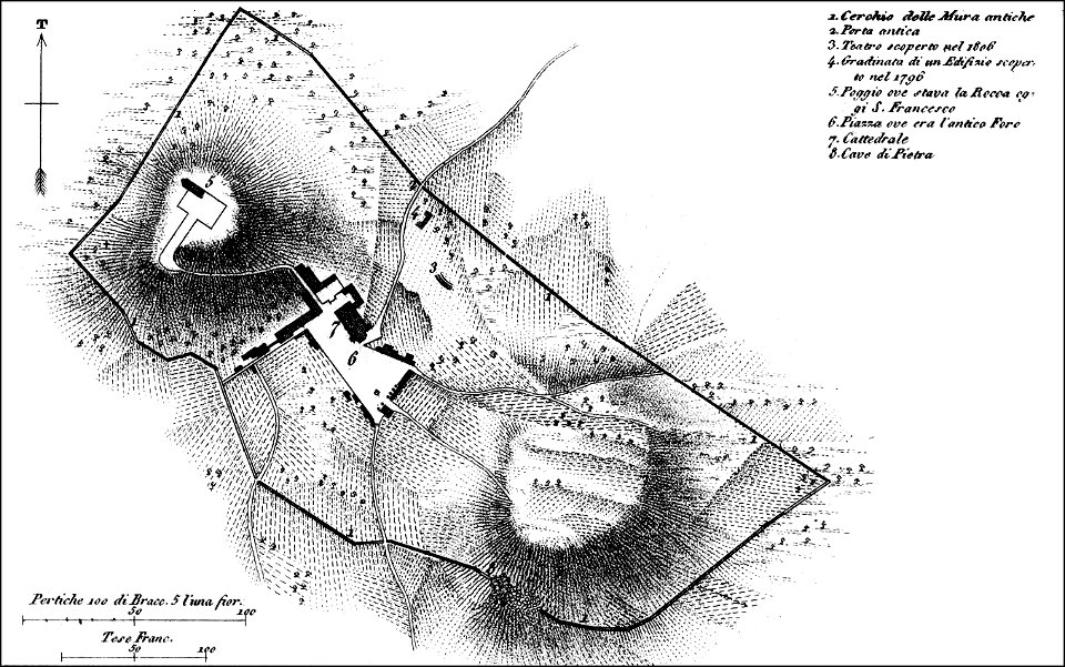
maps of archaeological sites in italy
storia degli antichi popoli italiani
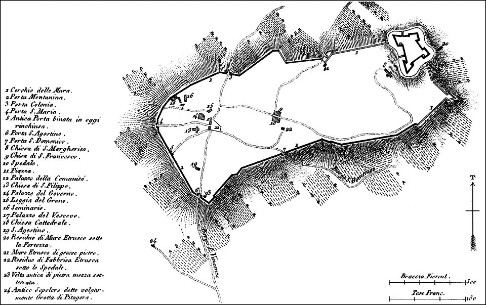
maps of archaeological sites in italy
storia degli antichi popoli italiani
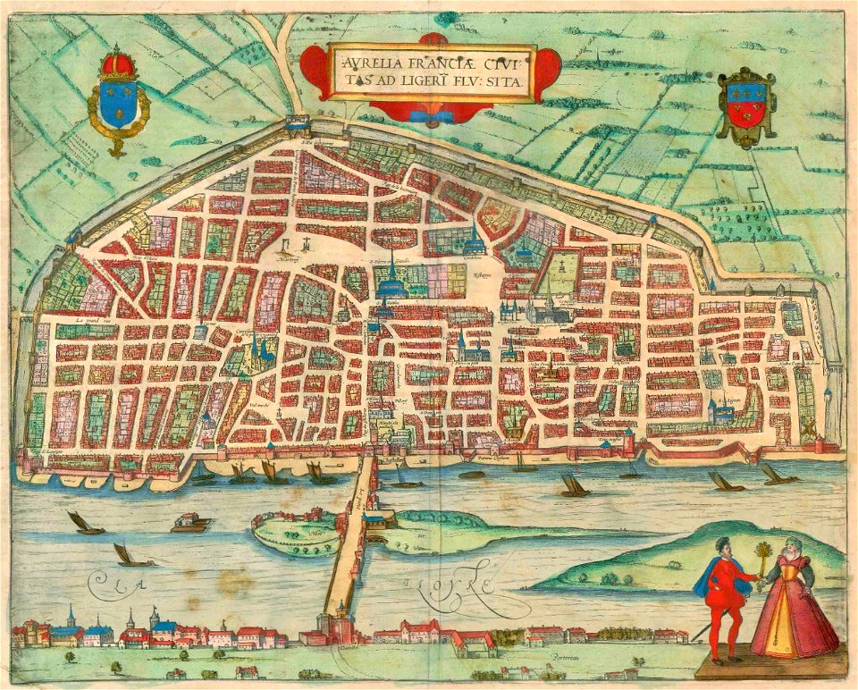
maps of orléans by braun & hogenberg
1581 maps of france
cornelius aurelius world map
ptolemaic taprobana
1620s maps of the iberian peninsula
maps by willem and johannes blaeu
old maps of castilla la nueva
1765 maps of spain
maps of liège by johannes blaeu - derivative files
église saint-remacle (liège)
truscott map of st-petersburg 1753
ivan sokolov
truscott map of st-petersburg 1753
ivan sokolov
truscott map of st-petersburg 1753
ivan sokolov
truscott map of st-petersburg 1753
ivan sokolov
truscott map of st-petersburg 1753
ivan sokolov
truscott map of st-petersburg 1753
ivan sokolov
truscott map of st-petersburg 1753
ivan sokolov
truscott map of st-petersburg 1753
ivan sokolov
truscott map of st-petersburg 1753
ivan sokolov
truscott map of st-petersburg 1753
ivan sokolov
truscott map of st-petersburg 1753
ivan sokolov
truscott map of st-petersburg 1753
ivan sokolov
truscott map of st-petersburg 1753
ivan sokolov
truscott map of st-petersburg 1753
ivan sokolov
truscott map of st-petersburg 1753
ivan sokolov
truscott map of st-petersburg 1753
ivan sokolov
truscott map of st-petersburg 1753
ivan sokolov
truscott map of st-petersburg 1753
ivan sokolov
maps by christian sgrothen
old maps of zeeland
propaganda map
truscott map of st-petersburg 1753
ivan sokolov
maps by christian sgrothen
old maps of zeeland
truscott map of st-petersburg 1753
ivan sokolov
german renaissance
old maps of venice
maps by willem and johannes blaeu
siege of groenlo 1627
maps made in the 17th century
old maps of china
old maps of the dutch east india company
1705
maps of arnhem by braun & hogenberg
maps of venlo by braun & hogenberg
old maps of the northern hemisphere
old maps of the arctic
maps in the library of congress
1861 maps of virginia
arnold van langren map of southwest africa
renaissance
maps by willem and johannes blaeu
17th-century maps of asia
old maps of somaliland
zeila
maps of washington, north carolina
solon m. allis
brazilian paintings in the museu antônio parreiras
clóvis arrault
media contributed by university of illinois urbana-champaign university library
1685 maps of africa
maps made in the 17th century
africa settentrionale
maps made in the 17th century
ancona (marca)
drawings in the museu antônio parreiras
paper and graphite
eran laor cartographic collection
afbeeldinge der stad jerusalem
eran laor cartographic collection
afbeeldinge der stad jerusalem
sanson maps of north america
maps by nicolas sanson
maps by jacques-nicolas bellin
1773 maps
maps of the holy roman empire
1767 maps of germany
maps by louis brion de la tour
18th-century maps of tartary
atlas maior, vol 5 (england) - joan blaeu, 1667 - bl 114.h(star).5
17th-century maps of cheshire
atlas maior, vol 5 (england) - joan blaeu, 1667 - bl 114.h(star).5
17th-century maps of cumberland
atlas maior, vol 5 (england) - joan blaeu, 1667 - bl 114.h(star).5
17th-century maps of gloucestershire
atlas maior, vol 3 (germany) - joan blaeu, 1667 - bl 114.h(star).3
17th-century maps of silesia
atlas maior, vol 5 (england) - joan blaeu, 1667 - bl 114.h(star).5
17th-century maps of wiltshire
atlas maior, vol 5 (england) - joan blaeu, 1667 - bl 114.h(star).5
17th-century maps of cardiganshire
atlas maior, vol 5 (england) - joan blaeu, 1667 - bl 114.h(star).5
17th-century maps of surrey
atlas maior, vol 7 (france i) - joan blaeu, 1667 - bl 114.h(star).7
1667 maps
atlas maior, vol 11 (asia) - joan blaeu, 1667 - bl 114.h(star).11
1667 maps
atlas maior, vol 5 (england) - joan blaeu, 1667 - bl 114.h(star).5
17th-century maps of hampshire
atlas maior, vol 5 (england) - joan blaeu, 1667 - bl 114.h(star).5
17th-century maps of suffolk
atlas maior, vol 9 (italy) - joan blaeu, 1667 - bl 114.h(star).9
1667 maps of italy
atlas maior, vol 5 (england) - joan blaeu, 1667 - bl 114.h(star).5
17th-century maps of berkshire
atlas maior, vol 12 (america) - joan blaeu, 1667 - bl 114.h(star).12
1667 maps
atlas maior, vol 9 (italy) - joan blaeu, 1667 - bl 114.h(star).9
1667 maps of italy
atlas maior, vol 6 (scotland and ireland) - joan blaeu, 1667 - bl 114.h(star).6
1667 maps
atlas maior, vol 6 (scotland and ireland) - joan blaeu, 1667 - bl 114.h(star).6
1667 maps
atlas maior, vol 5 (england) - joan blaeu, 1667 - bl 114.h(star).5
17th-century maps of kent
atlas maior, vol 5 (england) - joan blaeu, 1667 - bl 114.h(star).5
17th-century maps of cornwall
atlas maior, vol 5 (england) - joan blaeu, 1667 - bl 114.h(star).5
17th-century maps of sussex
atlas maior, vol 9 (italy) - joan blaeu, 1667 - bl 114.h(star).9
1667 maps of italy
atlas maior, vol 5 (england) - joan blaeu, 1667 - bl 114.h(star).5
17th-century maps of county durham
atlas maior, vol 5 (england) - joan blaeu, 1667 - bl 114.h(star).5
17th-century maps of devon
atlas maior, vol 5 (england) - joan blaeu, 1667 - bl 114.h(star).5
17th-century maps of dorset
atlas maior, vol 5 (england) - joan blaeu, 1667 - bl 114.h(star).5
17th-century maps of norfolk, england
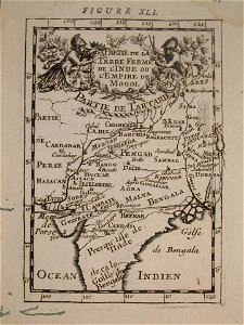
old maps of the mughal empire
description de l'universe
new york and brooklyn, with jersey city and hoboken water front
maps in the library of congress
turgot map of paris, university of wisconsin-milwaukee libraries
sheet 7 of the turgot map of paris
maps of the kingdom of valencia
1762 maps of spain
maps of spain by tomas lopez
1783 maps of spain
maps of spain by tomas lopez
1783 maps of spain
4901 - 5000 of 26,489
Next page
/ 265