Log in
All resources
Create a design
26,489 Free Artworks of Map
eran laor cartographic collection
latin-language maps
bibliothèque nationale de france
maps by willem and johannes blaeu
maps by gerard valck
maps by pieter schenk (i)
municipal library of trento
gerard valck
english-language maps
frans hogenberg
17th-century maps of southeast asia
description de l'universe
maps of the kingdom of kongo
maps by jodocus hondius
1636 maps of asia
baroque
miniature speed atlas (1627) pieter van den keere
county maps of england by john speed
recueil d'antiquités égyptiennes, étrusques, greques et romaines (1752)
18th-century maps of paris
maps from traité de la police, bibliothèque nationale de france
first map of paris from traité de la police
maps from the mechanical curator collection
1760
lithographs of paris
floor plans of paris
maps of the west-indische compagnie
1747 maps of africa
old maps of the dutch east india company
1740s maps of arabia
1840s maps of the world
german renaissance
latin-language maps
german renaissance
maps by jodocus hondius
old maps of the guianas
maps from the earth and its inhabitants, vol. xi
africa in the 1890s
asia secunda pars terrae in forma pegasir
classicism
maps of denmark by gerardus mercator
maps by willem and johannes blaeu
maps of ghent by armand heins
map of expo 1913
carel herman aart van der wijck
louis storm van 's-gravensande
maps from university of amsterdam special collections
atlas der neederlanden
map of ghent by pierre husson
moll's map collection
engravings of the arsenale (venice)
maps by willem and johannes blaeu
maps by nicolaes visscher i
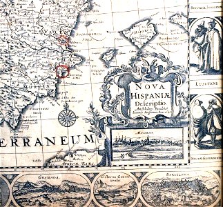
old maps of spain
hamburgische elbkarte von melchior lorichs
historical maps of uetersen
old maps of the bahamas
lucayas
old maps of ravenstein, germany
maps made in the 17th century
eran laor cartographic collection
pierre françois tardieu
map of the circle of the rhineland by sanson
1680s maps of rhineland-palatinate
17th-century maps of radnorshire
old county maps of radnorshire
maps in the british museum
prints by mario cartaro
novus atlas sinensis
old maps of guangxi
17th-century maps of corsica
maps by gerard valck
17th-century maps of devon
old county maps of devon
eran laor cartographic collection
thomas kitchin
17th-century maps of essex
old county maps of essex
17th-century maps of lancashire
old county maps of lancashire
map of the circle of the rhineland by sanson
1680s maps of rhineland-palatinate
maps of utrecht (city) city walls
old maps of utrecht (city)
maps of philippeville by braun & hogenberg
maps of chimay by braun & hogenberg
portolan charts made in the 17th century
maps by willem and johannes blaeu
18th-century maps of the canary islands
maps of spain by tomas lopez
gemeente atlas van nederland - gelderland
maps of ophemert
maps by daniel lizars
1831 maps of mexico
19th-century maps of west africa
maps by thomas starling
winthrop square (boston)
downtown crossing
locator maps of the harbour of rotterdam
maps of scheepvaartkwartier
eran laor cartographic collection
theodor de bry
gemeente atlas van nederland - south holland
1860s maps of south holland
maps by louis brion de la tour
1766 maps of africa
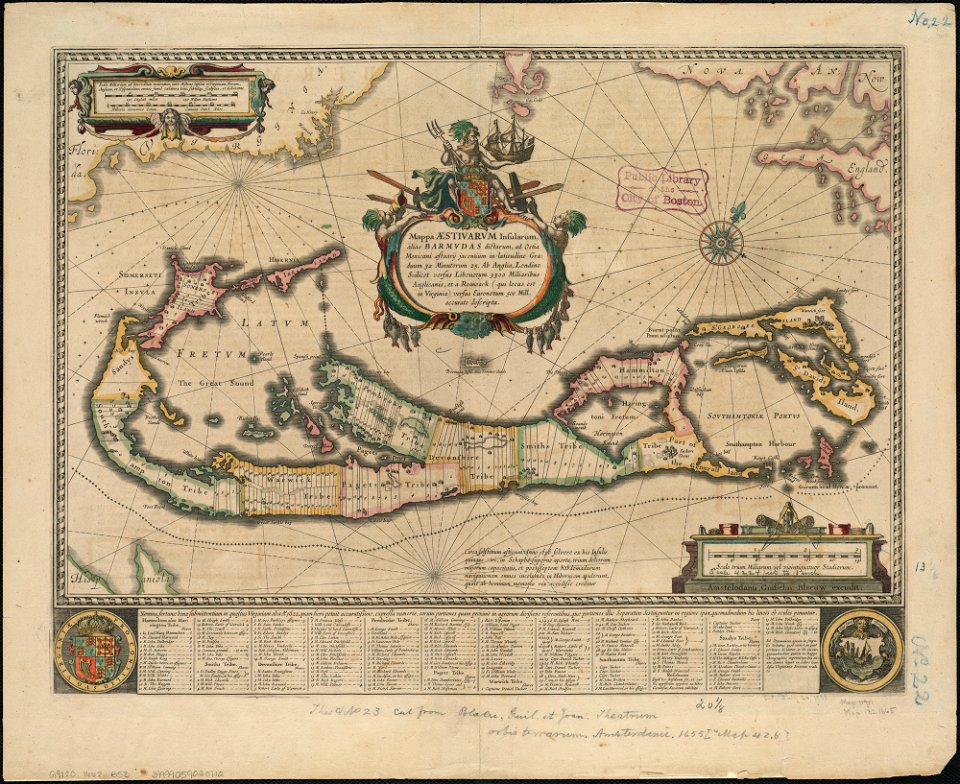
old maps of bermuda from the norman b. leventhal map center
1662 maps
description de l'universe
old maps of newfoundland
curt teich postcard archives
map postcards
old maps of rhineland-palatinate
baroque
maps by john cary
1801 maps
old maps of gravelines
flandria illustrata
gemeente atlas van nederland - south holland
hugo suringar
maps of the iberian peninsula by guillaume delisle
1700s maps of the iberian peninsula
maps in the british museum
maps of the irish sea
maps of raja ampat regency
dutch-language maps
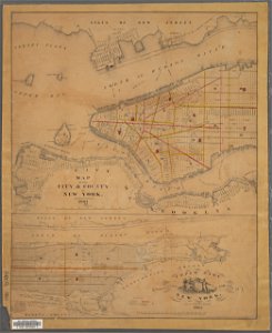
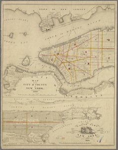
1777 maps of new york (state)
maps of the hudson river
media from the national library of finland
classicism
media from the national library of finland
classicism
kaart van het hoogheemraadschap van schieland, 1611-1635
17th-century maps of rotterdam
maps from the mechanical curator collection available to georeference
maps from the mechanical curator collection
maps in the library of congress
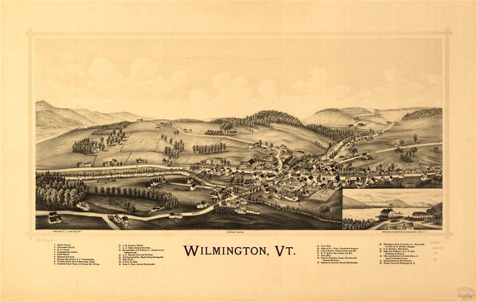
1891 maps of vermont
maps made in the 17th century
old maps of overijssel
17th-century maps of rotterdam
old maps of delfland
the comprehensive history of england (1876)
english-language maps showing history
maps by macdonald gill
royal mail
southwark, philadelphia
sparks shot tower
eran laor cartographic collection
latin-language maps
maps of vienna by braun & hogenberg
eran laor cartographic collection
maps of bourges by braun & hogenberg
eran laor cartographic collection
maps of heraklion by braun & hogenberg
eran laor cartographic collection
history of sherbrooke (quebec)
1881 in quebec
maps of conil by braun & hogenberg
eran laor cartographic collection
maps of prague by braun & hogenberg
eran laor cartographic collection
images of places from encyclopædia britannica
old maps of manchester and salford
maps from the earth and its inhabitants, vol. xiii
africa in the 1890s
maps of lübeck by braun & hogenberg
eran laor cartographic collection
maps of luxembourg city walls
old maps of luxembourg city
maps by willem and johannes blaeu
17th-century images of algiers
manual of the corporation of the city of new york (1861)
maps from valentine's manual
manual of the corporation of the city of new york (1860)
maps from valentine's manual
maps by jodocus hondius
1630s maps of asia
old maps of the channel islands
joan blaeu
maps by matthäus merian
baroque
maps from the earth and its inhabitants, vol. vi
maps with nicolosi globular projection
map of paris by claes jansz. visscher - derivate files
17th-century people of paris
collections of hauptstaatsarchiv stuttgart
1651 maps
maps of werkendam
maps of dussen
old maps of the hague
old maps of delfland
plan de paris levé par les ordres du roy, 1900
proletarian literature
maps by willem and johannes blaeu
old maps of friesland
atlas van loon
1664 maps
1858 van de velde maps of palestine and jerusalem
eran laor cartographic collection
historical images of abbaye de saint-germain-des-prés
foire saint-germain on old maps
1858 van de velde maps of palestine and jerusalem
eran laor cartographic collection
1858 van de velde maps of palestine and jerusalem
eran laor cartographic collection
1858 van de velde maps of palestine and jerusalem
eran laor cartographic collection
1858 van de velde maps of palestine and jerusalem
eran laor cartographic collection
3201 - 3300 of 26,489
Next page
/ 265