Log in
All resources
Create a design
26,489 Free Artworks of Map
bibliothèque nationale de france
atlas minor gerardi mercatoris (1621, maps)
maps from the earth and its inhabitants, vol. xvii
maps from the earth and its inhabitants, vol. viii
maps from the earth and its inhabitants, vol. xii
charles eugène perron
mississippi delta
ernst georg ravenstein
guillaume sanson
17th-century maps of the americas
asia noviter delineata
old images of kolkata
atlas maior, vol 1 (northern europe, norway, and denmark) - joan blaeu, 1667 - bl 114.h(star).1
1667 maps
atlas maior, vol 2 (sweden, russia, poland, eastern europe, and greece) - joan blaeu, 1667 - bl 114.h(star).2
1667 maps of russia
atlas maior, vol 4 (netherlands) - joan blaeu, 1667 - bl 114.h(star).4
1667 maps
old maps of austria
1695 books
maps from the earth and its inhabitants, vol. iv
stockton-on-tees
maps from the earth and its inhabitants, vol. xiii
south africa in the 1870s
maps from the earth and its inhabitants, vol. viii
charles eugène perron
maps from the earth and its inhabitants, vol. xvii
mississippi delta
maps from the earth and its inhabitants, vol. viii
charles eugène perron
maps from the earth and its inhabitants, vol. xvii
united states geological survey
maps from the earth and its inhabitants, vol. xvii
mississippi delta
maps from the earth and its inhabitants, vol. xii
ernst georg ravenstein
maps from the earth and its inhabitants, vol. xvii
mississippi delta
maps from the earth and its inhabitants, vol. xiii
south africa in the 1870s
maps from the earth and its inhabitants, vol. xii
ponta delgada (azores)
maps from the earth and its inhabitants, vol. xiv
st paul island
maps from the earth and its inhabitants, vol. viii
trade routes in india
maps from the earth and its inhabitants, vol. viii
charles eugène perron
maps from the earth and its inhabitants, vol. xi
ain el-turk
reconstruction of ruysch's africa map by stanley
new light on dark africa (dulcken)
maps from the earth and its inhabitants, vol. vii
islands of south korea
maps from the earth and its inhabitants, vol. xvi
colorado river delta
old maps of southeast asia
maps by gerard valck
maps from the earth and its inhabitants, vol. iii
rail transport in the netherlands
maps from the earth and its inhabitants, vol. iv
lake area comparison diagrams
maps from the earth and its inhabitants, vol. xvii
mississippi delta
maps from the earth and its inhabitants, vol. xviii
geology of south america
maps from the earth and its inhabitants, vol. xii
val das furnas
maps from the earth and its inhabitants, vol. vi
geology of the caucasus mountains
a voyage to abyssinia, and travels into the interior of that country, executed under the orders of the british government in the years 1809 & 1810
1810 maps of ethiopia
maps from the earth and its inhabitants, vol. ix
kelat-i-ghilzai
maps from the earth and its inhabitants, vol. vi
islands of the pacific ocean
maps from the earth and its inhabitants, vol. viii
christian mission in india
maps from the earth and its inhabitants, vol. vii
five great mountains
maps from the earth and its inhabitants, vol. xvii
flora of the united states
maps from the earth and its inhabitants, vol. x
meshra-er-rek
maps from the earth and its inhabitants, vol. xii
são miguel (azores)
maps from the earth and its inhabitants, vol. xii
ernst georg ravenstein
maps from the earth and its inhabitants, vol. viii
charles eugène perron
maps from the earth and its inhabitants, vol. viii
ernst georg ravenstein
maps from the earth and its inhabitants, vol. ii
maps from the earth and its inhabitants, vol. xvii
coasts of the united states
maps from the earth and its inhabitants, vol. xiv
saint-pierre (saint-pierre-et-miquelon)
maps from the earth and its inhabitants, vol. xvii
lake champlain
maps from the earth and its inhabitants, vol. xvii
lake champlain
maps from the earth and its inhabitants, vol. xii
las palmas de gran canaria
maps from the earth and its inhabitants, vol. xviii
weather and climate of north america
maps from the earth and its inhabitants, vol. viii
kachi-gandaya plain
maps from the earth and its inhabitants, vol. vii
ernst georg ravenstein
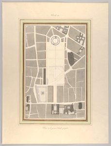
pierre françois léonard fontaine
neoclassicism
bibliothèque nationale de france
guillaume sanson
old and new london, illustrated (1873) by walter thornbury and edward walford - bl 1887 copy
maps from the mechanical curator collection
maps by nicolas sanson
sanson maps of asia
sanson maps of asia
1677 maps of asia
map of europe by guillaume sanson (1674)
1677 maps of europe
bibliothèque nationale de france
guillaume sanson
bibliothèque nationale de france
1698 map of evesché de meaux
bibliothèque nationale de france
guillaume sanson
bibliothèque nationale de france
guillaume sanson
1667 sanson map of africa
1719 maps of africa
18th-century maps of jamaica
maps by tomas lopez
map of europe by nicolas and guillaume sanson (1669)
1680s maps of europe
maps by nicolas sanson
sanson maps of asia
engraved maps
baroque
brazilian paintings in the museu antônio parreiras
francisco joaquim gomes ribeiro
portsmouth earthworks maps
squier and davis images
drawings in the yale center for british art
john russell (painter)
synopsis universae philologiae
1741 maps of europe
eran laor cartographic collection
giovanni marco pitteri
maps of heidelberg by braun & hogenberg
fra mauro map details
watercolor drawings by johannes vingboons
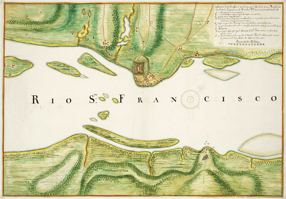
old maps of dutch brazil
17th-century maps of the americas
maps by jodocus hondius
atlas minor gerardi mercatoris (1621, maps)
maps of abyssinia by mercator-hondius
atlas minor gerardi mercatoris (1621, maps)
maps of south asia by mercator-hondius
kaiserdom st. bartholomäus in the 19th century
maps of frankfurt-innenstadt
atlas minor gerardi mercatoris (1621, maps)
maps of the caribbean by mercator-hondius
atlas minor gerardi mercatoris (1621, maps)
maps of asia by mercator-hondius
plan de roussel - derivative files
cimetière ancien d'ivry-sur-seine
maps of the iberian peninsula by mercator-hondius
atlas minor gerardi mercatoris (1621, maps)
atlas minor gerardi mercatoris (1621, maps)
maps of lake geneva by jacques goulart
atlas minor gerardi mercatoris (1621, maps)
maps of persia by mercator-hondius
atlas minor gerardi mercatoris (1621, maps)
maps of rügen by eilhard lubinus
atlas minor gerardi mercatoris (1621, maps)
maps of ceylon by petrus plancius
atlas minor gerardi mercatoris (1621, maps)
maps of paradise by mercator-hondius
atlas minor gerardi mercatoris (1621, maps)
maps of virginia by mercator-hondius
atlas minor gerardi mercatoris (1621, maps)
maps of valencia by mercator-hondius
17th-century maps of the americas
maps by jodocus hondius
maps of the malay archipelago by mercator-hondius
atlas minor gerardi mercatoris (1621, maps)
1704 works in germany
old maps of ulm
atlas minor gerardi mercatoris (1621, maps)
maps of abyssinia by mercator-hondius
atlas minor gerardi mercatoris (1621, maps)
maps of castile by mercator-hondius
17th-century maps of the americas
maps by jodocus hondius
17th-century maps of the americas
maps by willem and johannes blaeu
atlas minor gerardi mercatoris (1621, maps)
maps of barbary coast by mercator-hondius
columbus kristóf élete és amerika felfedezése (ferdinand colon)
atlantic ocean
atlas minor gerardi mercatoris (1621, maps)
maps of cyprus by mercator-hondius
atlas minor gerardi mercatoris (1621, maps)
maps of portugal by fernando álvares seco
maps by willem and johannes blaeu
1659 maps of europe
12501 - 12600 of 26,489
Next page
/ 265