Log in
All resources
Create a design
184 Free Artworks of Kart
enzyklopädie des eisenbahnwesens
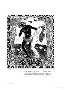
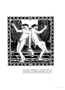
paul bürck
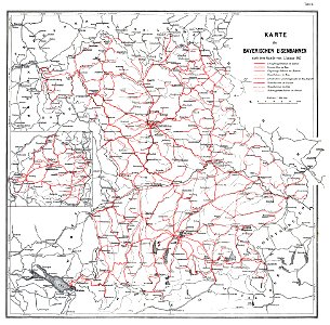
maps by royal bavarian land tax commission
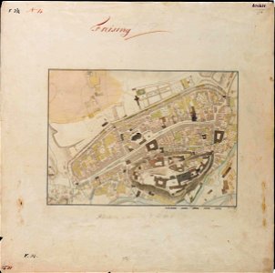
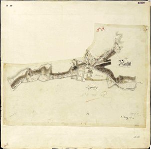
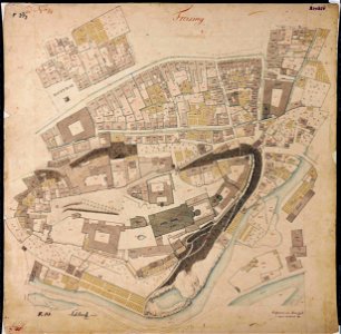
old maps of freising
faun
maps in utrecht university library
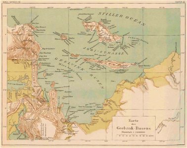
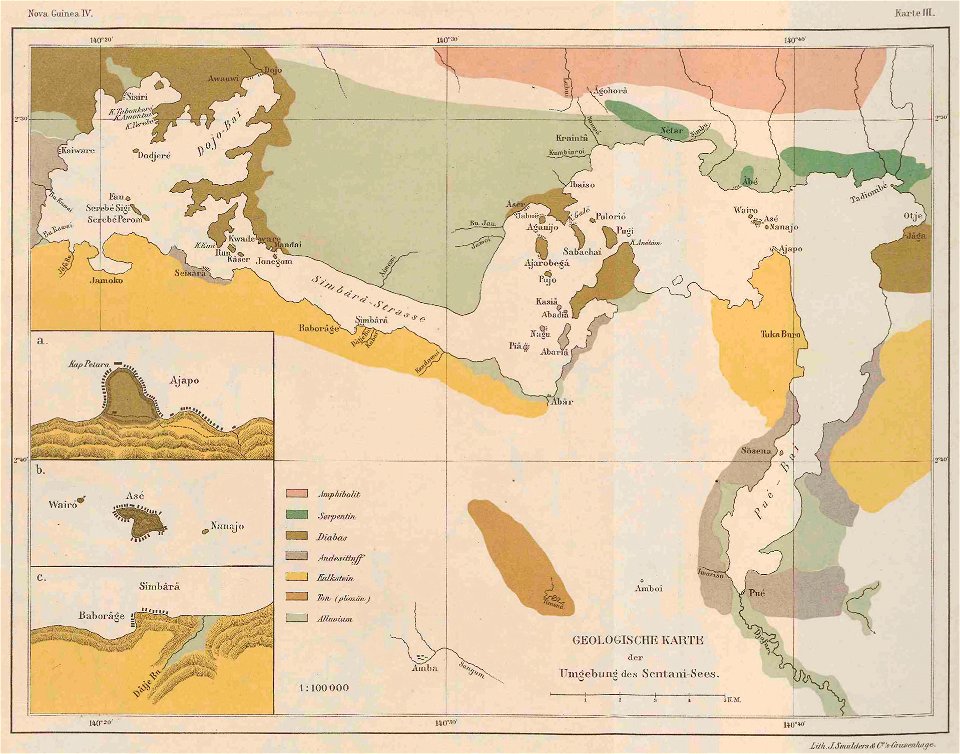
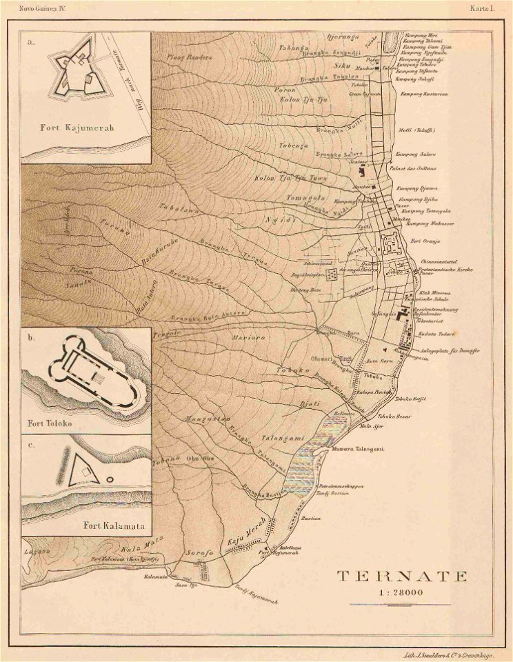
nova guinea vol. iv: bericht über einde im jahre 1903 ausgeführte reise nach neu-guinea
1828
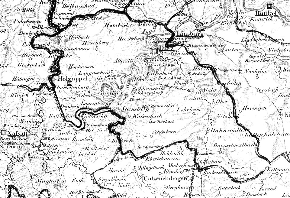
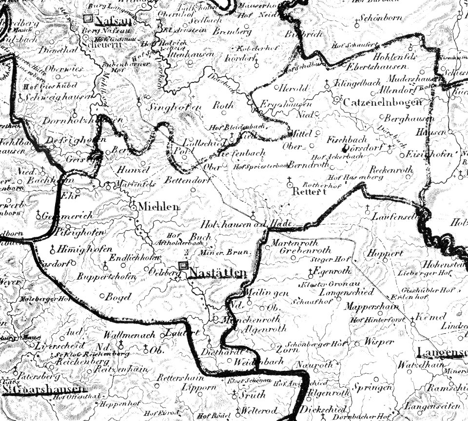
map „das herzogthum nassau“ by j.b. fischer
maps by brockhaus
third voyage of willem barentsz
16th-century maps of the arctic
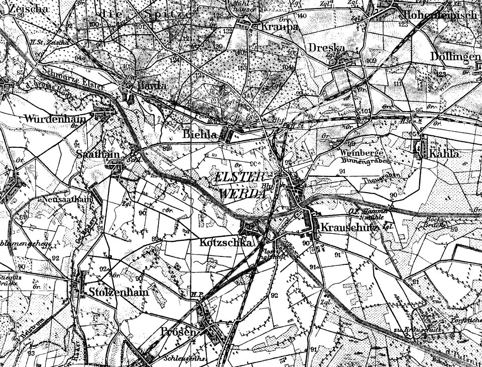
history of elsterwerda
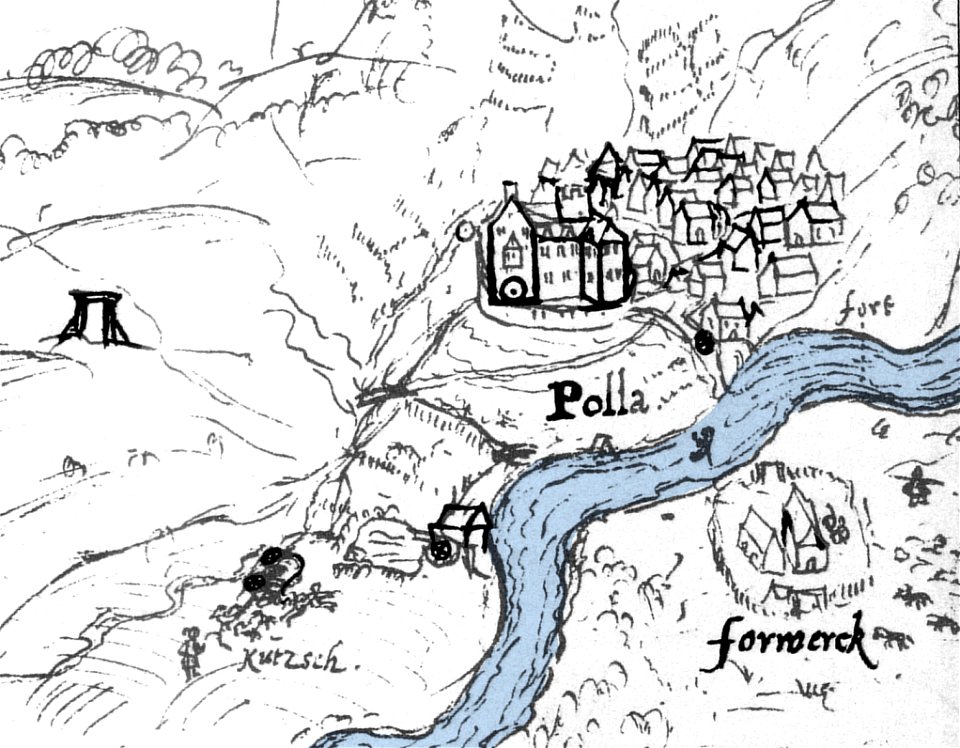
poll
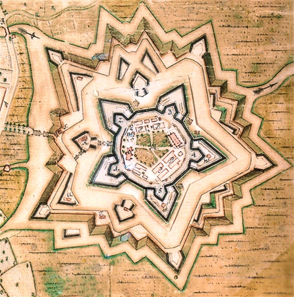
zitadelle vechta
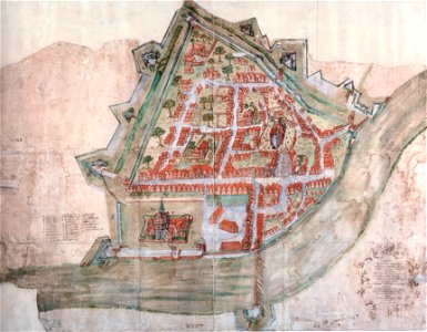
stadtbefestigung nienburg
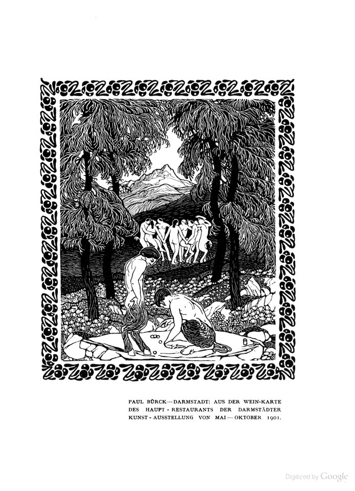
paul bürck
paul bürck
faun
paul bürck
faun
paul bürck
faun
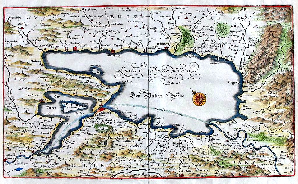
maps of lakes of switzerland
pilatussee
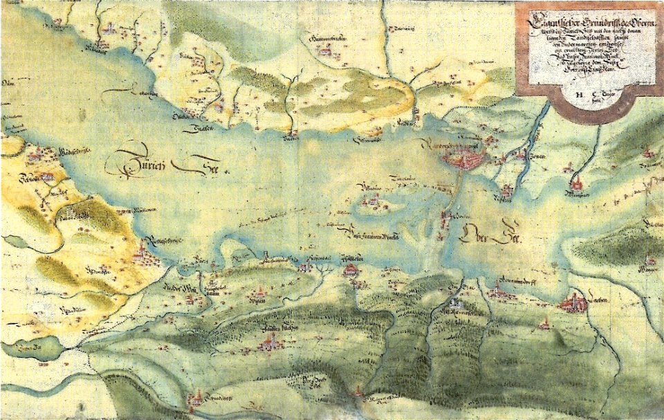
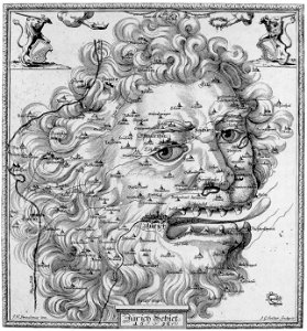
old maps of the canton of zürich
cartography of switzerland
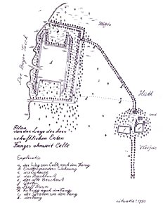
lakes in landkreis celle
entenfang (boye)
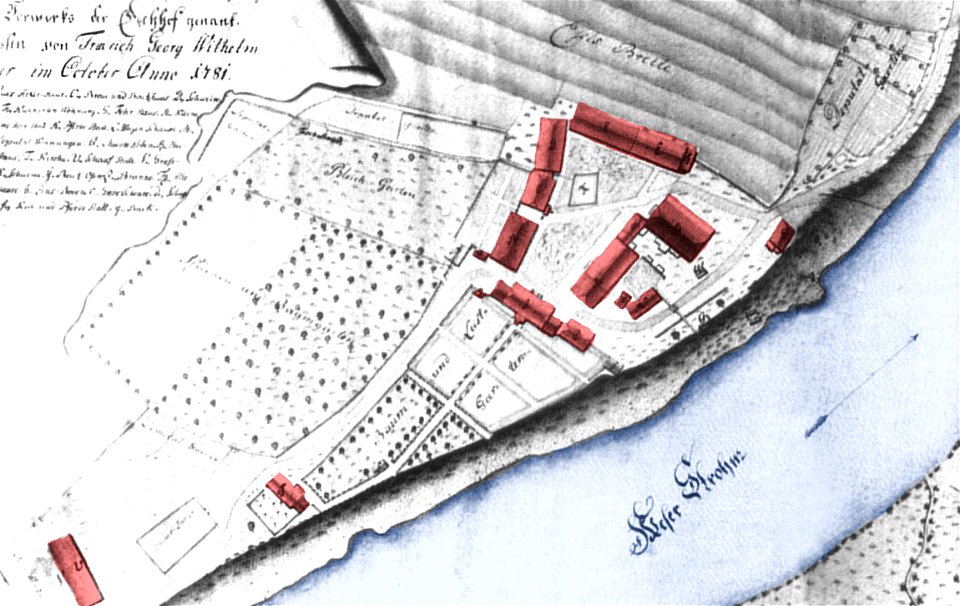
1781 in lower saxony
hilwartshausen
stadtbefestigung nienburg
courtship in art
paul bürck
ffh-gebiet busdorfer tal
drunken people in art
paul bürck
maps by samuel nienborg
maps of schraden
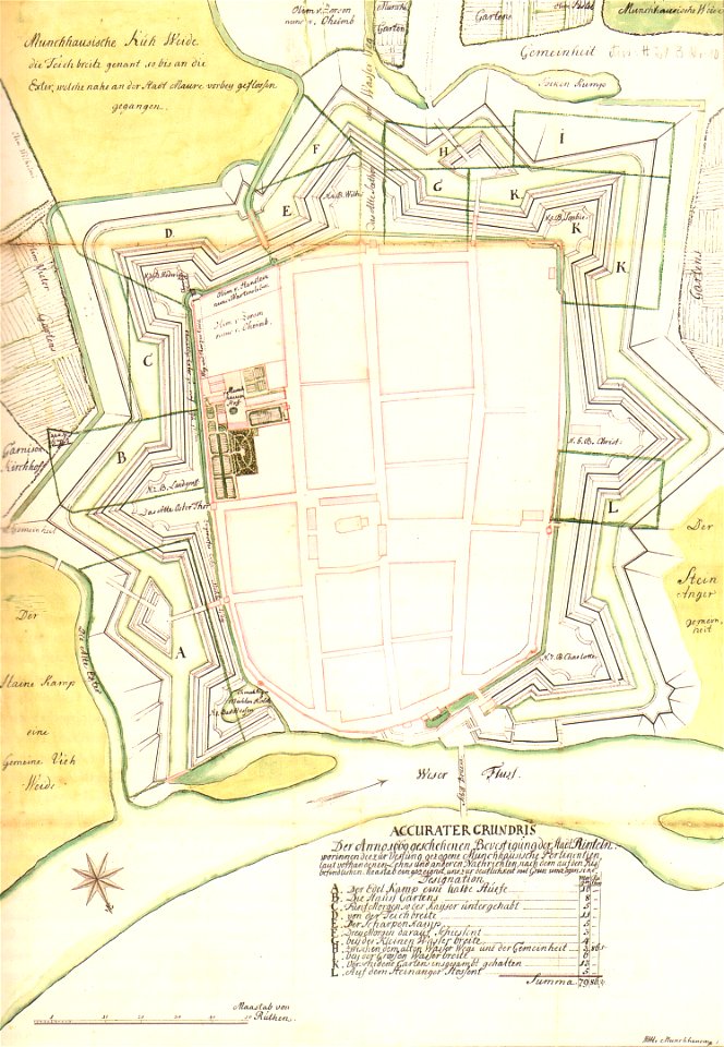
stadtbefestigung rinteln
maps of rinteln
old maps of zürichsee
gygerkarte
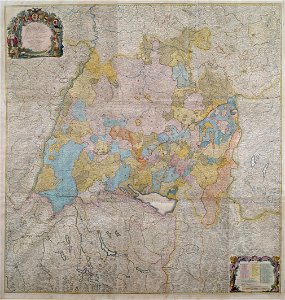
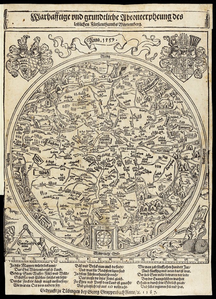
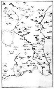
1750s maps of baden-württemberg
swabian circle
maps in utrecht university library
north new guinea expedition
maps by royal bavarian land tax commission
old maps of freising
19th-century maps of baden-württemberg
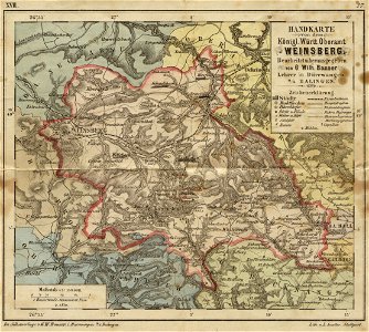
history of weinsberg
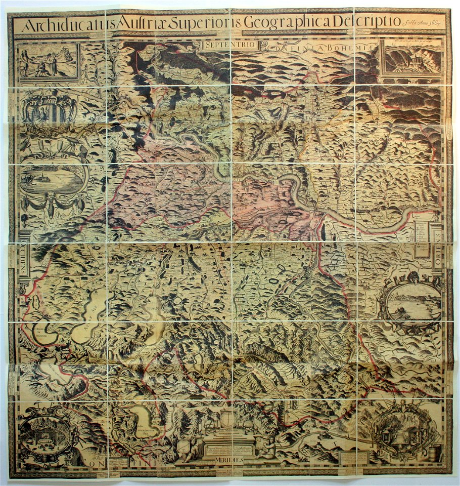
archiducatus austriae superioris descriptio facta anno 1667
1828
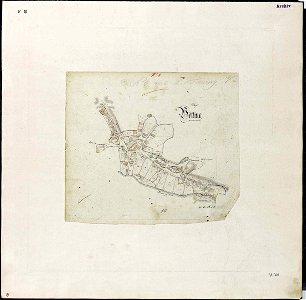
diez
nastätten
1828
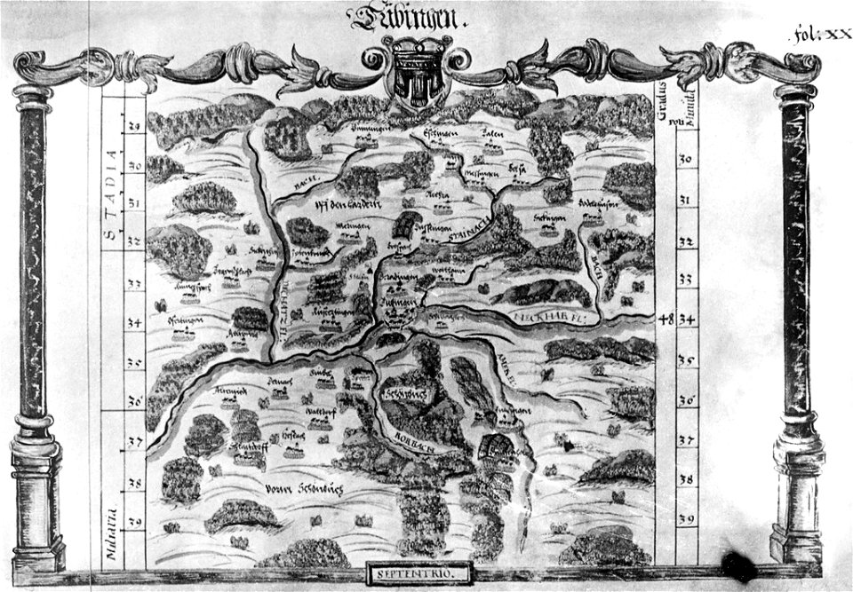
maps of tübingen
1575 in tübingen
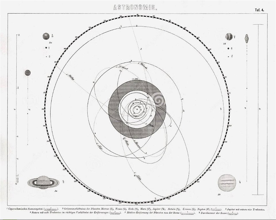
old celestial maps
maps by royal bavarian land tax commission
old maps of freising
maps by royal bavarian land tax commission
old maps of freising
maps by royal bavarian land tax commission
old maps of freising
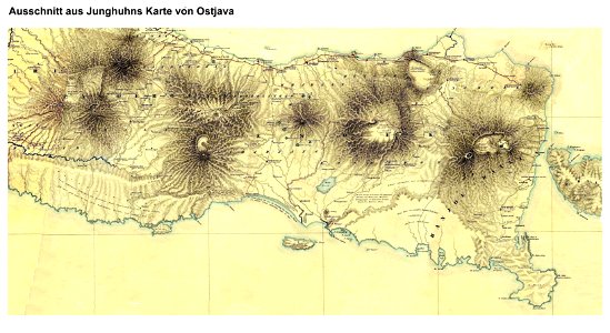
maps by franz wilhelm junghuhn
maps of east java
naval war on lake constance
old maps of lake constance
maps by royal bavarian land tax commission
old maps of freising
maps by royal bavarian land tax commission
old maps of freising
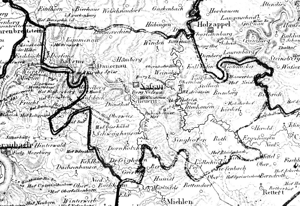
history of nassau (lahn)
1828
maps in utrecht university library
lake sentani
maps by willem and johannes blaeu
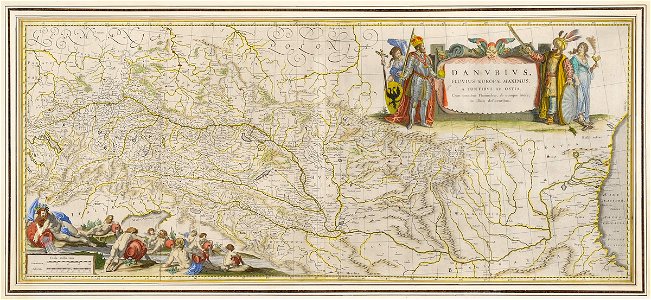
old maps of the danube
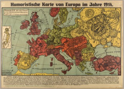
19th-century satirical maps
german-language maps
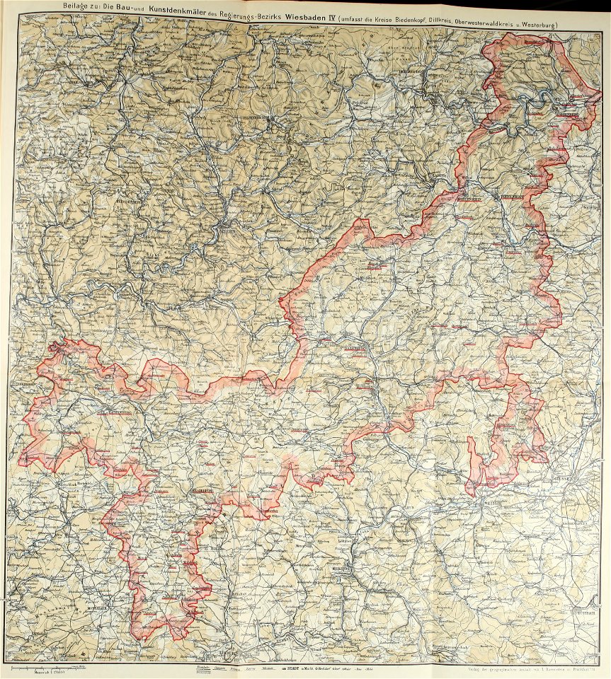
images from bau- und kunstdenkmäler des regierungsbezirks wiesbaden (volume 4)
westerwaldkreis
16th-century maps of baden-württemberg
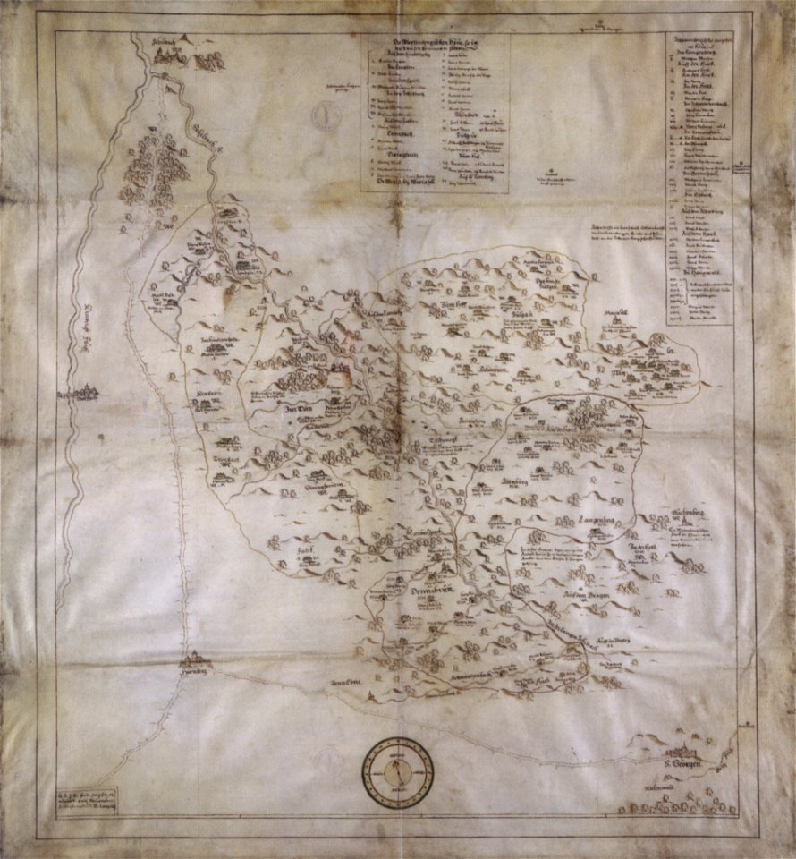
chorographia württemberg
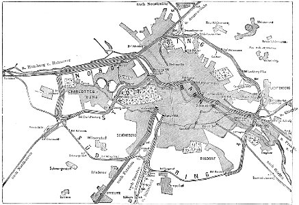
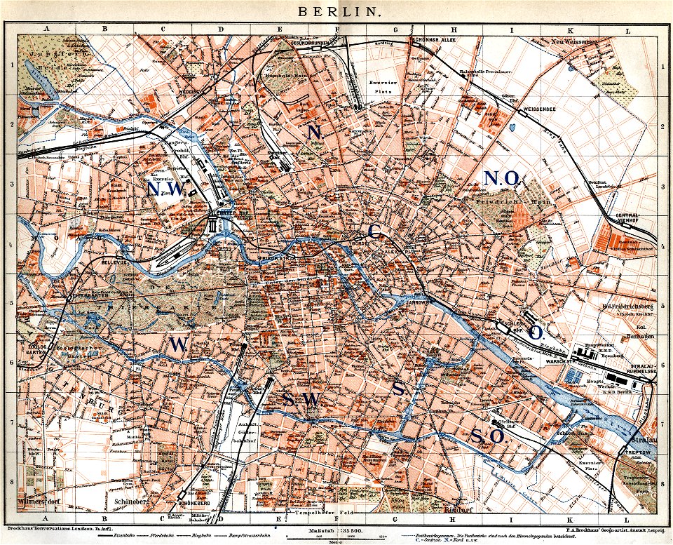
19th-century maps of berlin
maps by brockhaus
1680s maps of baden-württemberg
1681 maps
collections of hauptstaatsarchiv stuttgart
1584 maps
19th-century satirical maps
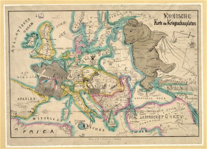
maps of crimean war
images from bau- und kunstdenkmäler des regierungsbezirks wiesbaden (volume 2)
19th-century maps of berlin
maps by brockhaus
18th-century fortress plans
maps by matthäus seutter
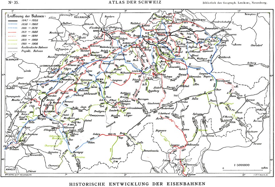
history of rail transport in switzerland
rail transport maps of switzerland
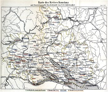
die kunstdenkmäler des kreises konstanz (1887)
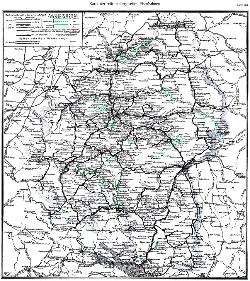
maps of baden-württemberg
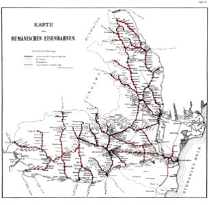
history of rail transport in romania
enzyklopädie des eisenbahnwesens
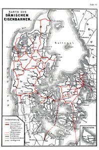
history of rail transport in denmark
enzyklopädie des eisenbahnwesens
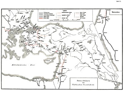
history of rail transport in turkey
enzyklopädie des eisenbahnwesens
history of rail transport in switzerland
rail transport maps of switzerland
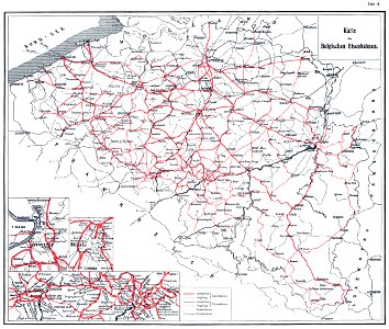
history of rail transport in belgium
enzyklopädie des eisenbahnwesens
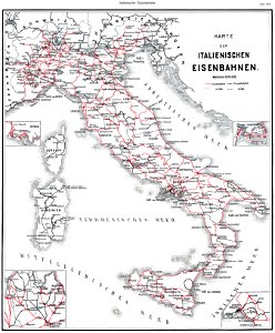
history of rail transport in italy
enzyklopädie des eisenbahnwesens
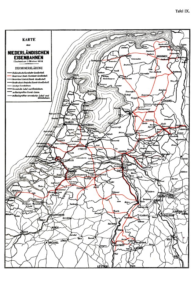
history of rail transport in the netherlands
enzyklopädie des eisenbahnwesens
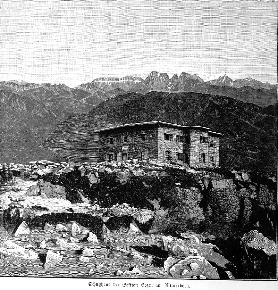
rittner-horn-haus
etc
maps in the biblioteca nacional do brasil
joinville
enzyklopädie des eisenbahnwesens
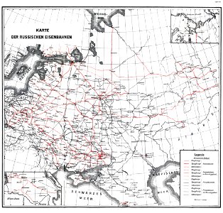
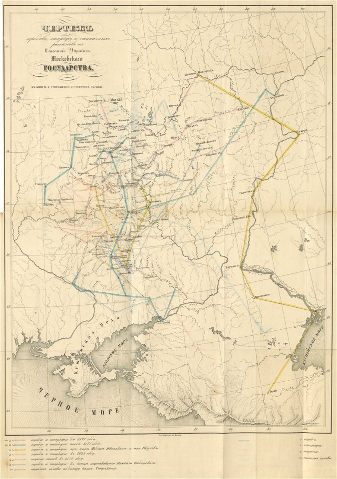
1912 in russia
maps by matthäus seutter
tobias conrad lotter
history of rail transport in hungary
enzyklopädie des eisenbahnwesens
rail transport maps of switzerland
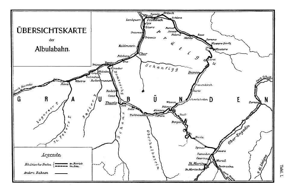
albula line
anonymous paintings in the kunsthistorisches museum
collections of tiroler landesmuseum
route
ancient roman chariots and carriages
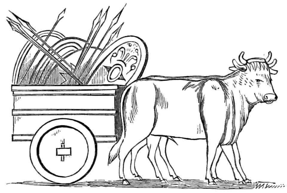
cattle-drawn carts
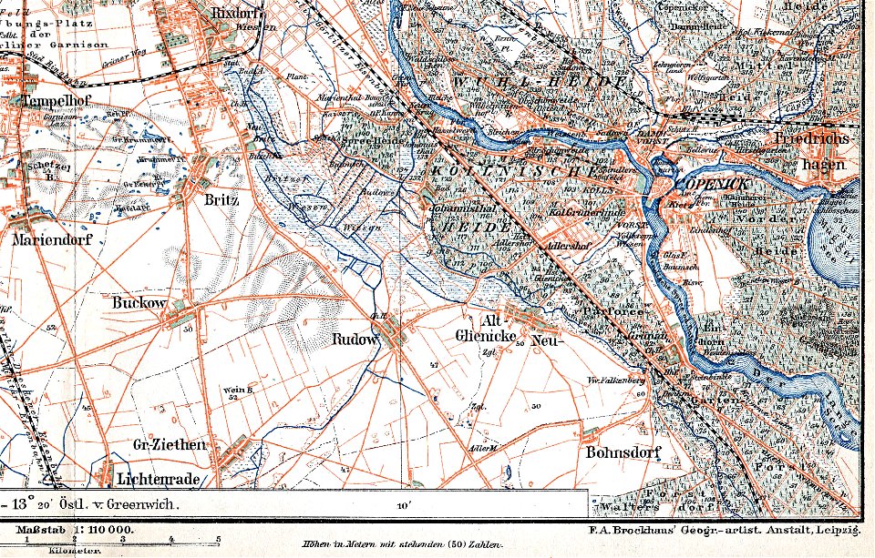
parts of old maps of berlin
maps by brockhaus
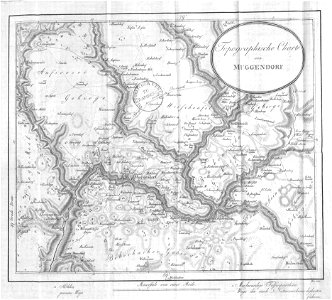
collections of staatsbibliothek bamberg
franconian switzerland
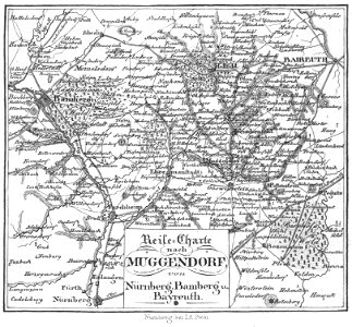
collections of staatsbibliothek bamberg
franconian switzerland
1700s maps of baden-württemberg
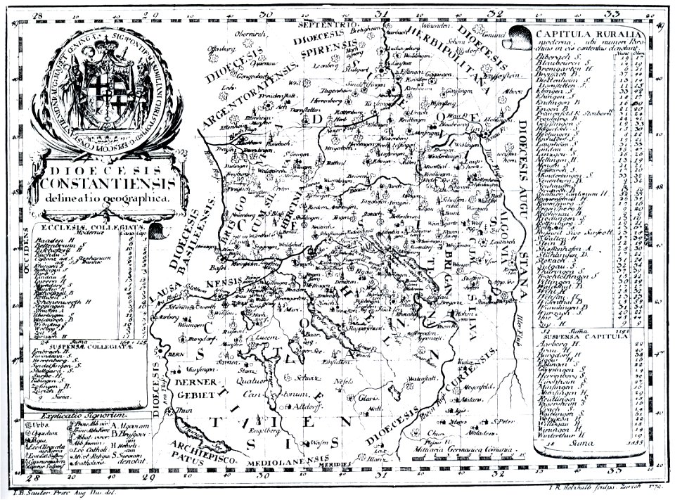
bishopric of constance
images from bau- und kunstdenkmäler des regierungsbezirks wiesbaden (volume 5)
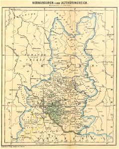
german-language maps showing history of europe
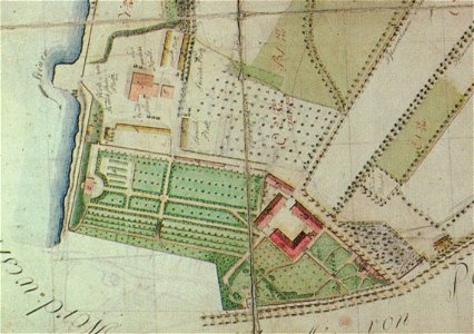
pleasureground (klein-glienicke)
parts of old maps of berlin
maps of the frankish territory
1892 maps
bishopric of constance
1779 in germany
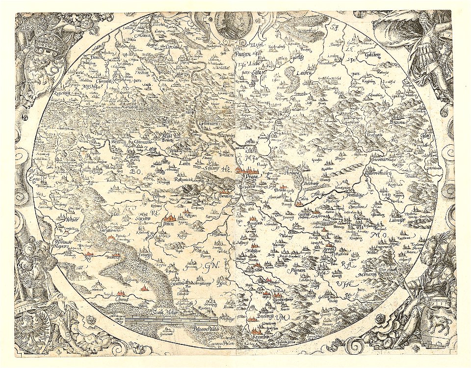
maps made in the 16th century
old maps of bohemia
cornell university library
political cartoons
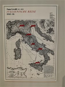
fanny lewald
route
1912 in rail transport in germany
enzyklopädie des eisenbahnwesens
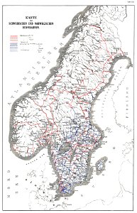
history of rail transport in norway
rail transport maps of norway
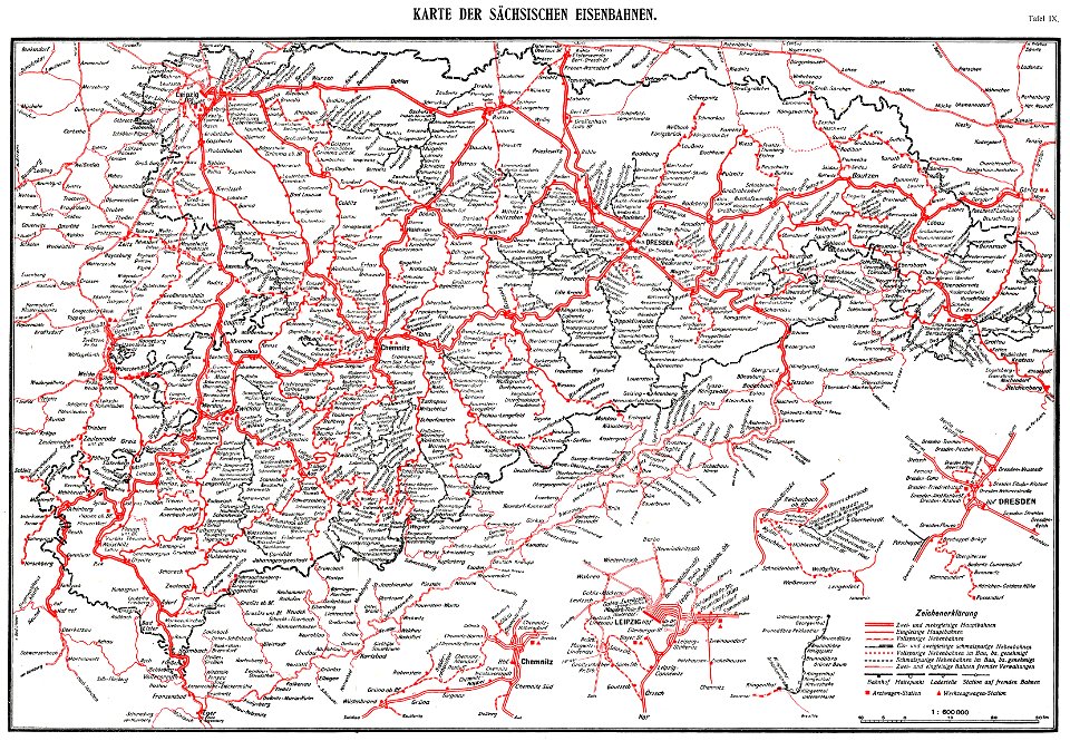
königlich sächsische staatseisenbahnen
enzyklopädie des eisenbahnwesens
1912 in rail transport in germany
enzyklopädie des eisenbahnwesens
maps made in the 16th century
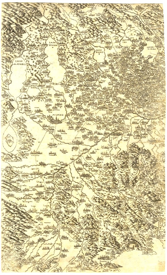
old maps of lombardy
19th-century maps of sweden
old maps of jämtland county
17th-century engravings
faces of men in art
geometrischer grundriss von frankfurt am mayn (1811)
fischerfeldviertel
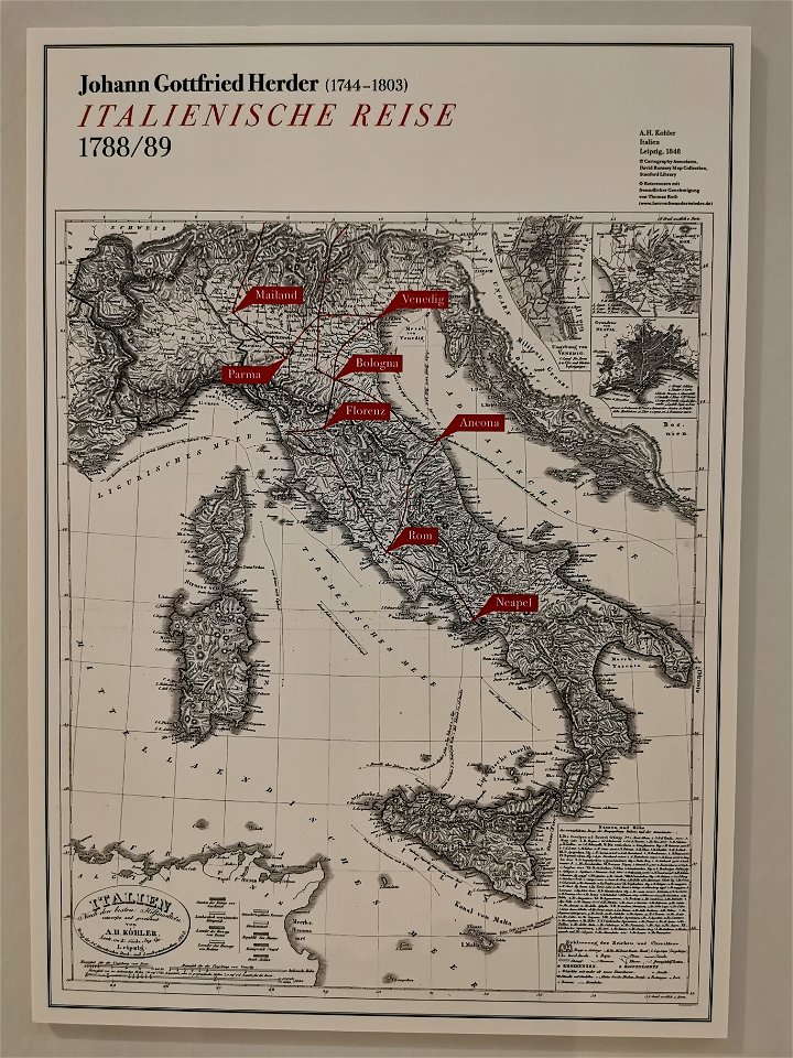
johann gottfried herder
route
maps from the mechanical curator collection
1899 books
maps made in the 16th century
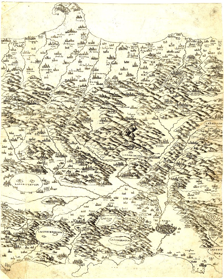
old maps of lazio
maps from the mechanical curator collection available to georeference
maps from the mechanical curator collection
people playing card games in art
radovljica
history of rail transport in ireland
enzyklopädie des eisenbahnwesens
maps in utrecht university library
indonesia
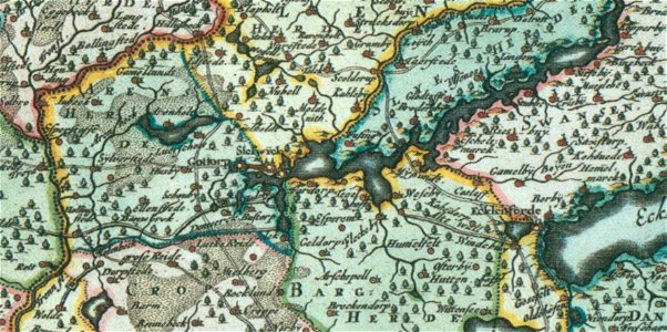
17th-century maps of schleswig-holstein
peninsulas of germany
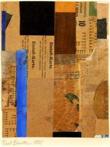
kurt schwitters
dada
maps of the european exploration of africa
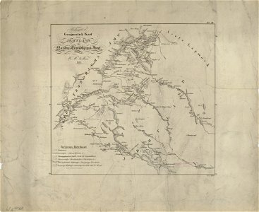
19th-century maps of south sudan
eran laor cartographic collection
tranquillo mollo
charles william meredith van de velde
eran laor cartographic collection
paul bürck
fauns
paul bürck
fauns
1 - 100 of 184
Next page
/ 2