Log in
All resources
Create a design
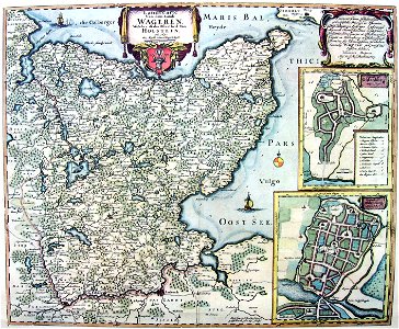
Karte Wagrien, Joan Blaeu, between 1682 and 1688
Historic map of wagrien, today located in northern germany. Date: between 1682 and 1688.
Download
Edit image
Published by:
Creazilla
Author:
Joan Blaeu
Source:
commons.wikimedia.org
Loading...
0 downloads
Print it
Copy image
Loading...
17th-century maps of schleswig-holstein
peninsulas of germany
wagria
house of vizlav
coats of arms of the house of vizlav
knyaz of obotrites
maps related to obotrites
history of kreis ostholstein
maps of kreis plön
maps of the baltic sea
maps of the history of denmark
schleswig-holstein in the 1680s
lechites
maps by willem and johannes blaeu
joan blaeu
MORE LIKE THIS