Log in
All resources
Create a design
140 Free Artworks of Iberian Peninsula
bibliothèque nationale de france
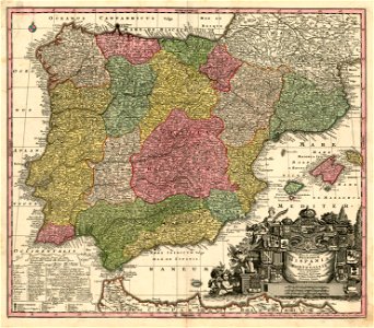
atlas geographico del reyno de españa e islas adjacentes (1757)
old maps of the iberian peninsula
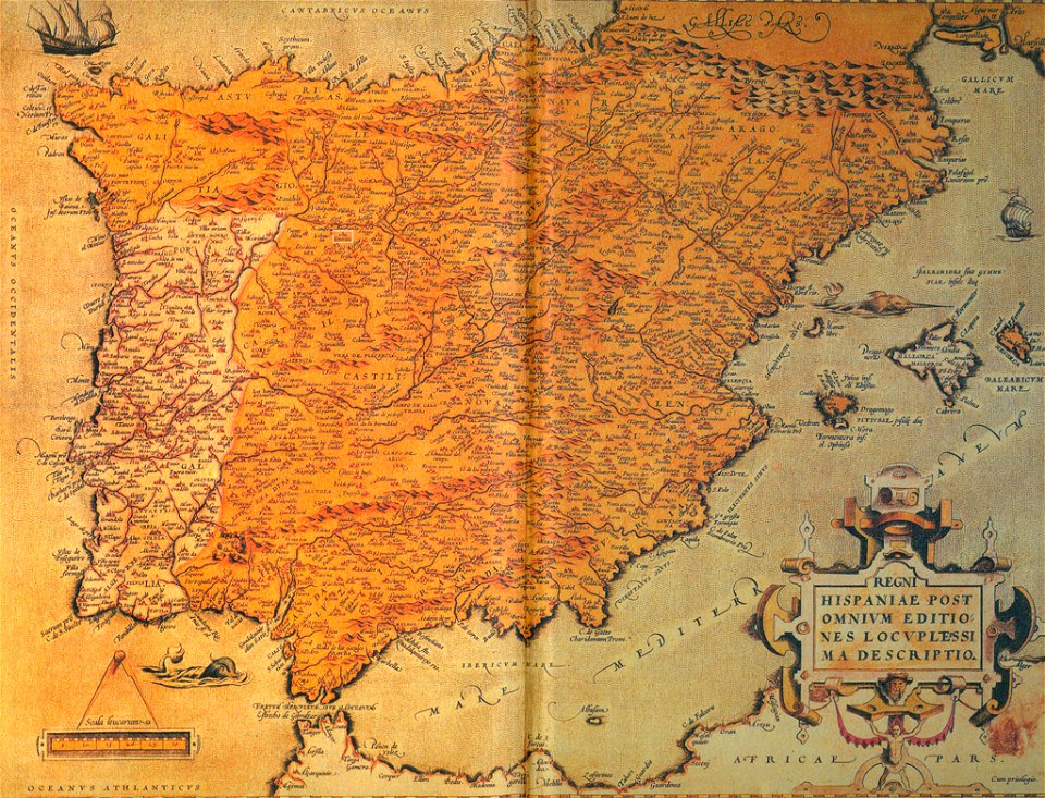
maps of the iberian peninsula by mercator-hondius
l'espagne divisée by guillaume sanson
maps of the iberian peninsula by guillaume delisle
1700s maps of portugal
latin-language maps
1700s maps of the iberian peninsula
1701 maps of spain
das kleine schmetterlingsbuch
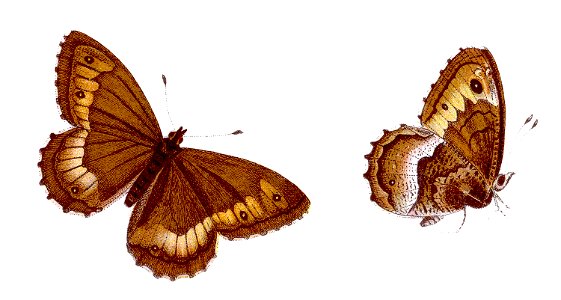
hipparchia hermione
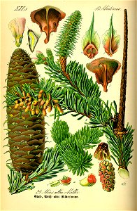
abies alba
tree
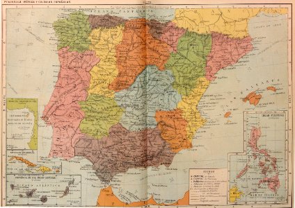
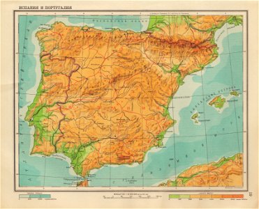
geographical atlas for the 5-6 grades of secondary school (1941)
old maps of the iberian peninsula
old maps of the iberian peninsula
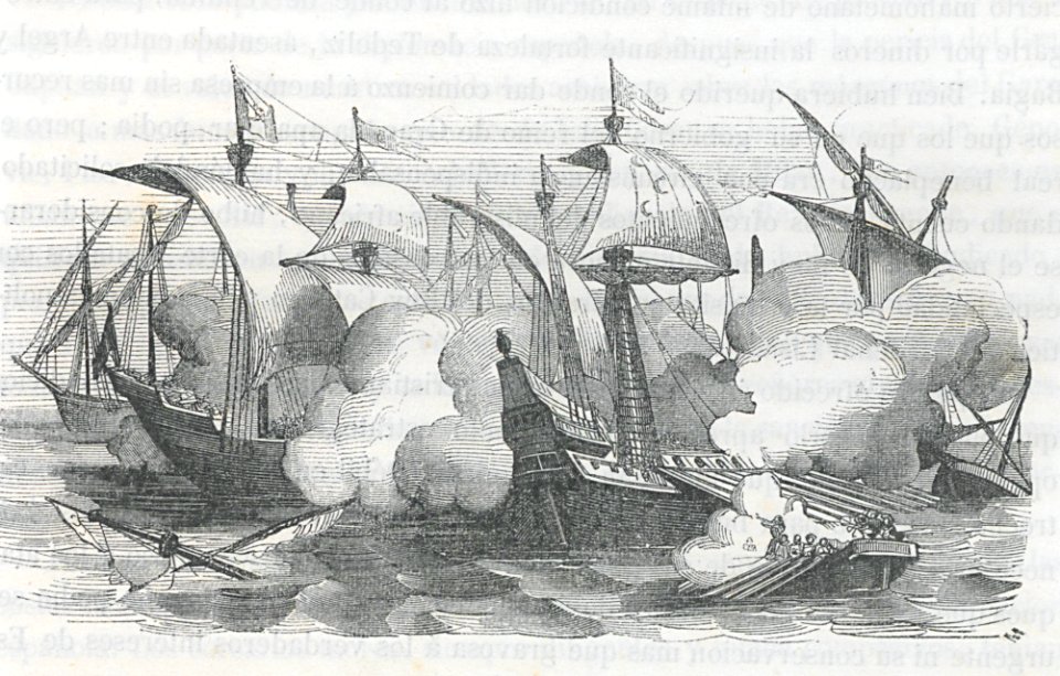
ships on maps
old maps of the iberian peninsula
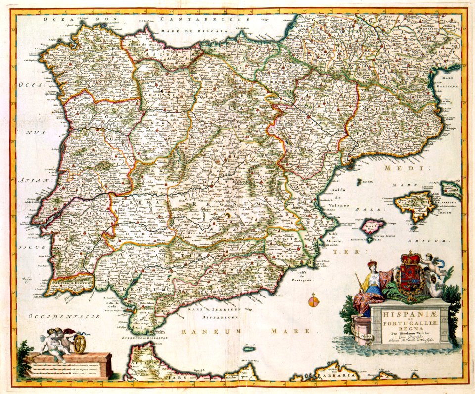
maps by nicolaes visscher i
ogier gisleen van busbeke
1620 maps of europe
old maps of the iberian peninsula
1850s maps of portugal
cosmographia claudii ptolomaei alexandrini
latin-language maps
old maps of the iberian peninsula
johann baptist homann
old maps of the iberian peninsula
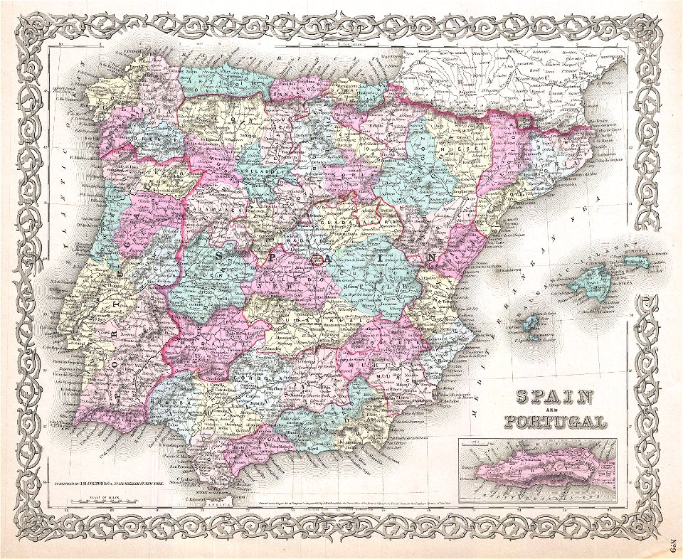
1865 maps
old maps of the iberian peninsula
johannes ratelband
old maps of the iberian peninsula
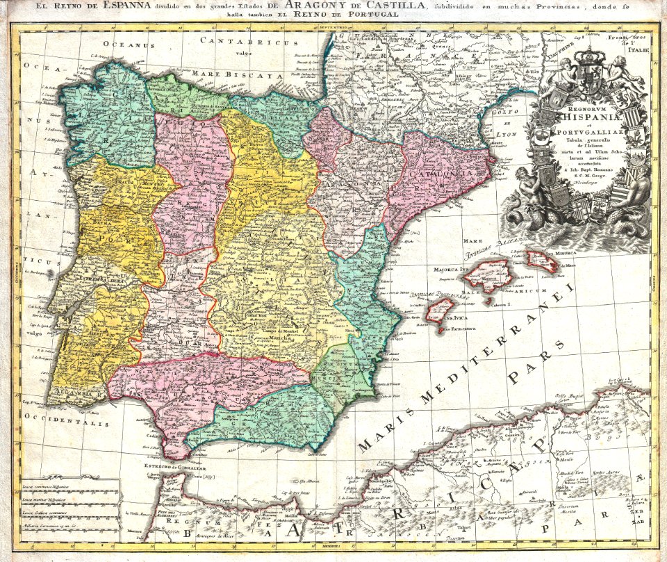
1780s maps of spain
old maps of the iberian peninsula
1870 in spain
old maps of the iberian peninsula
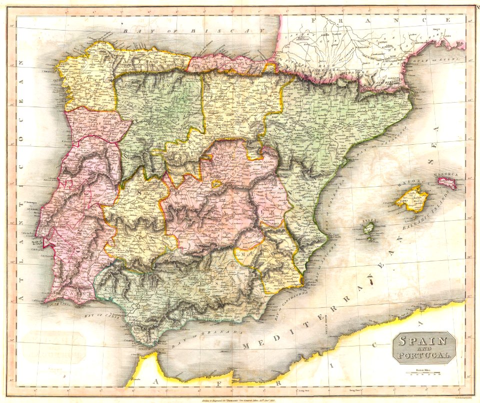
maps by john thomson
old maps of the iberian peninsula
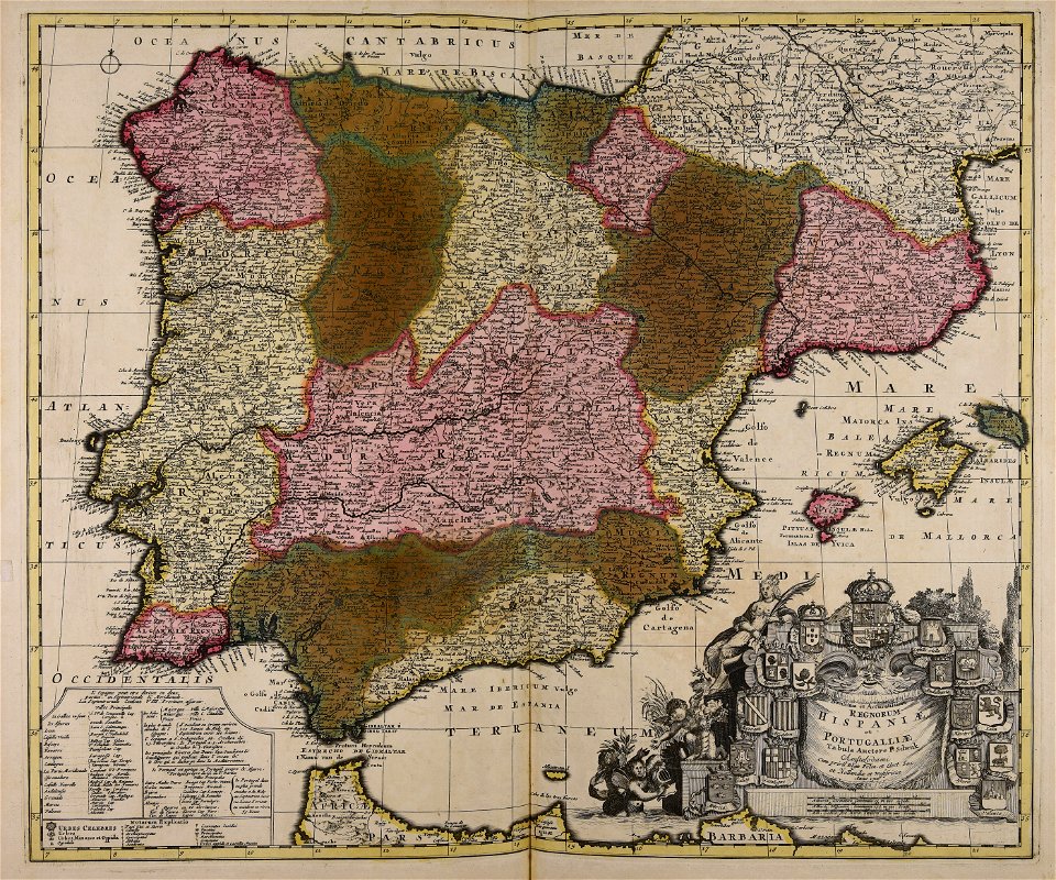
nicolaes visscher ii
old maps of the iberian peninsula
1700s maps of portugal
1780s maps of portugal
1780s maps of spain
artworks without wikidata item
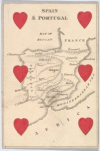
6 of hearts
coats of arms of the crown of aragon
coats of arms on maps
15th-century maps of the iberian peninsula
15th-century maps of africa
historisk atlas (stockholm, norstedt & söner, 1880)
maps showing 843
1670s maps of the iberian peninsula
hugo allardt
maps of the iberian peninsula by guillaume delisle
1780s maps of the iberian peninsula
galicia (spain) in the 1390s
galicia in portolan charts
maps in the biblioteca nacional de españa
spanish-language maps
1620s maps of the iberian peninsula
maps by willem and johannes blaeu
1550s maps of the iberian peninsula
1550s maps of france
fra mauro map details
1450s maps of europe
maps of the iberian peninsula by guillaume delisle
1700s maps of the iberian peninsula
maps of the iberian peninsula by guillaume delisle
1700s maps of the iberian peninsula
maps of the iberian peninsula by guillaume delisle
1700s maps of the iberian peninsula
atlas geographico del reyno de españa e islas adjacentes (1757)
1757 maps of spain
l'espagne divisée by guillaume sanson
1690s maps of the iberian peninsula
1550s maps of the iberian peninsula
renaissance
fra mauro map details
1459 maps
16th-century maps of the iberian peninsula
16th-century maps of spain
1760s maps of the iberian peninsula
1762 maps of spain
maps of the iberian peninsula by guillaume delisle
1700s maps of the iberian peninsula
pelayo i of asturias in paintings
paintings by luis de madrazo
1670s maps of the iberian peninsula
georg widmann
1800s maps of the iberian peninsula
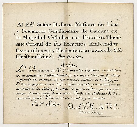
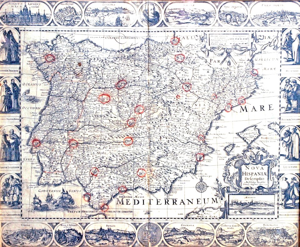
maps of spain by tomas lopez
charles turner (engraver)
battle of bussaco
maps of the iberian peninsula by mercator-hondius
paintings by eugenio oliva
orientalism
1630s maps of the iberian peninsula
hessel gerritsz
l'espagne divisée by guillaume sanson
bibliothèque nationale de france
mediterranean
piracy
maps of the iberian peninsula by guillaume delisle
eran laor cartographic collection
latin-language maps
bologna ptolemy
l'espagne divisée by guillaume sanson
1680s maps of the iberian peninsula
maps of the iberian peninsula by mercator-hondius
maps by pieter van der keere
maps of the iberian peninsula by mercator-hondius
maps by pieter van der keere
maps of the iberian peninsula by mercator-hondius
maps by pieter van der keere
l'espagne divisée by guillaume sanson
cities in spain in the 17th century
16th-century maps of hispaniola
cornelius aurelius world map
atlas sive cosmographicae (gerardus mercator, 1607)
maps of the iberian peninsula by mercator-hondius
l'espagne divisée by guillaume sanson
bibliothèque nationale de france
tresor des cartes geographiques (1659)
1650s maps of the iberian peninsula
maps of the iberian peninsula by mercator-hondius
atlas minor gerardi mercatoris (1621, maps)
atlas geographico del reyno de españa e islas adjacentes (1757)
bibliothèque nationale de france
atlas geographico del reyno de españa e islas adjacentes (1757)
bibliothèque nationale de france
atlas geographico del reyno de españa e islas adjacentes (1757)
bibliothèque nationale de france
atlas geographico del reyno de españa e islas adjacentes (1757)
bibliothèque nationale de france
travel
maps
atlas geographico del reyno de españa e islas adjacentes (1757)
bibliothèque nationale de france
atlas geographico del reyno de españa e islas adjacentes (1757)
bibliothèque nationale de france
atlas geographico del reyno de españa e islas adjacentes (1757)
bibliothèque nationale de france
atlas geographico del reyno de españa e islas adjacentes (1757)
bibliothèque nationale de france
atlas geographico del reyno de españa e islas adjacentes (1757)
bibliothèque nationale de france
atlas geographico del reyno de españa e islas adjacentes (1757)
bibliothèque nationale de france
atlas geographico del reyno de españa e islas adjacentes (1757)
bibliothèque nationale de france
atlas geographico del reyno de españa e islas adjacentes (1757)
bibliothèque nationale de france
ornament
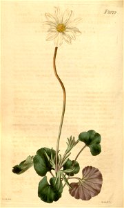
plants
atlas geographico del reyno de españa e islas adjacentes (1757)
bibliothèque nationale de france
atlas geographico del reyno de españa e islas adjacentes (1757)
bibliothèque nationale de france
atlas geographico del reyno de españa e islas adjacentes (1757)
bibliothèque nationale de france
atlas geographico del reyno de españa e islas adjacentes (1757)
bibliothèque nationale de france
atlas geographico del reyno de españa e islas adjacentes (1757)
1757 maps of spain
atlas geographico del reyno de españa e islas adjacentes (1757)
18th-century maps of andalusia
atlas geographico del reyno de españa e islas adjacentes (1757)
18th-century maps of madrid
atlas sive cosmographicae (gerardus mercator, 1630)
maps of the iberian peninsula by mercator-hondius
atlas geographico del reyno de españa e islas adjacentes (1757)
old maps of aragon
atlas geographico del reyno de españa e islas adjacentes (1757)
old maps of the region of murcia
atlas geographico del reyno de españa e islas adjacentes (1757)
18th-century maps of catalonia
atlas geographico del reyno de españa e islas adjacentes (1757)
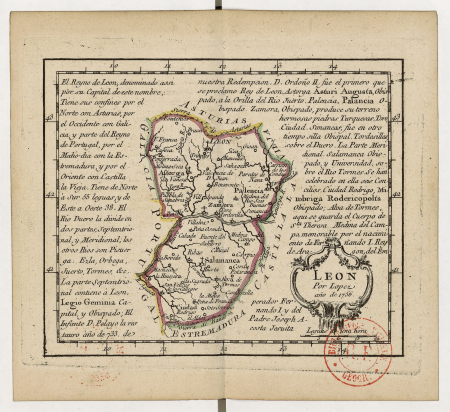
old maps of castile and león
atlas geographico del reyno de españa e islas adjacentes (1757)
1750s maps of portugal
atlas geographico del reyno de españa e islas adjacentes (1757)
old maps of asturias
atlas geographico del reyno de españa e islas adjacentes (1757)
maps of galicia (spain)
17th-century maps of europe
latin-language maps
atlas sive cosmographicae (gerardus mercator, 4th edition 1613)
maps of the iberian peninsula by mercator-hondius
atlas geographico del reyno de españa e islas adjacentes (1757)
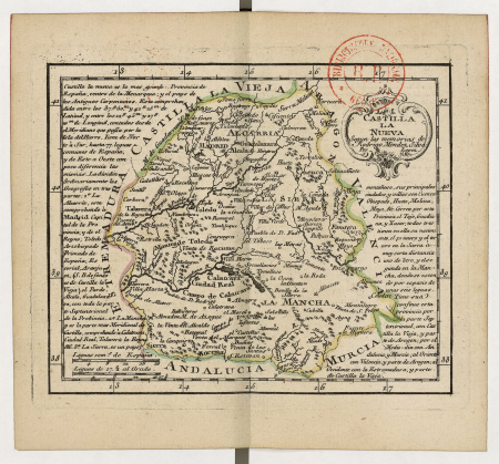
old maps of castilla la nueva
atlas geographico del reyno de españa e islas adjacentes (1757)
old maps of castilla la vieja
l'espagne divisée by guillaume sanson
1670s maps of the iberian peninsula
1770s maps of portugal
1770 maps of spain
maps of the iberian peninsula by mercator-hondius
maps by pieter van der keere
maps of the iberian peninsula by mercator-hondius
atlas minor gerardi mercatoris (1614, maps)
maps
ship
atlas sive cosmographicae (gerardus mercator, 1623)
maps of the iberian peninsula by mercator-hondius
atlas maior, vol 10 (spain and africa) - joan blaeu, 1667 - bl 114.h(star).10
1667 maps of europe
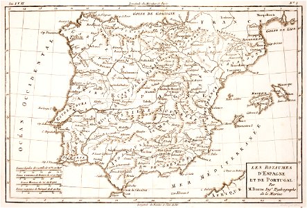
guillaume-nicolas delahaye
jacques martin
1 - 100 of 140
Next page
/ 2


![Treasure of geographical maps of the main states of the universe [...], 1659](https://cdn.creazilla.com/illustrations/10000485227/treasure-of-geographical-maps-of-the-main-states-of-the-universe-1659-md.jpg)