Log in
All resources
Create a design
312 Free Artworks of Ancient Map
description de l'universe
eran laor cartographic collection
english-language maps
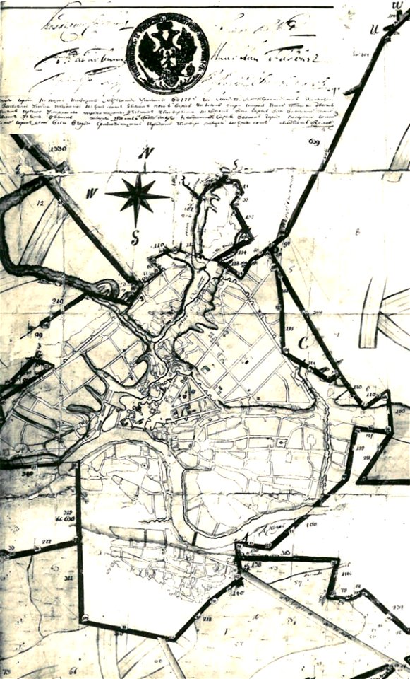
maps in russian state archives of ancient documents
karl spruner von merz
maps
alain manesson mallet
old maps of the middle east
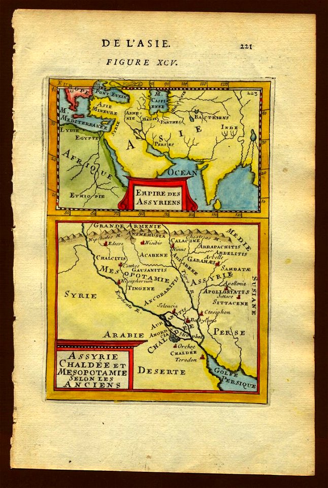
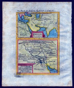
maps of chaldea
maps of assyria
old maps of the aegean sea
maps by matthäus seutter
old maps of ancient greece
karl spruner von merz
illustrations of cosmographia (münster)
old maps of the world
cosmographia (1600) by sebastian münster
1600 maps of iran
maps in russian state archives of ancient documents
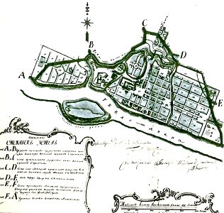
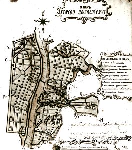
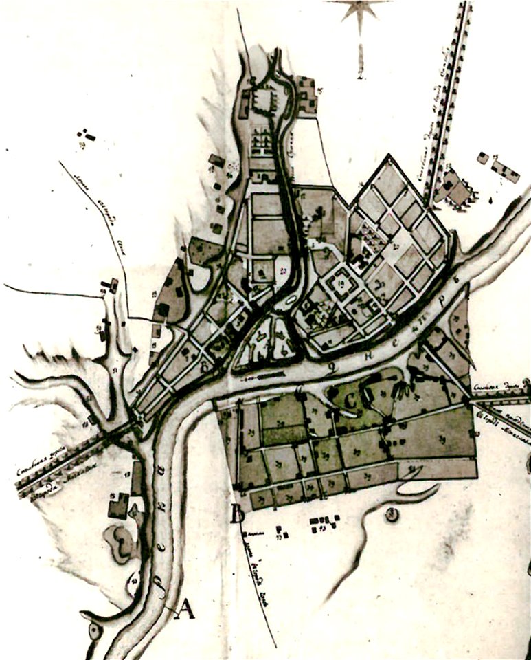
maps of mahilioŭ
maps in russian state archives of ancient documents
old maps of polotsk
cosmographia (1600) by sebastian münster
1600 maps of iran
maps in russian state archives of ancient documents
historical images of čerykaŭ
illustrations of cosmographia (münster)
old maps of france
maps in russian state archives of ancient documents
historical images of viciebsk
maps in russian state archives of ancient documents
historical images of viciebsk
maps in russian state archives of ancient documents
historical images of orša
karl spruner von merz
1865 maps
illustration
maps
1850s maps of palestine
1850s maps of israel
karl spruner von merz
old maps of sardinia
egypt
maps
old maps of the middle east
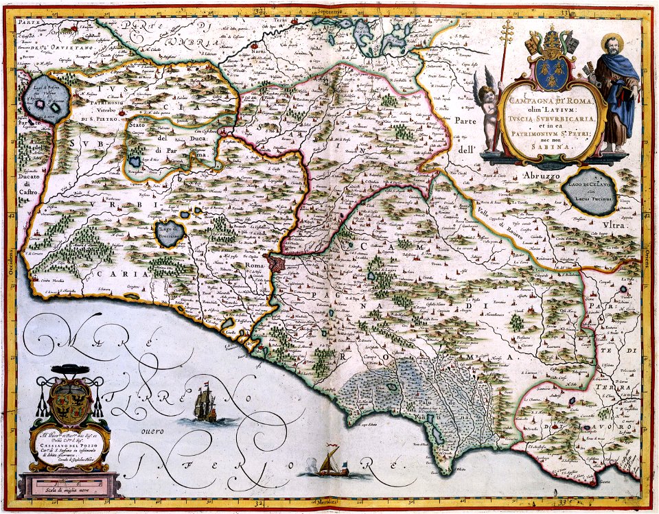
description de l'universe
old maps of the middle east
description de l'universe
geographical illustrations by coronelli
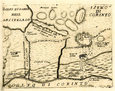
maps of ancient corinth
maps in russian state archives of ancient documents
historical images of viciebsk
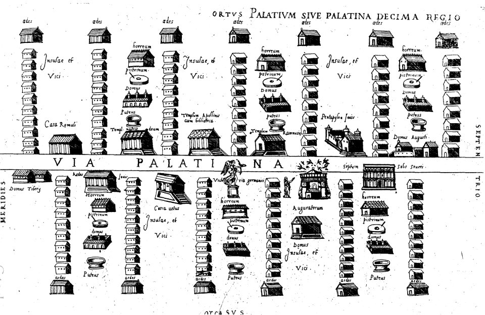
old maps of ancient rome (city)
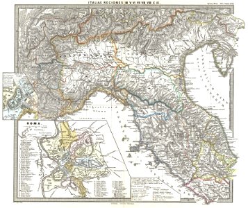
old maps of italy
travels in sicily greece and albania
old maps of greece
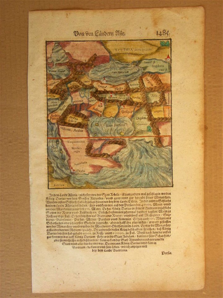
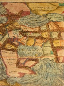
maps of ancient persia
karl spruner von merz
popular science monthly illustrations/volume 16
ancient greek maps of the world
karl spruner von merz
1865 maps
egypt
maps
popular science monthly illustrations/volume 16
eratosthenes
ancient egypt
egypt
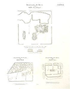
lepsius-projekt - maps
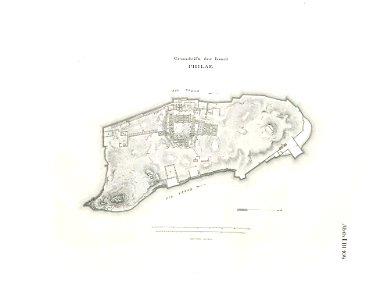
floor plans of philae
old maps of nile delta
1821 books
africa
maps
the antiquities of magna graecia (1807)
popular science monthly illustrations/volume 16
ancient greek maps of the world
old maps of the middle east
maps of canaan
1805 maps of the united states
maps by john cary
17th-century maps of georgia
old maps of turkey
old maps of the middle east
assyrian people
medieval
maps
maps in russian state archives of ancient documents
historical images of haradok
the antiquities of magna graecia (1807)
travels in sicily greece and albania
maps of syrakousai
old maps of ancient rome (city)
description de l'universe
maps of nineveh
description de l'universe
maps of nineveh
popular science monthly illustrations/volume 16
ancient greek maps of the world
paulys realencyclopädie der classischen altertumswissenschaft band i
2
popular science monthly illustrations/volume 10
ancient earth views
travels in sicily greece and albania
maps of ancient delphi
old maps of ancient rome (city)
16th-century engravings
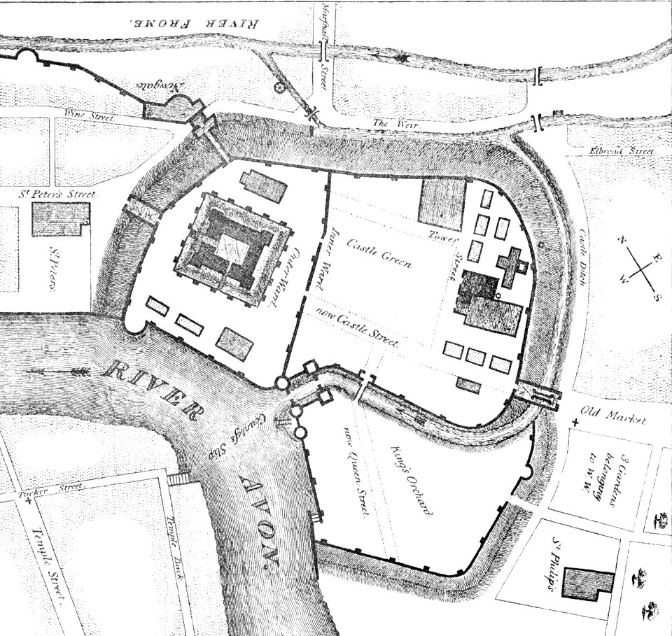
images from bristol past and present (1882)
bristol
maps with cartouches
atlas van der hagen
fort zeelandia, taiwan in art
siege of fort zeelandia
calculator
pencil
ancient kangleipak
high renaissance
maps with cartouches
1964 in cyprus
ancient kangleipak
high renaissance
maps in the biblioteca nacional de españa
spanish-language maps
mississippian sites
plaquemine culture
17th-century maps of the middle east
description de l'universe
description de l'universe
1680s maps of the levant
eran laor cartographic collection
michael burghers
description de l'universe
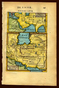
old maps of asia
18th-century maps of the middle east
description de l'universe
map of ancient assyria by philippe de la rué
maps
maps of ancient italy by philipp clüver
maps of ancient latium
latin-language maps
emery walker
eran laor cartographic collection
william hughes (geographer)
eran laor cartographic collection
william hughes (geographer)
eran laor cartographic collection
william hughes (geographer)
maps with figures
michael burghers
media from accademia delle scienze di torino
1574 illustrations
eran laor cartographic collection
nicolas langlois
english-language maps
1747 maps of asia
maps from the earth and its inhabitants, vol. xi
africa in the 1890s
description de l'universe
1680s maps of iran
somalia in the 15th century
1459
old maps showing history
1820s maps of europe
eran laor cartographic collection
nicolas langlois
ray in the 19th century
iran in the 1820s
maps from the earth and its inhabitants, vol. xi
africa in the 1890s
academic art,rococo revival
joint issues 2011
eran laor cartographic collection
edward weller
eran laor cartographic collection
edward weller
eran laor cartographic collection
edward weller
maps from the earth and its inhabitants, vol. xi
africa in the 1890s
wilhelm pleydenwurff
hartmann schedel
1810s maps of the near east
maps by john cary
maps of ancient italy by philipp clüver
maps of ancient sicily
maps by nicolaes visscher i
old maps of assyria
croppings from pianta di roma (pérac-lafréry)
le antichità romane (piranesi)
neoclassicism
1810s maps of the near east
maps by john cary
1680s maps of grand duchy of lithuania
guillaume le vasseur de beauplan
maps of ancient israel by philippe de la rué
map of modern syria by philippe de la rué
media from accademia delle scienze di torino
1620s maps of italy
maps of ancient italy by philipp clüver
eran laor cartographic collection
map of ancient asia minor by philippe de la rué
1650s maps of turkey
notes on the state of virginia
augustus kollner
engravings of rome
jan goeree
1 - 100 of 312
Next page
/ 4


![Siciliae antiquae descriptio. 15; Corsicae antiquae descriptio. 16; Sardiniae antiquae descriptio / auctore Phil[ippo] Cluverio; Henry le Roy fecit, 1624](https://cdn.creazilla.com/illustrations/10001349357/siciliae-antiquae-descriptio-15-corsicae-antiquae-descriptio-16-sardiniae-antiquae-descriptio-auctore-phil-ippo-cluverio-henry-le-roy-fecit-1624-sm.jpg)